Barn Record Killingly
RETURN TO ‘FIND BARNS’- Building Name (Common)
- Gazzola Barn
- Building Name (Historic)
- n/a
- Address
- 1871 Upper Maple Street, Killingly
- Typology

- Overview
-
Designations
n/a
Historic Significance
Architectural description:
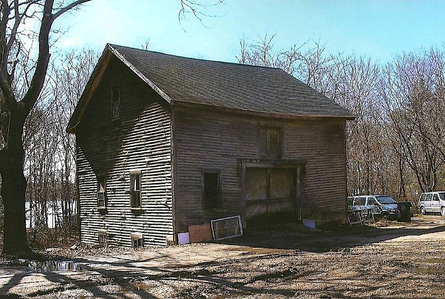
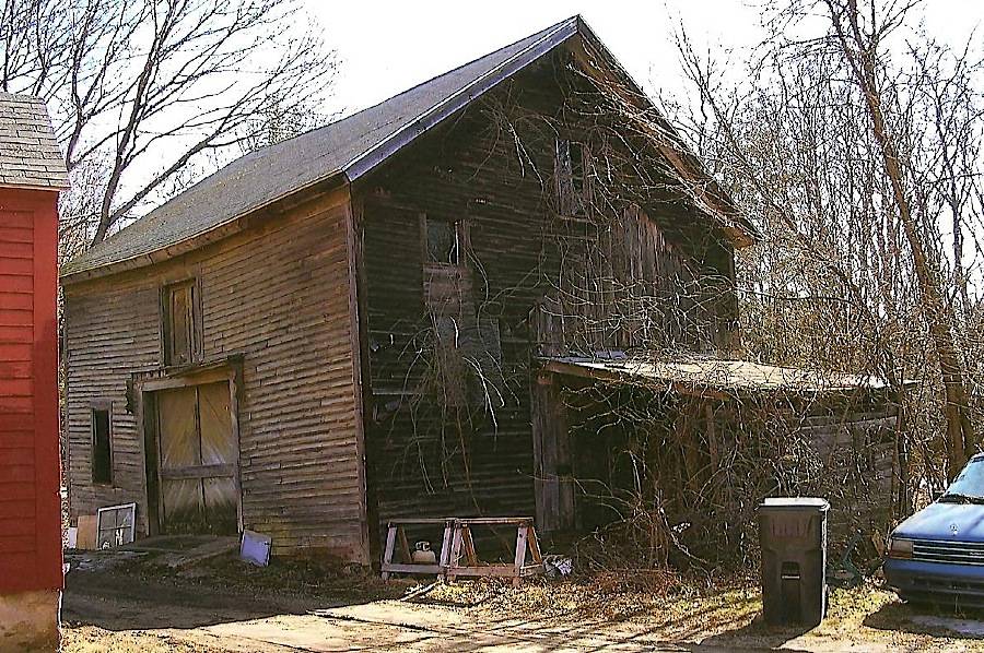
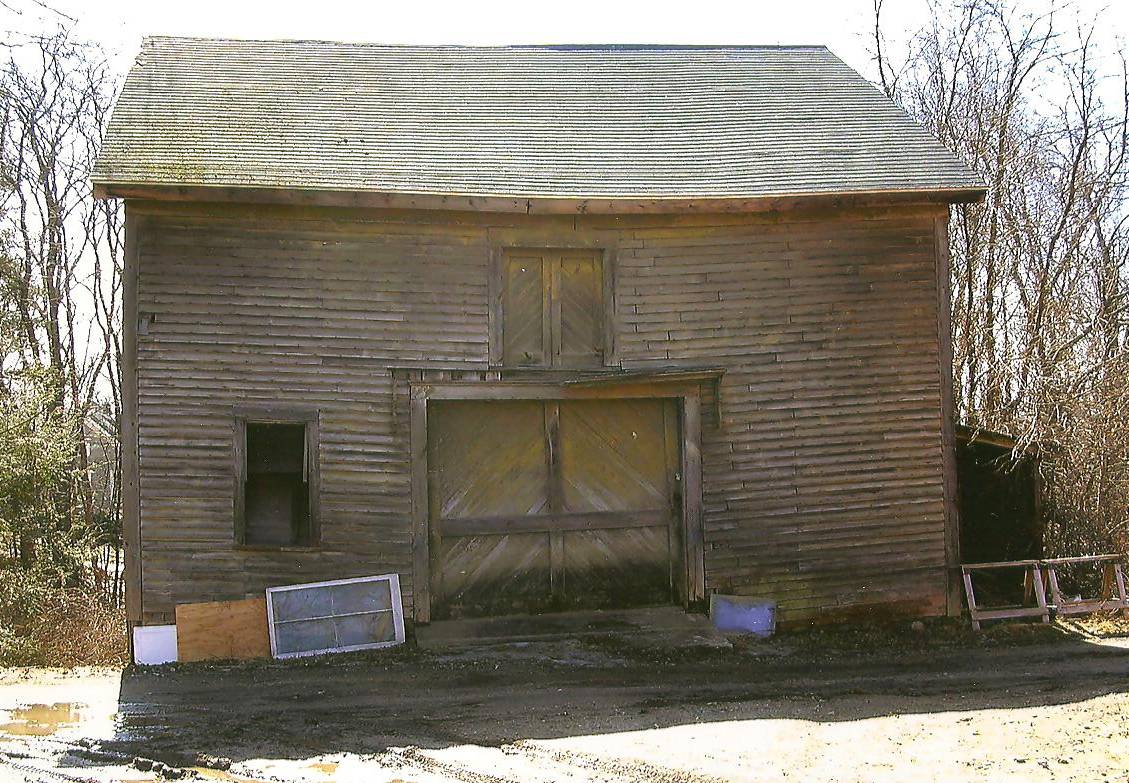
This is a 1 1/2-story side- or eave-entry bank barn with a shed-roof addition extending off the south half of its west side. The main facade faces north and the ridge-line of the barn is perpendicular to this portion of Upper Maple Street, which runs approximately north-south.
The main entry is a large wood door, which appears to slide on an interior track, located in the center of the north, eave-side of the barn. A window opening is located immediately to the east of the main entry. A pair of wood hayloft doors are located immediately above and centered over the main entry. The north side of the shed-roof addition is open.
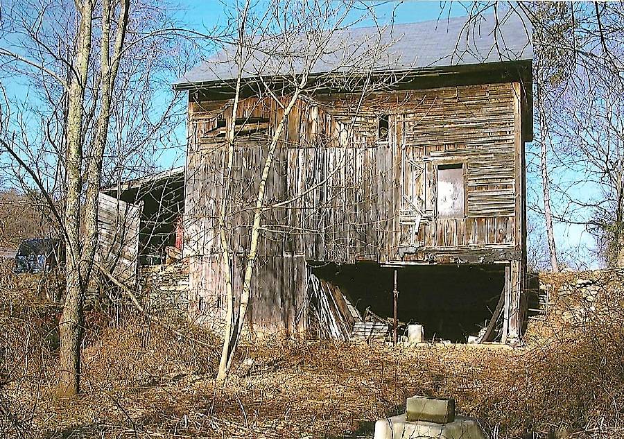
The grade at the east gable-end of the barn declines sharply, revealing a basement level. There is a two-pane window on the north side of the east gable-end of the barn and a six-pane window on the south side, both located at the basement level. Two double-hung windows are found on the first-floor level, and a double-hung window at the attic level, in the gable peak.
The south, eave-side of the barn has two open bays at the basement level: the center bay and the east bay. A single window opening is located at the first-floor level, in the east half of the south eave-side of the barn. The south side of the shed-roof addition is partly enclosed by deteriorated clapboard siding on its west half, but otherwise open.
The grade at the west, gable-end of the barn inclines sharply to the main level. There is a single window opening, partly filled-in, at the second-floor level, toward the north corner. There appears to be a two-over-two, double-hung window at the attic level, centered in the gable peak. The west side of the shed-roof addition is blank. Physical evidence indicates that there used to be a 1 1/2-story, gable-roof addition where the shed-roof addition is currently located; vertical wood siding has been used to fill in the opening where this earlier addition met the main part of the barn.
The barn has unpainted, wood clapboard siding with cornice boards and corner boards. The siding is deteriorated but intact on all but the south, eave-side of the barn, where much of the siding is missing and the vertical wood sheathing is visible. The foundation is not visible. The roof is covered with asphalt shingles.
Historical significance:The oldest barns still found in the state are called the “English Barn,” “side-entry barn,” “eave entry,” or a 30 x 40. They are simple buildings with rectangular plan, pitched gable roof, and a door or doors located on one or both of the eave sides of the building based on the grain warehouses of the English colonists’ homeland. The name “30 by 40” originates from its size (in feet), which was large enough for 1 family and could service about 100 acres. The multi-purpose use of the English barn is reflected by the building’s construction in three distinct bays - one for each use. The middle bay was used for threshing, which is separating the seed from the stalk in wheat and oat by beating the stalks with a flail. The flanking bays would be for animals and hay storage. The 19th century saw the introduction of a basement under the barn to allow for the easy collection and storage of a winter’s worth of manure from the animals sheltered within the building. The bank barn is characterized by the location of its main floor above grade, either through building into a hillside or by raising the building on a foundation. This innovation, aided by the introduction of windows for light and ventilation, would eventually be joined by the introduction of space to shelter more animals under the main floor of the barn.
Field Notes
Grant pre-app 2009 between Alexander Lake and I-395, across street from large Frito-Lay plant.
- Use & Accessibility
Use (Historic)
Use (Present)
Exterior Visible from Public Road?
Yes
Demolished
n/a
Location Integrity
Unknown
- Environment
Related features
Environment features
Relationship to surroundings
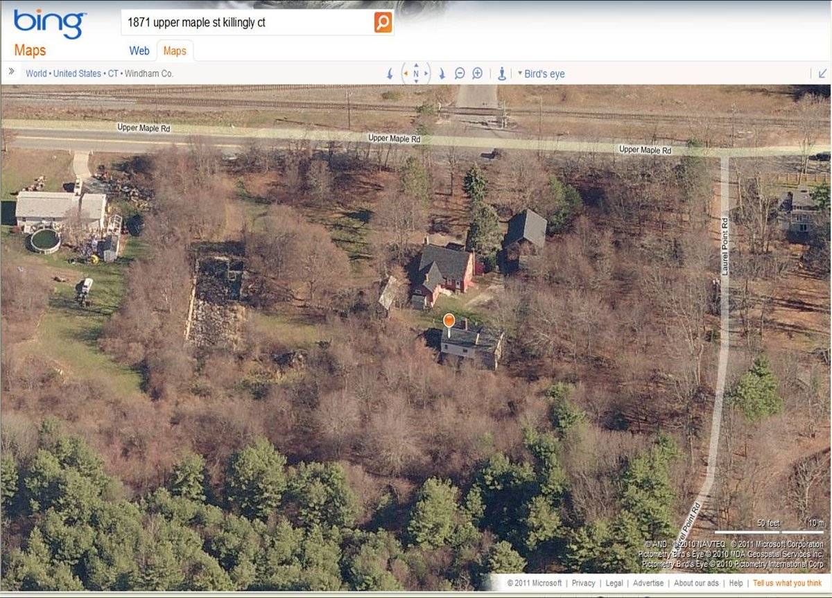
The barn is located on a wooded, 4.16-acre site on the west side of Upper Maple Street, to the south of its intersection with Attawaugan Crossing Road. There are two residences on the site: a c. 1800 house with four living units located behind and to the northwest of the barn and a c. 1900, two-family house to the north of the barn. A shed is located to the north of the c. 1900 house and what appears to be a large building foundation is to the north of the shed, at the northern perimeter of the property. A pond is located in the southwest corner of the site. I-395 is located a short distance to the east and Alexander Lake is to the southwest of the site. The area surrounding the site is light residential and woodland, and two industrial properties are nearby: the Frito Lay Corporation to the southeast, on the other side of Upper Maple Street, and a plastic manufacturer to the northwest.
Parcel ID: 002078
- Typology & Materials
-
Building Typology
Materials
Structural System
Roof materials
Roof type
Approximate Dimensions
840 square feet, 36 ft x 28 ft
- Source
-
Date Compiled
04/01/2011
Compiled By
J. M. Doherty & T. Levine; reviewed by CT Trust
Sources
Field notes and photographs by Paul Gazzola 04/02/2009.
Town of Killingly Assessor’s Record:
http://killingly.ias-clt.com/parcel.list.phpTown of Killingly GIS Viewer:
http://www.caigisonline.net/killinglyct/Parcel ID: 002078
Aerial Mapping:
http://www.bing.com/maps accessed 04/01/2011.Sexton, James, PhD, Survey Narrative of the Connecticut Barn, Connecticut Trust for Historic Preservation, Hamden, CT, 2005, http://www.connecticutbarns.org/history.
Visser, Thomas D., Field Guide to New England Barns and Farm Buildings, University Press of New England, 1997.
- PhotosClick on image to view full file
-