Barn Record Ledyard
RETURN TO ‘FIND BARNS’- Building Name (Common)
- Sarah Vincent Homestead
- Building Name (Historic)
- Sarah Vincent Homestead
- Address
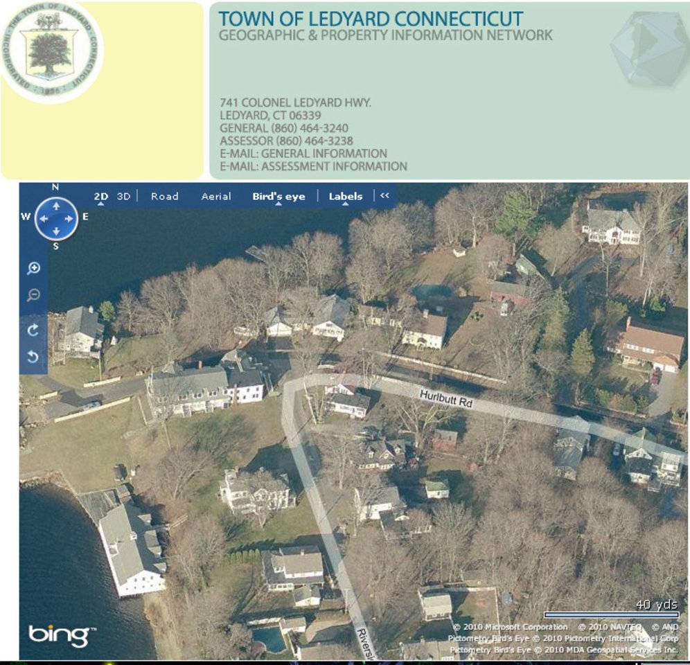
- 63 Hurlbutt Road, Ledyard
- Typology

- Overview
-
Designations
Historic Significance
Architectural description:
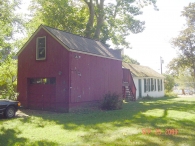
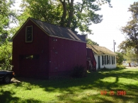
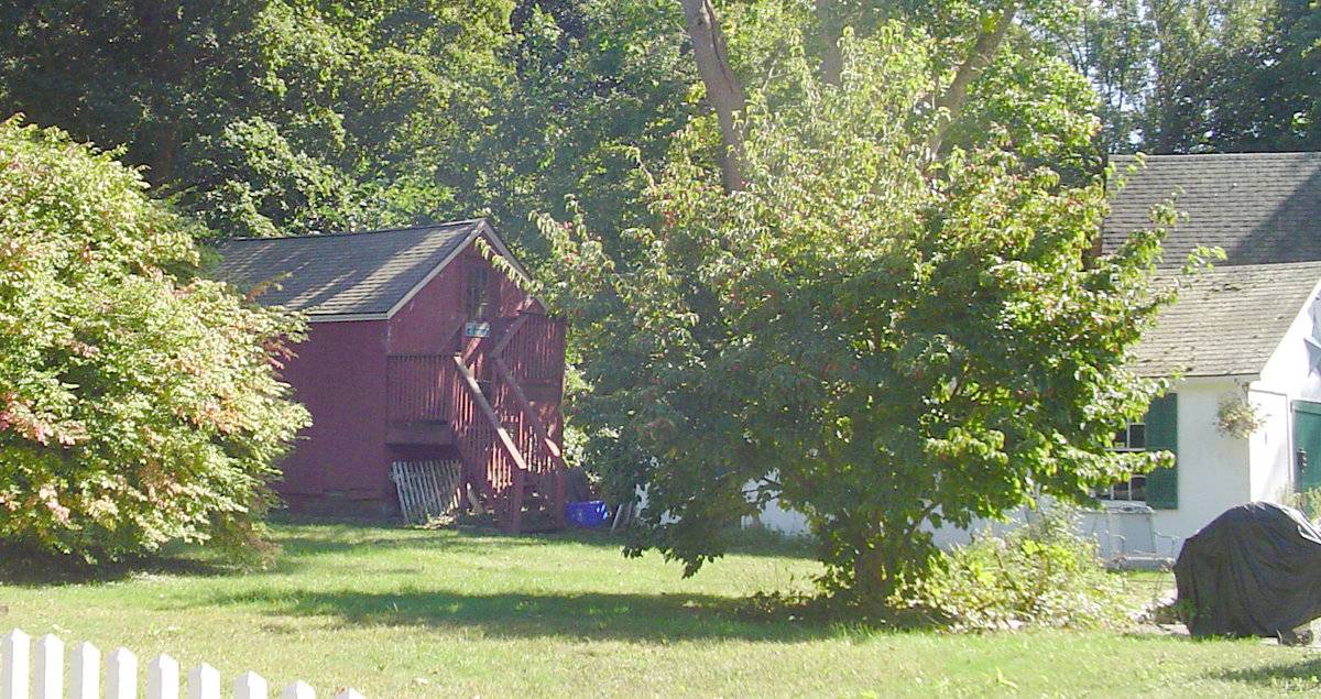
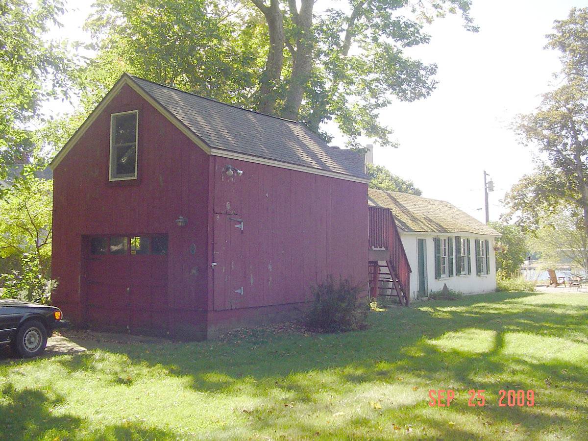
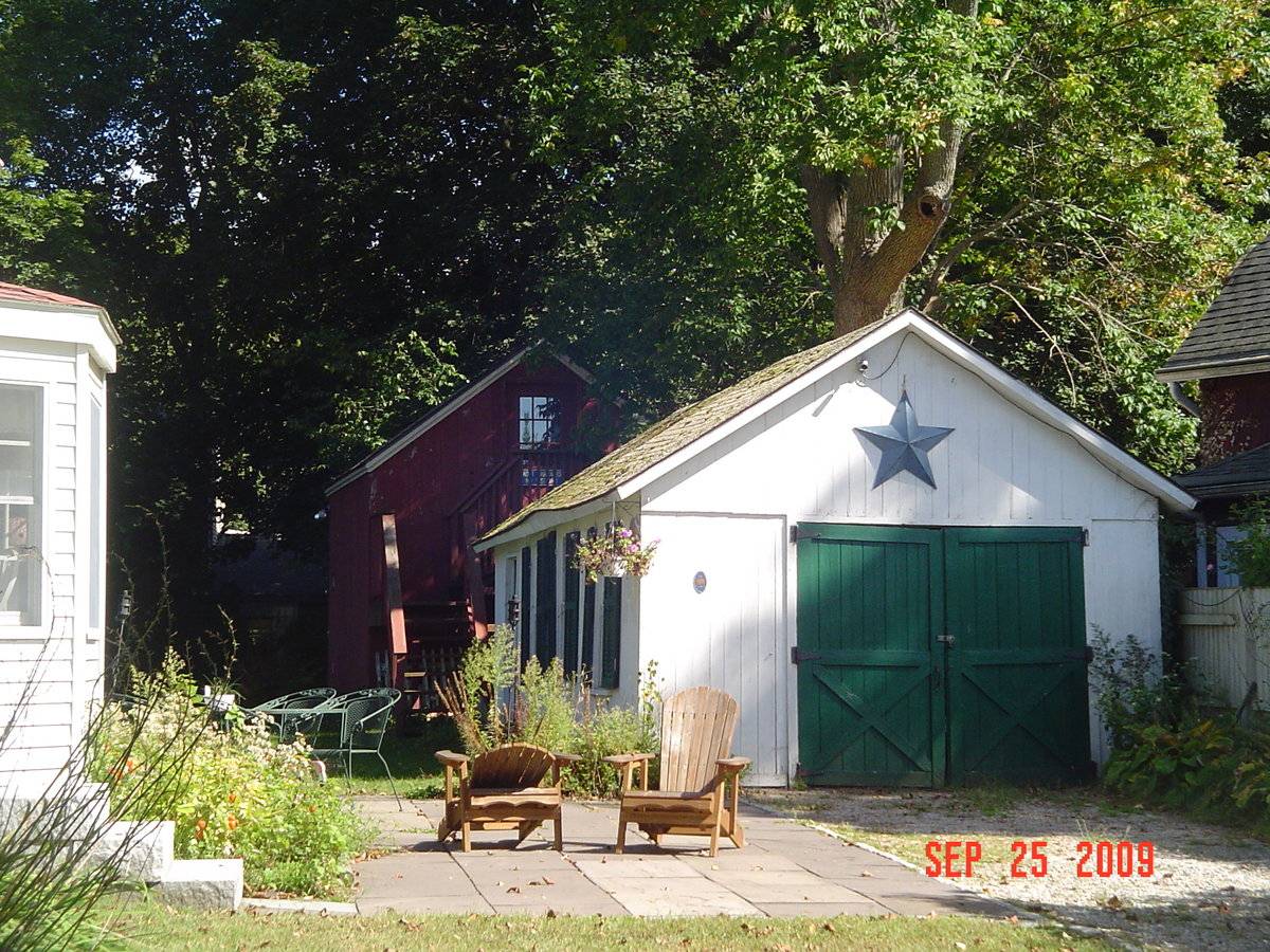
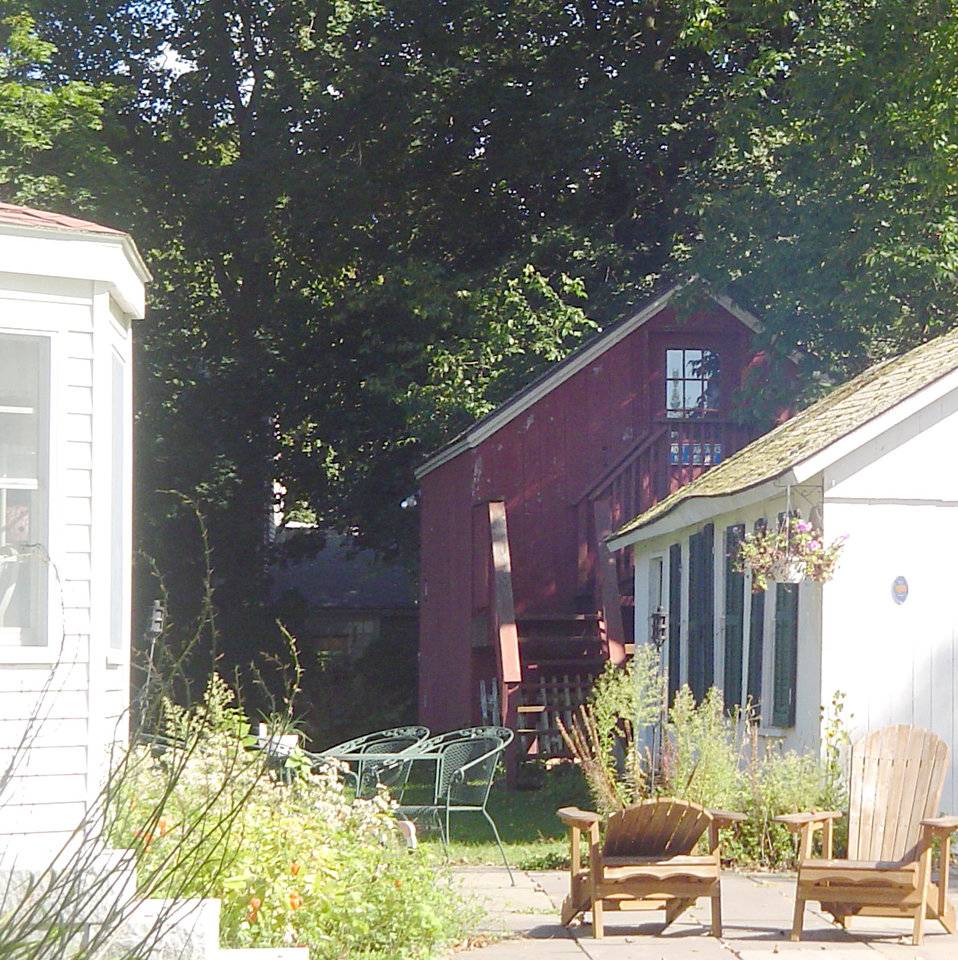
This is a 1 ½-story gable-roofed structure with its ridge line oriented east-west parallel to Hurlbutt Road. The east gable-end facade, facing away from the nearby house, has an overhead garage door in the ground floor and a one-over-one double hung window in the attic above. The north eave-side façade has no window openings and near the north corner there is a pass-through door with its sill at two feet above grade, at the top of the concrete masonry foundation. The west gable-end façade has a 12-pane glazed door in the attic level, with a wood-framed porch and steps down to grade.
The walls have vertical flush-board siding painted red, the foundation is concrete masonry three courses high, and the roofing is asphalt shingles.Historical significance:
Known as the shop, workshop, carpentry shop, toolshed, blacksmith shop, or machine shop, these small, well-lighted buildings provide a heated space for making and repairing furnishings, tools, and equipment, as well as for earning outside income through various trades. Typically 1 1/2 stories with a gabled front, and easily accessible doorway, and windows all around, most shops have a chimney for venting a cast iron rood or coal stove.
The adjacent building was historically in use as a store (Samuel Brown Store, 1899).
Historical background:
Ledyard was a “daughter town,” several stages removed from the settlement of the oldest parent community, New London, and the second stage community of Groton, as European settlers pushed inland from the coast in the early 18th century. Threats of Native American (Indian) attack were no longer a problem and people moved into remote areas to build farms widely separated from neighbors, in contrast to the earlier settlements focused on proximity to a meeting house. Native Americans remained a significant presence throughout history, with the Mashantucket Pequot tribal reservation first dating from the 1660s.
As the last section of Connecticut to be settled by Europeans, Ledyard contains some of the least desirable acreage for farming, located in a post-glacial landscape of bedrock and boulder-strewn glacial till. The land was acquired by descendants of the New London proprietors. Small farms, water-powered mills, lumbering, and fishing provided means of support. An exceptional level of family cohesiveness evolved in Ledyard, with family ties taking precedence over community. Several local population centers became small village clusters, including Gales Ferry, Ledyard Center, Quakertown, and the Gurdon Bill Store site.
Ledyard citizens played a significant part in the Revolutionary War. Later, in the 19th and 20th centuries, subsistence farming shifted to dairy farming to serve the urban markets of New London and Norwich. The maritime and naval shipbuilding of the Thames River later influenced the residential development of Ledyard, while the growth of the tribal casinos brought further growth in the late 20th century.Field Notes
Red wooden vertical siding. Barn is a contributing resource in Gales Ferry National Register District No. 1. Gable end upstairs window is a replacement. Exterior stairs to second level an addition. Contemporary garage door is an addition. House on the site is 1850. Present reuse is upstairs office space with skylights.
- Use & Accessibility
Use (Historic)
Use (Present)
Exterior Visible from Public Road?
Yes
Demolished
n/a
Location Integrity
Unknown
- Environment
Related features
Environment features
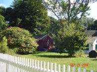
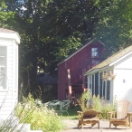
Relationship to surroundings
The village of Gales Ferry is on the western edge of Ledyard on the Thames River where an 18th-century ferry route established the core of the settlement. The district consists of 19th-century buildings associated with the ferry, wharves, and seafaring commerce, summer residences built following the arrival of a railroad line from the coast, and civic buildings serving the village.
- Typology & Materials
-
Building Typology
Materials
Structural System
Roof materials
Roof type
Approximate Dimensions
14 feet x 20 feet
- Source
-
Date Compiled
06/15/2010
Compiled By
Charlotte Hitchcock, reviewed by CT Trust
Sources
Field notes and photographs by Anne T. Roberts-Pierson 12/07/2009 ar-pierson@att.net
Town of Ledyard Assessor’s Record Map/Lot: Barn is on parcel 75-1050-61 adjacent to 63 Hurlbutt Road ( Parcel 75-1050-63). (barn 14 x 20 feet, 1880s).
Cunningham, Jan, A Historic and Architectural Resource Survey of the Town of Ledyard, Ledyard Historic District Commission, 1992.
Cunningham, Jan, Gales Ferry Historic District No. 1 National Register Historic District Nomination No. 92001639, National Park Service, 1992.
Ransom, David, Gales Ferry Historic District No. 2 National Register Historic District Nomination No. 02000865, National Park Service, 2002.
Foster, Kit, Ledyard Town Historian, history of Ledyard
http://www.town.ledyard.ct.us/index.aspx?NID=279
http://www.town.ledyard.ct.us/index.aspx?NID=280
http://www.town.ledyard.ct.us/index.aspx?NID=281
Sexton, James, PhD, Survey Narrative of the Connecticut Barn, Connecticut Trust for Historic Preservation, Hamden, CT, 2005, http://www.connecticutbarns.org/history.
Visser, Thomas D., Field Guide to New England Barns and Farm Buildings, University Press of New England, 1997. - PhotosClick on image to view full file
-