Barn Record Ledyard
RETURN TO ‘FIND BARNS’- Building Name (Common)
- AA Lock & Key
- Building Name (Historic)
- Maple Terrace Farm
- Address
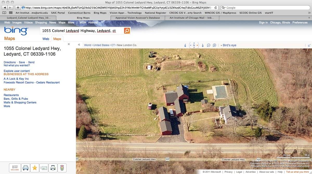
- 1055 Colonel Ledyard Highway (Rte 117), Ledyard
- Typology

- Overview
-
Designations
n/a
Historic Significance
Architectural description:
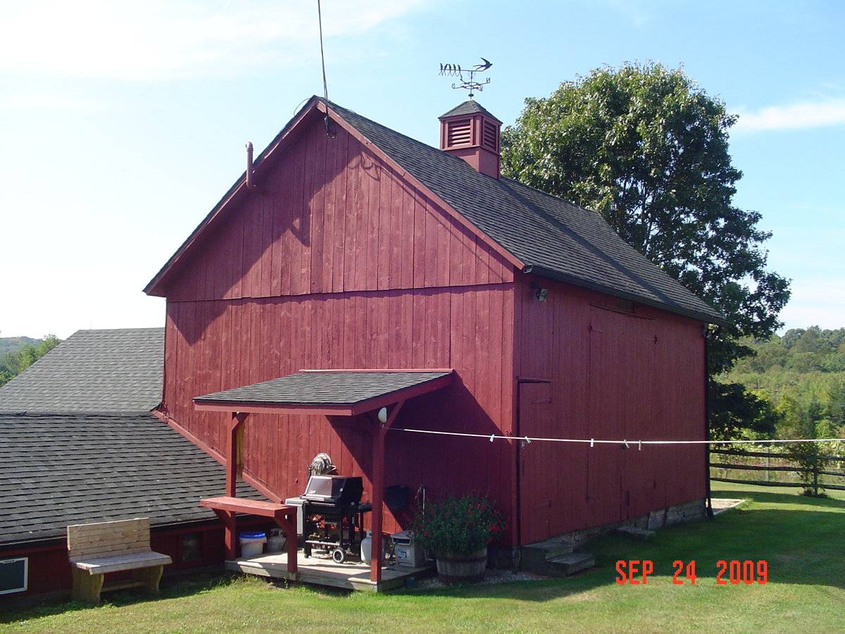
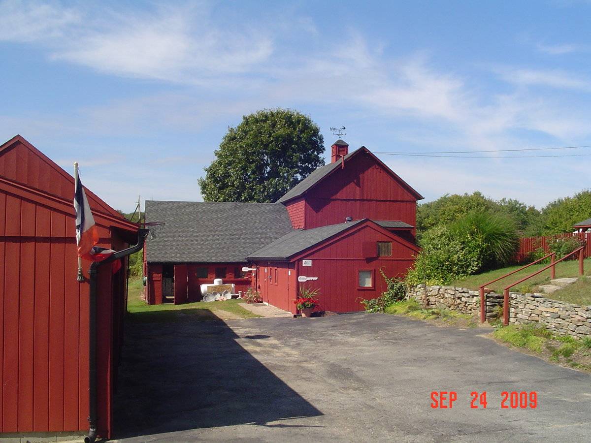
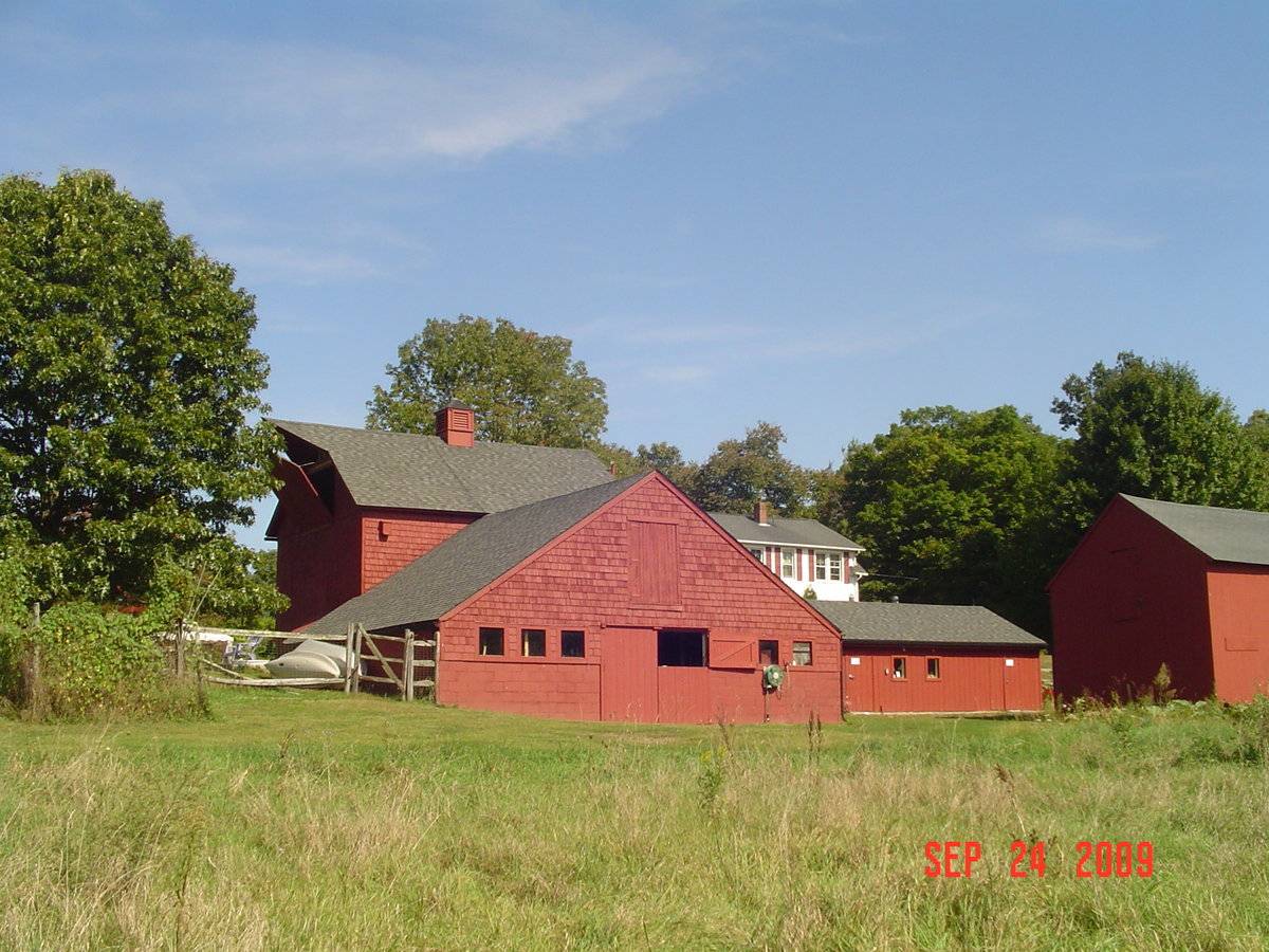
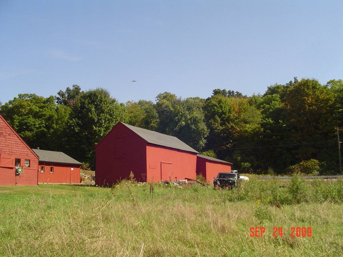
This is a 1 ½ story, eave-entry bank barn with three additions. The barn has a rectangular footprint and a pitched roof with a ridge-line running east-west, which is perpendicular to Colonel Ledyard Highway. The main eave faces north and has a pair of double-height swinging hinged doors, which are centrally located and a pass-through door at the east corner. Mortared fieldstone foundtion is exposed. The east gable-end of the barn has a shed-roof porch addition, which is located off center to the north. Connected to the southeast corner is a gable-roof addition, which extends to the east and its ridgeline runs east-west. The south eave-side has a second gable-roof addition, which extends to the south and its ridgeline runs north-south. The west gable-end has a projecting hay hood and a hinged hay door, which is located toward the top of the gable. The rest of the west gable-end appears to be blank. The barn is clad in vertical siding on the north, east, and west sides and wood shingles on the south side, which have been painted red. The roof has a projecting overhang and is covered in asphalt shingles. In the center of the ridgeline is a cupola with a weathervane.
Historical significance:The oldest barns still found in the state are called the “English Barn,” “side-entry barn,” “eave entry,” or a 30 x 40. They are simple buildings with rectangular plan, pitched gable roof, and a door or doors located on one or both of the eave sides of the building based on the grain warehouses of
the English colonists’ homeland. The name “30 by 40” originates from its size (in feet), which was large enough for 1 family and could service about 100 acres. The multi-purpose use of the English barn is reflected by the building’s construction in three distinct bays - one for each use. The middle
bay was used for threshing, which is separating the seed from the stalk in wheat and oat by beating the stalks with a flail. The flanking bays would be for animals and hay storage.Field Notes
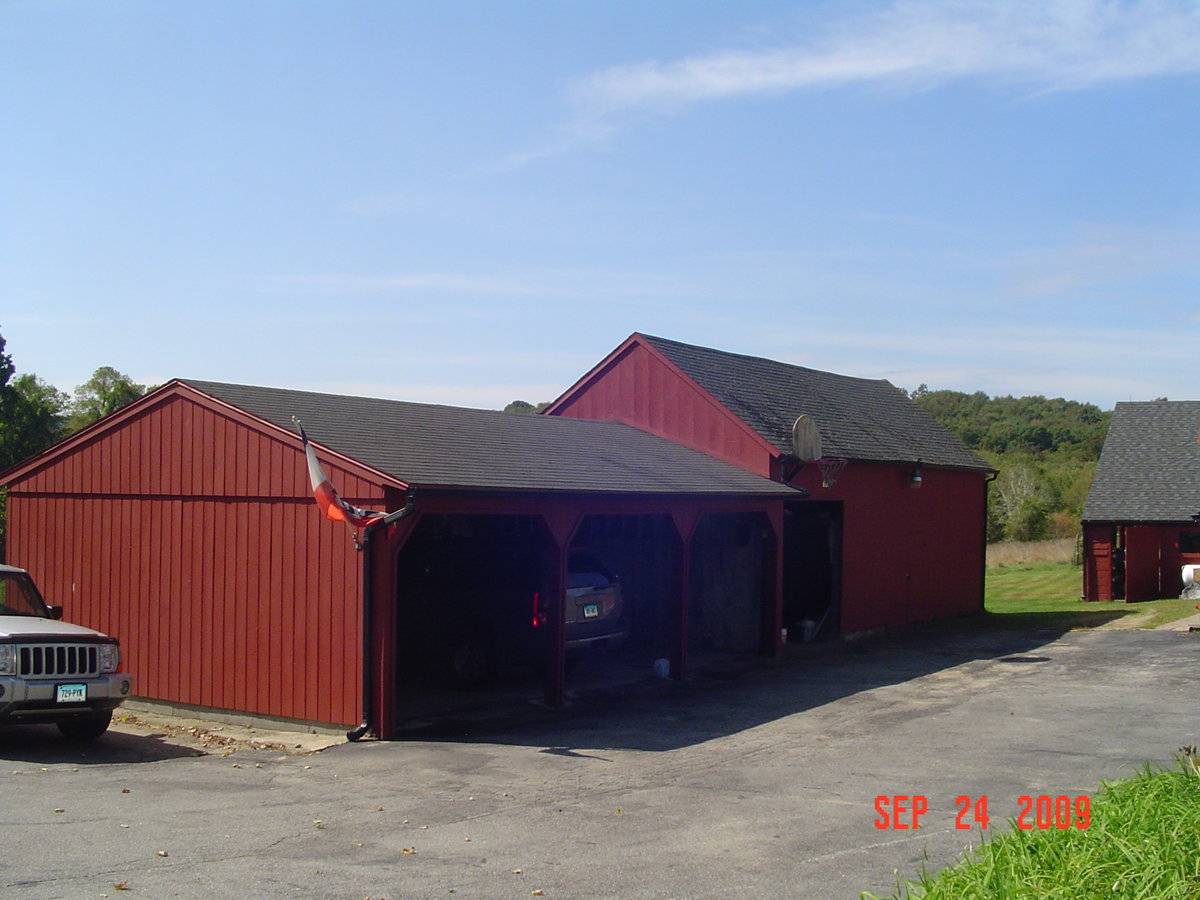
George and Marybelle Garypie owned this dairy farm in the 1940-1950s. House is 1893. Present owner thinks the original parts of this dairy barn may be older than the house. The milking parlor portion of the barn was rebuilt in 1986 and is now the business office of AA Lock & Key. The cupola is fake and purely decorative, states the present owner, as is the red paint on the barn and secondary building. They enhanced the barn with red exterior paint and cupola in 1978. Barn was whitewashed when they bought the property. Secondary building closer to the road housed farm equipment and was also a roadside vegetable farmstand at one time.
- Use & Accessibility
Use (Historic)
Use (Present)
Exterior Visible from Public Road?
Yes
Demolished
n/a
Location Integrity
Unknown
- Environment
Related features
Environment features
Relationship to surroundings
The total area of the site is 18.63 acres, which includes a house, four barns, wagon shed, shed, in-ground pool, and a stone wall. The house faces south and is located to the northeast of the barn. The ridgeline of the house runs east-west, as does the ridgeline of the barn. The in-ground pool is located to the west of the house and the smaller shed is located to the southwest of the house. Connected onto the south eave of the barn are two barns, one of which extends to the south and the other extends to the east. Southeast of the three connected barns is a barn and wagon shed, which are connected. A stone wall is built into a bank on the north side of the driveway. The land is being used for active agriculture and woodlands are found primarily to the west of the property.
- Typology & Materials
-
Building Typology
Materials
Structural System
Roof materials
Roof type
Approximate Dimensions
540 sq. ft.
- Source
-
Date Compiled
02/13/2011
Compiled By
C. Whims & T. Levine, reviewed by CT Trust
Sources
Field notes and photographs by Anne T. Roberts-Pierson date 12/07/2009.
Town of Ledyard Assessor’s Record or GIS Viewer http://data.visionappraisal.com/
Parcel ID: 3/ 530/ 1055/ / /Aerial Mapping:
http://www.bing.com/maps accessed 02/19/2011.Sexton, James, PhD, Survey Narrative of the Connecticut Barn, Connecticut Trust for Historic Preservation, Hamden, CT, 2005, http://www.connecticutbarns.org/history.
Visser, Thomas D., Field Guide to New England Barns and Farm Buildings, University Press of New England, 1997.
Sexton, Visser p. 61 ff. - PhotosClick on image to view full file
-