Barn Record Preston
RETURN TO ‘FIND BARNS’
- Overview
-
Designations
n/a
Historic Significance
Architectural description:
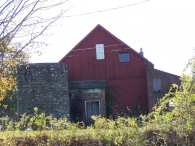
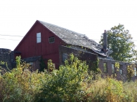
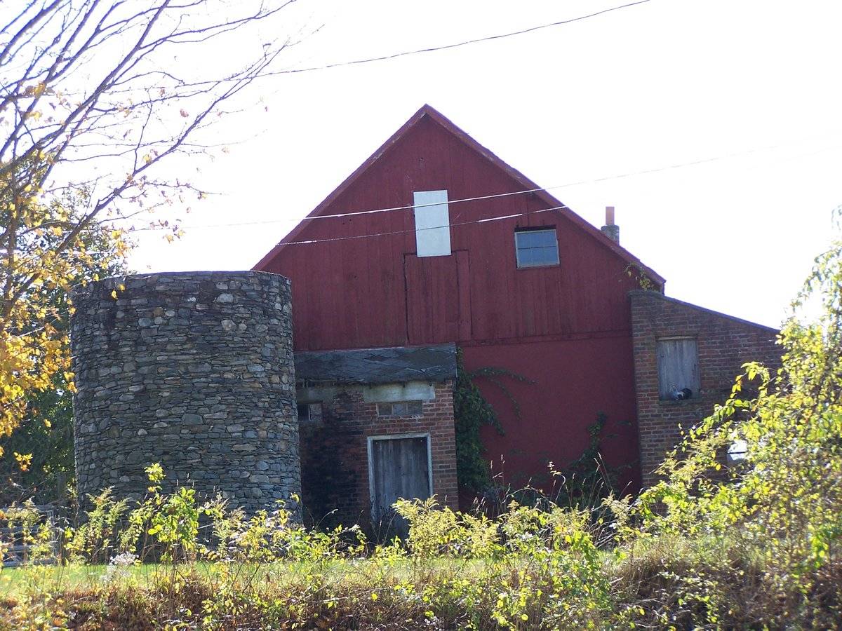
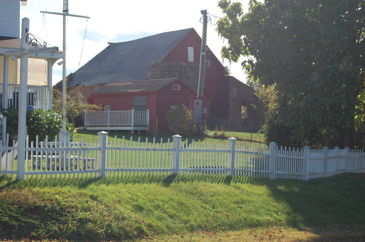
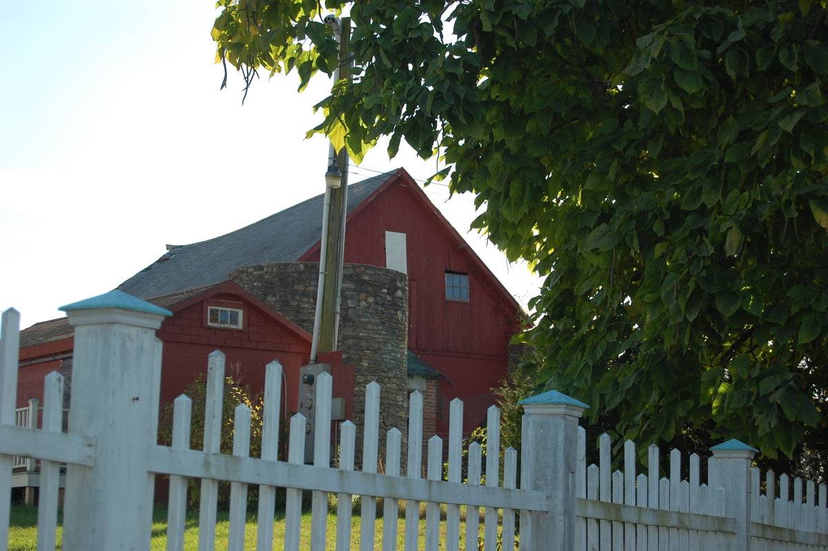
This is a 1 1/2 story side or eave-entry barn with two shed-roofed additions and a stone silo. The ridge-line of the gable roof is oriented north-south and the silo is located at the northeast corner. The shed-roofed additions wrap around the west and south sides. The barn appears to have brick eave-facades and vertical flush-board siding on the gable ends, possibly covering brick. Both shed-roofed additions have brick walls. The north gable-end close to the silo has a projecting overhang with sofits. Beneath the apex of the roof is a hay door. To the right of the hay door is a fixed six-pane window. The silo appears to be made of mortared fieldstone. The top of the silo is now gone and the roof of the barn is severely deteriorated. The roof of the right shed-roofed addition is completely gone.
Historical significance:
The oldest barns still found in the state are called the “English Barn,” “side-entry barn,” “eave entry,” or a 30 x 40. They are simple buildings with rectangular plan, pitched gable roof, and a door or doors located on one or both of the eave sides of the building based on the grain warehouses of the English colonists’ homeland. The name “30 by 40” originates from its size (in feet), which was large enough for 1 family and could service about 100 acres. The multi-purpose use of the English barn is reflected by the building’s construction in three distinct bays - one for each use. The middle bay was used for threshing, which is separating the seed from the stalk in wheat and oat by beating the stalks with a flail. The flanking bays would be for animals and hay storage.
Field Notes
Old barn with stone silo. (ST) Home – 1798 (LC)
- Use & Accessibility
Use (Historic)
Use (Present)
Exterior Visible from Public Road?
Yes
Demolished
n/a
Location Integrity
Unknown
- Environment
Related features
Environment features
Relationship to surroundings
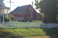
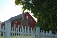
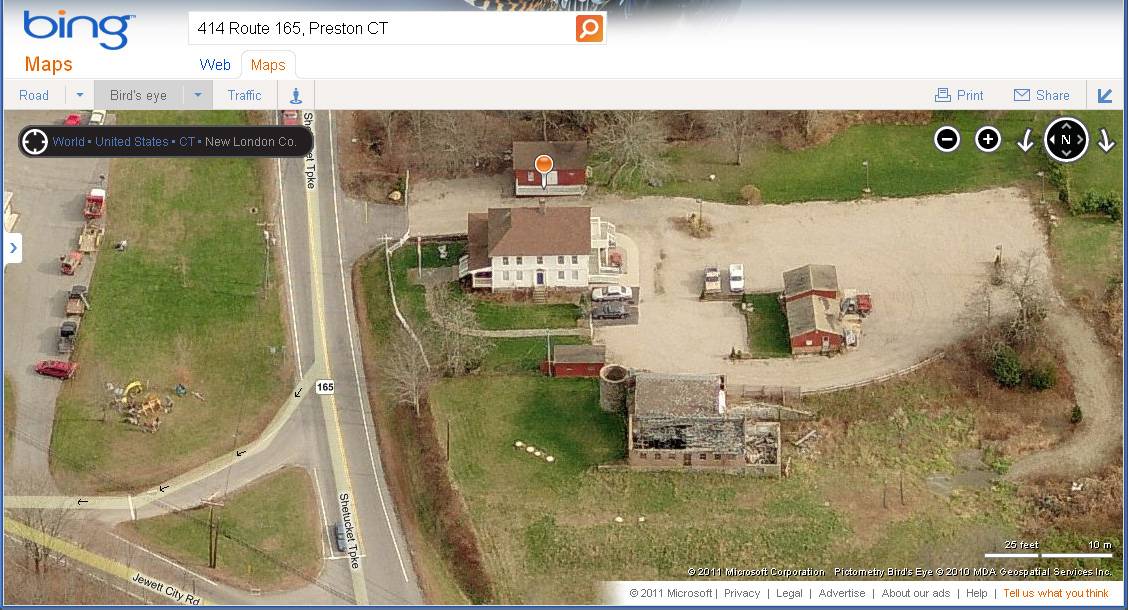
This site is located at the southeast corner of the intersection of Route 165, Shetucket Turnpike, and Route 164, Preston Plains/Jewett City Road. A house dated 1798 is located at the north edge of the site set back behind a narrow lawn from Shetucket Turpike. Its ridge-line is oriented north-south perpendicular to the road. The north side has a gable-on-hip roof while the south side has a gable-end. A 1-story porch wraps around the east and north sides. Southwest of the house is the barn with a stone silo attached at its northeast corner. A small shed is located between the barn and house, and a larger shed or garage is to the south of the other buildings. A gravel parking area extends from the south wall of the house westward to the barn and southward beyond the larger shed. There is a small island which may have held gasoline pumps, and several street lights on poles around the perimeter. It appears that the property had a commercial use until recent times. The area around the intersection of Routes 165 and 164 is the commercial center of Preston and Preston City, a decentralized grouping of municipal and commercial functions spread out along the major roads. Woodlands, residential home developments, and working farmland are intermixed, along with a number of lakes and ponds. The city of Norwich is located to the west along the Thames River.
- Typology & Materials
-
Building Typology
Materials
Structural System
n/a
Roof materials
Roof type
Approximate Dimensions
n/a
- Source
-
Date Compiled
04/14/2010
Compiled By
T. Levine, C. Hitchcock, reviewed by CT Trust
Sources
Photograph 1 & 2 and field notes by Sue Theve: stheve@snet.net - 12/09/2009
Photograph 3 & 4 and field notes by Linda Christensen: LindaCh5@snet.net - 12/07/2009
Assessor’s Record: http://data.visionappraisal.com/PrestonCT/findpid.asp?iTable=pid&pid=909
Parcel ID: 13-0/ 165/ 414/ 3.77 acres House date 1798BRN1 BARN - 1 STORY 589 S.F.
BRN1 BARN - 1 STORY 800 S.F.
IMP IMPLEMENT SHED 600 S.F.
Aerial Mapping:
http://maps.google.com
http://www.bing.com/maps accessed 6/30/2011.Sexton, James, PhD, Survey Narrative of the Connecticut Barn, Connecticut Trust for Historic Preservation, Hamden, CT, 2005, http://www.connecticutbarns.org/history.
Visser, Thomas D., Field Guide to New England Barns and Farm Buildings, University Press of New England, 1997.
- PhotosClick on image to view full file
-