Barn Record Willington
RETURN TO ‘FIND BARNS’- Building Name (Common)
- n/a
- Building Name (Historic)
- n/a
- Address
- 351 River Road (Rte. 32), Willington
- Typology

- Overview
-
Designations
n/a
Historic Significance
Architectural description:
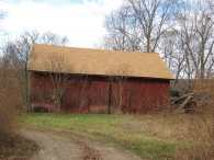
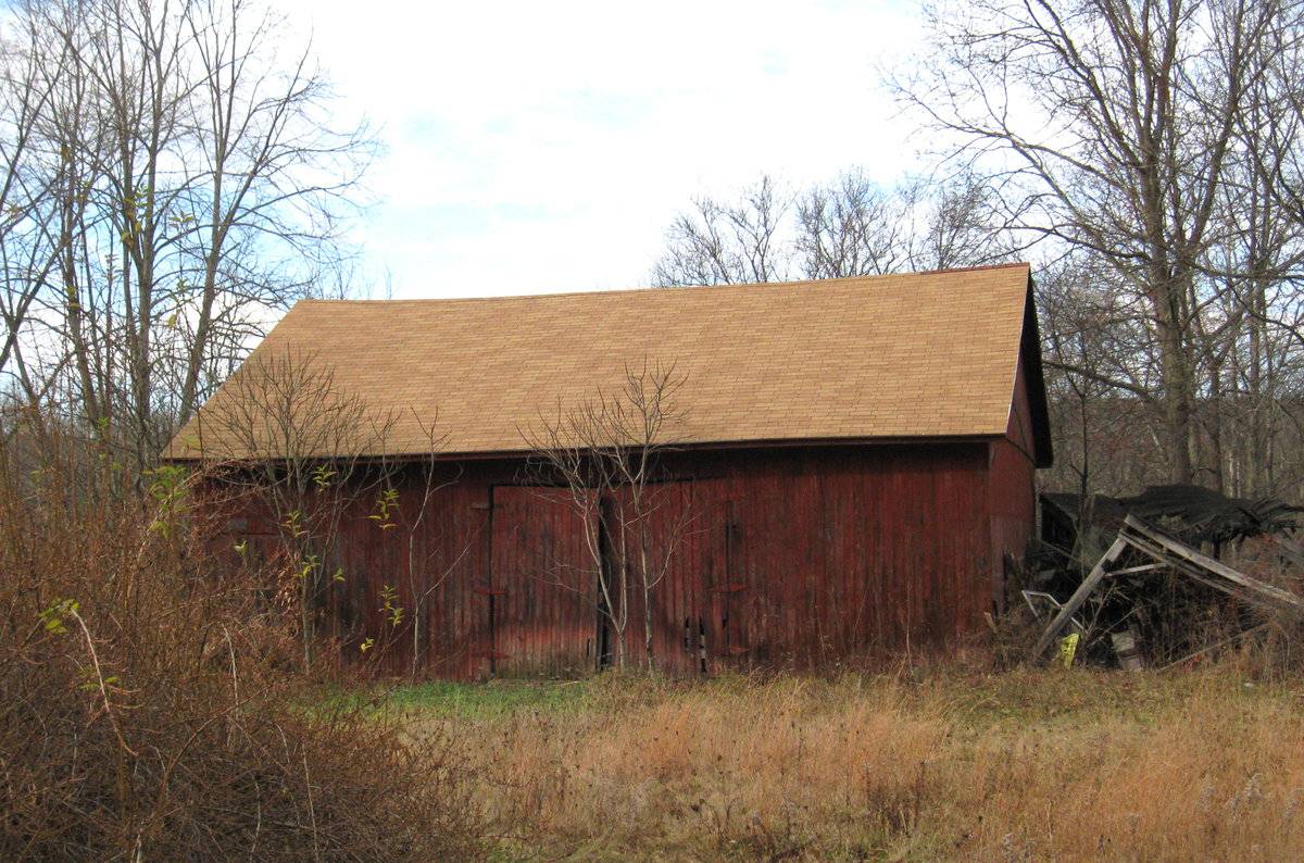
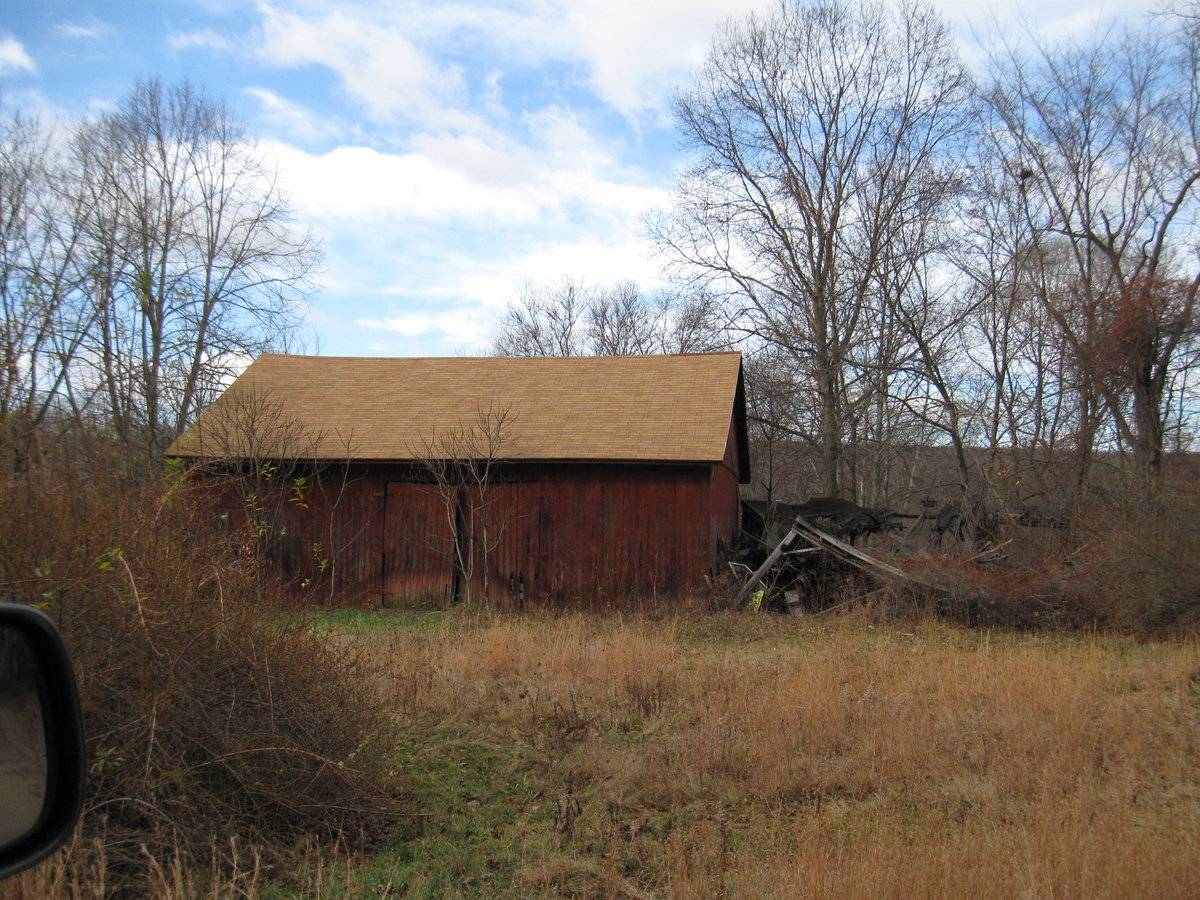
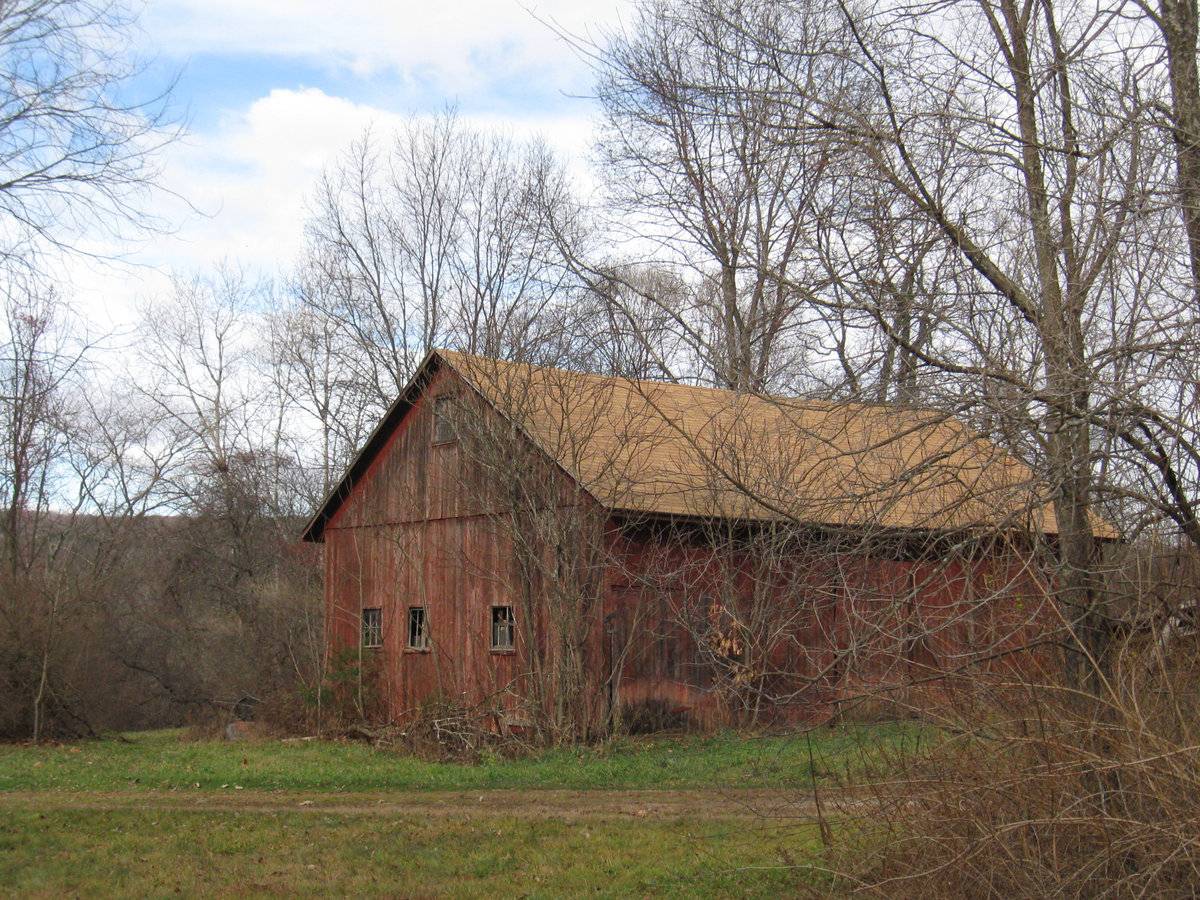
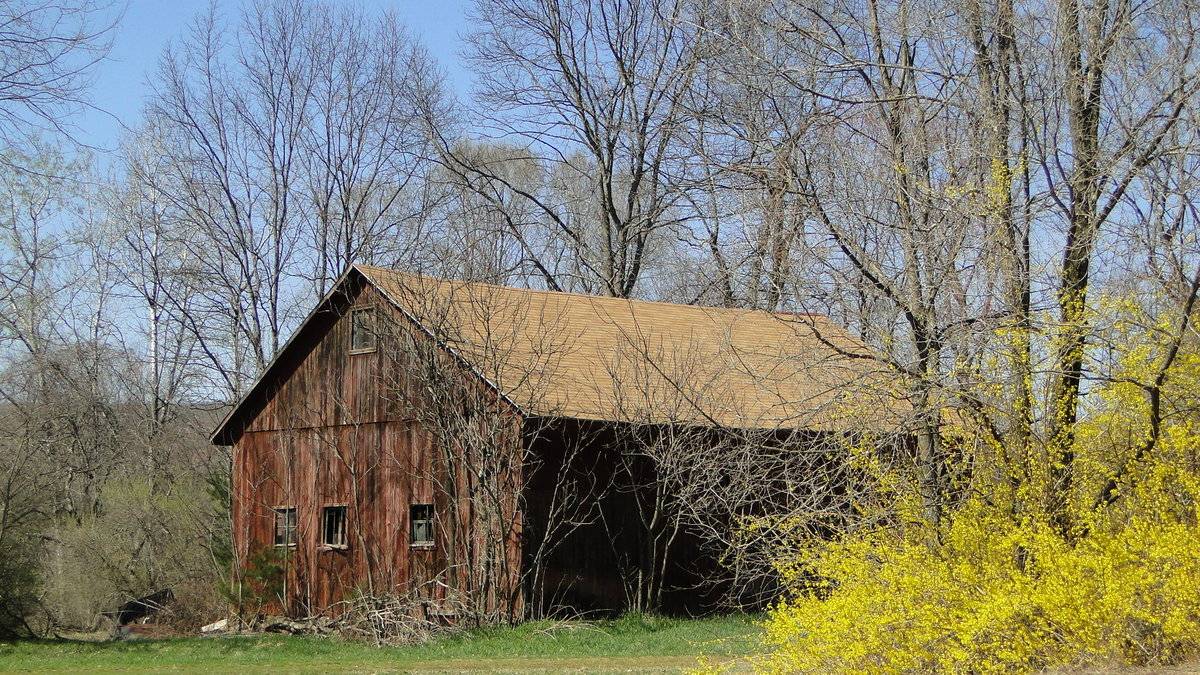
This is a 1 1/2-story, tripartite, eave-entry barn. The main facade of this barn faces southeast, and its ridge line is parallel to River Road, which runs northeast-southwest along this property.
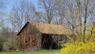
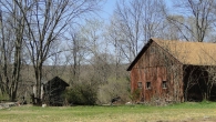
The primary southeast eave-façade is three bays in width and includes a pair of oversize hinged doors, located in the center bay. Three large hinges attach the wooden doors to the exterior wall cladding. An oversized pass-through door, also of wood construction, is present in the south bay of the southeast eave-façade. The north bay is blank. The southwest gable-side of the barn features three window openings on the main floor. Two of the windows are to the west of the center of the south wall, and one to the east. A rectangular opening is present on the southwest gable-side beneath the roof apex, but this has since been replaced with a solid piece of wood. The northwest eave-side of the barn appears blank. The northeast gable-side of the barn features a full-width shed roof addition extending to the north, which has collapsed.
The exterior walls are covered by medium-width vertical board-and-batten wooden siding, at one time painted red. The gable roof is covered in tan asphalt shingles. There are no projections from the roof.
Historical significance:
The oldest barns still found in the state are called the “English Barn,” “side-entry barn,” “eave entry,” or a 30 x 40. They are simple buildings with rectangular plan, pitched gable roof, and a door or doors located on one or both of the eave sides of the building based on the grain warehouses of the English colonists’ homeland. The name “30 by 40” originates from its size (in feet), which was large enough for 1 family and could service about 100 acres. The multi-purpose use of the English barn is reflected by the building’s construction in three distinct bays - one for each use. The middle bay was used for threshing, which is separating the seed from the stalk in wheat and oat by beating the stalks with a flail. The flanking bays would be for animals and hay storage.
Field Notes
Map/Lot 30/022-00 House c. 1900, 5.69 acres, 1440 square feet barn
- Use & Accessibility
Use (Historic)
Use (Present)
Exterior Visible from Public Road?
Yes
Demolished
n/a
Location Integrity
Unknown
- Environment
Related features
n/a
Environment features
Relationship to surroundings
Environmental Information:
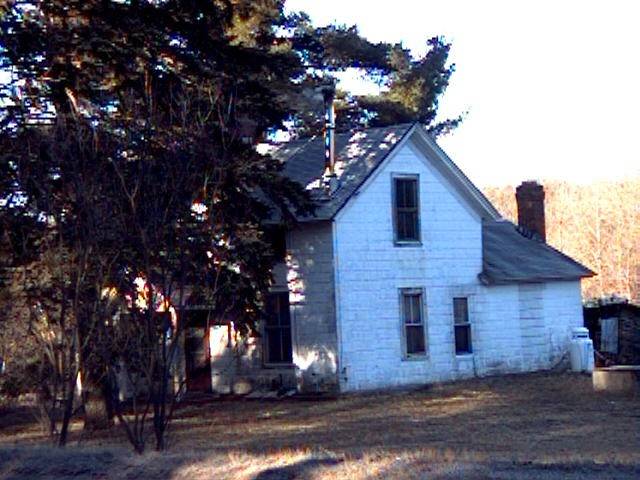
The main barn runs parallel to River Road and with the primary entry facing southeast. The farmhouse associated with this barn is located just to the south of the barn, separated by a small grass and gravel parking area, and set back from the road about the same distance. Southwest of the farmhouse is a small grassy open space, a row of deciduous trees, and beyond an area of light density residential. To the northwest of the barn is an area of grassy open space dotted with trees, beyond which is a single track railroad line owned by New England Central Railroad. Beyond the railroad track is a wooded area and the Willimantic River. Immediately to the northeast of the barn is a small pond and grassy open area. Beyond this to the north is an industrial gravel transloading facility. The land immediately between the barn’s primary southeast façade and River Road is grassy and open. Across River Road to the southeast is a small woodland beyond which is a county road commission maintenance facility.
- Typology & Materials
-
Building Typology
Materials
Structural System
Roof materials
Roof type
Approximate Dimensions
1440 square feet
- Source
-
Date Compiled
10/24/2010
Compiled By
N. Nietering & T. Levine, reviewed by CT Trust
Sources
Photographs by Fannie Young and Charlotte Hitchcock.
Sexton, James, PhD; Survey Narrative of the Connecticut Barn, Connecticut Trust for Historic
Preservation, Hamden, CT, 2005, http://www.connecticutbarns.org/history.Visser, Thomas D.,Field Guide to New England Barns and Farm Buildings, University Press of
New England, 1997, 213 pages.Map of Willington, CT, retrieved on October 9, 2010 from website www.bing.com.
Willington Assessor’s Records - Vision Appraisal online - http://data.visionappraisal.com/
WillingtonCT - PhotosClick on image to view full file
-