Barn Record Guilford
RETURN TO ‘FIND BARNS’- Building Name (Common)
- n/a
- Building Name (Historic)
- n/a
- Address
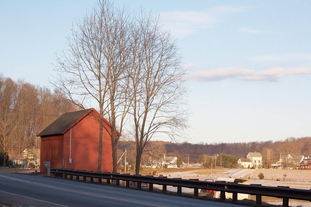
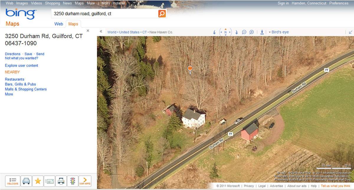
- 3250 Durham Road (Route 77), Guilford
- Typology

- Overview
-
Designations
n/a
Historic Significance
Architectural description:
This is a 1 1/2-story eave-entry bank barn. The main facade faces northwest with the ridge-line running northeast-southwest, which is parallel to Durham Road at this point. The main entrance is a double-height sliding door on the north half of the northwest eave-side. The other three sides of the barn appear blank. The ground level declines sharply at the gable-ends of the barn. The southeast eave-side slightly overhangs the ground and appears to have openings in the basement level. The barn has vertical flush-boards painted red. The roof has a projecting overhang and is covered in asphalt shingles. The foundation is not visible.
Historical significance:The oldest barns still found in the state are called the “English Barn,” “side-entry barn,” “eave entry,” or a 30 x 40. They are simple buildings with rectangular plan, pitched gable roof, and a door or doors located on one or both of the eave sides of the building based on the grain warehouses of the English colonists’ homeland. The name “30 by 40” originates from its size (in feet), which was large enough for 1 family and could service about 100 acres. The multi-purpose use of the English barn is reflected by the building’s construction in three distinct bays - one for each use. The middle bay was used for threshing, which is separating the seed from the stalk in wheat and oat by beating the stalks with a flail. The flanking bays would be for animals and hay storage.
Field Notes
n/a
- Use & Accessibility
Use (Historic)
Use (Present)
Exterior Visible from Public Road?
Yes
Demolished
n/a
Location Integrity
Unknown
- Environment
Related features
Environment features
Relationship to surroundings
The barn is located east of the c. 1835 house it is associated with, across Durham Road. The ridge-line of the house runs perpendicular to that of the barn. A small gabled shed is located slightly northwest and behind the house. The ridge-line of the shed runs parallel to that of the barn. North of the barn is open fields. The total size of the site is 2 acres. The surrounding area is rural residential, woodlands, and open land.
Parcel ID: 113037.
- Typology & Materials
-
Building Typology
Materials
Structural System
Roof materials
Roof type
Approximate Dimensions
Approximately 400 sq. ft.
- Source
-
Date Compiled
02/22/2011
Compiled By
B. Bjorklund & T. Levine, reviewed by CT Trust
Sources
Field notes and photographs by Ellie Green, 03/22/2010
Town of Guilford Assessor’s Record or GIS Viewer: http://www.guilfordgis.com/detail.asp?parid=113037
Parcel ID: 113037Aerial Mapping:
http://maps.google.com accessed 02/22/2011
http://www.bing.com/maps accessed 02/22/2011Sexton, James, PhD, Survey Narrative of the Connecticut Barn, Connecticut Trust for Historic Preservation, Hamden, CT, 2005, http://www.connecticutbarns.org/history.
Visser, Thomas D., Field Guide to New England Barns and Farm Buildings (Hanover: University Press of New England, 1997), 61.
- PhotosClick on image to view full file
-