Barn Record Guilford
RETURN TO ‘FIND BARNS’- Building Name (Common)
- Charles Monte (Part 2 of 2)
- Building Name (Historic)
- Charles Monte
- Address
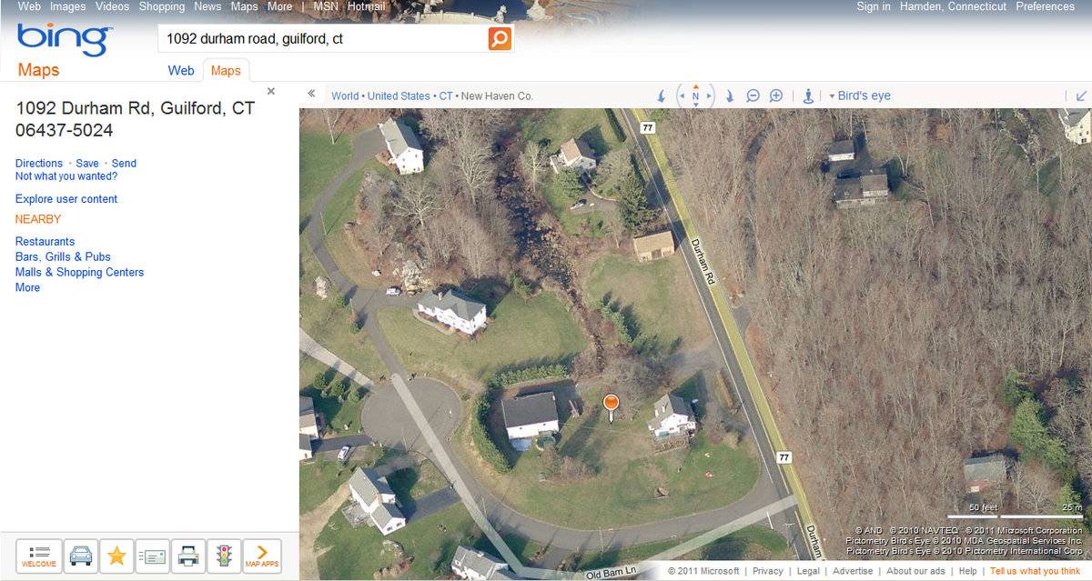
- 1092 Durham Road (Route 77), Guilford
- Typology

- Overview
-
Designations
n/a
Historic Significance
Architectural description:
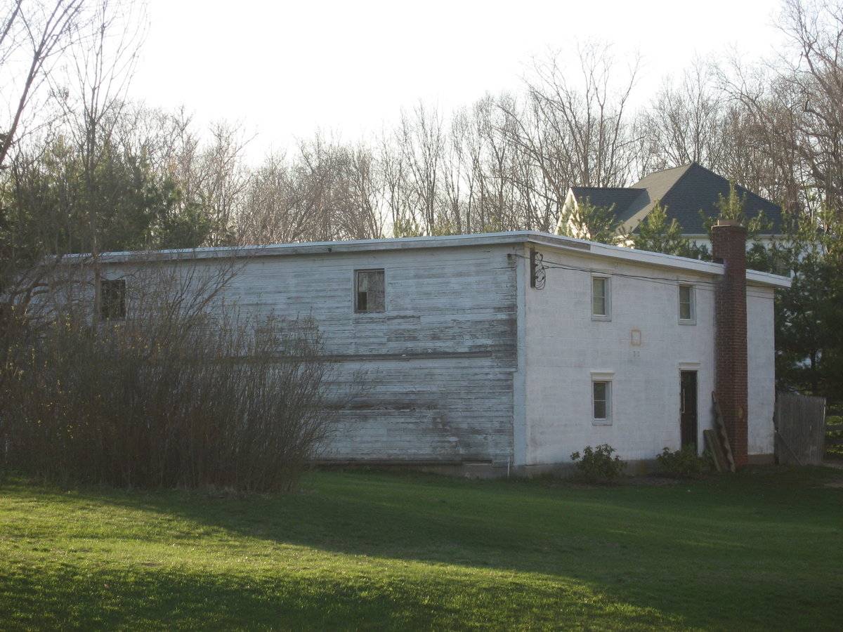
This is a 2-story flat-roof barn. The main facade faces southwest. The main entrance is a pair of large doors centered on the southwest side, though it is unclear what kind of doors they are. Two small windows flank the entrance on the second story. The northwest side has four evenly-spaced windows on the second story. The northeast side has a modern door centered on the northeast facade. South of the door is a one-over-one window. North of the entrance is an exterior brick chimney. Above the door is a one-over-one window and above the first-story window also is a one-over-one window. The southeast side has two six-pane windows on the second story, one on the north end and one on the south end. The northeast side of the barn is masonry, while the southeast side has vertical siding, both painted white. The foundation is concrete. It has a built-up roof.
Historical significance:By the 1930s, large two-and three-story poultry barns were being built for raising broilers and capons for meat and pullets for eggs. These often have a shallow-pitched gable or shed roof and many windows on the south side, which are often covered with wire mesh. Mineral-surfaced asphalt paper or shingles typically cover the roof and walls. Housing thousands of birds, these large structures became virtual factories, with automatic, clock-activated feeders and waterers to reduce labor.
Field Notes
This barn is behind the stone barn on Rt. 77 which belonged to John Rebuzzini. Charles Monte bought the farm from Rebuzzini and had a poultry business there for 40 years.
- Use & Accessibility
- Environment
Related features
Environment features
Relationship to surroundings
The barn is located west of and behind the c. 1914 house it is associated with. The ridge-line of the house runs parallel to Durham Road, which runs approximately northwest-southeast. A 1 1/2-story English bank barn is located northeast of the house. The total size of the site is 1.04 acres. The surrounding area is residential and woodlands.
Parcel ID: 09104707.
- Typology & Materials
-
Building Typology
Materials
Structural System
Roof materials
Roof type
Approximate Dimensions
Approximately 1500 sq. ft.
- Source
-
Date Compiled
02/18/2011
Compiled By
B. Bjorklund & T. Levine, reviewed by CT Trust
Sources
Field notes and photographs by Ellie Green, 06/28/2010.
Town of Guilford Assessor’s Record or GIS Viewer:
http://www.guilfordgis.com/detail.asp?parid=09104707
http://www.prophecyone.us/fieldcard.php?property_id=2151181
Parcel ID: 09104707Aerial Mapping:
http://maps.google.com accessed 02/18/11
http://www.bing.com/maps accessed 02/18/2011Sexton, James, PhD, Survey Narrative of the Connecticut Barn, Connecticut Trust for Historic Preservation, Hamden, CT, 2005, http://www.connecticutbarns.org/history.
Visser, Thomas D., Field Guide to New England Barns and Farm Buildings (Hanover: University Press of New England, 1997), 172-173.
- PhotosClick on image to view full file
-