Barn Record New London
RETURN TO ‘FIND BARNS’- Building Name (Common)
- Planned Parenthood of S. New England
- Building Name (Historic)
- Elisha Palmer Estate Carriage House
- Address
- 45 Franklin Street, New London
- Typology

- Overview
-
Designations
Historic Significance
Architectural description:
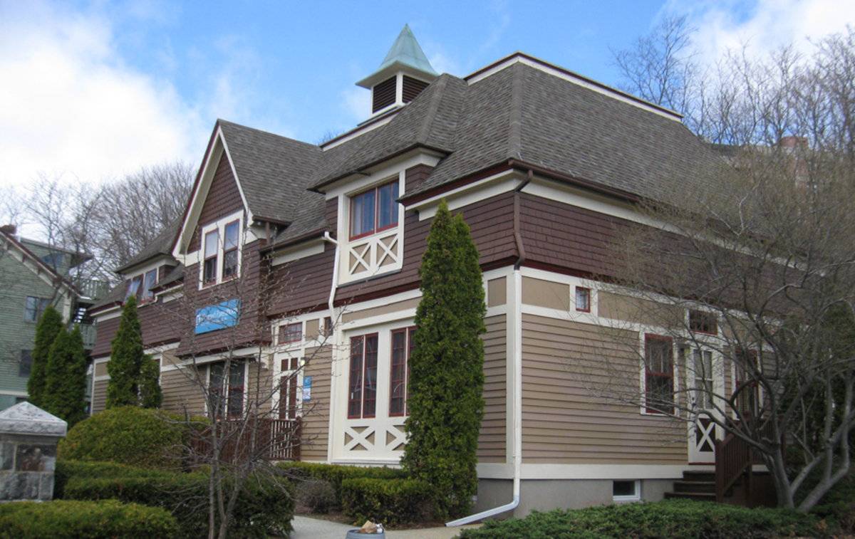
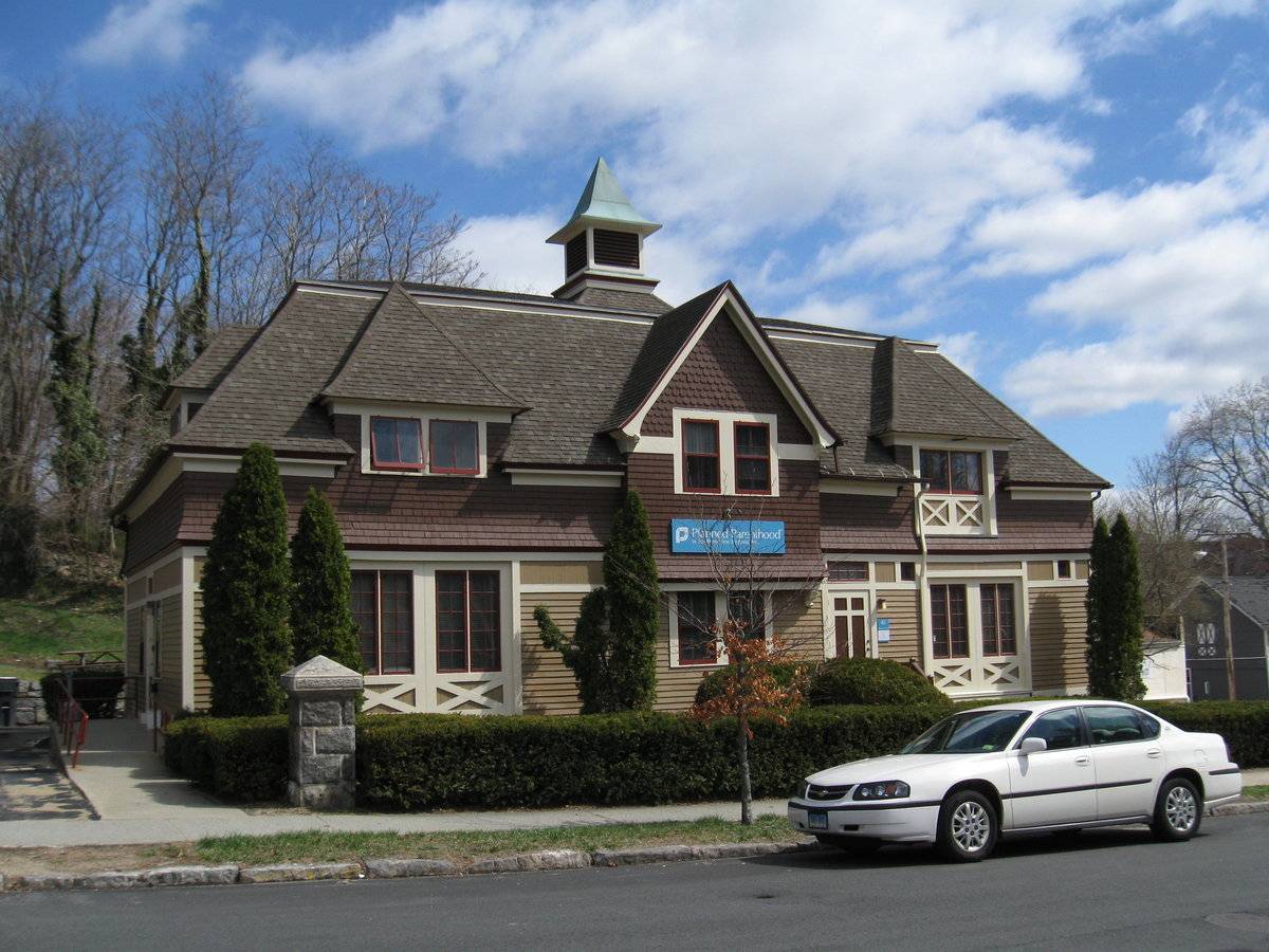
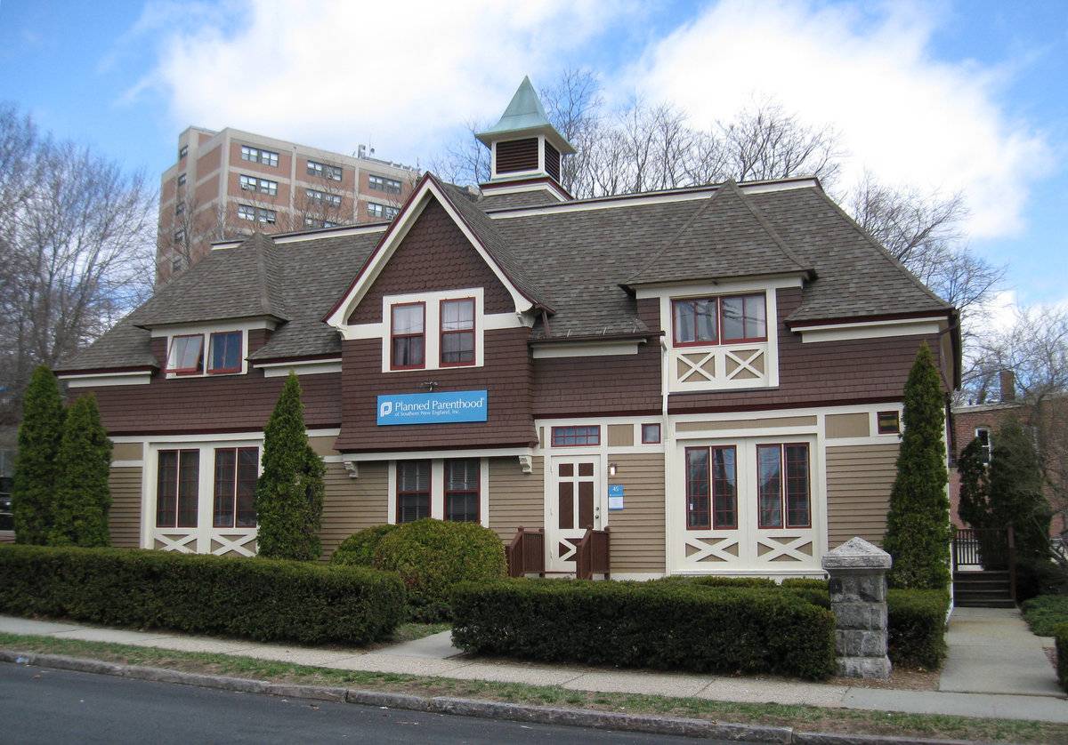
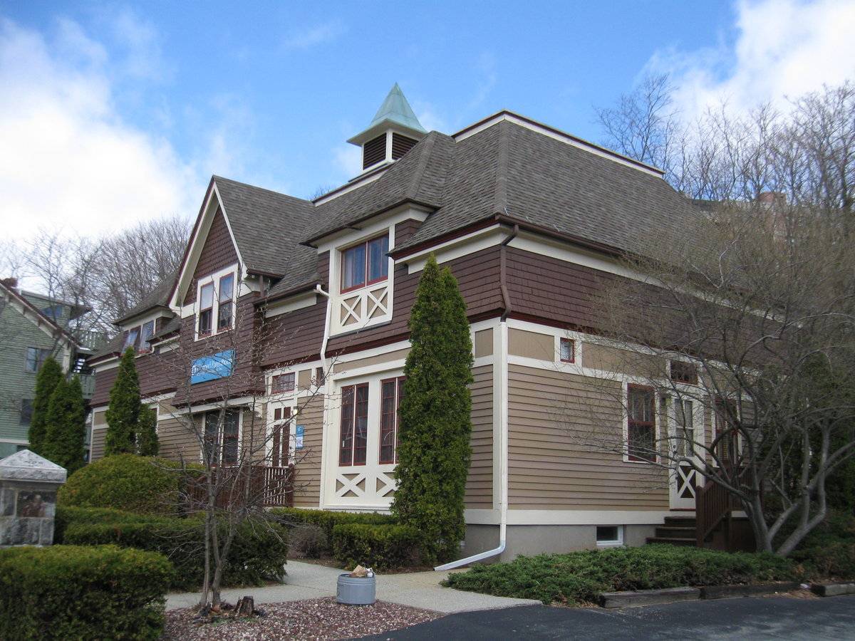
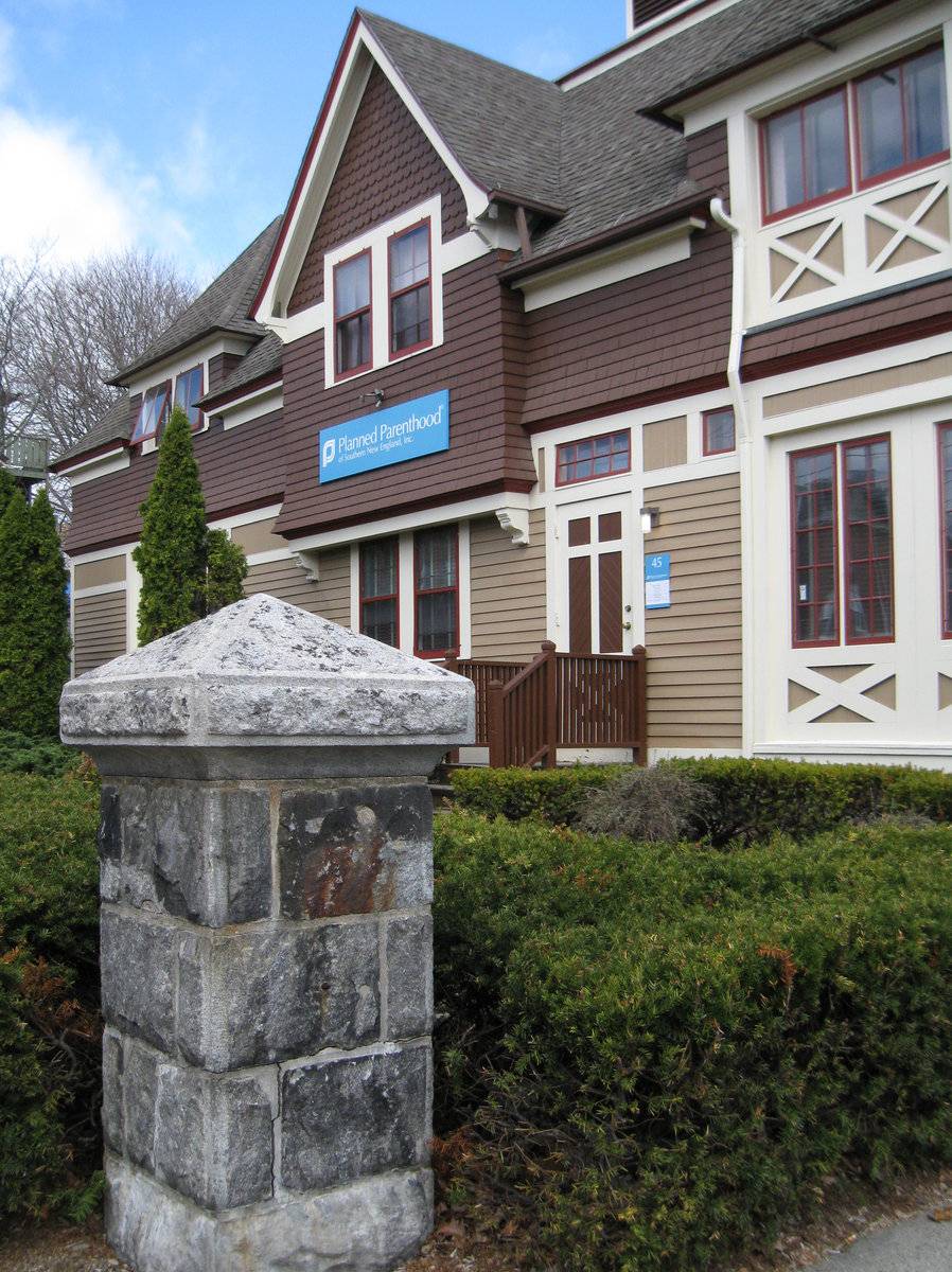
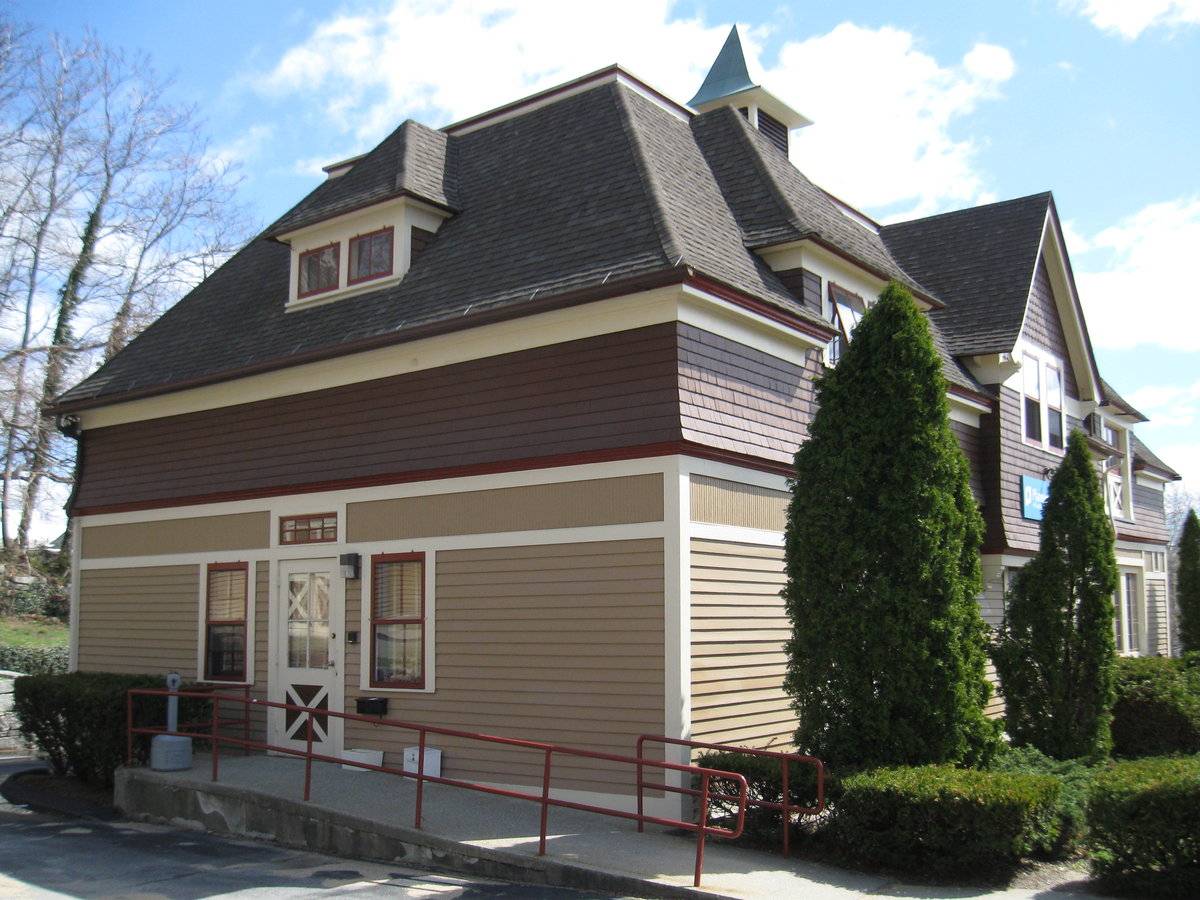
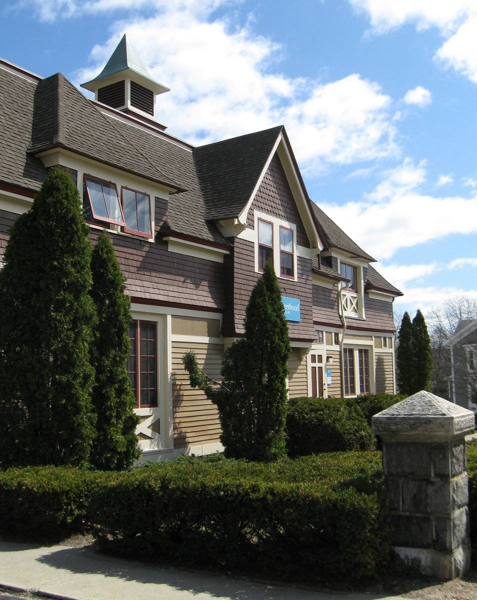
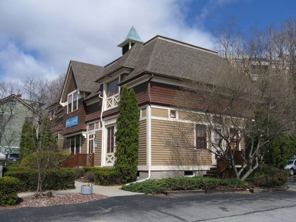
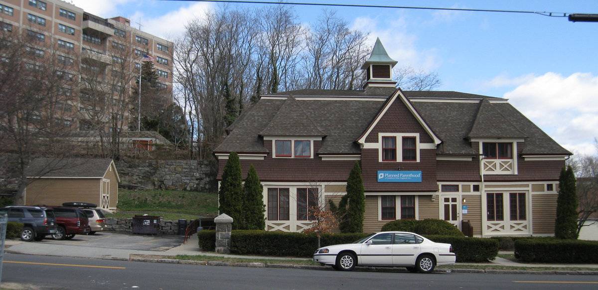
This is a one-story with full attic, mansard-roofed structure oriented with its facade facing southwest toward the street. The primary facade has a central gable-roofed dormer in the attic over a projecting hood supported by brackets. A pair of six-over-six double hung windows is located in the dormer and also below the hood. Flanking are matching hip-roofed dormers in the attic, each with a pair of two-light awning windows (the right pair has paneling below). Below these at the ground level are matching openings now filled by windows and panels, but these appear likely to have been the barn door locations originally. An entry door is located between the projecting roof hood and the right-hand window opening; it has an eight-light transom sash above. This main facade has horizontal clapboard siding from the foundation up to the window heads; above is a band of trim and bead-board panels, and above is a shingled course below the eave line. The central attic gable has scalloped shingle siding and the rake boards are supported by brackets at the eave line.
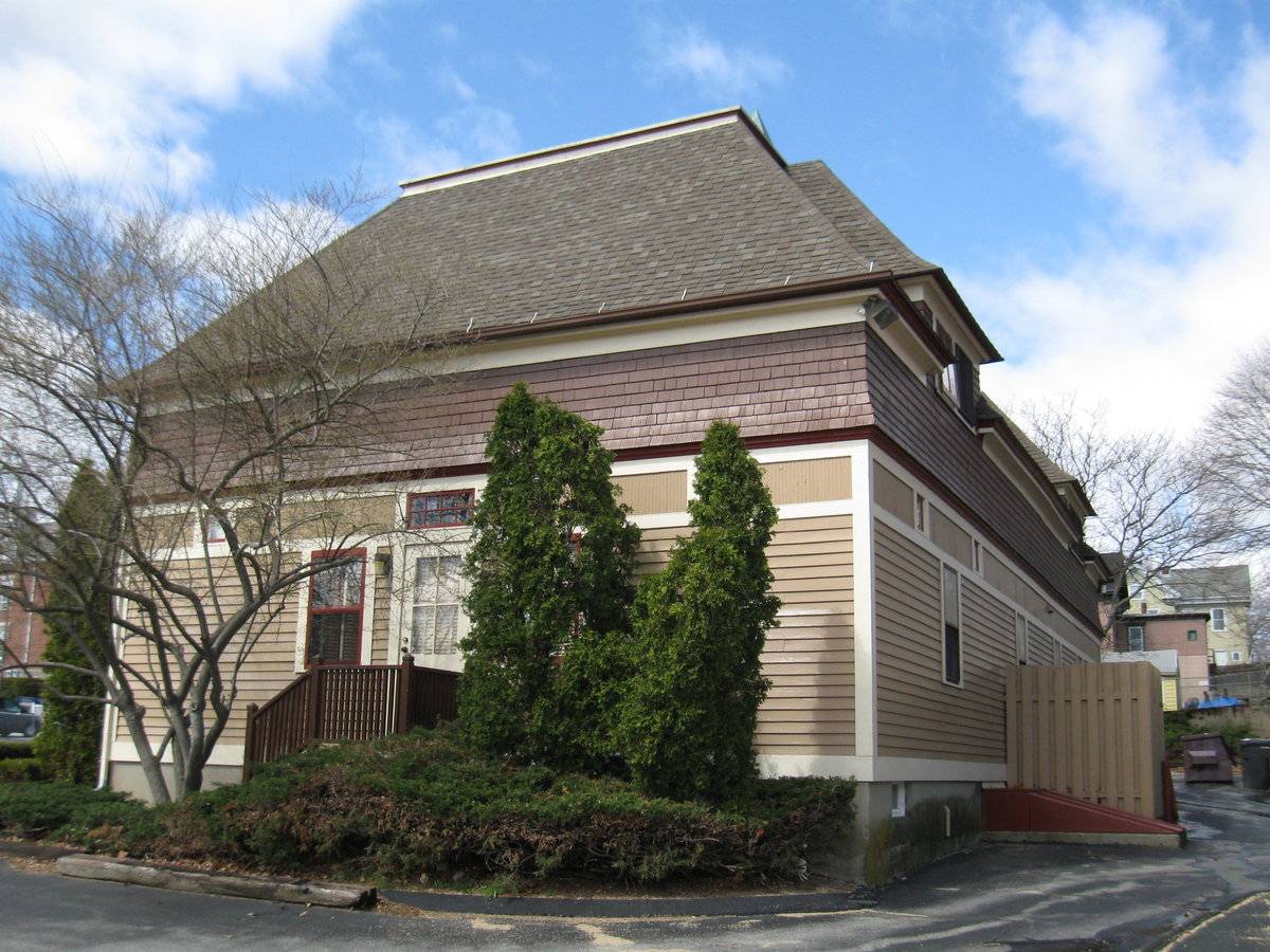
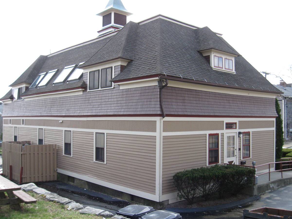
The three remaining facades are similar but simplified, with hip-roofed dormers, one on the northwest and two at the rear (northeast) facade, each with a pair of two-light awning windows. The end facades each have a pass-through door (four light over diagonal panels) flanked by double hung windows of either six-over-six or two-over-two sash and an eight-light transom over the door. The rear facade has four double hung windows roughly evenly spaced and two small transom lights near the south end.
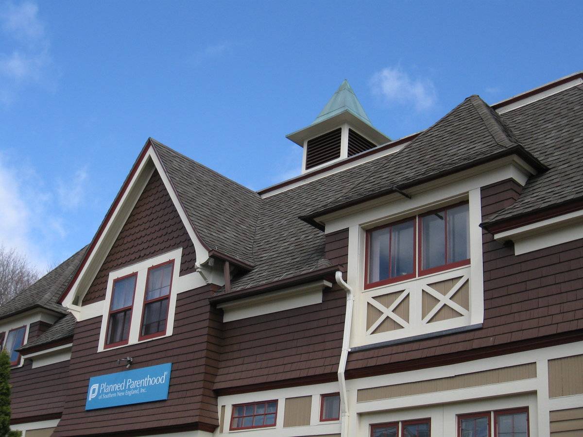
The roof is asphalt shingles and at the center of the ridge there is a cupola with a steep copper-clad hipped roof flared at its eaves.
A small shed is located at the north corner of the site and another garage or shed at the east corner facing Cottage Street. The rear property line is marked by a high fieldstone retaining wall. At the front yard abutting the sidewalk are two rough ashlar piers with pyramidal stone caps which appear likely to have been relocated from the original estate site.Historical significance:
Until the 1830s, the horses used for riding and driving carriages were often kept in the main barn along with the other farm animals. By the 1850s, some New England farmers built separate horse stables and carriage houses. Early carriage houses were built just to shelter a carriage and perhaps a sleigh, but no horses. The pre-cursor to the twentieth-century garage, these outbuildings are distinguished by their large hinged doors, few windows, and proximity to the dooryard. The combined horse stable and carriage house continued to be a common farm building through the second half of the nineteenth century and the first decade of the twentieth century, until automobiles became common. Elaborate carriage houses were also associated with gentlemen farms and country estates of the late 19th and early 20th centuries while urban livery stables served the needs of tradespeople.
Field Notes
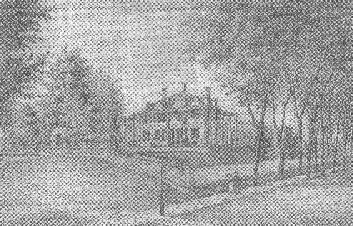
Located in the Hempstead National Register Historic District. The Planned Parenthood building was moved from a site behind the historic County Courthouse where there is now a parking lot. It was built in 1892 as a carriage house for the Elisha Palmer estate at the corner of Broad and State. Attached photo: It was called Little Mt. Vernon because of its resemblance to the original. - Sandra Chalk, New London Landmarks Quote from National Register Form: The topography of the Hempstead Historic District defined the area of its settlement in the 17th century and continued to play an important role in its development throughout its history. Located geographically away from the center of town in the outlying farm area, the land on the west side of Hempstead Street was too steep and rocky for agricultural use other than pasturage, while the land to the east and along Hempstead Street could be partially mowed and tilled. Original homelots were not divided up extensively until the 1840s, when enriched by the burgeoning whaling industry, New Londoners began to seek land for dwelling houses in outlying neighborhoods close to the center of town. In the ensuing 75 years, houses were built in the Gothic Revival, Stick, French Second Empire, Queen Anne, Folk Victorian and Colonial Revival styles in addition to the Greek Revival and Italianate styles which predominate in the district. Each house was generally built in scale similar to its neighbors, so that groups of houses along Franklin (Photographs #3, #4) and Hempstead Streets (Photograph #5) and Mountain Avenue (Photographs #2, #6) relate proportionately in workmanship, materials, size and style to each other. Cohesiveness throughout the district is achieved by the closed in sense of the street scene, as all the houses face one another, down from the hill, or up from the hollow, except where the original Hempstead homelot looks out across Jay Street towards the coves (since filled in) and harbor. Significance: The Hempstead Historic District is an historically complex urban neighborhood which developed in the mid 19th-century from the subdivision of lands owned by the Hempstead and Holt families. Part of the land was developed by local abolitionists to provide housing for free blacks. The black community which developed in the district created a number of institutions for self-help and the support of its members, several of which still survive. The presence of the New London County Jail and of a number of small industries within the district influenced its development as a working-class neighborhood on the edge of New London's downtown district. (Criterion A) The Hempstead Historic District is significant for its architecture, which ranges from the 17th-century Hempstead House to early 20th-century commercial buildings. The district contains a number of mid 19th-century vernacular houses built for blacks. Major 19thcentury styles represented in the district include Greek Revival, Italianate, French Second Empire and Queen Anne. Buildings in the Hempstead Historic District vary in size from large two-family houses to small one and one-half story homes. The houses are generally more modest in scale and architectural detail than the wealthier homes of the nearby northwest section of the city.
- Use & Accessibility
Use (Historic)
Use (Present)
Exterior Visible from Public Road?
Yes
Demolished
n/a
Location Integrity
Moved
- Environment
Related features
Environment features
Relationship to surroundings
The Hempstead Historic District is a neighborhood in New London, located north of the harbor. It extends from a hollow behind the County Courthouse on Huntington Street, and runs up a steep rocky hill to the south and west. The district has the moderate density of a primarily residential neighborhood of 19th-century single and two-family dwellings. The hilly topography of the district required the extensive use of terracing and retaining walls during its development. The houses as they now stand reflect the evolution of a cohesive urban neighborhood from 17th-century homelots.
- Typology & Materials
-
Building Typology
Materials
Structural System
Roof materials
Roof type
Approximate Dimensions
32' x 64'
- Source
-
Date Compiled
04/12/2010
Compiled By
Charlotte Hitchcock, reviewed by CT Trust
Sources
Field notes and photographs by Charlotte Hitchcock 4/14/2010.
Additional background from New London Landmarks.New London Assessor’s Record Map/Lot F12/173/15
(Queen Anne carriage house 1893, building moved 1982 from Cottage St. 32’ x 64’).Field notes and photographs by Charlotte Hitchcock 3/10/2010
New London Assessor’s Record Map/Lot F12/ 169/ 23/
(house built 1678 , barn area 126 sf).Churchill, Sharon P., Hempstead Historic District National Register Nomination No.86002112, National Park Service, 1996.
Luyster, Constance, Joshua Hempstead House National Register Nomination No.7110090023, National Park Service, 1970.
City of New London Office of Development and Planning, Preserving Our Heritage: A Guide to the National Register Historic Districts and Individually Listed Properties in New London, New London, CT 06320 undated.
Sexton, James, PhD, Survey Narrative of the Connecticut Barn, Connecticut Trust for Historic Preservation, Hamden, CT, 2005, http://www.connecticutbarns.org/history.
Visser, Thomas D., Field Guide to New England Barns and Farm Buildings, University Press of New England, 1997.
Wikipedia: http://en.wikipedia.org/wiki/New_London,_Connecticut
City of New London Office of Development and Planning, Preserving Our Heritage: A Guide to the National Register Historic Districts and Individually Listed Properties in New London, New London, CT 06320 undated.Sexton, James, PhD, Survey Narrative of the Connecticut Barn, Connecticut Trust for Historic Preservation, Hamden, CT, 2005, http://www.connecticutbarns.org/history.
Visser, Thomas D., Field Guide to New England Barns and Farm Buildings, University Press of New England, 1997.
Wikipedia: http://en.wikipedia.org/wiki/New_London,_Connecticut - PhotosClick on image to view full file
-