Barn Record Manchester
RETURN TO ‘FIND BARNS’- Building Name (Common)
- n/a
- Building Name (Historic)
- n/a
- Address
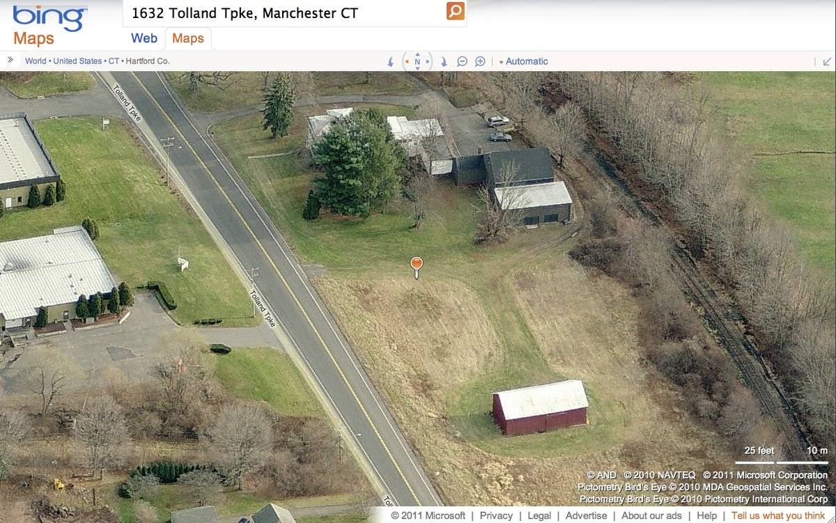
- 1632 Tolland Turnpike, Manchester
- Typology
- Overview
-
Designations
n/a
Historic Significance
Architectural description:
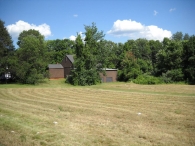
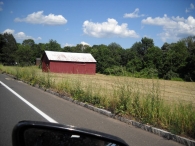
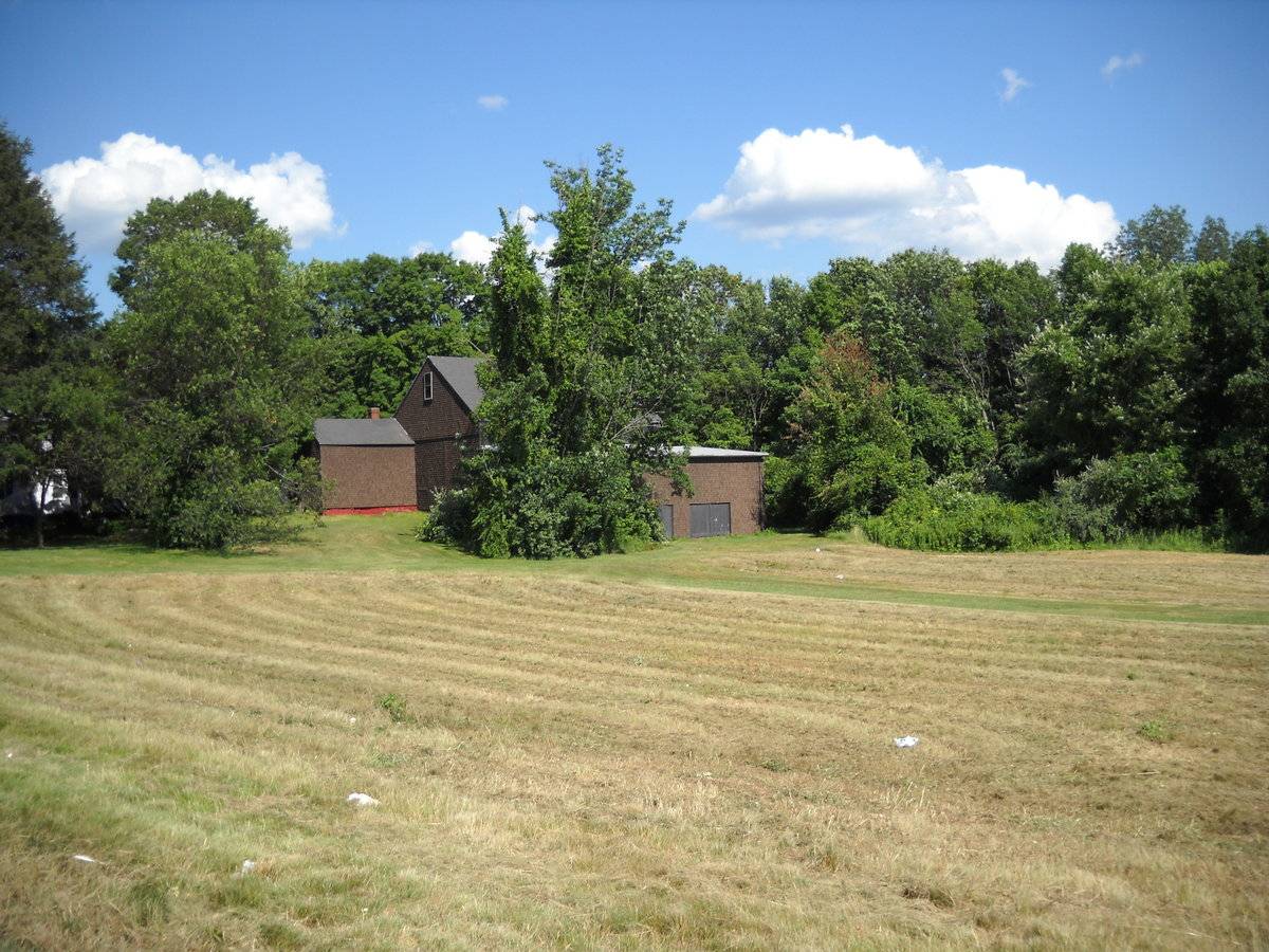
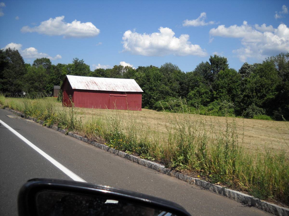
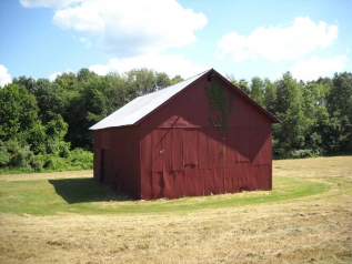
This is a 1 ½-story four-bay gable-roofed eave-entry barn. The ridge-line of the barn is oriented north-south, perpendicular to Tolland Turnpike, which runs approximately east-west. The main entries are doors on both the east and west eave-sides of the barn in the second bay from the south. The east eave-side door has been altered to a lowered head and an overhead door installed. The south gable-end appears blank. The west eave-side has a full-height exterior door that appears to be fixed shut. The north gable-end is blank except for a ventilation opening directly under the apex of the roof.
The barn is clad with metal or plywood sheets which are painted red. The roof has projecting eaves and is corrugated metal panels.
Historical significance:
The oldest barns still found in the state are called the “English Barn,” “side-entry barn,” “eave entry,” or a 30 x 40. They are simple buildings with rectangular plan, pitched gable roof, and a door or doors located on one or both of the eave sides of the building based on the grain warehouses of the English colonists’ homeland. The name “30 by 40” originates from its size (in feet), which was large enough for 1 family and could service about 100 acres. The multi-purpose use of the English barn is reflected by the building’s construction in three distinct bays - one for each use. The middle bay was used for threshing, which is separating the seed from the stalk in wheat and oat by beating the stalks with a flail. The flanking bays would be for animals and hay storage.
Field Notes
n/a
- Use & Accessibility
Use (Historic)
Use (Present)
Exterior Visible from Public Road?
Yes
Demolished
n/a
Location Integrity
Unknown
- Environment
Related features
Environment features
Relationship to surroundings
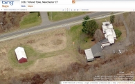
The barn is located beside a c. 1900 house it is associated with on a 5.4-acre site of open land sandwiched between highways, rail line, and commercial development interspersed with some remnant woodlands. The house is a 2-story building with a T-shaped plan facing north to the street, a hip roof and several lower additions extending south behind the main block. To the southwest of the house are an attached garage and a series of three attached sheds. The barn is located in the middle of the site to the west of the house, in an open mowed field. To the north of the barn, across Tolland Turnpike, are some commercial areas and residential lots. To the east and south of the site are highways, I-84 and I-291. To the south of the barn there is a rail line bordered by trees creating a border between the site and Wickham Park, a public park which is just south of the property.
- Typology & Materials
-
Building Typology
Materials
Structural System
Roof materials
Roof type
Approximate Dimensions
1440 sq. ft.
- Source
-
Date Compiled
02/22/2011
Compiled By
R. Parris & T. Levine; reviewed by CT Trust
Sources
Field notes and photographs by Jim Snyder date 8/05/2010.
Town of Manchester Assessor’s Record or GIS Viewer: http://data.visionappraisal.com/ManchesterCT/findpid.asp?iTable=pid&pid=16019
Parcel ID: 549001632Aerial Mapping:
http://www.bing.com/maps accessed 02/22/2011.Sexton, James, PhD, Survey Narrative of the Connecticut Barn, Connecticut Trust for Historic Preservation, Hamden, CT, 2005, http://www.connecticutbarns.org/history.
Visser, Thomas D., Field Guide to New England Barns and Farm Buildings, University Press of New England, 1997. - PhotosClick on image to view full file
-