Barn Record Middletown
RETURN TO ‘FIND BARNS’- Building Name (Common)
- Stanley and Elizabeth Wyskiel Farm
- Building Name (Historic)
- Stanley and Elizabeth Wyskiel Farm
- Address
- 439 Long Hill Road, Middletown
- Typology
- Overview
-
Designations
n/a
Historic Significance
Architectural description:
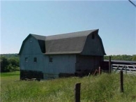
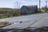
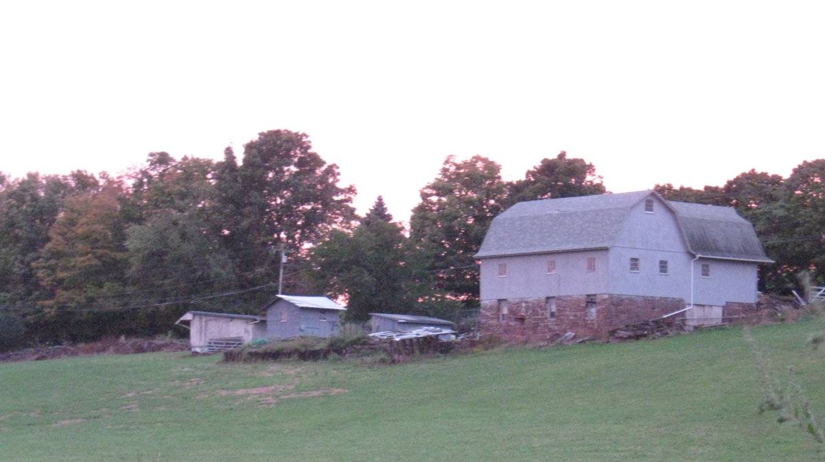
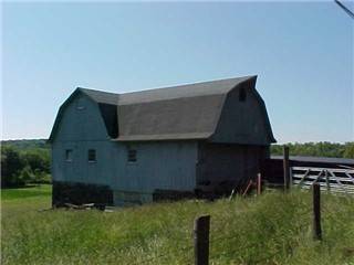
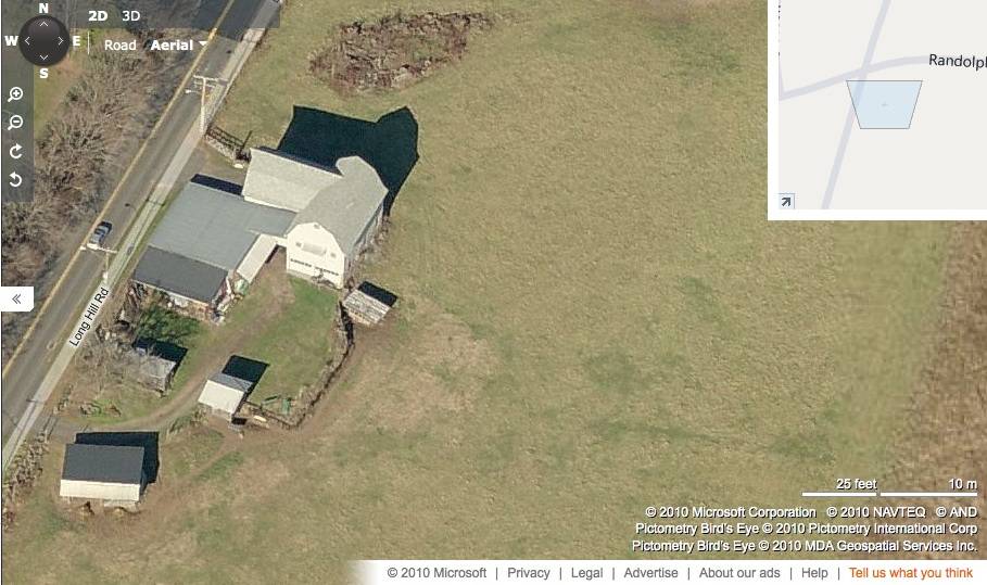
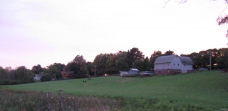
This is an inverted L-shaped bank barn towards the east of Long Hill Road with a cross-gambrel Dutch roof and a shed-roof addition at the inner junction of the barn. The main arm of the L-shaped barn complex is formed by Arm-I with the cross-gable intersection, Arm-II, on its west eave-side towards the north. The ridge line of Arm-I runs north-south parallel to this portion of Long Hill Road while that of Arm-II runs east-west. The west gable-end of Arm-II faces the road and appears to be the main façade of the barn with the main entrance at the center through a sunken wagon door entrance and the apex of the roof projecting out to form a hay hood. The grade level along the north eave-side of Arm-II gradually declines towards the east revealing the stone masonry wall of the bank level which is accessed by a sliding wagon door entrance towards the east. A nine-pane window can be seen at the first floor level centered above the wagon door entrance. The grade level continues to drop towards the east along the north gable-end of Arm-I which is flush with the north eave-side of Arm-II. The north gable-end of Arm-I has exposed masonry at the bank level and two nine-pane windows towards either side at the first floor level. A similar nine-pane window can be seen centered in the gable attic just below the apex of the roof. The low grade level along the north gable-end of Arm-I wraps the barn along its east eave-side and the south gable-end to form the bank level. The stone masonry of the bank level of the east eave-side of Arm-I is punctured by three equally spaced windows with three nine-pane windows above them at the first floor level. The bank level of the south gable-end of Arm-I appears to have two entrances through two over-head garage doors. The south gable-end of Arm-I has two nine-pane windows at the first floor level and a similar nine-pane window just below the apex of the roof.
The wooden frame of the L-shaped barn is supported on coursed mortared field stone masonry of the bank. The barn has asphalt shingle roofing and light grey painted vertical siding walls.
Historical significance:The New England barn or gable front barn is the successor to the English barn and relies on a gable entry rather than an entry under the eaves. The gable front offers many practical advantages. Roofs drain off the side, rather than flooding the dooryard. With the main drive floor running parallel to the ridge, the size of the barn could be increased to accommodate larger herds by adding additional bays to the rear gable end. Although it was seen by many as an improvement over the earlier side entry English Barn, the New England barn did not replace its predecessor but rather coexisted with it as both types continued to be constructed.
The gambrel roof enclosed a much greater volume than a gable roof did, and its shape could be formed with trusses that did not require cross beams, which would interfere with the movement and storage of hay. Also known as the curb roof, the double slopes of the gambrel offer more volume in the hayloft without increasing the height of the side walls.
The 19th century would see the introduction of a basement under the barn to allow for the easy collection and storage of a winter’s worth of manure from the animals sheltered within the building. The bank barn is characterized by the location of its main floor above grade, either through building on a hillside or by raising the building on a foundation. This innovation, aided by the introduction of windows for light and ventilation, would eventually be joined by the introduction of space to shelter more animals under the main floor of the barn.Field Notes
n/a
- Use & Accessibility
Use (Historic)
Use (Present)
Exterior Visible from Public Road?
Yes
Demolished
n/a
Location Integrity
Unknown
- Environment
Related features
Environment features
Relationship to surroundings
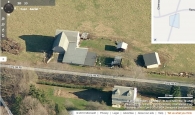
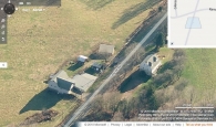
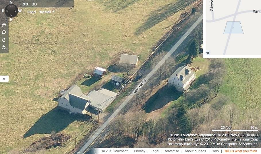
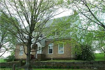
The 8.4 + 1 acres property, Account number – R12782 & R12783 and Map lot numbers- 30-0153 & 16-0142, is a corner plot located towards the south of Randolph Road and spread across both sides of Long Hill Road. The L-shaped barn complex and its associated outbuildings are located in the land towards the east of Long Hill Road while the circa 1787 colonial main residence is located towards the west. The property is situated in a mixed land use area surrounded by residential plots and schools in close proximity. Residential plots can be seen towards the north, northwest and south of the plot while the area towards the east and the southeast is covered by dense woodland. Vinal Technical High Scholl is located towards the west of the plot while another Mercy High School is located towards further northwest.
The main barn and its additions is located towards the north of the barn complex while two gable-roof sheds can be seen towards the south with their ridge lines running east-west perpendicular to Long Hill Road. Another salt-box roof out-building can be seen towards further south with its ridge line at an angle from the northeast to the southwest. The building complex is surrounded by farm land towards the north, east and the south.
land with outbuilding.- Typology & Materials
-
Building Typology
Materials
Structural System
Roof materials
Roof type
Approximate Dimensions
Bank barn: 4060 Sqft; Bank barn: 4032 Sqft; Flat barn: 20X30 Sqft; Flat barn: 12X12 Sqft; Pole barn: 10X14 Sqft; Shed: 31X21 Sqft.
- Source
-
Date Compiled
03/18/2011
Compiled By
T. Levine and M. Patnaik, reviewed by CT Trust
Sources
Field notes and photographs provided by: Charlotte R. Hitchcock, 10/03/2010.
Assessors’ records retrieved on March 18th, 2011 from website http://middletown.univers-clt.com/index.php .
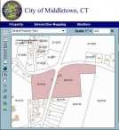
GIS information retrieved on March 18th, 2011 from website http://host.appgeo.com/MiddletownCT/Map.aspx .
Photograph/Information retrieved on March 18th, 2011 from website http://www.google.com
Photograph/Information retrieved on October 3rd, 2010 from website http://www.bing.com.
Photograph/Information retrieved on March 18th, 2011 from website http://www.zillow.com.
Information retrieved from http://www.moodogpress.com/2010/06/wyskiel-hubbard-farm-a-history-part-one/.
Sexton, James, PhD; Survey Narrative of the Connecticut Barn, Connecticut Trust for Historic Preservation, Hamden, CT, 2005, http://www.connecticutbarns.org/history
Visser, Thomas D.,Field Guide to New England Barns and Farm Buildings, University Press of New England, 1997.
- PhotosClick on image to view full file
-