Barn Record Cheshire
RETURN TO ‘FIND BARNS’
- Overview
-
Designations
n/a
Historic Significance
Architectural description:
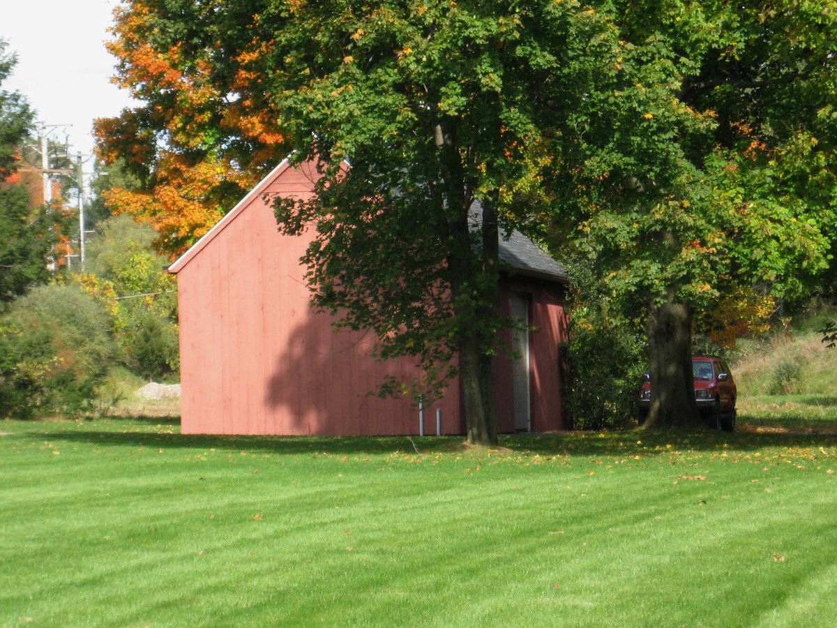
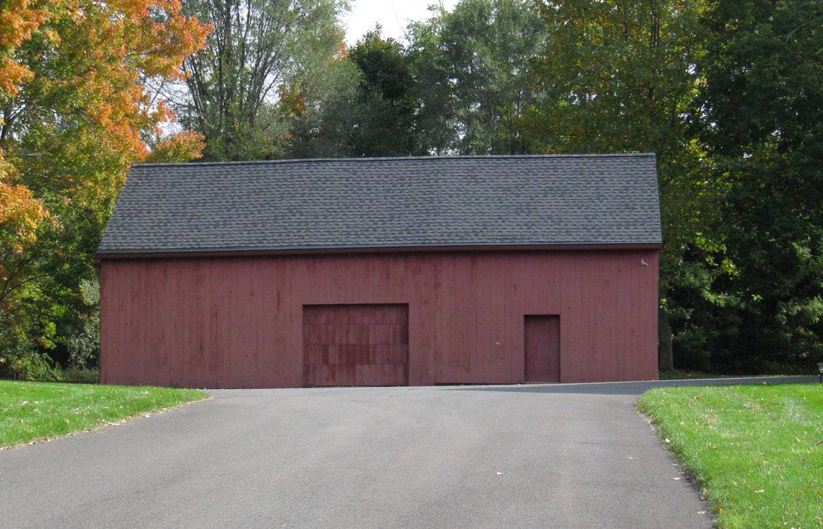
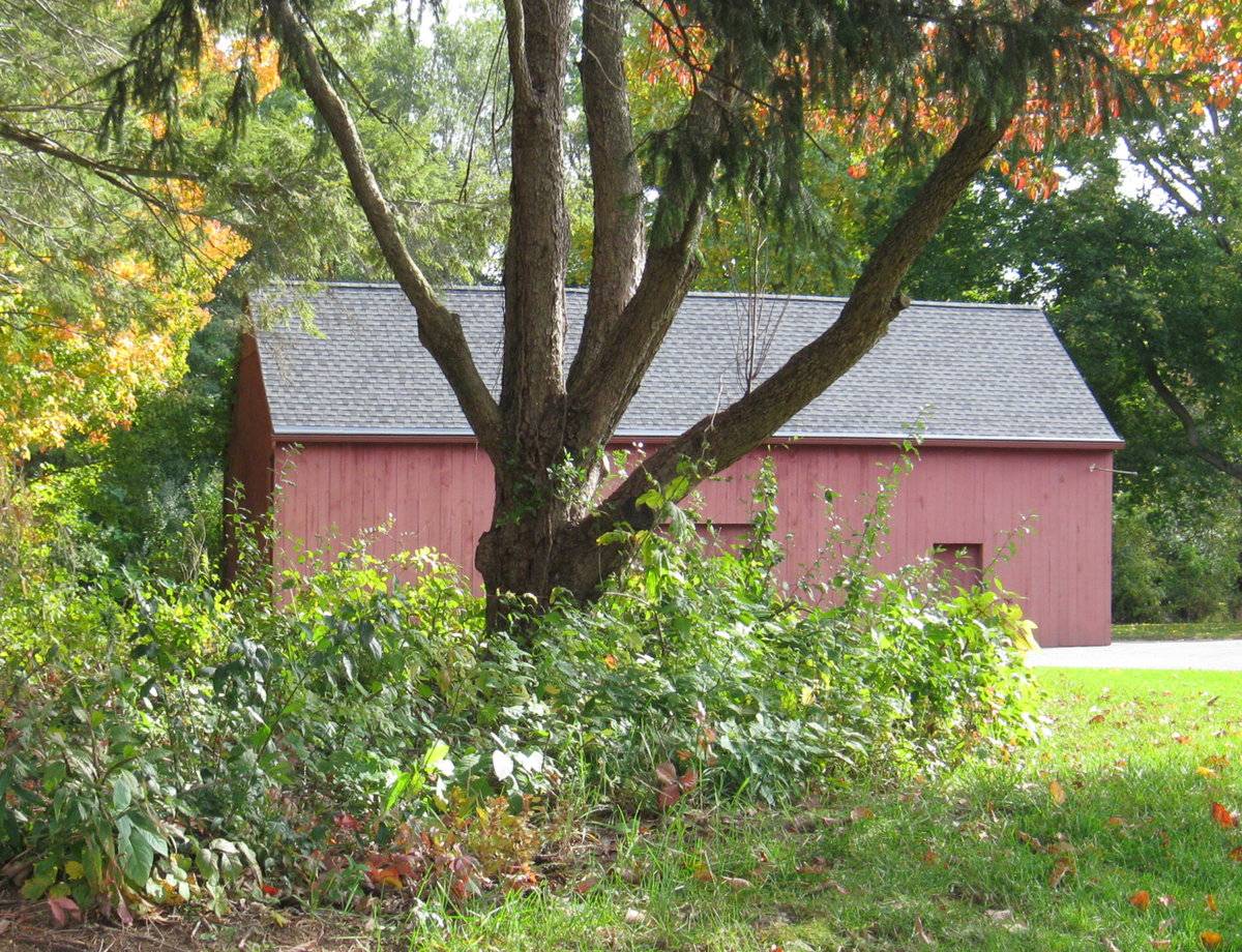
This is a 1 ½-story gable-roofed barn structure oriented with its ridge-line parallel to Peck Lane, which runs approximately north-south. The west eave-side of the barn, facing the road, has three-bays. The main entry, located in the center bay on the west eave-side, is an overhead garage door. The south bay has a single pass-through door and the north bay is blank. The north gable-end of the barn appears to be blank.
The east eave-side of the barn appears to have a double height overhead garage door located in the center bay. The south gable-end of the barn is blank.
The barn has vertical flush-board siding painted red with horizontal siding painted red in the upper half of the gable attics on the north and south gable-ends. The roof is asphalt shingle.
Historical significance:The oldest barns still found in the state are called the “English Barn,” “side-entry barn,” “eave entry,” or a 30 x 40. They are simple buildings with rectangular plan, pitched gable roof, and a door or doors located on one or both of the eave sides of the building based on the grain warehouses of the English colonists’ homeland. The name “30 by 40” originates from its size (in feet), which was large enough for 1 family and could service about 100 acres. The multi-purpose use of the English barn is reflected by the building’s construction in three distinct bays - one for each use. The middle bay was used for threshing, which is separating the seed from the stalk in wheat and oat by beating the stalks with a flail. The flanking bays would be for animals and hay storage.
Field Notes
n/a
- Use & Accessibility
Use (Historic)
Use (Present)
Exterior Visible from Public Road?
Yes
Demolished
n/a
Location Integrity
Unknown
- Environment
Related features
Environment features
Relationship to surroundings
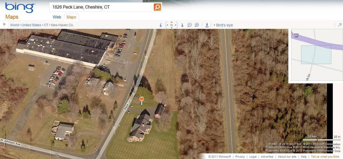
The barn is to the north of the c. 2002 Ranch-style house it is associated with. The ridge-line of the house is parallel to the ridge-line of the barn. An asphalt drive extends from Peck Lane, located to the west of the barn and the house, extends east to meet the barn on the west eave-façade of the barn and wraps around to the south gable-end and the east eave-side of the barn. A lawn extends to the south of the house. To the north of the barn is a small open field. Further north of the barn and the house is Highway I-691, which runs east-west. The total size of the site is 2.60 acres. The area surrounding the site is commercial, industrial and residential, with the Cheshire Industrial Park to the south and east of the property.
- Typology & Materials
-
Building Typology
Materials
Structural System
n/a
Roof materials
Roof type
Approximate Dimensions
828 square feet
- Source
-
Date Compiled
03/15/2011
Compiled By
A. Ehrgott & T. Levine; reviewed by CT Trust
Sources
Field notes and photographs by Charlotte Hitchcock date 10/20/2010.
Town of Cheshire Assessor’s Record
http://www.prophecyone.us/fieldcard.php?property_id=2165333
Parcel ID: 0004700Aerial Mapping:
http://www.bing.com/maps accessed 03/15/2011.Sexton, James, PhD, Survey Narrative of the Connecticut Barn, Connecticut Trust for Historic Preservation, Hamden, CT, 2005, http://www.connecticutbarns.org/history.
Visser, Thomas D., Field Guide to New England Barns and Farm Buildings, University Press of New England, 1997. - PhotosClick on image to view full file
-