Barn Record Thompson
RETURN TO ‘FIND BARNS’- Building Name (Common)
- n/a
- Building Name (Historic)
- n/a
- Address
- 39 East Thompson Road, Thompson
- Typology
- Overview
-
Designations
n/a
Historic Significance
Architectural description:
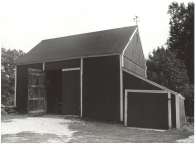
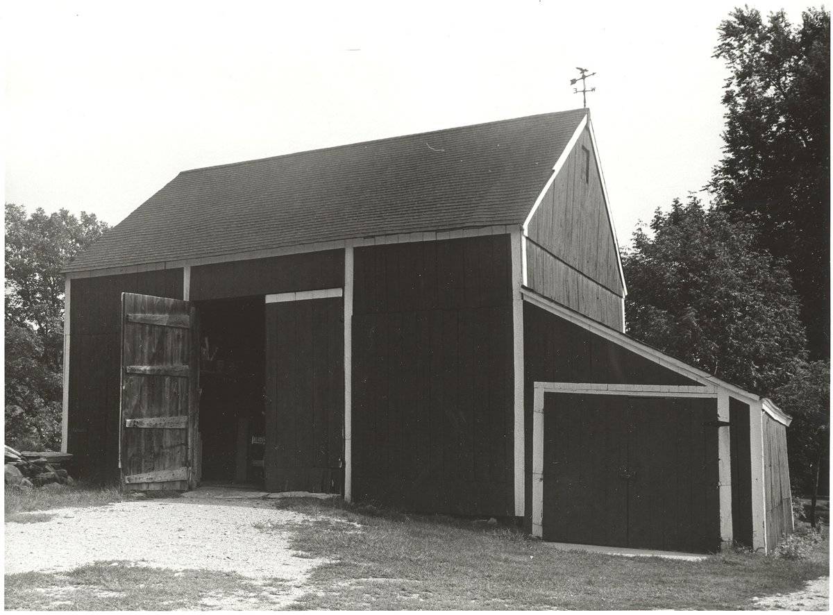
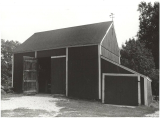
This is a three-bay 1 ½-story gable-roofed structure with its ridge-line oriented east-west and its principal entry in the north eave-side. There appears to be a lower level opening to the south side. The entry is a pair of out-swinging hinged barn doors in the center bay of the north side. Above the doors is a transom opening consisting of a top-hinged shutter the width of the door.
The west gable-end has a small vent opening near the peak of the roof and a 1-story shed-roofed addition the full width of the gable-end. In the north end of the shed a pair of hinged doors fills nearly the width of the gable-end wall. The west eave-side of the shed is blank. Grade slopes down gradually toward the west and south, with the floor elevation of the shed addition located below the main floor level. There appear to be basement windows exposed along the south eave-side wall, and a hay door opening above. The east gable-end appears to be blank.
Information from the Sturbridge survey of 1978 indicates chestnut square-rule post and beam framing.Siding is vertical flush-boards painted red with white-painted bands representing an appearance of trim at the corners, eaves, and surrounding the doors. A white-painted board trims the siding along the rakes.
Roofing is asphalt shingles and a weather vane is located at the west end of the roof ridge. The foundation appears to be fieldstone.Historical significance:
The oldest barns still found in the state are called the “English Barn,” “side-entry barn,” “eave entry,” or a 30 x 40. They are simple buildings with rectangular plan, pitched gable roof, and a door or doors located on one or both of the eave sides of the building based on the grain warehouses of the English colonists’ homeland. The name “30 by 40” originates from its size (in feet), which was large enough for 1 family and could service about 100 acres. The multi-purpose use of the English barn is reflected by the building’s construction in three distinct bays - one for each use. The middle bay was used for threshing, which is separating the seed from the stalk in wheat and oat by beating the stalks with a flail. The flanking bays would be for animals and hay storage.
The 19th century saw the introduction of a basement under the barn to allow for the easy collection and storage of a winter’s worth of manure from the animals sheltered within the building. The bank barn is characterized by the location of its main floor above grade, either through building into a hillside or by raising the building on a foundation. This innovation, aided by the introduction of windows for light and ventilation, would eventually be joined by the introduction of space to shelter more animals under the main floor of the barn.
Field Notes
Historical name of street: Douglas Road / Speedway Road Information from Sturbridge Survey (1976-8): LENGTH: 31 WIDTH: 25 HEIGHT (Sill to plate): 15 BARN FORM: English ROOF FORM: Gable Rafter Overhang minimal ROOF PITCH (GABLE): Depressed SHEATHING: Vertical Ends overlapped DOORS: Hinged BENT TYPE (ala Glassie): Continuous tie beam ROOF FRAME: Ridge Pole Rafter continuous Rafters Squared, sawn FRAMED ELEMENTS: Hewed Wood species, chestnut Braces & small girts sawn
- Use & Accessibility
Use (Historic)
Use (Present)
Exterior Visible from Public Road?
Yes
Demolished
n/a
Location Integrity
Unknown
- Environment
Related features
Environment features
Relationship to surroundings
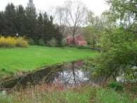
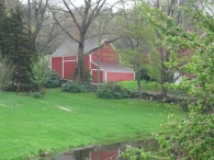
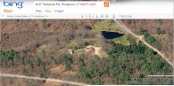
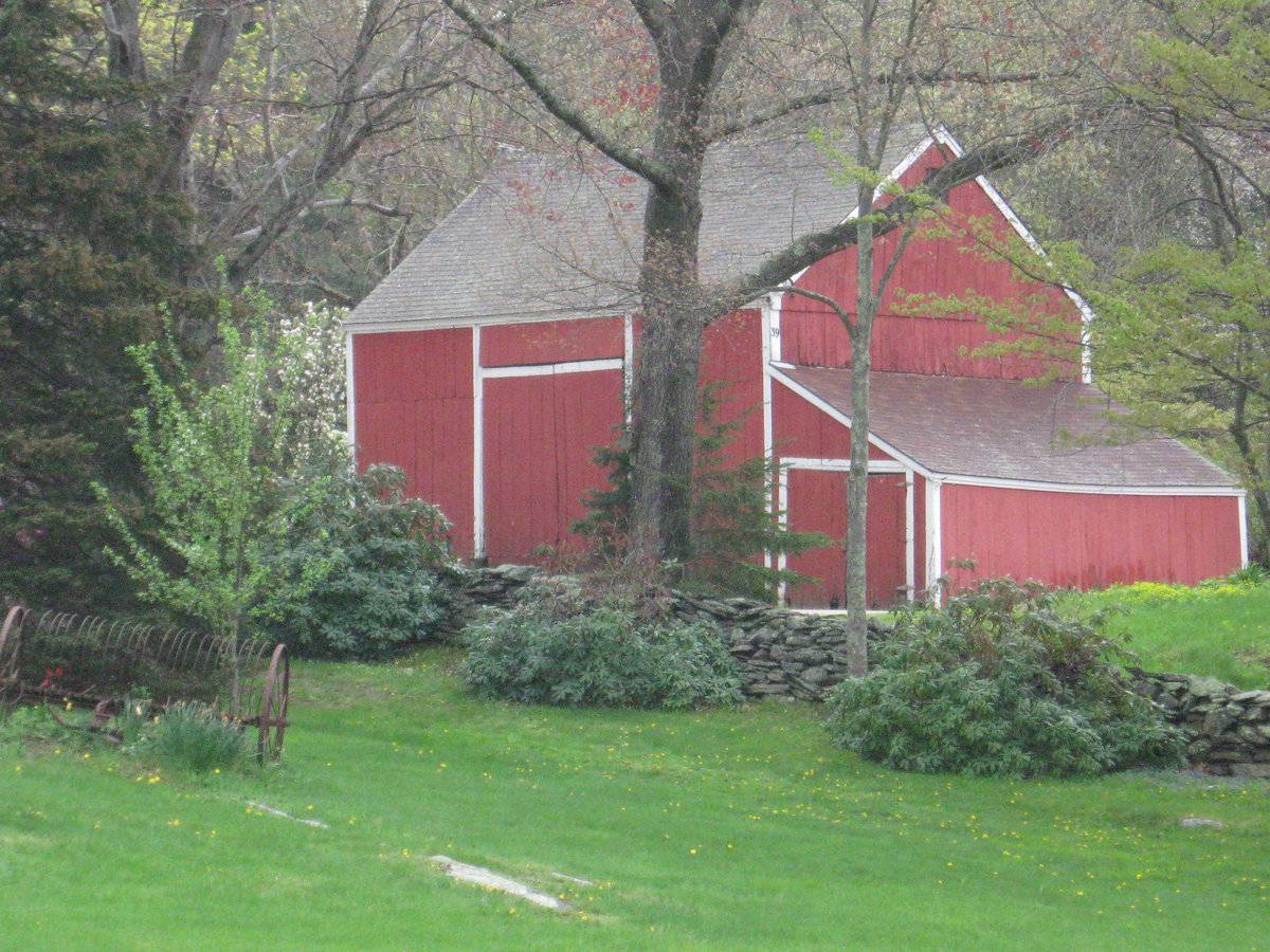
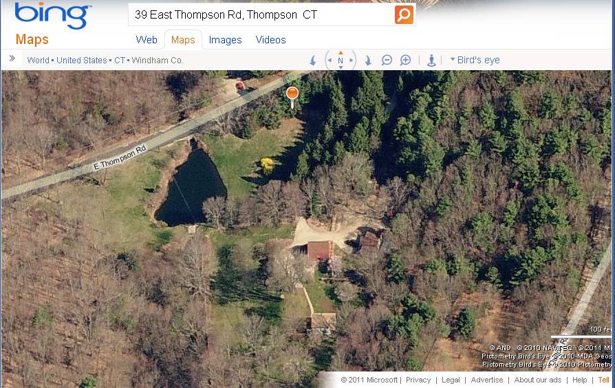
The barn is located on a 7.3-acre property on the south side of East Thompson Road, in the northeast corner of Thompson near the Rhode Island border. The road was formerly known as Douglas Road or Speedway, for the race track, now known as the Thompson International Speedway, which is located just east of the site. The house, c. 1924, is located southeast of the barn and a small pond with a dam is to the northwest close to the road. The adjacent properties are mainly wooded, with some open farmland in the area. To the west along Route 193 there is some industry and the village center of East Thompson. An interstate highway, I-395, passes nearby to the west, connecting Norwich CT with Worcester MA to the north.
- Typology & Materials
-
Building Typology
Materials
Structural System
Roof materials
Roof type
Approximate Dimensions
25 x 31 feet
- Source
-
Date Compiled
05/09/2011
Compiled By
Charlotte Hitchcock, reviewed by CT Trust
Sources
Field notes and photography: Sturbridge Survey (1976-8) and Charlotte Hitchcock (2011).
Town of Thompson Assessor’s Record http://data.visionappraisal.com/ThompsonCT/
Parcel ID: 122/ 19/ 3
Aerial Mapping:
http://maps.google.com
http://www.bing.com/maps accessed 5/09/2011.Historic Sturbridge Village Survey
In 1976-78 two researchers from Old Sturbridge Village performed a survey of barns in four communities in the northeast corner of the state - Canterbury, Pomfret, Thompson, Woodstock. The 273 identified barns were documented with photographs and notes. This information is available at the Old Sturbridge Village Library.Sexton, James, PhD, Survey Narrative of the Connecticut Barn, Connecticut Trust for Historic Preservation, Hamden, CT, 2005, http://www.connecticutbarns.org/history.
Visser, Thomas D., Field Guide to New England Barns and Farm Buildings, University Press of New England, 1997.
- PhotosClick on image to view full file
-