Barn Record Farmington
RETURN TO ‘FIND BARNS’- Building Name (Common)
- George E. Bryant Barn / CT DEP Storage
- Building Name (Historic)
- George E. Bryant Barn
- Address
- 181 Scott Swamp Road (Route 6), Farmington
- Typology

- Overview
-
Designations
n/a
Historic Significance
Architectural description:
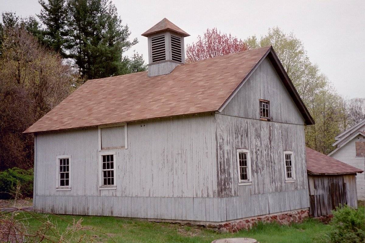
This is a 1 ½-story eave-entry barn with a gable roof. The primary façade faces south, which contains the main entry. A small shed-roof addition is attached to the main barn at the southwest corner, oriented perpendicular to the main building.
The primary façade is the south eave-side, which includes the primary entry. This entry consists of an oversize door places off-center in the eastern half of the façade. No other openings appear present in this side. The east gable-end contains what appears to be a small opening in the attic loft. No other openings appear present. The north eave-side contains two six-over-six double-hung windows with trim, one in the east bay and one offset to the east in the center bay. The west bay is blank. Framing for what may have been a loft access door is present over the center bay window, offset from the window opening. The west gable-end contains two symmetrically placed six-over-six double-hung windows with trim on the first story. A six-pane window, oriented horizontally, is centered in the attic loft just above the siding divide. The ground also drops away along this entire west side, revealing a portion of the mortared brown fieldstone foundation on this side only. The addition appears to be open on the east eave-side. The south-end and west eave-side appear to be blank.
The exterior walls of the barn are clad in narrow vertical wooden flush-board siding, painted gray. The bottom few feet of siding on the main barn’s north and west side have been replaced by a wider-width wooden flush-board siding. The siding on the attached shed-roof addition appears to be in worse condition than that found on the main barn. The roof of both the barn and addition is covered in brown asphalt shingles. A square ventilation cupola is centered on the ridgeline of the main barn. It contains a ventilation louver on each side, and is also painted gray. It is topped by a pyramidal roof also covered in brown asphalt shingles.
Historical significance:
The oldest barns still found in the state are called the “English Barn,” “side-entry barn,” “eave entry,” or a 30 x 40. They are simple buildings with rectangular plan, pitched gable roof, and a door or doors located on one or both of the eave sides of the building based on the grain warehouses of the English colonists’ homeland. The name “30 by 40” originates from its size (in feet), which was large enough for 1 family and could service about 100 acres. The multi-purpose use of the English barn is reflected by the building’s construction in three distinct bays - one for each use. The middle bay was used for threshing, which is separating the seed from the stalk in wheat and oat by beating the stalks with a flail. The flanking bays would be for animals and hay storage.
Field Notes
c.1865 Bryant was injured in the Civil War. His wife and children did most of the farming on their 37 acres. Bought by the Balozy family in 1913, who owned it until 1984, when it was sold to a developer. Currently used by the State DEP for storage.
- Use & Accessibility
Use (Historic)
Use (Present)
Exterior Visible from Public Road?
Yes
Demolished
n/a
Location Integrity
Unknown
- Environment
Related features
n/a
Environment features
Relationship to surroundings
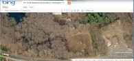
The barn and accompanying house are situated well back from Scott Swamp Road, separated by a large plot of open land. The house is located to the immediate south of the barn, and is situated perpendicular to the barn’s alignment. These are connected to Scott Swamp Road by a long gravel driveway which passes along the east side of the house before curving around the front of the house and intersecting the road to the west at some distance. The land to the immediate northwest of the barn is occupied by three pole barns of various sizes, surrounded by a small plot of open land. To the immediate west and northwest of the pole barns is a pond. The land to the east, north, and west of the barn is woodland, mainly deciduous with a large stand of conifers to the immediate east and north. A small creek travels south from the pond to the west of the barn, passing under Scott Swamp Road. The larger area surrounding the barn at some distance includes larger tracts of industrial and commercial uses to the east, south, and southwest, and a residential subdivision to the west, beyond the woodland and pond.
- Typology & Materials
-
Building Typology
Materials
Structural System
n/a
Roof materials
Roof type
Approximate Dimensions
n/a
- Source
-
Date Compiled
04/10/2011
Compiled By
N. Nietering & T. Levine, reviewed by CT Trust
Sources
Sexton, James, PhD; Survey Narrative of the Connecticut Barn, Connecticut Trust for Historic Preservation, Hamden, CT, 2005, http://www.connecticutbarns.org/history.
Visser, Thomas D.,Field Guide to New England Barns and Farm Buildings, University Press of New England, 1997, 213 pages.
Map of Farmington, CT, retrieved on April 9, 2011 from website www.bing.com.
Farmington Assessor’s Records - online - http://www.farmington-ct.org/landrecords/search.php
- PhotosClick on image to view full file
-