Barn Record Branford
RETURN TO ‘FIND BARNS’- Building Name (Common)
- n/a
- Building Name (Historic)
- n/a
- Address
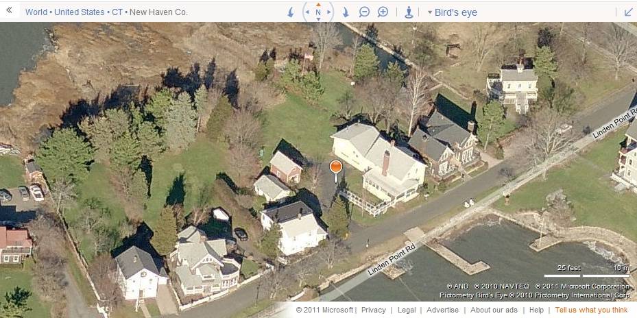
- 10 Linden Point Road, Branford
- Typology

- Overview
-
Designations
Historic Significance
Architectural description:
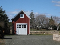
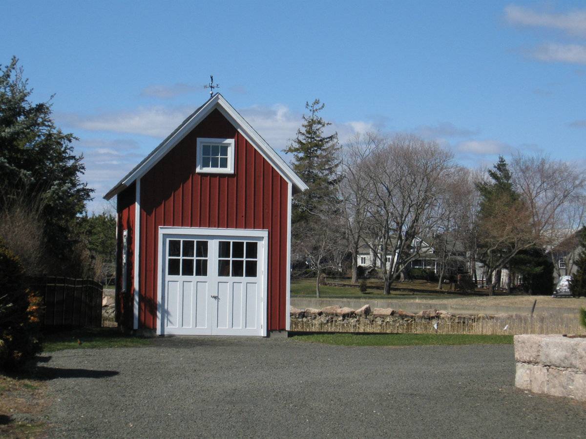
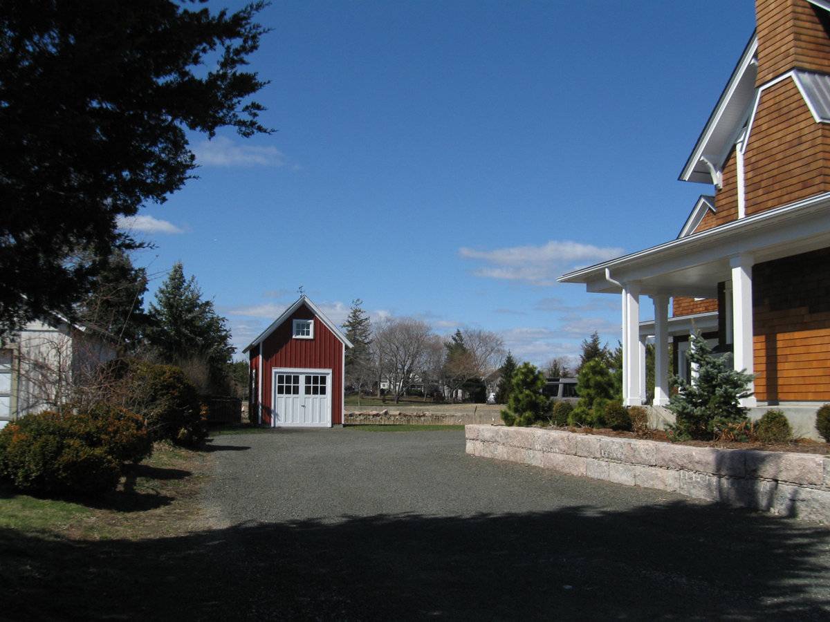
This is a 1 ½ - story gable-entry barn with its ridge line running north-south, perpendicular to this portion of Linden Point Road. The south gable-end of the barn facing the road is the main façade with the main entrance at the center through a pair of hinged wagon doors. Each door leaf of the main entrance is six-pane with three vertical panels. The façade has a six-pane window centered in the gable attic which is lined by cornice board with raking detail. The west eave-side of the barn has a window at the center while the east eave-side appears to have two similar windows. The gable-roof of the barn has a weather-vane at the center.
The wooden frame of the barn is supported on cement plastered masonry foundation. The barn has asphalt shingle roofing and red painted board-and-batten siding with white trim and corner boards.
Historical significance:
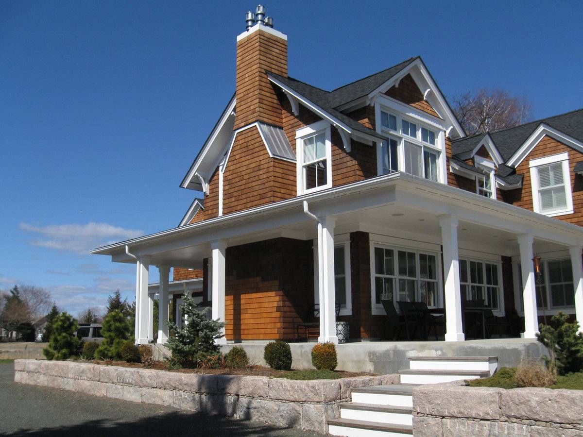
The barn is associated with the main residence at 10 Linden Point Road which is a contributing resource in the Stony Creek/Thimble Islands Historic District.[NR]
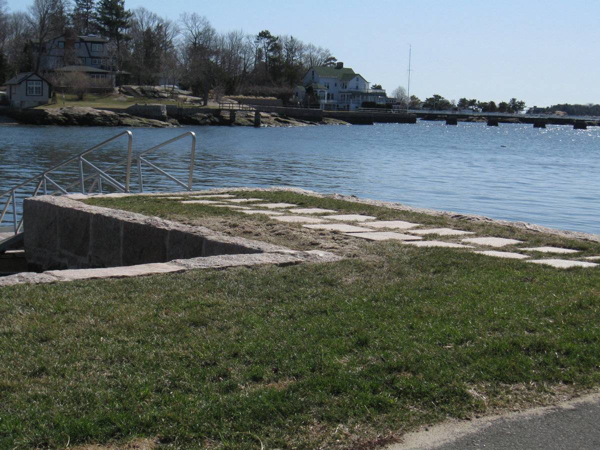
Oyster barn: Their major architectural characteristic is a high foundation of traprock or brick with an entrance at basement level so the oyster boats could be unloaded there at high tide.
Field Notes
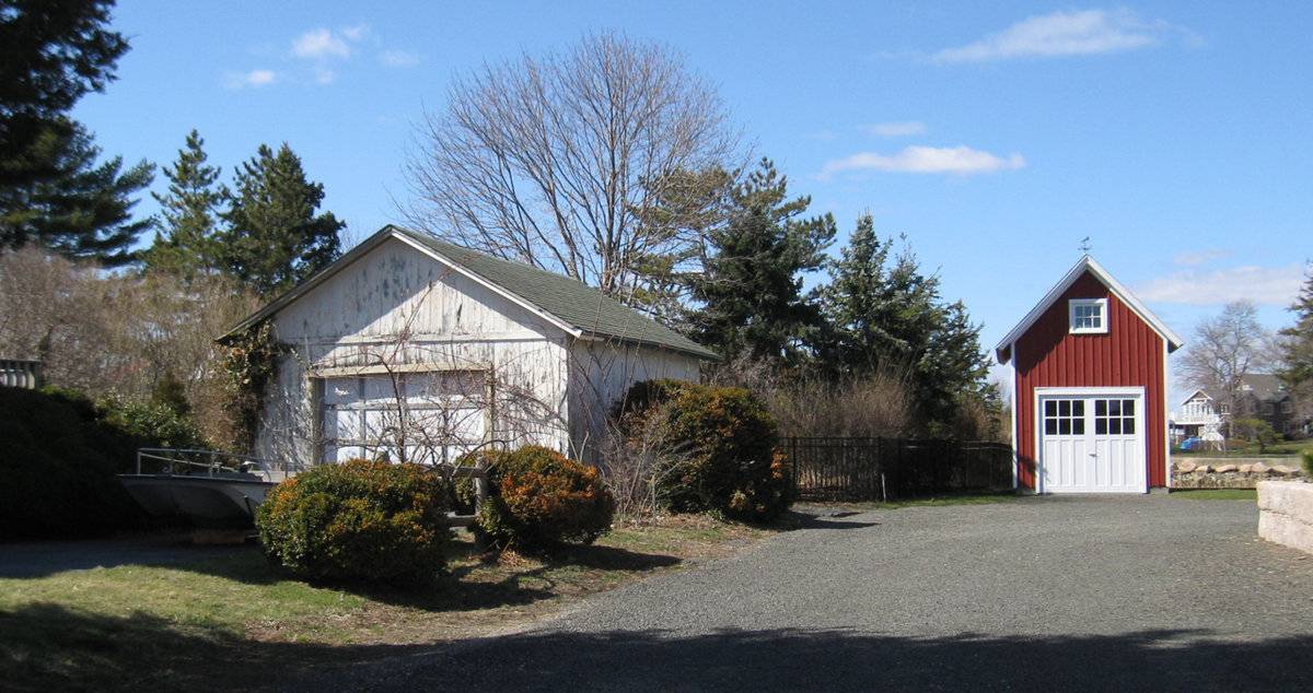
Oyster barn moved from water side (see photo of foundation) to rear of house. House (c. 1880) is a contributing resource in the Stony Creek/Thimble Islands Historic District, shed not mentioned. [The Stony Creek/Thimble Islands Historic District is located in the southeastern corner of the Town of Branford. The district is roughly bounded on the northeast by Route 146; on the east and the southeast by Long Island Sound; and on the west by Long Island Sound, the eastern side of Pleasant Point, and the northern most portions of Thimble Islands Road. The district as a whole maintains its historic integrity to a substantial degree. Including major outbuildings (e.g., garages, barns, and boathouses), it embraces a total of 487 buildings.] [NR- 88002844 NRIS]
- Use & Accessibility
Use (Historic)
Use (Present)
Exterior Visible from Public Road?
Yes
Demolished
n/a
Location Integrity
Moved
- Environment
Related features
Environment features
Relationship to surroundings
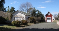
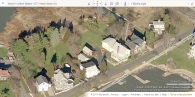
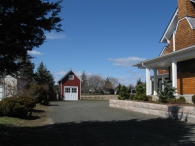
The .5 acres property, Account number – 008899 and Parcel number - J10/000/004/00011, is located towards the north of Linden Point Road in Stony Creek/Thimble Islands Historic District. It is situated in a predominantly residential area of sub-urban character having a relatively narrow frontage to the road and stretching out towards the north. Residential plots flank the property towards the east and the west with the shore line along the northern edge of the property and towards the south, across the road.
The barn is located along the western edge of the property with its ridge line running north-south, perpendicular to this portion of the road. The circa 1900 main residence of the property is located in the southeast corner. The property is accessed by a driveway from the southwest corner which continues towards the north approaching the barn and a garage attached to the north gable-end of the main residence. A garden with woodland along its fringes can be seen towards the north of the building complex while the sandy shore line runs along the northern edge of the property.
- Typology & Materials
-
Building Typology
Materials
Structural System
Roof materials
Roof type
Approximate Dimensions
n/a
- Source
-
Date Compiled
05/13/2011
Compiled By
T. Levine and M. Patnaik, reviewed by CT Trust
Sources
Field notes provided by: John Herzan & Charlotte Hitchcock, 03/20/2011.
Assessors’ information retrieved on May 13th, 2011 from website http://data.visionappraisal.com/BranfordCT/search.asp.
GIS Map retrieved on May 13th, 2011 from website http://www.branfordgis.com/AGS_MAP/default.htm
Loether, J. Paul, Stony Creek/Thimble Islands Historic District, National Register Nomination Number- 88002844 NRIS, National Park Service, 1988.
http://pdfhost.focus.nps.gov/docs/NRHP/Text/88002844.pdf
http://pdfhost.focus.nps.gov/docs/NRHP/Photos/88002844.pdfCunningham, Jan, Draft National Register District Nomination for Oyster Point, 1989, section 7 page 2.
Photograph/Information retrieved on May 13th, 2011 from website http://www.google.com
Photograph/Information retrieved on May 13th, 2011 from website http://www.bing.com.
Photograph/Information retrieved on May 13th, 2011 from website http://www.zillow.com.
Sexton, James, PhD; Survey Narrative of the Connecticut Barn, Connecticut Trust for Historic Preservation, Hamden, CT, 2005, http://www.connecticutbarns.org/history.
Visser, Thomas D.,Field Guide to New England Barns and Farm Buildings, University Press of New England, 1997.
- PhotosClick on image to view full file
-