Barn Record East Windsor
RETURN TO ‘FIND BARNS’- Building Name (Common)
- Myers Storage
- Building Name (Historic)
- Myers Storage
- Address
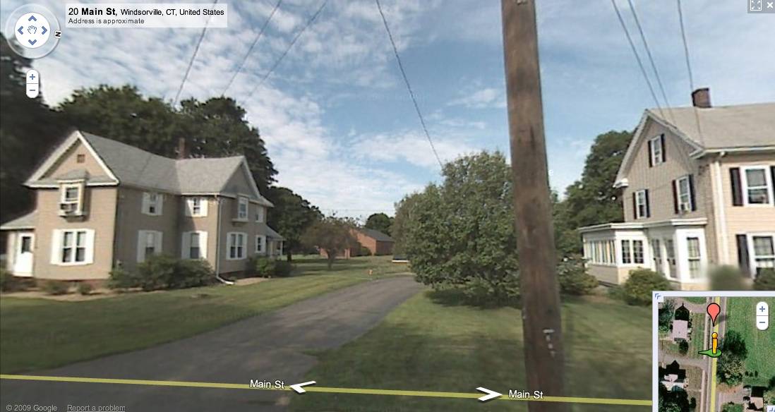
- 18 Main Street, East Windsor
- Typology
- Overview
-
Designations
n/a
Historic Significance
Architectural Description:
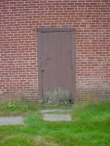
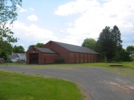
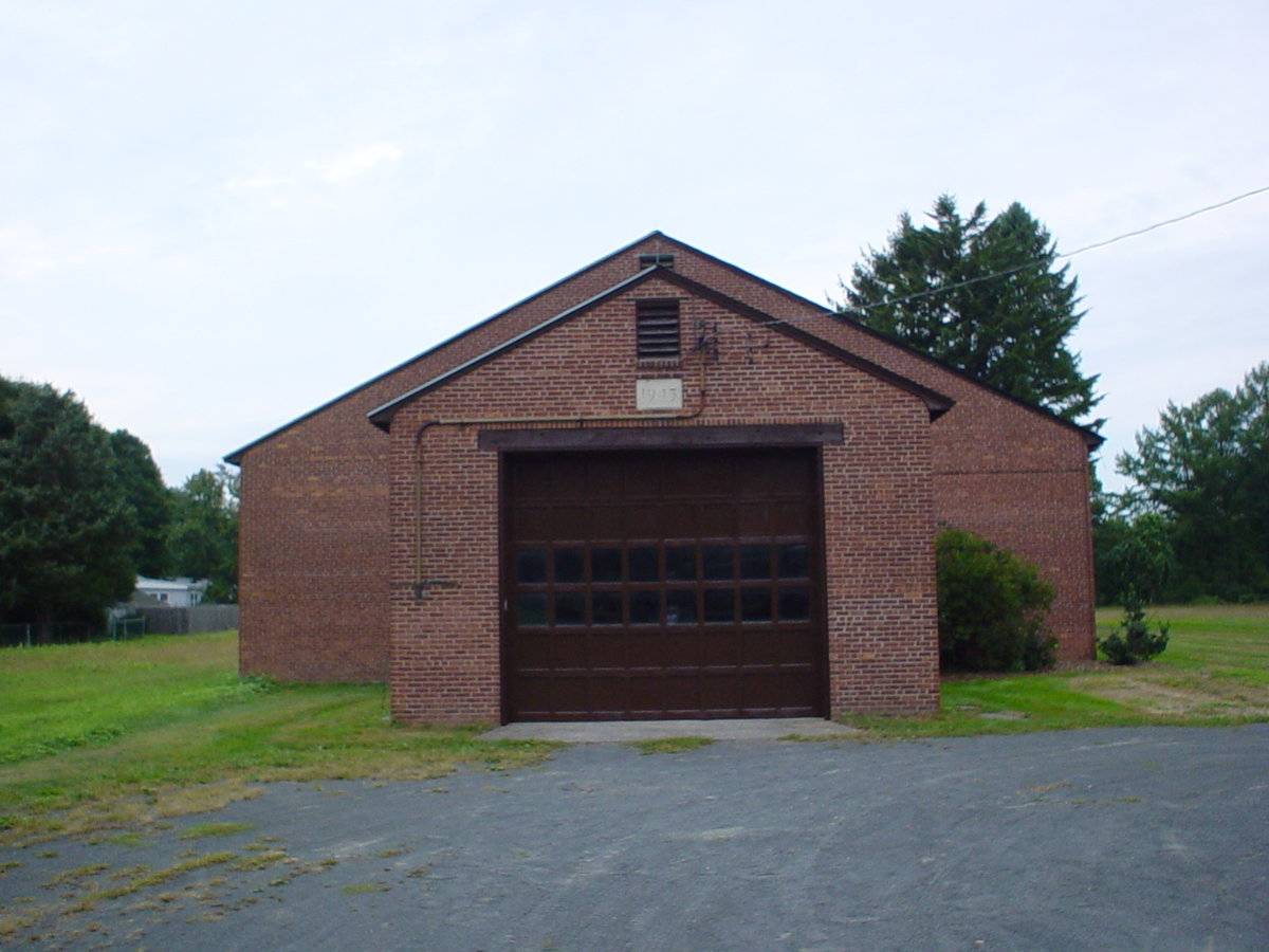
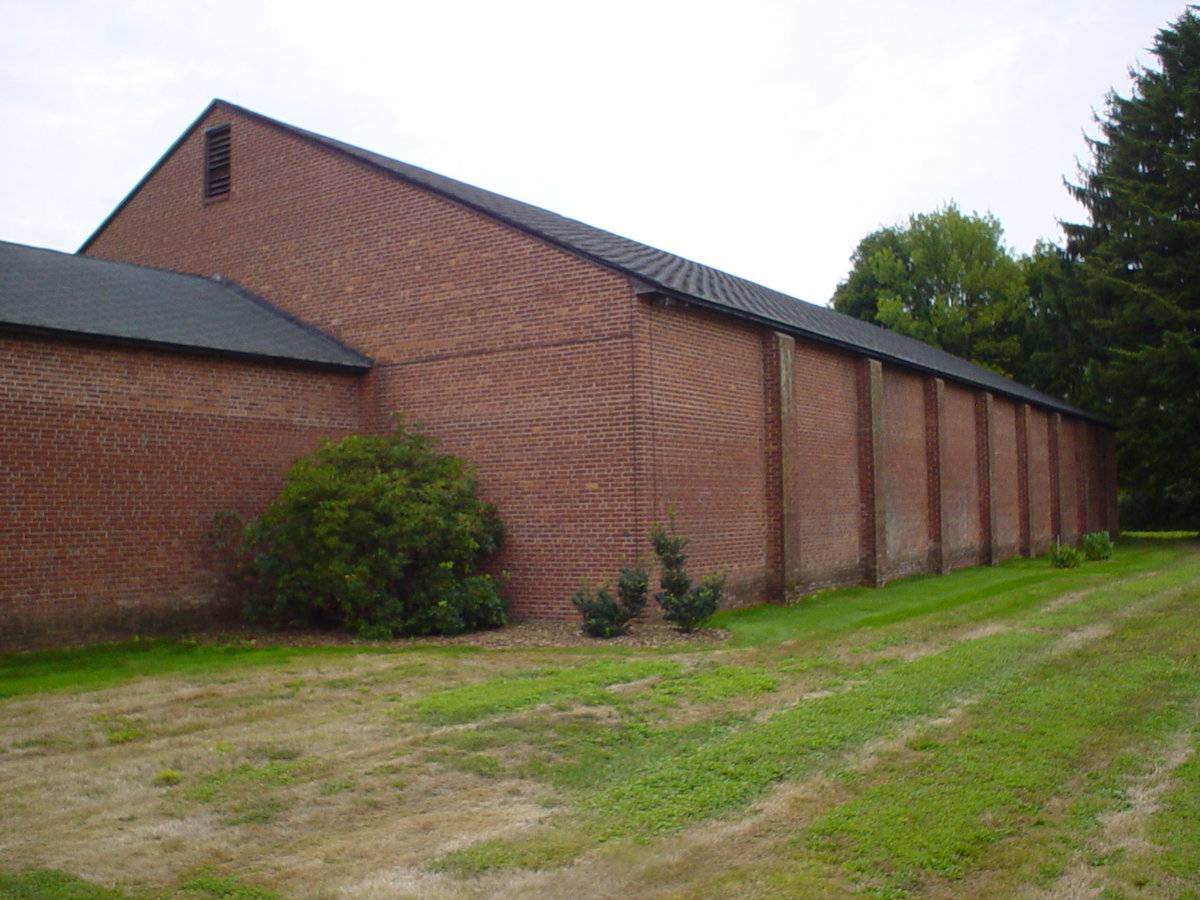
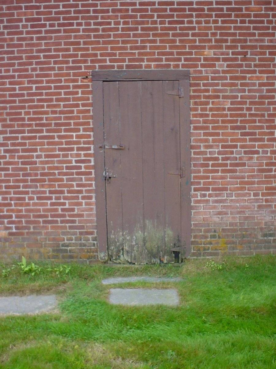
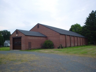
This is a 1 ½ - story nine-bay gable-entry barn with a gable-roof addition on its east gable-side. The east gable-sides of the main barn and the gable-roof addition face Main Street while their ridge lines runs east-west, perpendicular to the road. The main façade of the barn is the east gable-side of the gable-roof addition with the main entrance at the center through an over-head garage door. The façade has a louvered vent just below the apex of the roof. The north eave-side of the gable-roof addition has an entrance through a pass-through door towards the east. The east gable-side of the main barn has a distinct dropped girt siding divide line and has a louvered vent just below the apex of the roof. The nine-bays on the north eave-side of the main barn have been distinctly demarcated by protruding brick piers.
The barn has un-plastered brick masonry walls and asphalt shingle roofing.
Historical Significance:
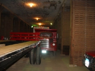
Potato houses or storage barns come in many different shapes and sizes all linked by the common goal of keeping harvested potatoes at a constant temperature and in the dark. The most traditional of these are characterized by a semi-subterranean arrangement.
Field Notes
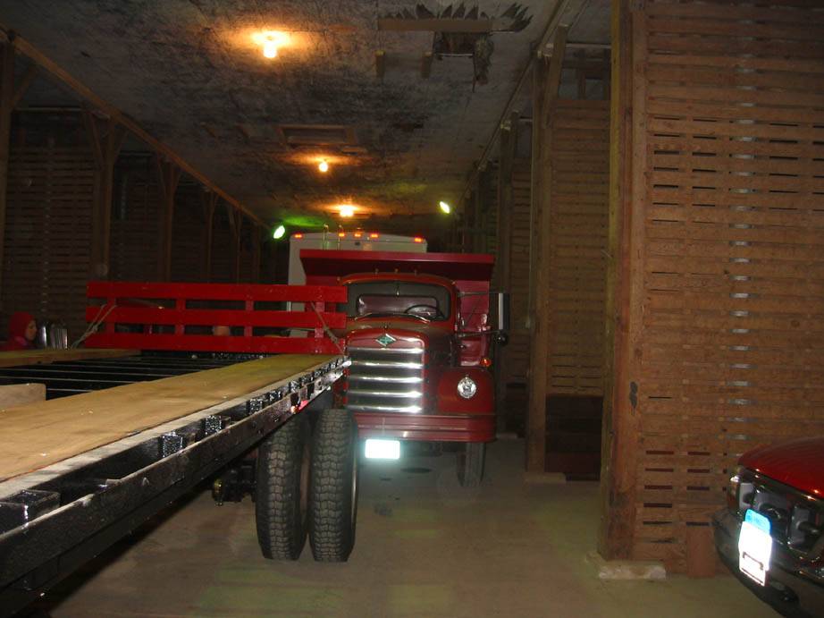
This potato storage is unusual in that it is completely above ground and constructed out of brick. The masonry wall, cork insulation and rock wool perform the task of keeping the temperature constant normally accomplished by making this type of building semi-subterranean. The building also contains an insulated room that briefly functioned as a giant refrigerator with space rented to community members prior to these appliances being common household items. (57x105; 20x33)
- Use & Accessibility
Use (Historic)
Use (Present)
Exterior Visible from Public Road?
Yes
Demolished
n/a
Location Integrity
Unknown
- Environment
Related features
n/a
Environment features
Relationship to surroundings
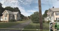
The 14.17 acres property, Map number - 19 30 025, is situated towards the west of Main Street in a pre-dominantly residential area. The property has relatively narrow frontage to the road, spreading out towards the west. Residential plots flank the property towards the north and the south while dense woodland can be seen towards the west. Parcels of open land and residential plots can also be seen towards the east of the propert , across Main Street.
The barn is located towards the southern edge of the property with the circa 1888 colonial main residence towards its north-east, abutting to Main Street. Patches of open land can be seen towards the north and the north-west of the barn while few trees can be seen towards its west.
- Typology & Materials
-
Building Typology
Materials
Structural System
Roof materials
Roof type
Approximate Dimensions
Barn: 7740 SqFt, Circa 1943 Garage: 2565 SqFt, Circa 1950
- Source
-
Date Compiled
11/10/2010
Compiled By
T. Levine and M. Patnaik, reviewed by CT Trust
Sources
Field-notes provided by –
James Sexton, PhD, and Todd LevineAssessors’ records retrieved on November 10th, 2010 from website http://www.equalitycama.com/
GIS information retrieved on November 10th, 2010 from website http://www.crcog.org/gissearch/
Photograph/Information retrieved on November 10th, 2010 from website http://www.google.com
Information retrieved on November 10th, 2010 from website http://www.zillow.com
Sexton, James, PhD; Survey Narrative of the Connecticut Barn, Connecticut Trust for Historic Preservation, Hamden, CT, 2005, http://www.connecticutbarns.org/history
Visser, Thomas D.,Field Guide to New England Barns and Farm Buildings, University Press of New England, 1997.
- PhotosClick on image to view full file
-