Barn Record Bethany
RETURN TO ‘FIND BARNS’- Building Name (Common)
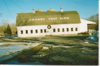
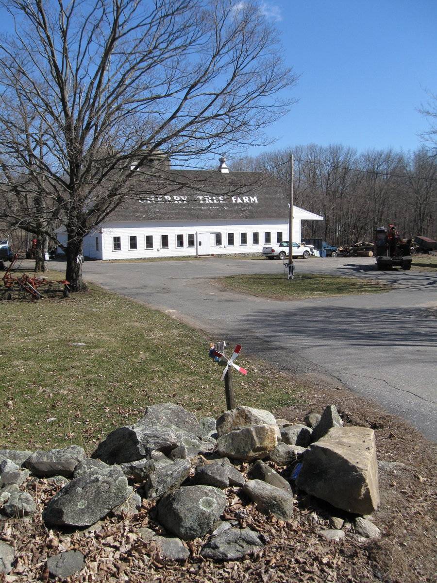
- Cherry Tree Farm
- Building Name (Historic)
- Abram Carrington / Cherry Tree Farm
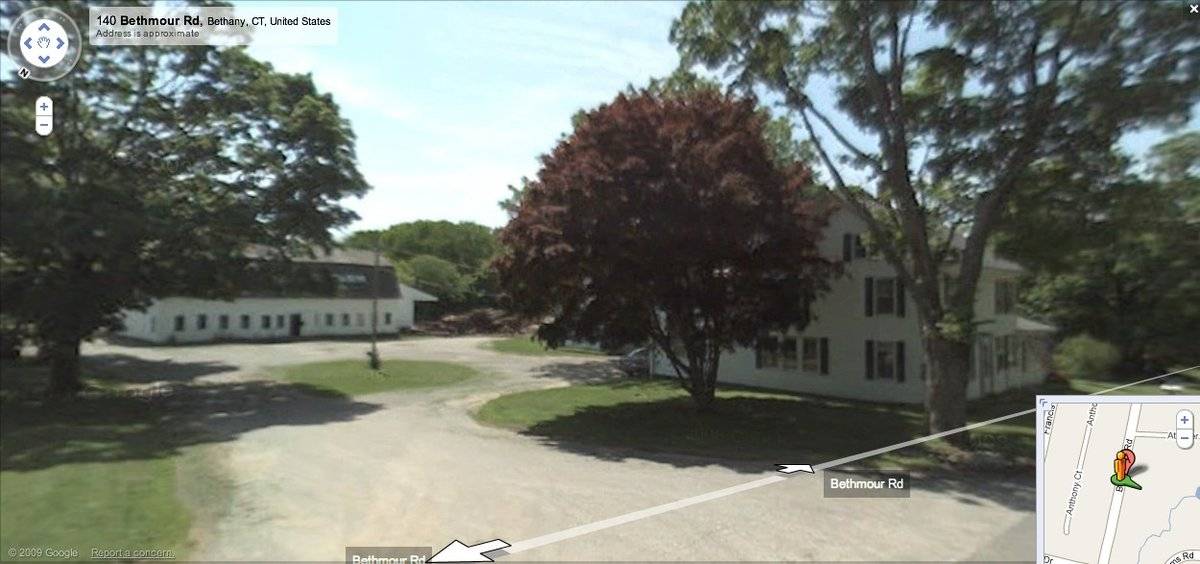
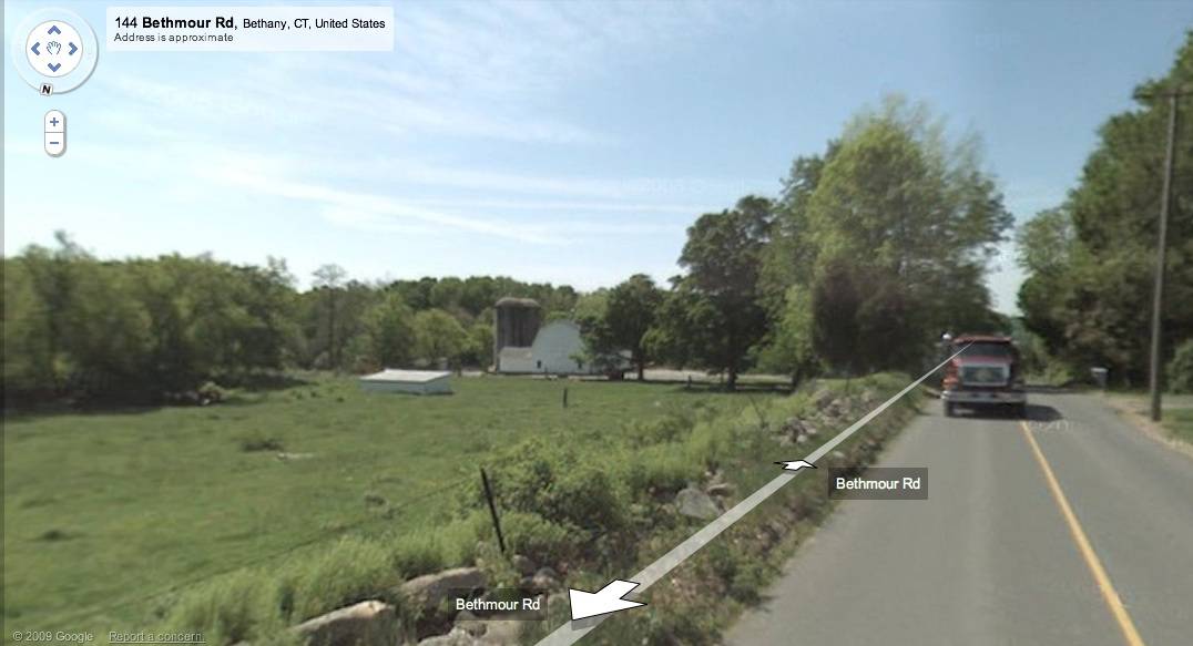
- Address
- 144 Bethmour Road, Bethany
- Typology
- Overview
-
Designations
Historic Significance
Architectural description:
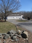
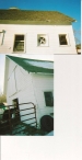
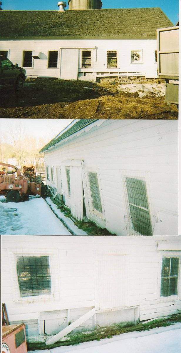
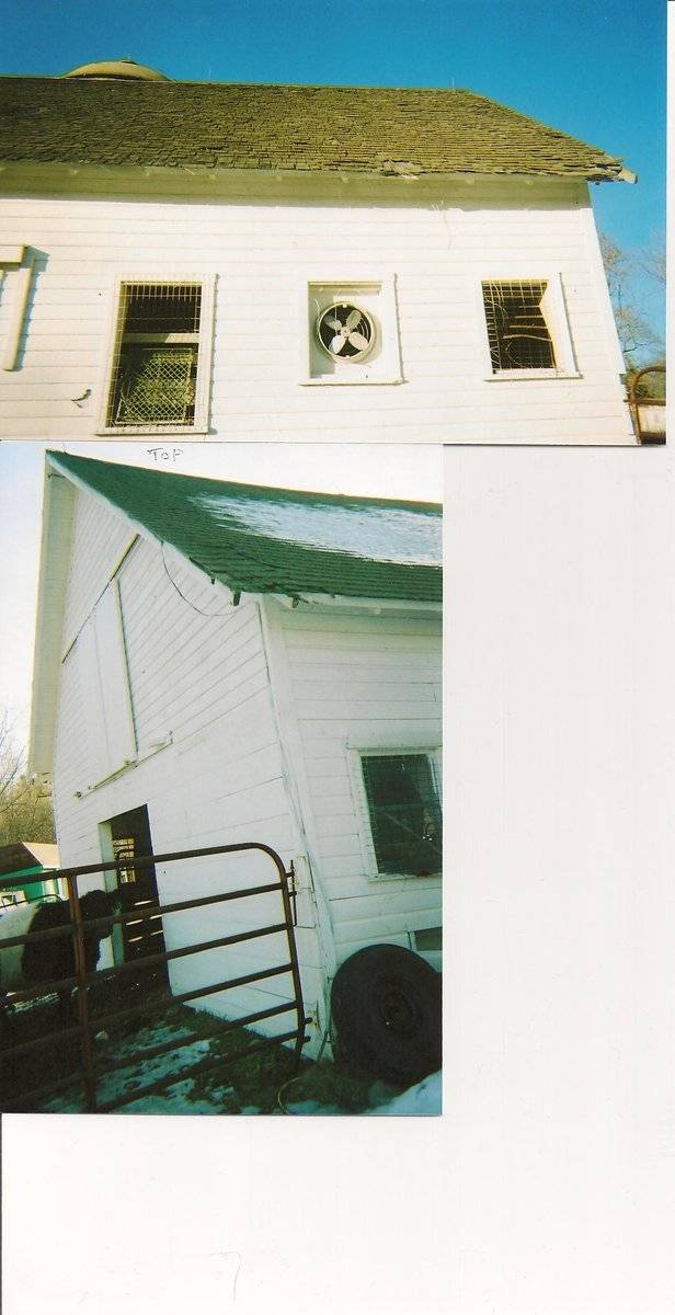
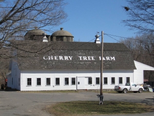
This is a 2-story gambrel-roofed ground floor stable barn. The main facade faces west and the ridge-line of the barn is parallel to this portion of Bethmour Road, which runs approximately north-south. The west eave-facade of the barn has a series of twelve four-pane windows with trim along the main level with an exterior sliding pass-through in the center. In the lower pitch of the double-pitch gambrel roof are the words “CHERRY TREE FARM” in large white letters apparently painted directly on the roof shingles. Mortared field-stone foundation is evident on this facade. The north gable-end of the barn appears to have a pass-through door flanked by a window in each side in the main level. Centered above the door is a sliding hay door. In the second level appears to be a larger pair of hay doors. The roof has a projecting hay hood on the north gable-end. The east eave-side of the barn is mostly encompassed by additions; towards the north corner is a small gable-roofed addition, towards the center are two attached poured concrete silos by gable-roofed enclosures and towards the south corner is a gable-roofed barn structure. The south gable-end of the barn has a shed-roofed addition with a deep porch extending south. The barn has horizontal novelty board painted white. The roof has a projecting overhang, exposed rafter tails and is covered with wood shingles. Atop the ridge of the roof re two equally spaced metal ventilators. The gable-roofed addition has a single metal ventilator.
Historical significance:By the early 20th century agricultural engineers developed a new approach to dairy barn design: the ground-level stable barn, to reduce the spread of tuberculosis bacteria by improving ventilation, lighting, and reducing the airborne dust of manure. A concrete slab typically serves as the floor for the cow stables. Many farmers converted manure basements in older barns into ground-level stables with concrete floors. Some older barns were jacked up and set on new first stories to allow sufficient headroom. With the stables occupying the entire first story, the space above serves a a hayloft. By the 1920s most ground-level stable barns were being constructed with lightweight balloon frames using two-by-fours or two-by-sixes for most of the timbers. Novelty or tongue-and-groove beveled siding is common on the walls, although asbestos cement shingles also were a popular sheathing. Some barns have concrete for the first-story walls, either poured in place or built up out of blocks. The gambrel roof design was universally accepted as it enclosed a much greater volume than a gable roof did, and its shape could be formed with trusses.
Field Notes
Listed on the State Register of Historic Places 11/06/2013. Third generation of farmers at this farm
- Use & Accessibility
Use (Historic)
Use (Present)
Exterior Visible from Public Road?
1
Demolished
n/a
Location Integrity
Unknown
- Environment
Related features
Environment features
Relationship to surroundings
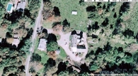
Bethmour Road runs north-south in the southwestern part of the town of Bethany. It intersects with Route 67 at its southern end at the Woodbridge town line and slopes steadily upward toward the north. Cherry Tree Farm is located on the east side of the road .8 mile north. The 86.32-acre property includes an open pasture stretching parallel with the road , and the Farmhouse and Barn at the southern edge of the site. To the east the site include a wooded area through which a small brook runs, and beyond that is another open pasture and an extensive woodland acreage. Pine Brook runs southward through the site, to join Bladens Brook, draining west to the Naugatuck River.
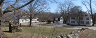
The barn is behind and to the northeast of the c. 1800 Farmhouse. The ridge-line of the house is oriented north-south parallel to the road and to the ridge-line of the barn. To the north of the main residence is a driveway that leads to the east to the barn and to the southeast to the two-car garage, whose upper floor has been finished as an apartment. Most of the area between the main residence and the barn is paved, except a circular area (as a result of a circular drive) northeast of the house. To the north of the barn is a small shed-roofed shed. The area around the shed is used for cattle grazing. A stone wall fronts Bethmour Road to the west.Map 107/124-1A
- Typology & Materials
-
Building Typology
Materials
Structural System
Roof materials
Roof type
Approximate Dimensions
70 ft x 30 ft, ell 50 ft x 25 ft, 2 silos
- Source
-
Date Compiled
12/02/2010
Compiled By
Todd Levine, reviewed by the Connecticut Trust
Sources
Photographs by Charlotte R. Hitchcock & Hiram Carrington.
Grant pre-application 2009.Field notes by Charlotte R. Hitchcock.
Map of Bethany, CT, retrieved on December 2, 2010 from website www.zillow.com.
eQuality Valuation Services, LLC Database. http://www.equalitycama.com/tvweb/MainSearch.aspx?city=Bethany
Bunton, Alice Bice, Bethany’s Old Houses and Community Buildings, Bethany Library Association, 1972.
Sexton, James, PhD; Survey Narrative of the Connecticut Barn, Connecticut Trust for Historic Preservation, Hamden, CT, 2005, http://www.connecticutbarns.org/history.
Visser, Thomas D.,Field Guide to New England Barns and Farm Buildings, University Press of New England, 1997.
- PhotosClick on image to view full file
-