Barn Record Bolton
RETURN TO ‘FIND BARNS’- Building Name (Common)
- Bolton Heritage Farm
- Building Name (Historic)
- Valley View / Rose / Minister's Farm
- Address
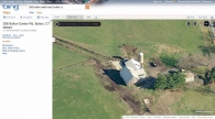
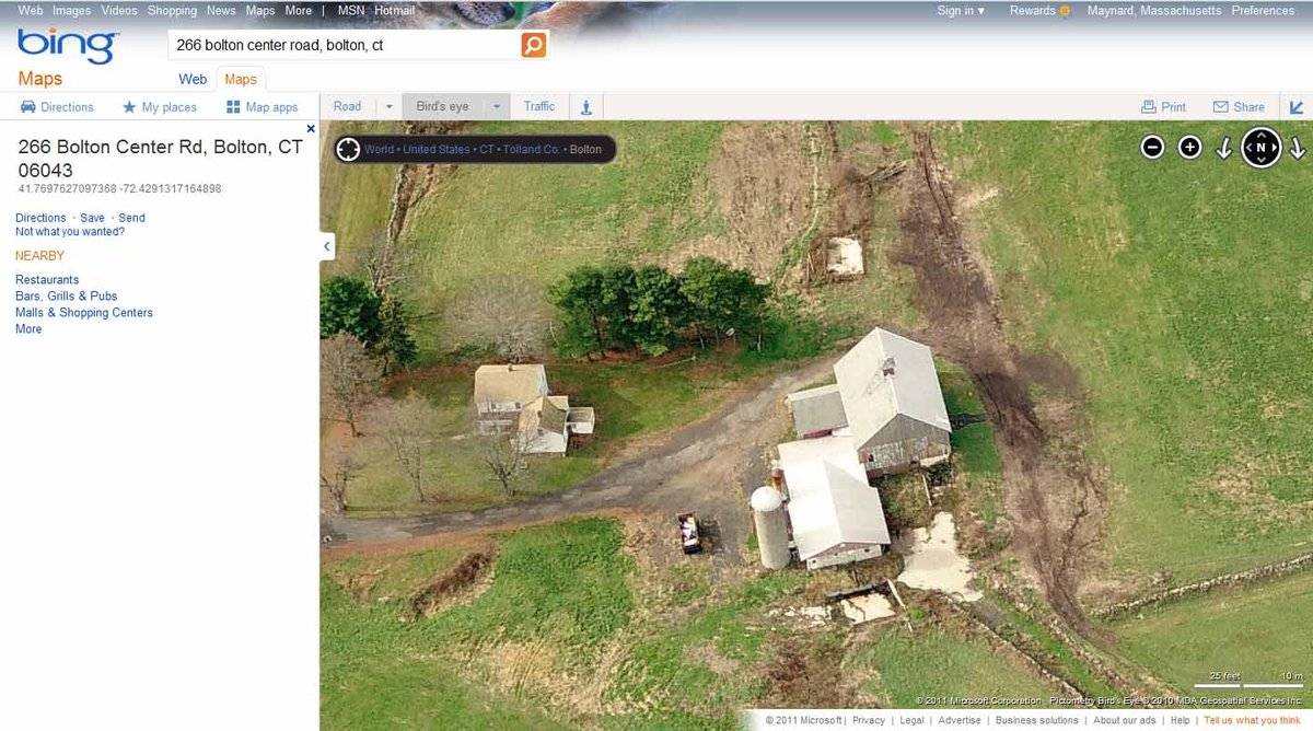
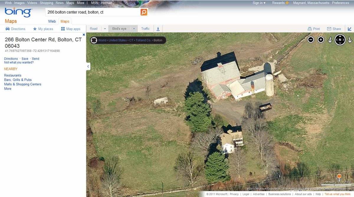
- 266 Bolton Center Road, Bolton
- Typology

- Overview
-
Designations
Historic Significance
Architectural description:
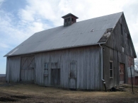
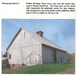
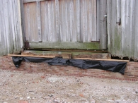
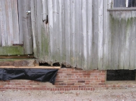
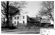
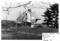
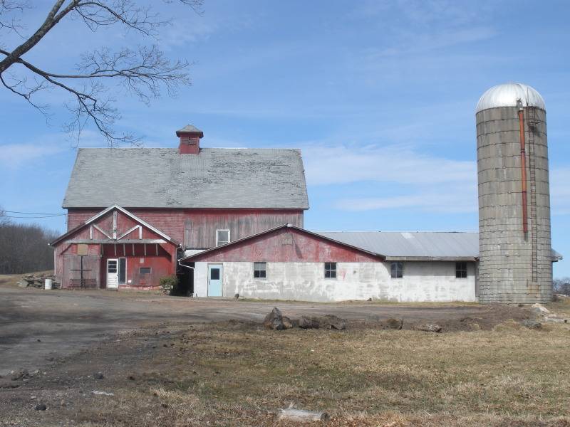
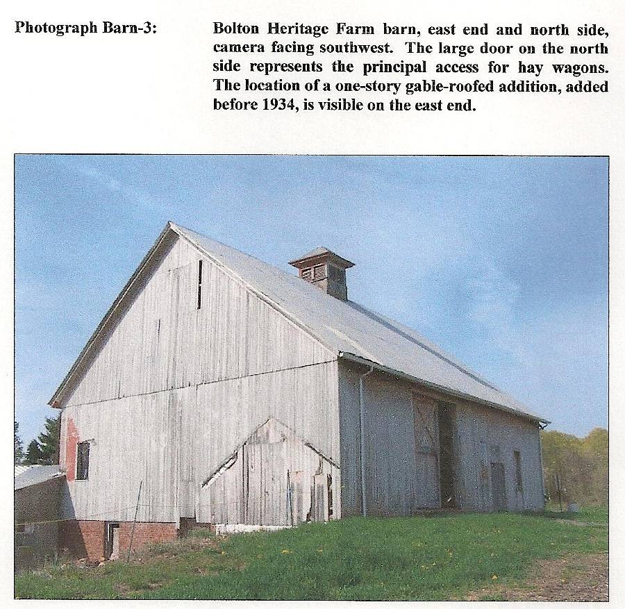
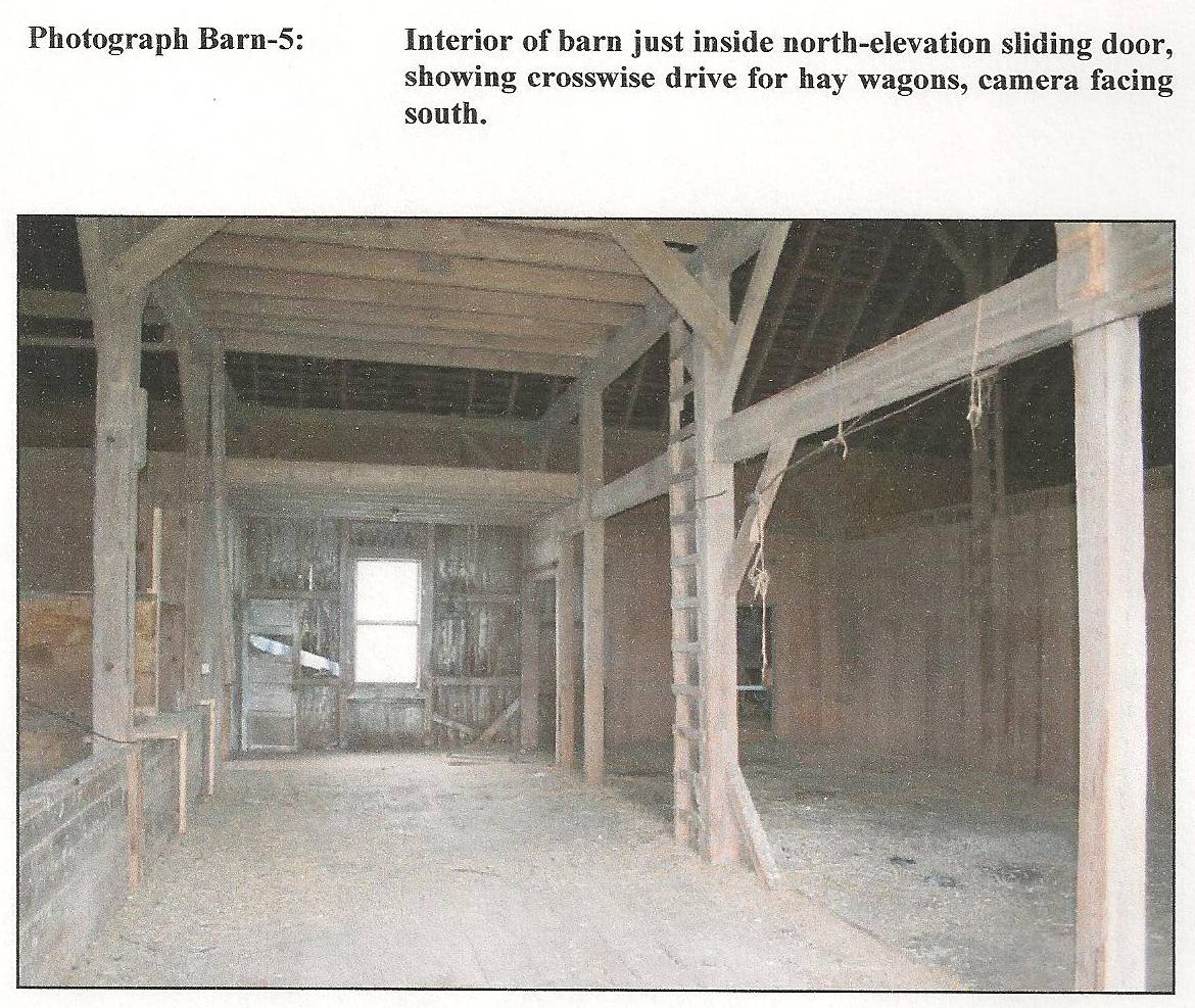
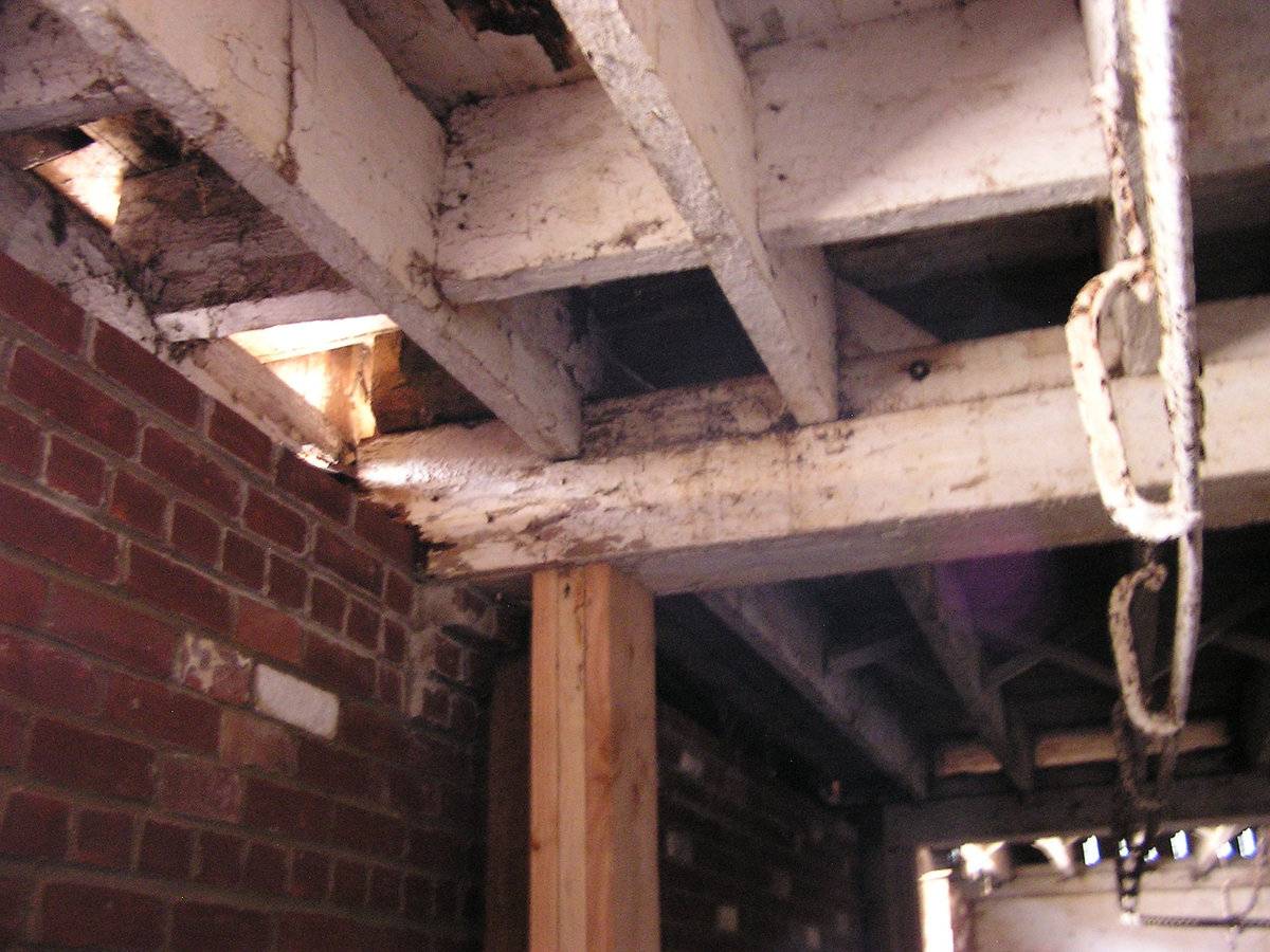
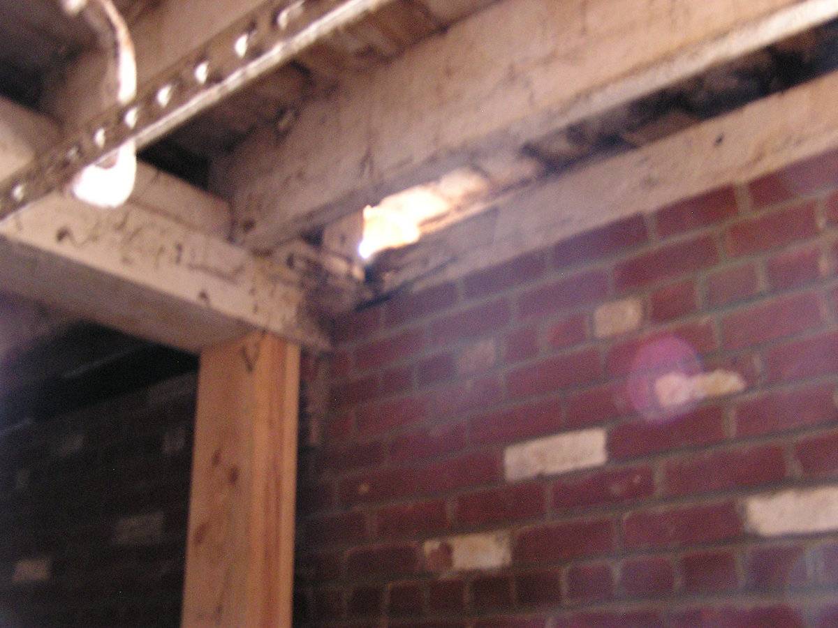
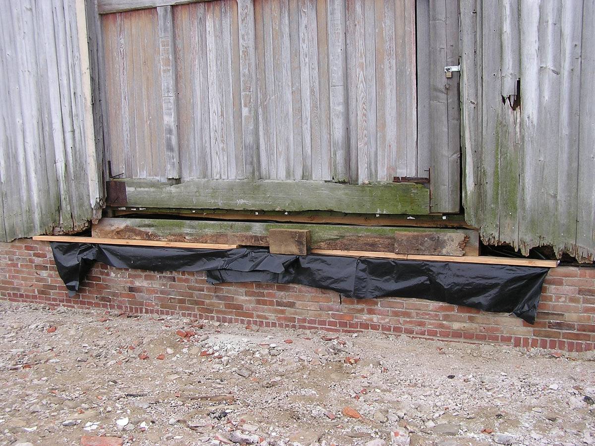
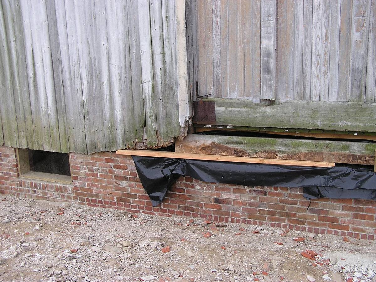
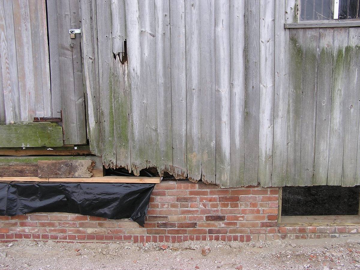
This is a 1 1/2-story eave-entry bank barn with a gable-roof addition. The main facade faces north and the ridge-line is parallel to Bolton Center Road, which runs approximately east-west. The main entry appears to be an interior sliding door just east of center in the north eave-facade. There is a top-hinged access door between one large- and one slightly smaller rectangular window on the west side of the north eave-facade. The larger window is boarded shut and the smaller is a fixed two-pane window. There are at least two windows in the brick foundation visible just above ground level.
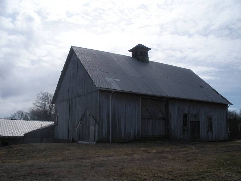
The east gable-side of the barn is blank except for a window on the far south side. The remains of a 1-story, gable-roof addition are visible on the north half of the east gable-side. The basement story is fully exposed and the ground is paved with concrete in front of the east gable-side of the barn. It appears that there was one wide pass-through door in the middle and one narrow pass-through door on the south side of the basement story.
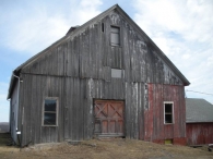
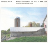
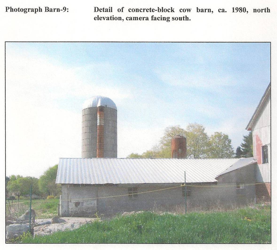
The south eave-side of the barn lies behind a two side-by-side gable-roof additions. The older addition, constructed of wood, is located on the west side and a newer, concrete cow barn occupies the east side and extends beyond the east end of the barn. Corresponding with the dividing line between the two additions, the west side of the barn has shingle siding, while the the east side has vertical, flush-board siding. The single window divided horizontally into two panes appears in the east side of the upper story.
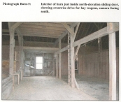
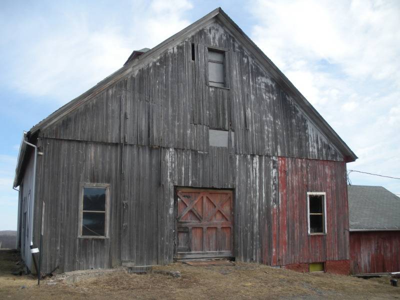
The west gable-side of the barn has an interior sliding door centered in the lower story, which leads to a wainscoted carriage room. Single, rectangular windows divided horizontally into two panes are placed symmetrically on either side of the central entry. A third window opening with the same proportions is sealed with a sheet of tin at the apex of the gable attic. A basement window is situated directly beneath the window on the south side where the foundation is exposed.
The roof is covered with tin sheets on asphalt shingles. A cupola, square in section, with a hip roof is mounted on the ridge of the roof. It has paired louvers on all sides. The barn has mostly unpainted vertical flush-board siding, but there are traces of red and white paint in several places.
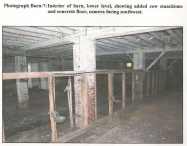
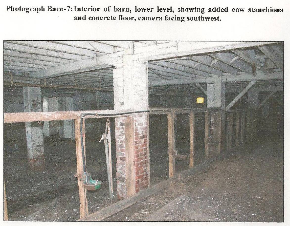
Historical significance:The oldest barns still found in the state are called the “English Barn,” “side-entry barn,” “eave entry,” or a 30 x 40. They are simple buildings with rectangular plan, pitched gable roof, and a door or doors located on one or both of the eave sides of the building based on the grain warehouses of the English colonists’ homeland. The name “30 by 40” originates from its size (in feet), which was large enough for 1 family and could service about 100 acres. The multi-purpose use of the English barn is reflected by the building’s construction in three distinct bays - one for each use. The middle bay was used for threshing, which is separating the seed from the stalk in wheat and oat by beating the stalks with a flail. The flanking bays would be for animals and hay storage. The 19th century saw the introduction of a basement under the barn to allow for the easy collection and storage of a winter’s worth of manure from the animals sheltered within the building. The bank barn is characterized by the location of its main floor above grade, either through building into a hillside or by raising the building on a foundation. This innovation, aided by the introduction of windows for light and ventilation, would eventually be joined by the introduction of space to shelter more animals under the main floor of the barn.
Field Notes
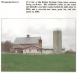
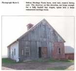
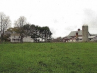
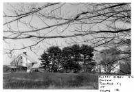
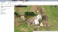
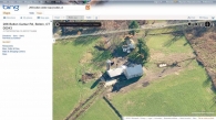
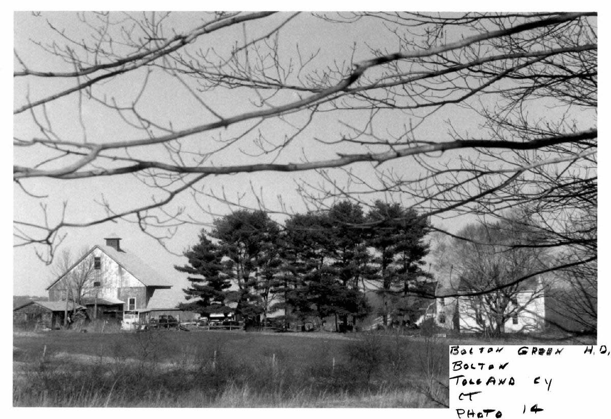
The barn belongs to the 'Rose Farm' or the 'Bolton Heritage Farm', with its east facade facing the road. It is part of a cluster of sheds and a concrete silo. The barn originally has asphalt shingles on roof with areas mounted by tin sheets. The gable roof is mounted by a louvered cupola. The Town of Bolton received a Barn Grant in 2009 for the stabilization of the barn. Additional photos from 2011 Barns Grant Application. The barn at Bolton Heritage Farm has long been a source of civic pride. The barn sits high on a hill behind the Town Hall overlooking an easterly vista that is largely unchanged since the Revolutionary War. The property is listed in the Washington Rochambeau Revolutionary Route and Rochambeau's troops camped on the property at least twice. The property is designated as a State of Connecticut Archaeological Site. The Town of Bolton acquired the property in August of 2000 and has been working on stabilizing the barn. 266 Bolton Center Road is part of the Bolton Green Historic District and is a contributing resource within the district.
- Use & Accessibility
Use (Historic)
Use (Present)
Exterior Visible from Public Road?
1
Demolished
n/a
Location Integrity
Unknown
- Environment
Related features
Environment features
Relationship to surroundings
The barn is behind and to the north of the house set on the 100-acre Bolton Heritage Farm owned and maintained by the Town of Bolton. The south gable-side of the house, which is believed to have a colonial core, fronts Bolton Center Road. An open porch on the east side of the house connects to an addition set at a right angle at the rear of the house. The ridge-line of the house is perpendicular to the ridge-line of the barn. The driveway enters the property from Bolton Center Road on the east side of the house and leads past the west gable-side of the barn until it meets the Rose Trail running parallel to the north eave-side of the barn. The trail turns to the northeast just beyond the east gable-side of the barn where it runs between two stone walls and circles around a grove of mature oak trees in the center of the lot before it returns to enclose a rectangular field on the west side of the property. Stone walls divide the property into several separate fields or pastures. The remains of at least four of these date back to the eighteenth century according to a map drafted in the Revolutionary War. To the east of the barn lies the Encampment Hill, which is commemorated as the spot where regiments of Rochambeau’s army spent the night in 1781. Roughly one-half of the property consists of woodlands which adjoin Hop River State Park on the northeast side. The area surrounding the site is residential, light agriculture, open space and woodland.
Map/Block/Lot 00021 00011 00001
- Typology & Materials
-
Building Typology
Materials
Structural System
Roof materials
Roof type
Approximate Dimensions
n/a
- Source
-
Date Compiled
11/07/2010
Compiled By
Amy Prescher & Todd Levine, reviewed by CT Trust
Sources
Photographs and field notes by J.M. Treat.
Additional photographs by Sandra Pierog - 8/30/2011.
eQuality Valuation Services, LLC Database. http://www.equalitycama.com/tvweb/MainSearch.aspx?city=Bolton
Map of Bolton, CT, retrieved on November 6, 2010 from website www.bing.com.
Map of Bolton, CT, retrieved on November 6, 2010 from website http://maps.google.com/
Map of Bolton Heritage Farm, retrieved on November 6, 2010 from website
http://bolton.govoffice.com/index.asp?Type=B_BASIC&SEC={99E847B6-411C-422B-9CE9-7A0625504A74}Ransom, David F., Bolton Green National Register Historic District Nomination No. 01000357, National Park Services, 2001.
http://pdfhost.focus.nps.gov/docs/NRHP/Text/01000357.pdf
http://pdfhost.focus.nps.gov/docs/NRHP/Photos/01000357.pdfSexton, James, PhD; Survey Narrative of the Connecticut Barn, Connecticut Trust for Historic Preservation, Hamden, CT, 2005, http://www.connecticutbarns.org/history.
Visser, Thomas D.,Field Guide to New England Barns and Farm Buildings, University Press of New England, 1997.
- PhotosClick on image to view full file
-