Barn Record Mansfield
RETURN TO ‘FIND BARNS’- Building Name (Common)
- n/a
- Building Name (Historic)
- n/a
- Address
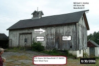
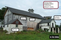
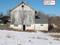
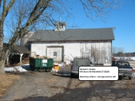
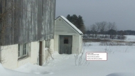
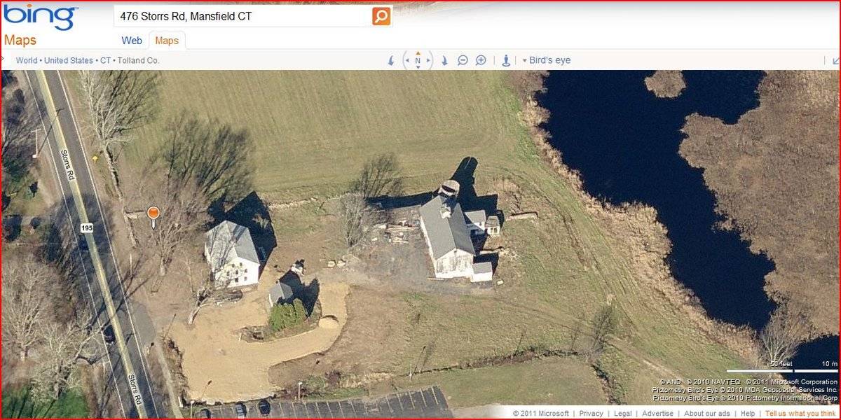
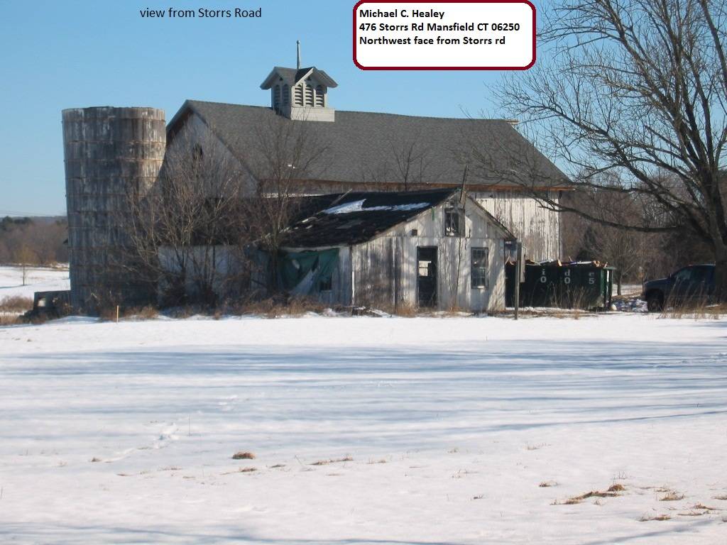
- 476 Storrs Road (Rte 195), Mansfield
- Typology
- Overview
-
Designations
n/a
Historic Significance
Architectural description:
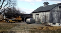
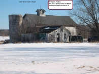
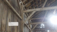
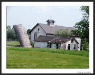
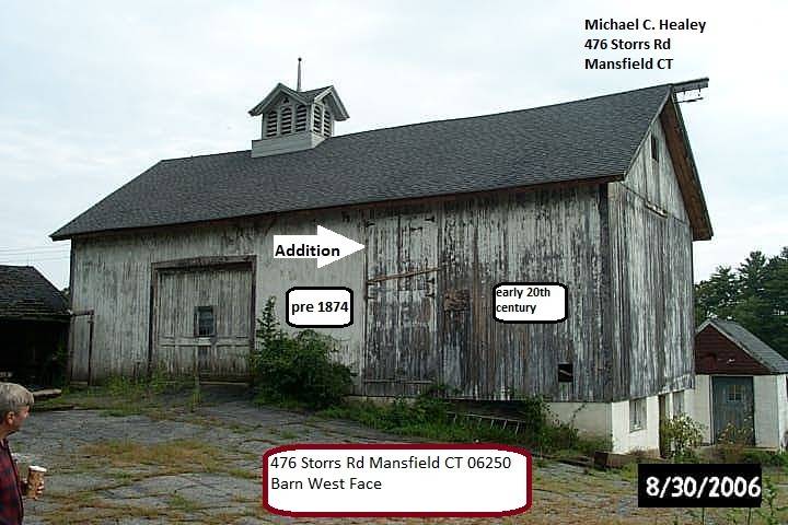
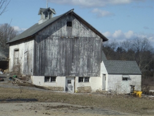
This is a 1 ½-story eave entry bank barn. The main façade faces west and the ridge-line of the barn is approximately parallel to Storrs Road, which at this point runs northwest to southeast.
The main entry is a single sliding door off-center to the north. The main entry door has a six-pane window set in the center. Off center to the south of the west eave-façade are two pairs of side-hinged hay doors one set atop the other. Towards the lower south corner of the west eave-side of the barn is a small square opening. The grade of the west eave-façade declines slightly to the south revealing the concrete foundation.
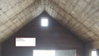
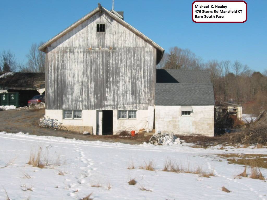
On the basement level of the south gable-end of the barn are two sets of evenly spaced six-pane windows, with a side-hinged door centered between them. The door has a small six-pane window set in the center. Centered in the gable-attic of the south gable-end of the barn is a six-pane window. Extending from the apex of the south gable-end of the barn is a hay track. At the east corner of the basement level of the south gable-end of the barn is the small gable-roof addition (Addition I) constructed of concrete block. There is a side-hinged pass-through door in the west gable-end of Addition I, and a louvered vent in the gable-attic. A six-pane window with a shed-roof hood is found on the south eave-side of Addition I. On the east gable-end of Addition I, there appears to be a window opening in the gable-attic.
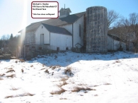
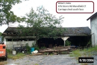
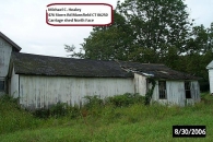
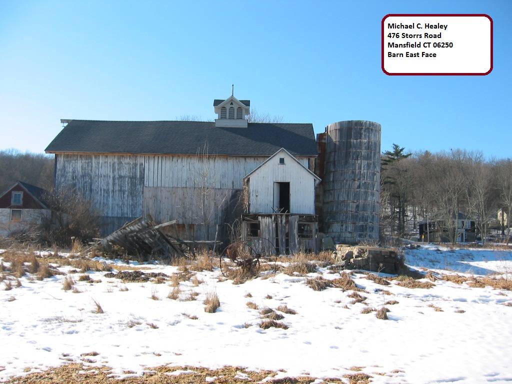
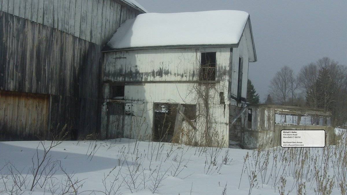
The grade of the east eave-side of the barn declines sharply, revealing a basement level consisting of concrete block with white paint. At the north corner of the east eave-side of the barn is the gable-roof addition (Addition II) projecting east with a centered door opening in the upper half, which leads onto the roof of a lower shed-roof extension. Centered in the basement level of the east eave-side of the barn is a large door opening.
Along the north eave-side of Addition II are what appear to be two window openings. There appears to be a window centered in the attic of the north gable-end of the barn. Extending to the west from the west corner of the north gable-end of the barn is a large gable-roof addition (Addition III).
Located in the west half of the north eave-side of Addition III is a small shed-roof extension which appears to have two evenly spaced openings. The rest of the north eave-side of Addition III appears blank. An off-center door opening is found on the west gable-end of Addition III, with a window opening to the south of that. There appears to be an opening in the gable-attic of the west gable-end of Addition III. The south eave-side of Addition III consists of two large double-height openings in the east half, and a large over-head garage door in the west half.
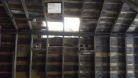
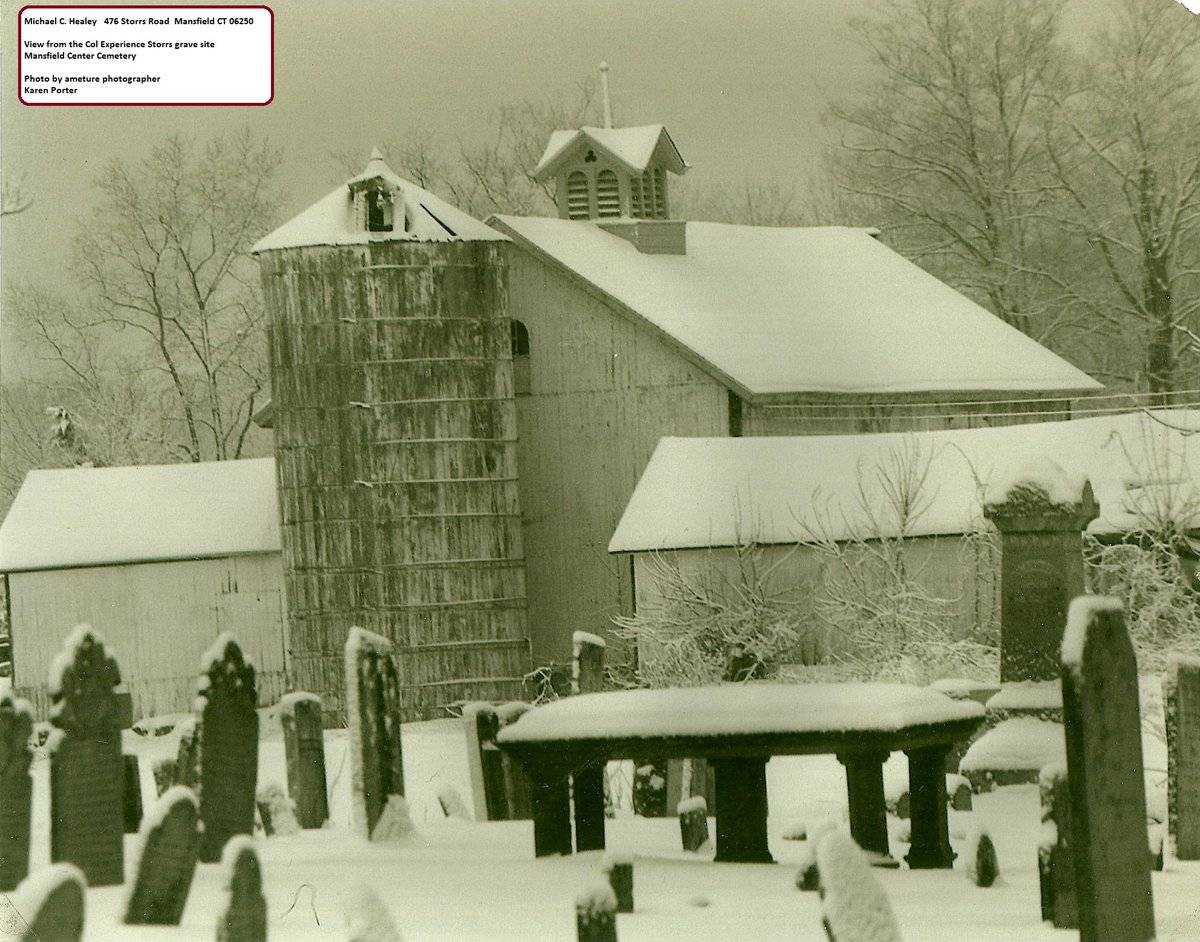
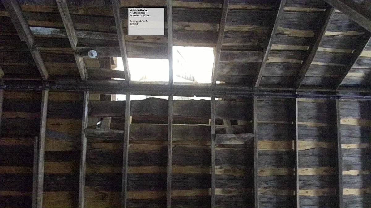
The barn is covered in un-painted vertical siding. The foundation is concrete block painted white. The roof is covered with asphalt and atop the ridge-line is a cupola off-center to the north. The cupola is in a Victorian style with three louvered arches on the east and west sides and two louvered arches on the north and south sides. The cupola has a gable-roof, with a gable on each side and a clover cut-out in each gable. The cupola is top with a plain balled top finial.
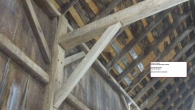
Historical significance:The oldest barns still found in the state are called the “English Barn,” “side-entry barn,” “eave entry,” or a 30 x 40. They are simple buildings with rectangular plan, pitched gable roof, and a door or doors located on one or both of the eave sides of the building based on the grain warehouses of the English colonists’ homeland. The name “30 by 40” originates from its size (in feet), which was large enough for 1 family and could service about 100 acres. The multi-purpose use of the English barn is reflected by the building’s construction in three distinct bays - one for each use. The middle bay was used for threshing, which is separating the seed from the stalk in wheat and oat by beating the stalks with a flail. The flanking bays would be for animals and hay storage.
The 19th century saw the introduction of a basement under the barn to allow for the easy collection and storage of a winter’s worth of manure from the animals sheltered within the building. The bank barn is characterized by the location of its main floor above grade, either through building into a hillside or by raising the building on a foundation. This innovation, aided by the introduction of windows for light and ventilation, would eventually be joined by the introduction of space to shelter more animals under the main floor of the barn.
Field Notes
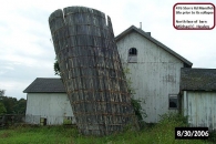
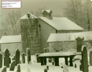
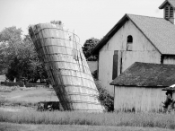
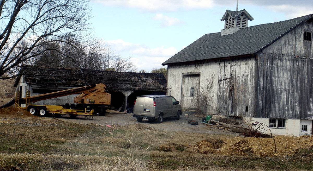
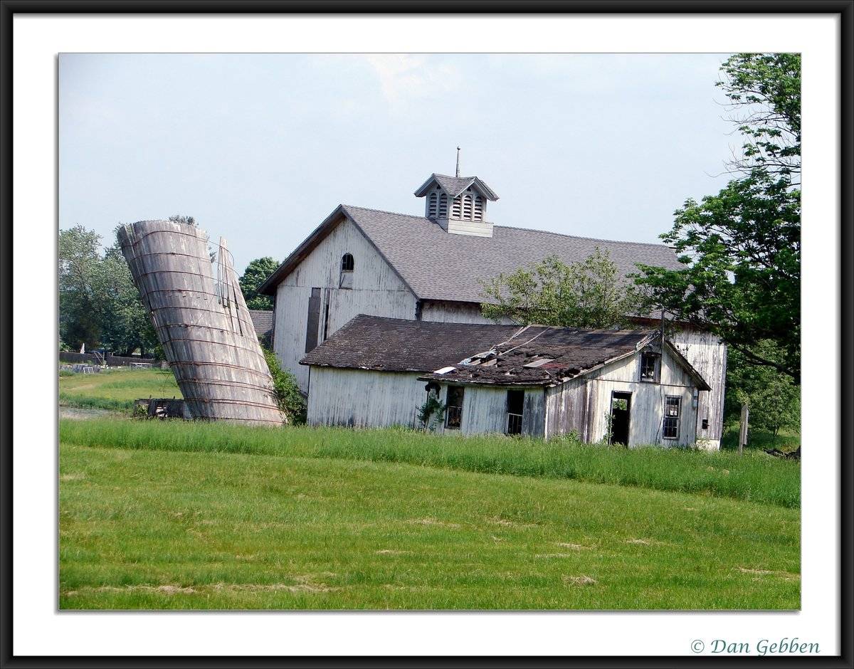
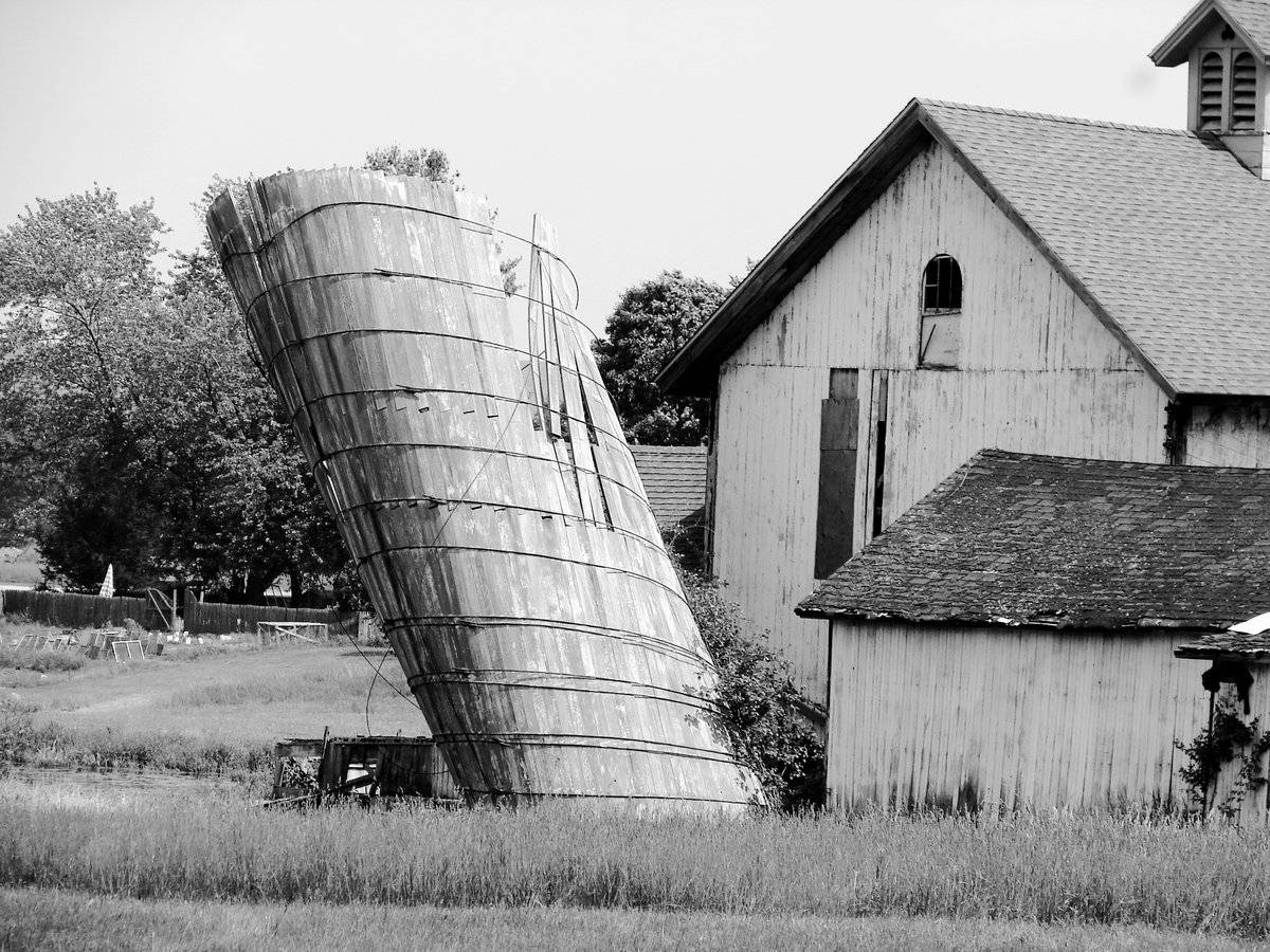
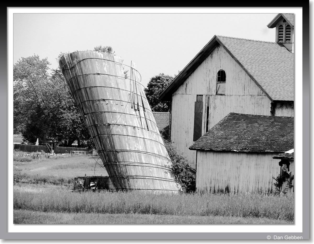
This barn is located in Mansfield Center behind a house and next to a restaurant with a field in back. It is seriously dilapidated, but construction crews have been on site for awhile, so they are working on repairing it. It is comprised of white, vertical wooden siding and asphalt shingles on the gable style roof. There is a cupola on top. The main entrance is on the straight side of the roof, so it can be labeled as an English style barn. 2011 Barns Grant Applicant An old silo about ready to fall down as part of an old barn. Since I took the photo the silo has fallen and is lost forever. The silo could be seen from the Mansfield Cemetery on Rt 195 Storrs Road in Mansfield Center. (DG - 2008)
- Use & Accessibility
Use (Historic)
Use (Present)
Exterior Visible from Public Road?
Yes
Demolished
n/a
Location Integrity
Unknown
- Environment
Related features
Environment features
Relationship to surroundings
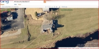
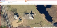
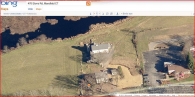
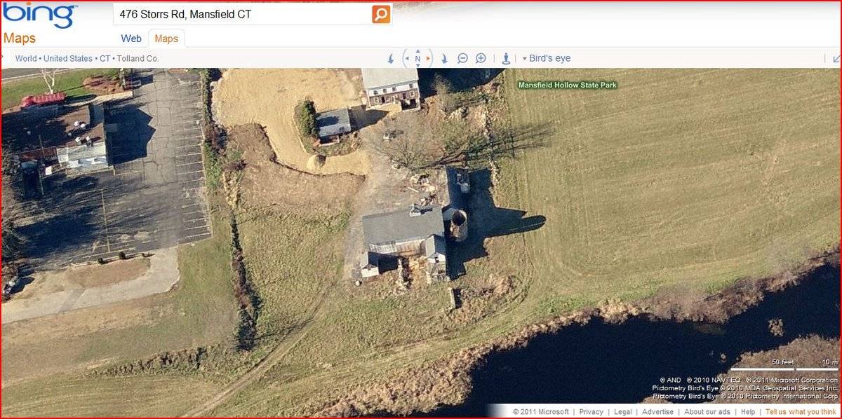
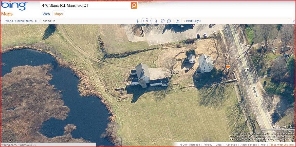
The barn is to the east of the c. 1740 house with which it is associated. The ridge-line of the house is parallel to that of the barn. At the west corner of the barn is a small derelict three bay barn. At the north corner of the barn is a derelict silo. At the east corner of the barn is a small gable-roof shed. There is a garage to the southeast of the house. There is a lake to the west of the site. To the south of the site is a commercial property. The north and east of the property is bordered by stone walls. The total size of the site is 2.0 acres. The area surrounding the site is light residential, commercial, open land and woodlands.
- Typology & Materials
-
Building Typology
Materials
Structural System
Roof materials
Roof type
Approximate Dimensions
55ft. x 38 ft.
- Source
-
Date Compiled
03/10/2011
Compiled By
TR Revella & T. Levine, reviewed by CT Trust
Sources
Field notes and photographs by Carolyn Barry date 05/14/2009.
Additional photographs by Michael Healey - 5/11/2011 and Dan Gebben - 4/3/2008.
Additional field notes by Dan Gebben - 4/3/2008.
Town of Mansfield Assessor’s Record:
http://www.mainstreetmaps.com/CT/Mansfield/
Parcel ID: 29-113-17AAerial Mapping:
http://www.bing.com/maps accessed03/10/2011.Sexton, James, PhD, Survey Narrative of the Connecticut Barn, Connecticut Trust for Historic Preservation, Hamden, CT, 2005, http://www.connecticutbarns.org/history.
Visser, Thomas D., Field Guide to New England Barns and Farm Buildings, University Press of New England, 1997.
- PhotosClick on image to view full file
-