Barn Record Ashford
RETURN TO ‘FIND BARNS’- Building Name (Common)
- n/a
- Building Name (Historic)
- n/a
- Address
- 15 Boston Hollow Road, Ashford
- Typology

- Overview
-
Designations
n/a
Historic Significance
Architectural description:
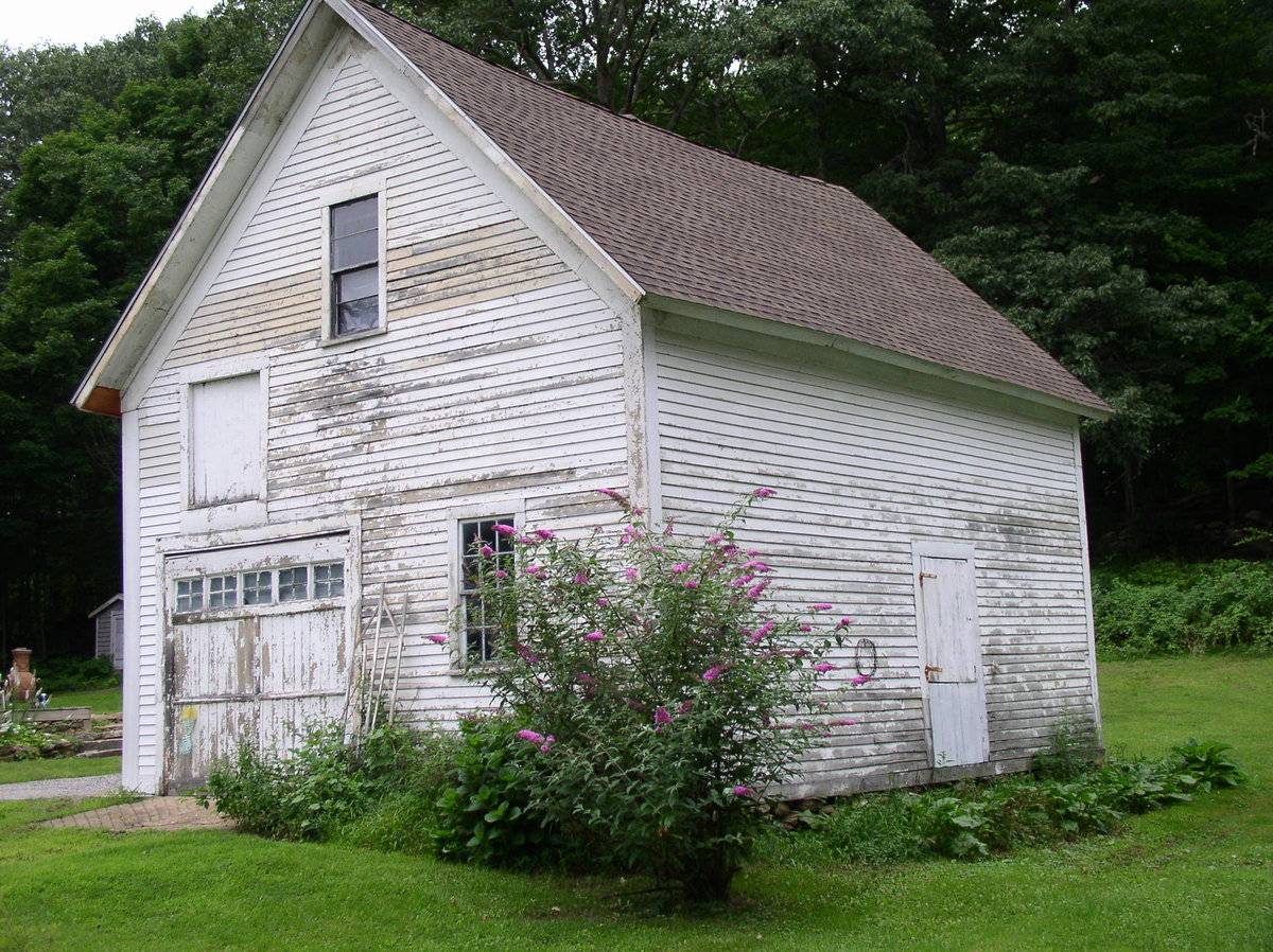
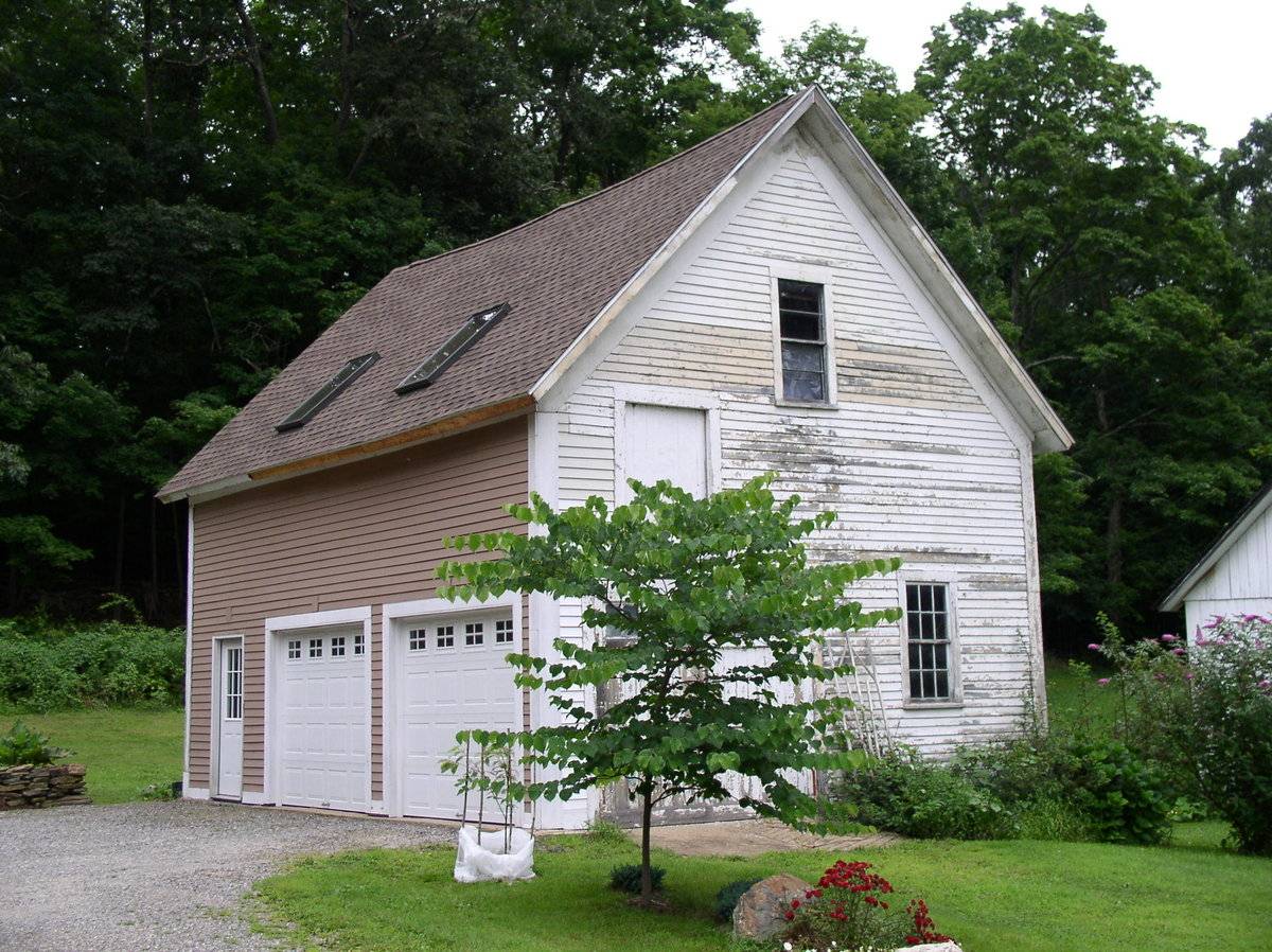
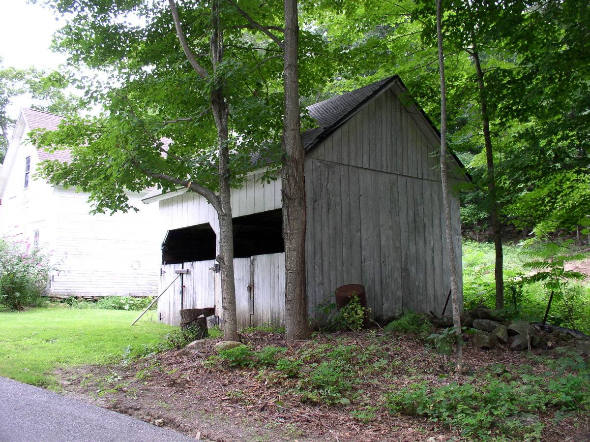
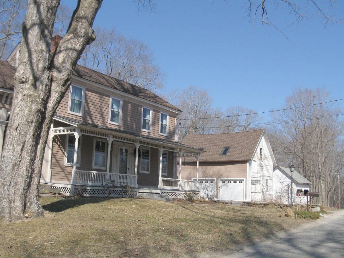
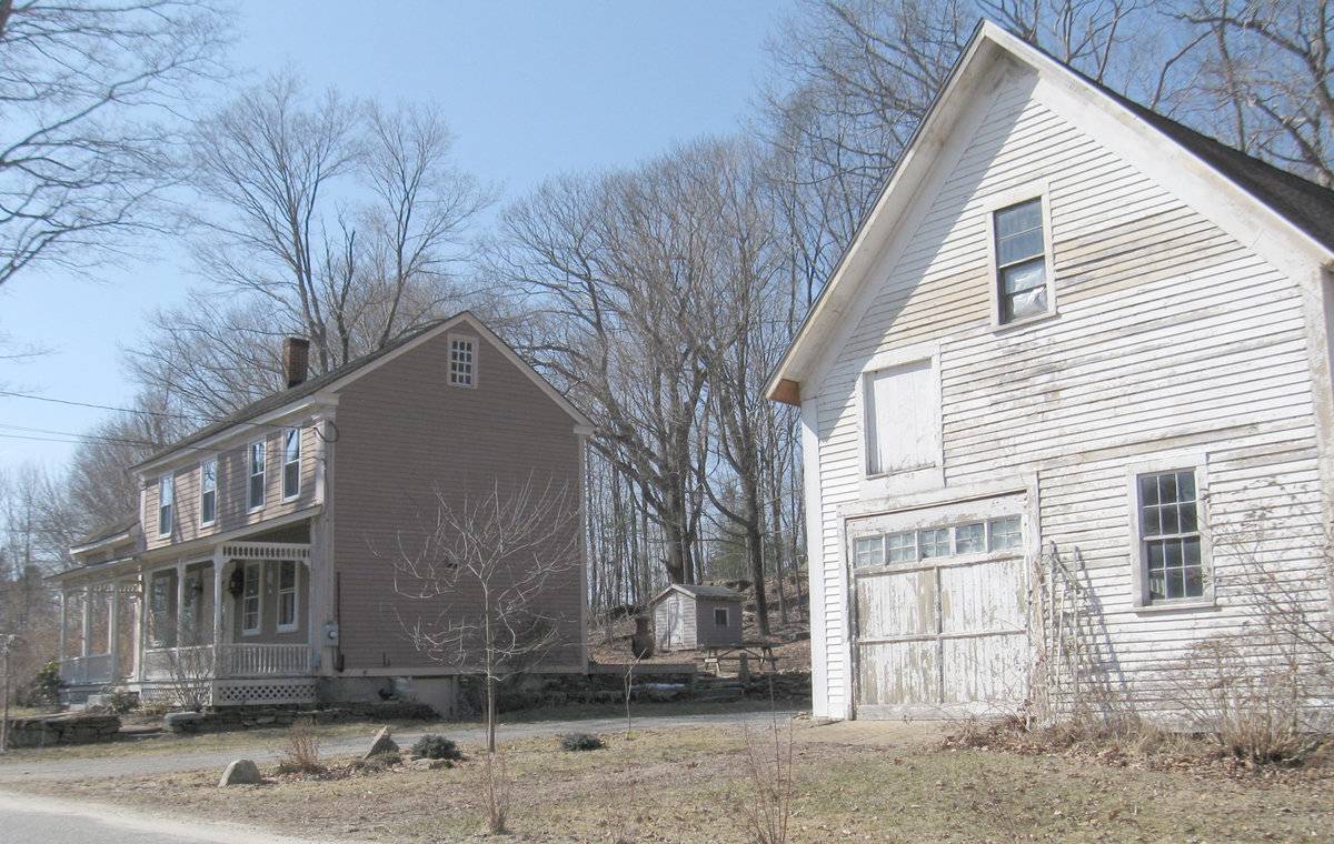
Two structures, a 1 ½ story gable-entry barn or shed and a small open-sided barn or wagon shed, are located on the north side of the road to the east of the associated house.
The larger structure (Barn I) has its gable-end facing south to the road, with an off-center overhead door in the left (west) part of the gable-end and a six-over-six double hung window to the right. Above the door is a hay door and high in the attic gable is another six-over-six double hung window. The west eave-side of the barn has a pair of modern overhead garage doors. The east eave-side of the barn has a single pass-through door off center toward the north.
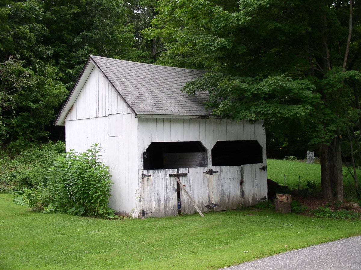
The siding is horizontal clapboards with corner board trim painted white except the west side which appears to have vinyl siding. The roof is a steep-pitched gable with asphalt shingles.Barn II is a small gable-roofed shed with its eave-side facing south toward the road. The two-bay south facade is open in the manner of a wagon shed or livestock stable, and has half-height pairs of hinged doors. The upper corners of the openings are beveled with siding on diagonal braces.
The gable-ends have no openings; the siding is vertical flush boards painted white. The pitched gable roof has asphalt shingles.Historical significance:
Until the 1830’s, the horses used for riding and driving carriages were often kept in the main barn along with the other farm animals. By the 1850’s, some New England farmers built separate horse stables and carriage houses. Early carriage houses were built just to shelter a carriage and perhaps a sleigh, but no horses. The pre-cursor to the twentieth-century garage, these outbuildings are distinguished by their large hinged doors, few windows, and proximity to the dooryard. The combined horse stable and carriage house continued to be a common farm building through the second half of the nineteenth century and the first decade of the twentieth century, until automobiles became common.
Historical background:
The town of Ashford was incorporated in 1714 and for its first century had the typical scattered settlement on upland ridges which characterized nearly all of Connecticut. The economy was community-subsistence agriculture. Industry was limited to the mills of the agricultural economy – grist, saw, fulling mills.
In the early 19th century, turnpikes and improved roads, along with limited market-oriented agriculture, resulted in some local wealth and settlement nuclei at the major crossroads. Ashford Center, Westford, and Warrenville date from this period. So do the fancy Federal-style houses in these villages and along Route 89 (Mansfield Road) south of Warrenville. Also in this period there existed a short-lived glass factory at Westford.
In the 19th century, the lack of significant waterpower and railroad connections led to stagnation. Its peak population, 1820 (2,778) which had declined to 668 by 1910, was not exceeded until 1980.
In the early 20th century, the declining farms of Ashford were abandoned by their Yankee owners and sold to East European immigrants, notably Slovaks, Bohemians, and Hungarians (Magyars). This transformation of the rural countryside is one of the great stories of modern Connecticut. Today a large portion of the town is descended from these people.
Today Ashford remains a beautiful, scenic town. All roads are mostly scenic, with wooded, overgrown pastures (stone walls, young hardwoods) predominating (Clouette, Ashford survey).Field Notes
Open-sided on one side, two openings with horse-stall gates; garage overhead doors on opposite side.
- Use & Accessibility
Use (Historic)
Use (Present)
Exterior Visible from Public Road?
Yes
Demolished
n/a
Location Integrity
Unknown
- Environment
Related features
Environment features
Relationship to surroundings
The barn is to the north and across the street from the c 1800 house with which it is associated. The ridgeline of the house is parallel wit the ridgeline of barn II and perpendicular to the ridgeline of barn I. The total size of this lot is 1 acre. The area surrounding the site is active agriculture, open space, light residential and woodland.
The historic village center of Westford is now a hill-top cross-roads with a church and a few historic homes.- Typology & Materials
-
Building Typology
Materials
Structural System
Roof materials
Roof type
Approximate Dimensions
690 square feet and 320 square feet.
- Source
-
Date Compiled
03/08/2010
Compiled By
Charlotte Hitchcock, reviewed by CT Trust
Sources
Field notes and photographs by Richard Delhaie 08/07/2009, Charlotte Hitchcock.
Town of Ashford Assessor’s Record Map/Lot 12/ E/ 3 (house built 1800, 1 acre, barns 690 & 320 sf).
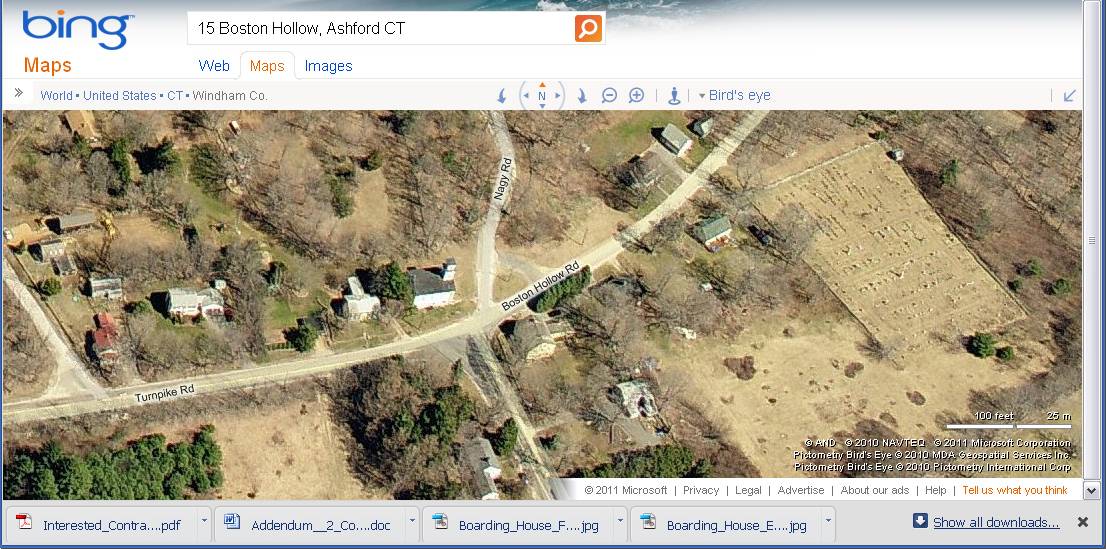
Aerial view from Bing Maps:
http://www.bing.com/maps accessed 2/15,2011.Bayles, Richard M.; History of Windham County, Connecticut, New York: W.W. Preston, 1889. excerpts available at
< http://www.connecticutgenealogy.com/windham/ashford.htm >.
Clouette, Bruce, National Register of Historic Places, Church Farm, Nomination #270921, 1988. Item No. 88002650 NRIS (National Register Information System) http://pdfhost.focus.nps.gov/docs/NRHP/Text/88002650.pdf
< http://pdfhost.focus.nps.gov/docs/NRHP/Photos/88002650.pdf >Clouette, Bruce, Ashford Township Survey, handwritten manuscript, Connecticut Trust for Historic Preservation, 199x.
Cunningham, Janice, and Ransom, David; Back to the Land: Jewish Farms and Resorts in Connecticut 1890-1945, State of Connecticut Historical Commission and Jewish Historical Society of Greater Hartford, 1998,186 pages.
Sexton, James, PhD, Survey Narrative of the Connecticut Barn, Connecticut Trust for Historic Preservation, Hamden, CT, 2005, http://www.connecticutbarns.org/history.
Visser, Thomas D., Field Guide to New England Barns and Farm Buildings, University Press of New England, 1997.
- PhotosClick on image to view full file
-