Barn Record Stafford
RETURN TO ‘FIND BARNS’- Building Name (Common)
- n/a
- Building Name (Historic)
- n/a
- Address
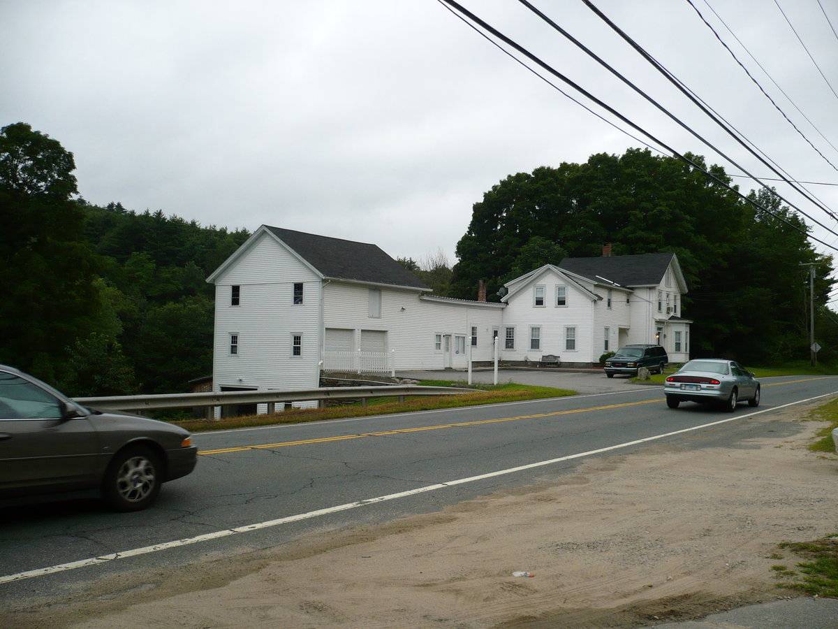
- 172 West Stafford Road (Rte 190), Stafford
- Typology

- Overview
-
Designations
n/a
Historic Significance
Architectural description:
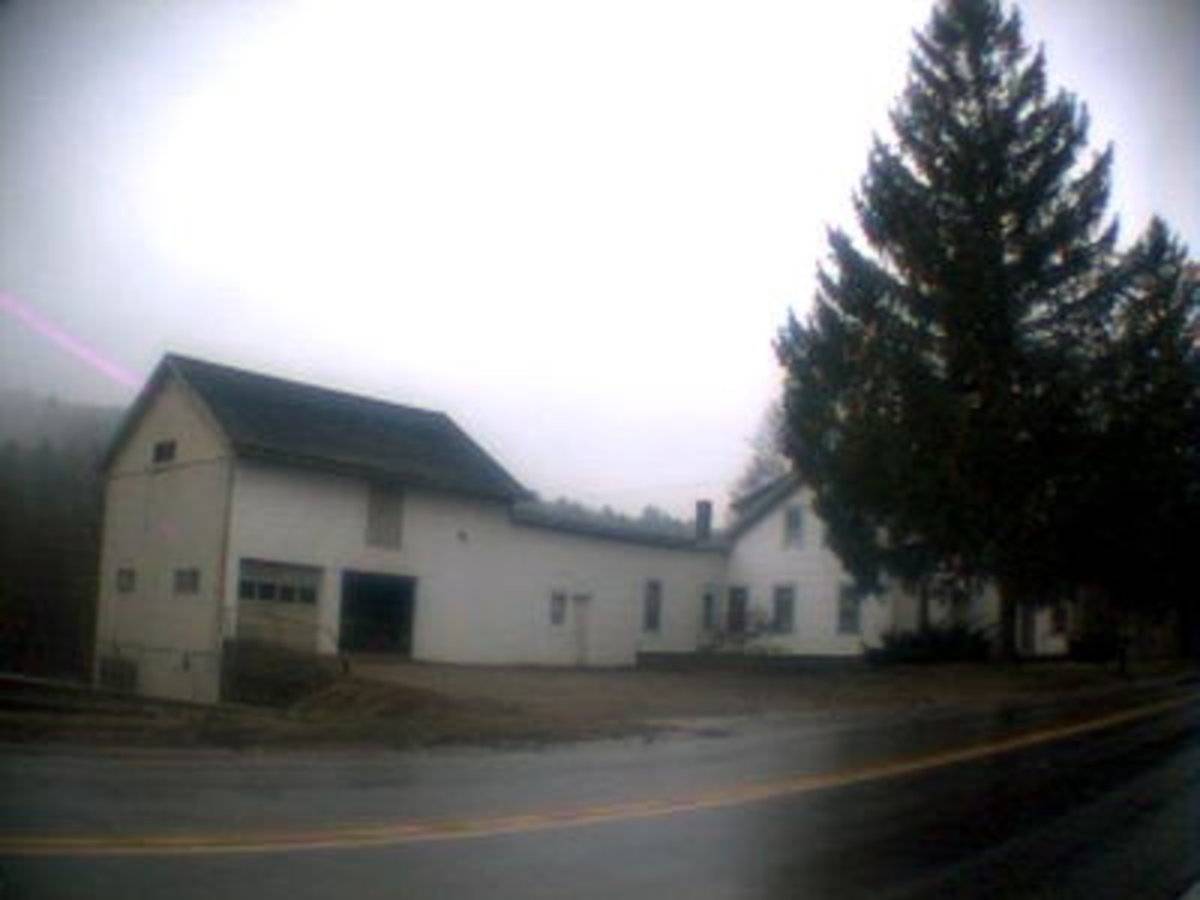
This is a 2 1/2-story connected bank barn. The barn is attached to a connecting shed-roof section that is connected to an addition to the house. The main facade faces north and the ridgeline of the barn runs parallel to this portion of West Stafford Road; east-west. The main entries are two overhead garage doors at grade with a hay door above the center garage door. The grade declines sharply at the northeast corner, revealing a mortared fieldstone retaining wall and a basement level. The east gable-end of the barn has a garage door, pass-through door and window in the basement level; two six-over-six double-hung windows in the main level; and two two six-over-six double-hung windows in the second level. The gable attic is blank. The barn is clad in clapboards painted white. The roof is covered with asphalt shingles.
Historical significance:The oldest barns still found in the state are called the “English Barn,” “side-entry barn,” “eave entry,” or a 30 x 40. They are simple buildings with rectangular plan, pitched gable roof, and a door or doors located on one or both of the eave sides of the building based on the grain warehouses of the English colonists’ homeland. The name “30 by 40” originates from its size (in feet), which was large enough for 1 family and could service about 100 acres. The multi-purpose use of the English barn is reflected by the building’s construction in three distinct bays - one for each use. The middle bay was used for threshing, which is separating the seed from the stalk in wheat and oat by beating the stalks with a flail. The flanking bays would be for animals and hay storage.
Connected barns tied all of the functions of a farmstead - home, hearth, workplace and barn - into a series of linked buildings. This is the “big house, little house, back house, barn” of nursery rhymes.
Field Notes
n/a
- Use & Accessibility
Use (Historic)
Use (Present)
Exterior Visible from Public Road?
Yes
Demolished
n/a
Location Integrity
Unknown
- Environment
Related features
Environment features
Relationship to surroundings
The barn is connected to the c.1900 house with which it is associated. A small parking lot/driveway leads north from the barn to the road. A series of stone retaining walls run to the south of the house and barn, as the grade declines. The 1.455 acre side is demarcated to the north by W Stafford Road, to the east by a diagonal running Krol Road, to the south by a stream and to the north by woodland. The area surrounding the site is residential and woodland.
- Typology & Materials
-
Building Typology
Materials
Structural System
Roof materials
Roof type
Approximate Dimensions
24' x 30'
- Source
-
Date Compiled
01/20/2010
Compiled By
Todd Levine, reviewed by the Connecticut Trust
Sources
Photograph by P. Portier - 09/18/2009
Sexton, James, PhD; Survey Narrative of the Connecticut Barn, Connecticut Trust for Historic Preservation, Hamden, CT, 2005, http://www.connecticutbarns.org/history.
Visser, Thomas D.,Field Guide to New England Barns and Farm Buildings, University Press of New England,1997.
Town of Stafford online assessor: http://stafford.univers-clt.com/view_property_C.php?account_no=45%2F117&series_card=1
Map-Block-Lot: 45/117
- PhotosClick on image to view full file
-