Barn Record Ashford
RETURN TO ‘FIND BARNS’
- Overview
-
Designations
Historic Significance
Architectural description:
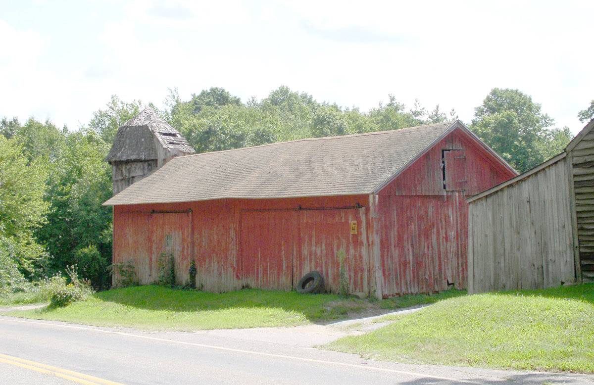
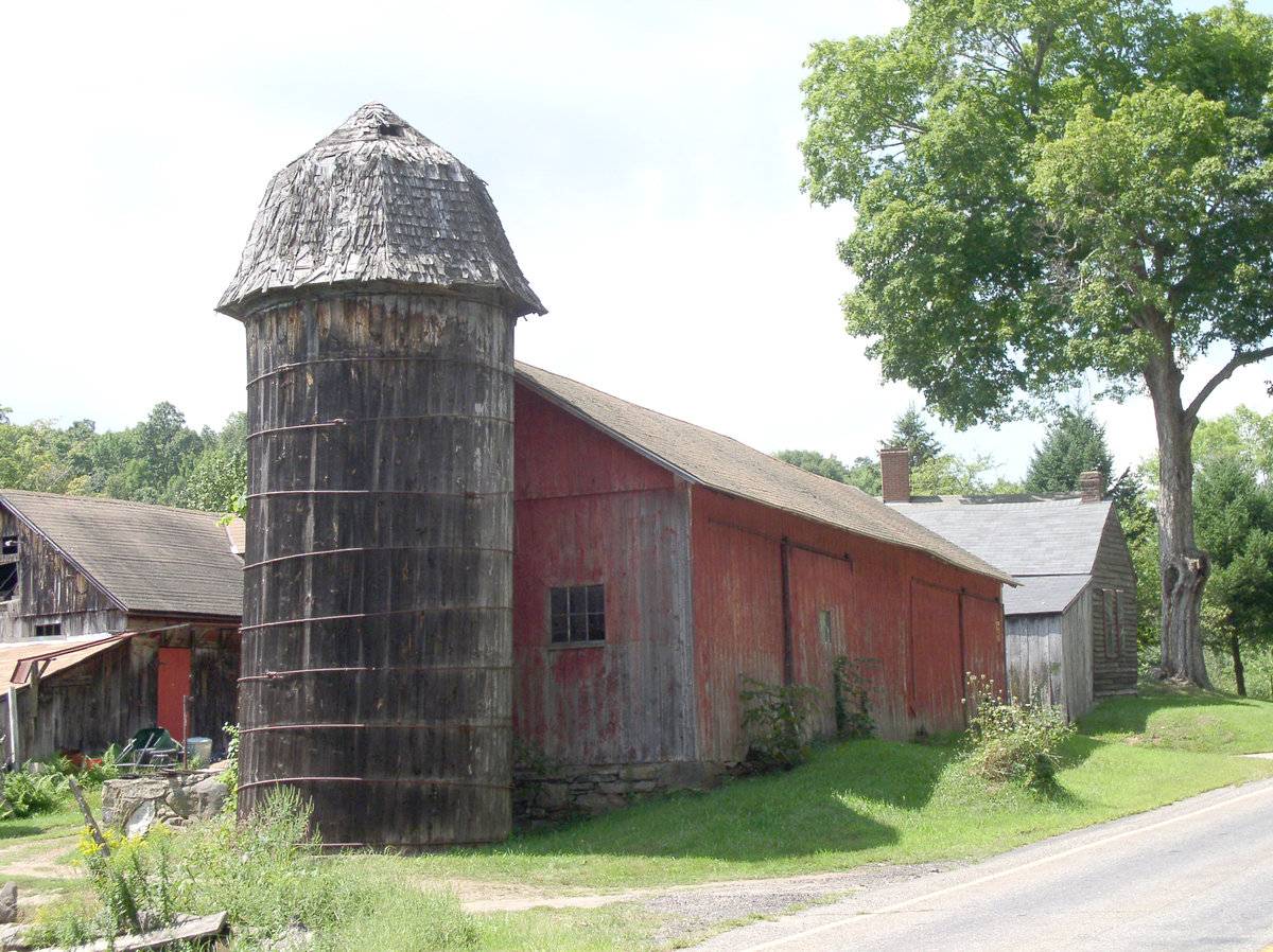
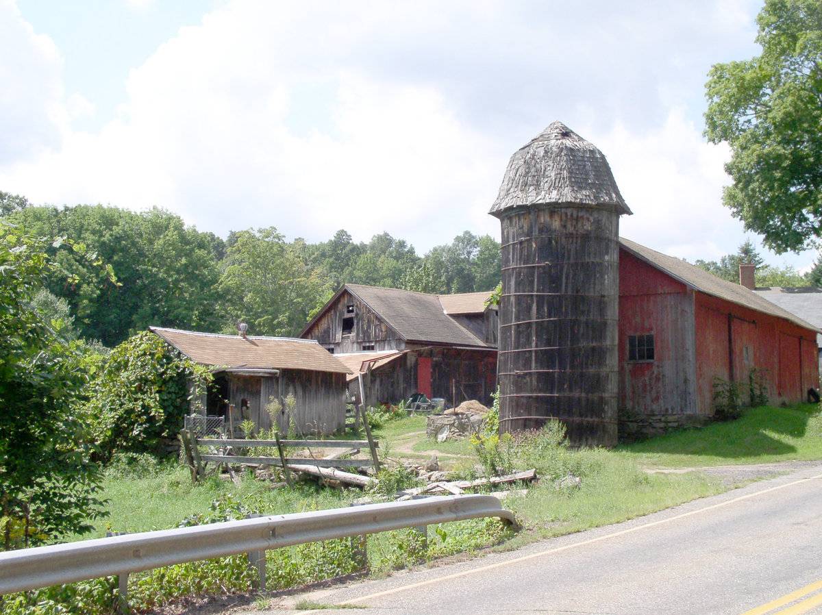
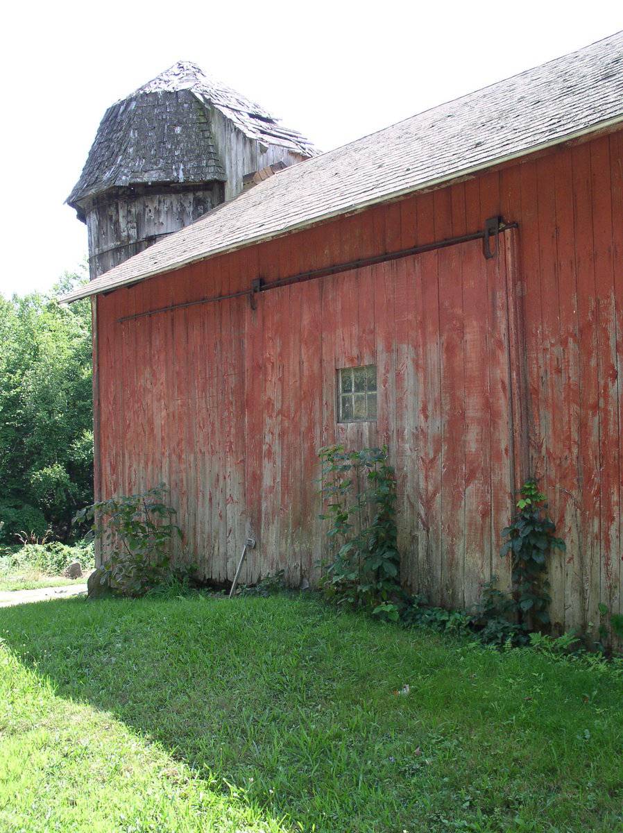
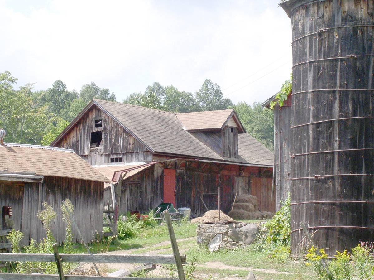
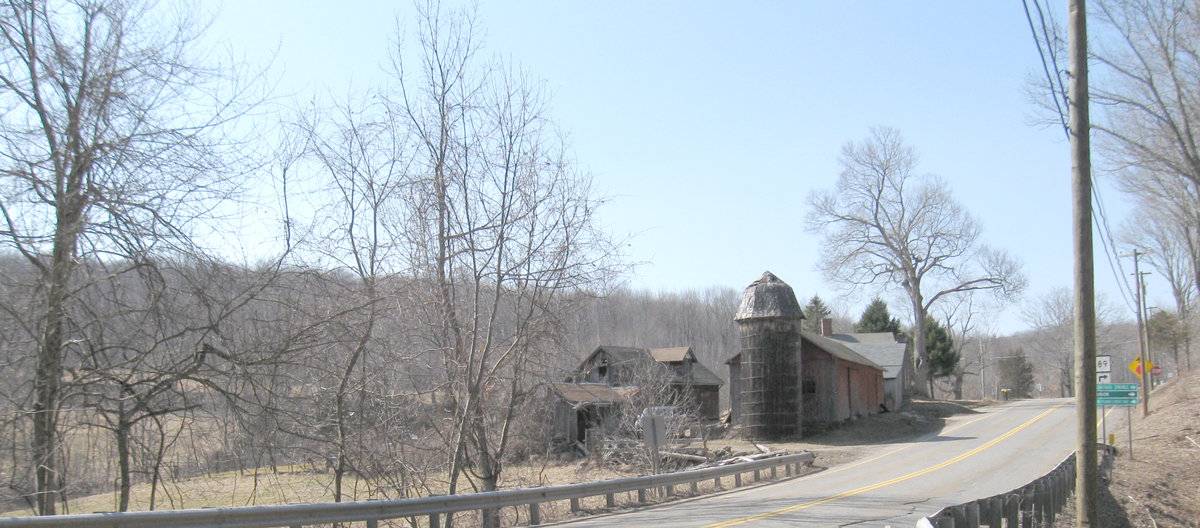
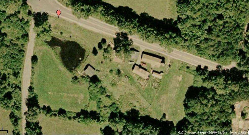
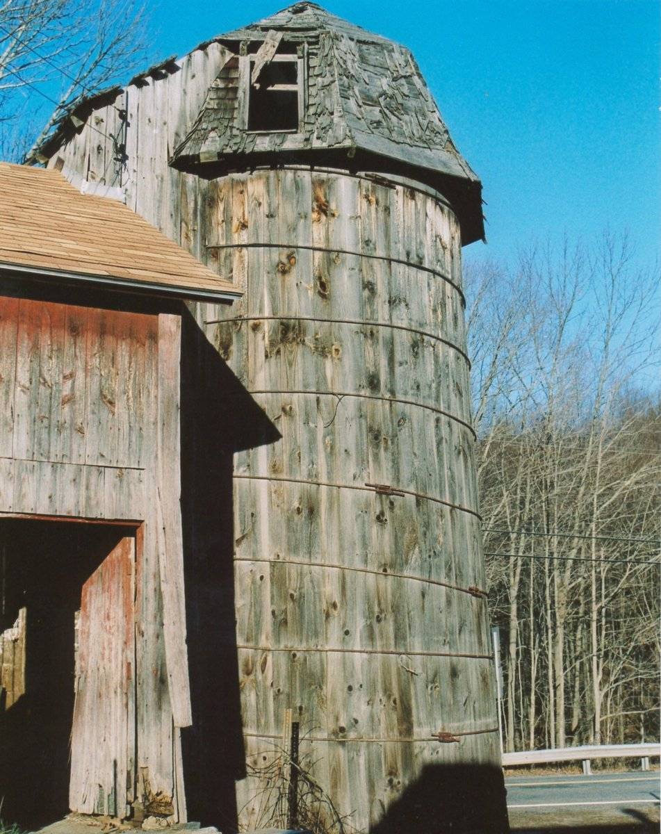
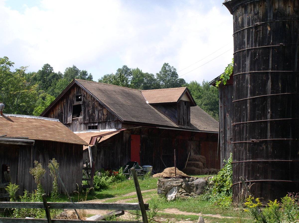
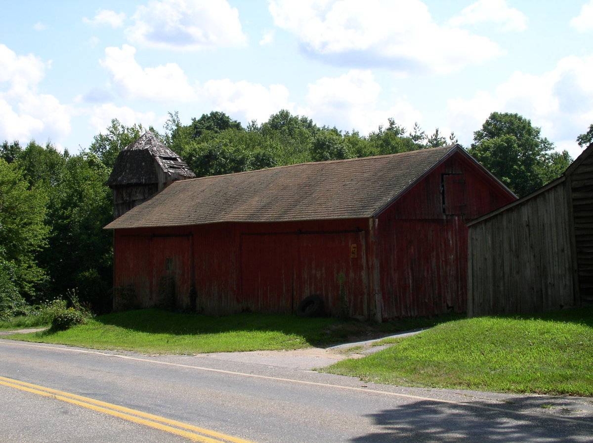
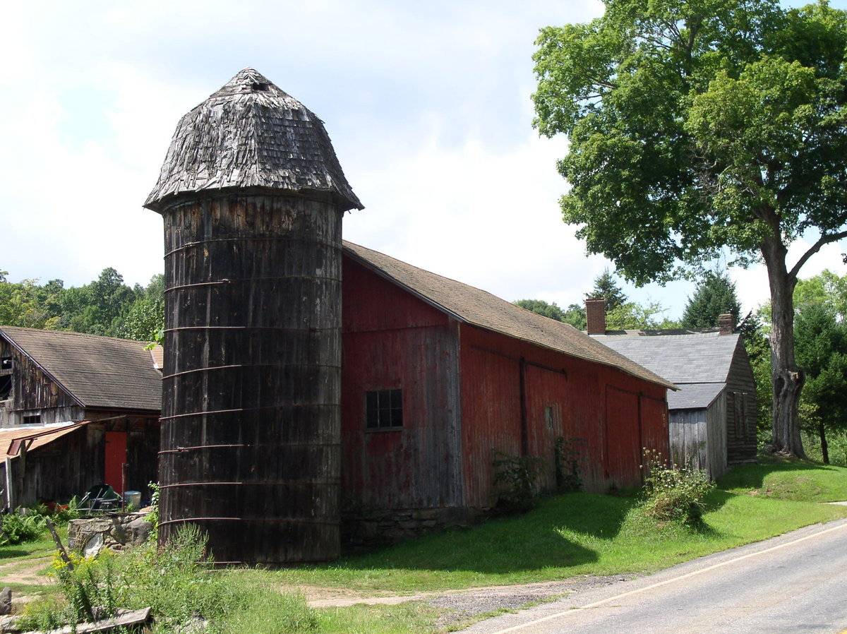
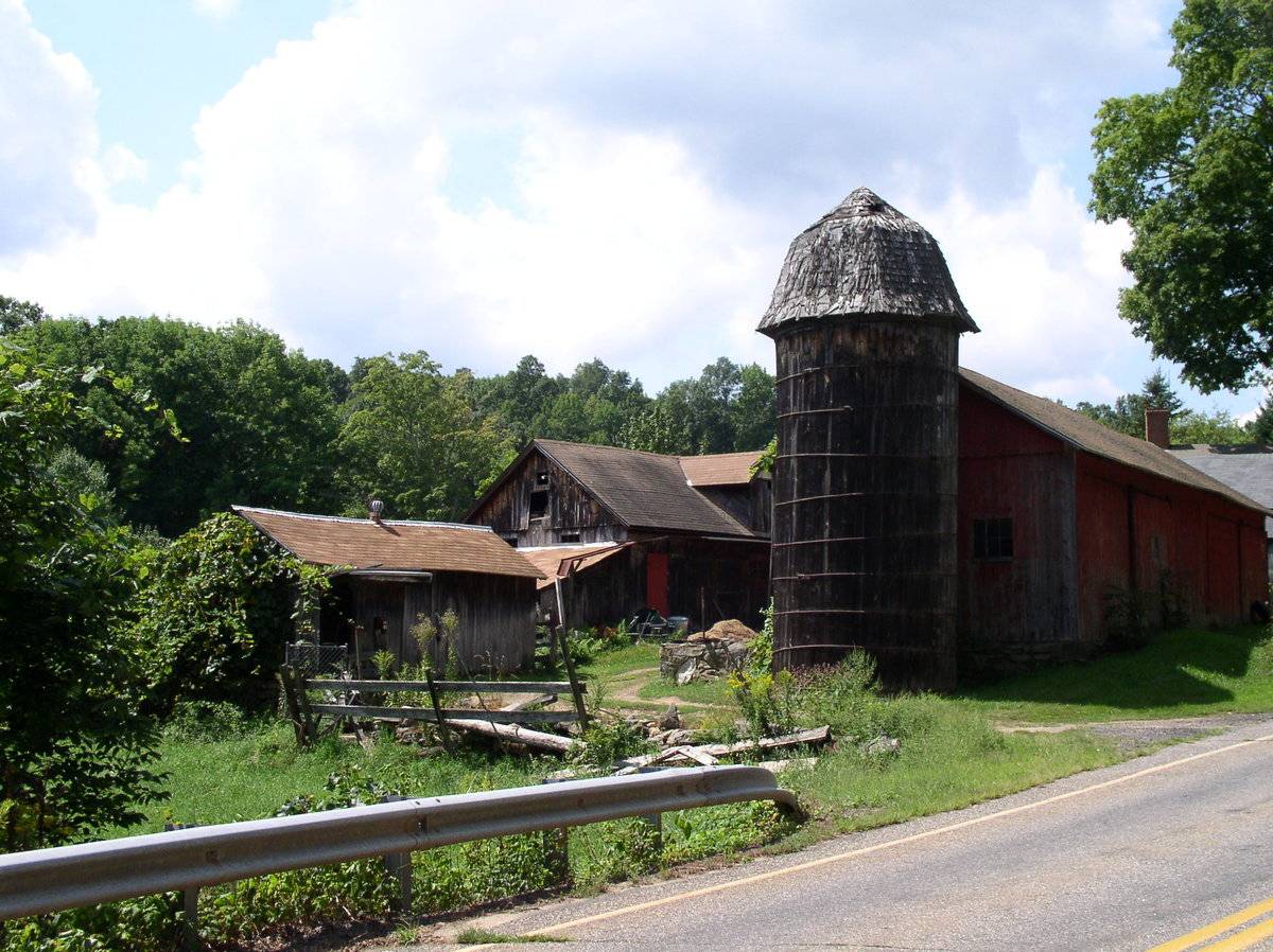
This is a complete farm complex including a house, two barns, a silo, a former toll booth, and an ice house. The main barn (A) with wooden barrel stave silo, is located close to the road on the south side, with its ridge line oriented east-west parallel to the road. It is a 1 ½ story gable-roofed eave-side entry barn with five bays. In the north façade, facing the road, there is a sliding door in each of the second and fifth bays. The west gable-end façade has a hay door in the attic gable. The east gable-end abuts the silo, which has a round mansard-type roof with wood shingles. The barn roof is asphalt shingles and the vertical siding is painted a faded red.
A second barn (B) is located to the south of Barn A. It is a gable-roofed structure with its ridge line oriented east-west and a dormer in the north pitch of the roof. There appear to be several door openings in the north eave-side façade and possibly a hay door in the dormer. A shed addition is attached to the east gable-end.
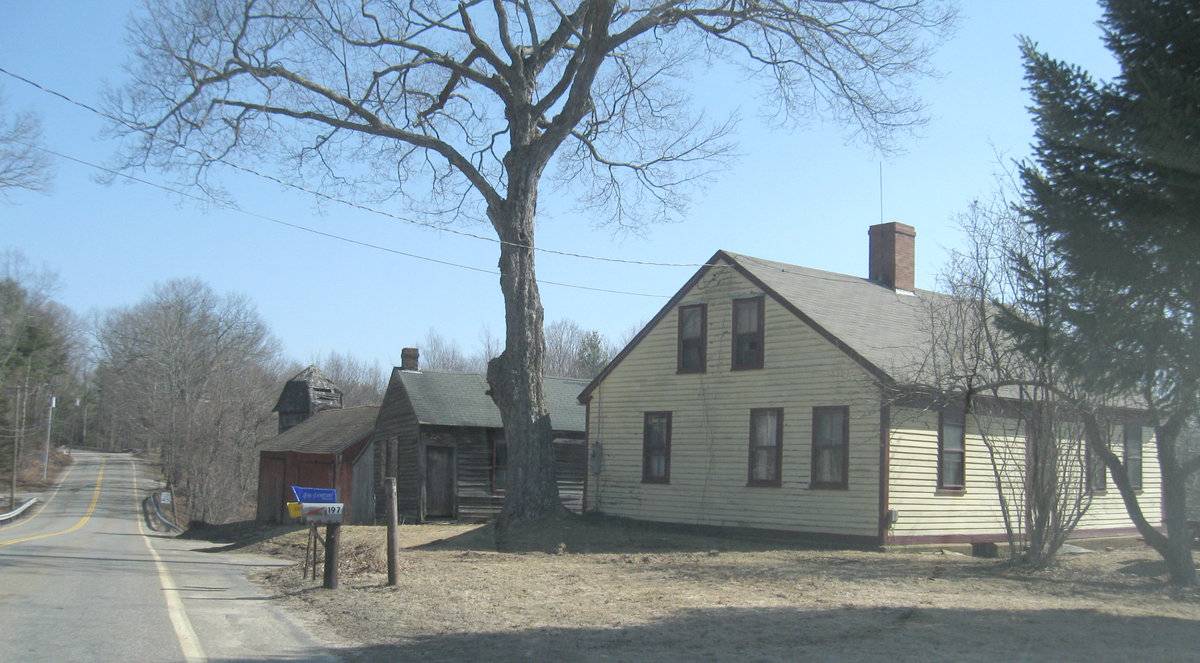
A third outbuilding (C) is a former toll house for the turnpike, now in use for agriculture; this is located west of Barn A. It is a one-story gable-roofed building with its ridge line perpendicular to the road and its eave entry side facing west toward the farmhouse.
A fourth outbuilding (D) is a one-story gable-roofed ice house located to the south at a lower elevation near the outlet of a small pond.
Historical significance:The oldest barns still found in the state are called the “English Barn,” “side-entry barn,” “eave entry,” or a 30 x 40. They are simple buildings with rectangular plan, pitched gable roof, and a door or doors located on one or both of the eave sides of the building based on the grain warehouses of the English colonists’ homeland. The name “30 by 40” originates from its size (in feet), which was large enough for 1 family and could service about 100 acres. The multi-purpose use of the English barn is reflected by the building’s construction in three distinct bays - one for each use. The middle bay was used for threshing, which is separating the seed from the stalk in wheat and oat by beating the stalks with a flail. The flanking bays would be for animals and hay storage.
This example has an additional two bays which often represents an addition to a standard three-bay structure.When chopped cornstalks are compressed to prevent their exposure to the air, the silage ferments instead of spoiling, providing nutritious food for the dairy herd and allowing them to produce milk through the winter. Early silos were built inside the barns, but by the 1890s free-standing silos were being built outside dairy barns. Constructed much like a very large wooden barrel, with adjustable steel hoops holding the vertical grooved staves together, the round wooden stave silo was widely accepted by dairy farmers in New England from the 1890s through the 1930s. Conical roofs are most common on wooden stave silos, usually covered with composition sheet roofing and topped with a metal ventilator. Removable wooden access doors extend up one side. The hoops were loosened in fall to accommodate the swelling of the wood as it absorbed moisture from the silage, and tightened over the winter as the silage dried.
Historical background:
The town of Ashford was incorporated in 1714 and for its first century had the typical scattered settlement on upland ridges which characterized nearly all of Connecticut. The economy was community-subsistence agriculture. Industry was limited to the mills of the agricultural economy – grist, saw, fulling mills.
In the early 19th century, turnpikes and improved roads, along with limited market-oriented agriculture, resulted in some local wealth and settlement nuclei at the major crossroads. Ashford Center, Westford, and Warrenville date from this period. So do the fancy Federal-style houses in these villages and along Route 89 (Mansfield Road) south of Warrenville. Also in this period there existed a short-lived glass factory at Westford.
In the 19th century, the lack of significant waterpower and railroad connections led to stagnation. Its peak population, 1820 (2,778) which had declined to 668 by 1910, was not exceeded until 1980.
In the early 20th century, the declining farms of Ashford were abandoned by their Yankee owners and sold to East European immigrants, notably Slovaks, Bohemians, and Hungarians (Magyars). This transformation of the rural countryside is one of the great stories of modern Connecticut. Today a large portion of the town is descended from these people (Clouette, Township Survey).Field Notes
Listed on the State Register of Historic Places 10/02/2013. The only wooden silo left in town, according to Bill Karosi. Two English barns, silo, a former toll both (Part 2) and an ice house (Part 3) on the property. Assessor's record indicates date of 1790.
- Use & Accessibility
Use (Historic)
Use (Present)
Exterior Visible from Public Road?
Yes
Demolished
n/a
Location Integrity
Unknown
- Environment
Related features
Environment features
Relationship to surroundings
The Urda Farm is located on a sloping site at a brook crossing and a locally important road junction of north-south Route 89 and east-west Turnpike Road. Cleared hillside pasture land is interspersed with woodlands.
- Typology & Materials
-
Building Typology
Materials
Structural System
Roof materials
Roof type
Approximate Dimensions
972 square feet and 200 square feet.
- Source
-
Date Compiled
03/08/2010
Compiled By
Charlotte Hitchcock, reviewed by CT Trust
Sources
Field notes and photographs by William Karosi, Richard Delhaie 12/09/2009, Charlotte Hitchcock.
Aerial Mapping: Ashford Maps
www.bing.com/maps - accessed 03/08/2010.Town of Ashford Assessor’s Record Map/Lot 12/ H/ 1 (house built 1790, barns 972 & 200 sf, sheds 612 & 460 sf).
Bayles, Richard M.; History of Windham County, Connecticut, New York: W.W. Preston, 1889. excerpts available at
< http://www.connecticutgenealogy.com/windham/ashford.htm >.
Clouette, Bruce, National Register of Historic Places, Church Farm, Nomination #270921, 1988. Item No. 88002650 NRIS (National Register Information System) http://pdfhost.focus.nps.gov/docs/NRHP/Text/88002650.pdf
< http://pdfhost.focus.nps.gov/docs/NRHP/Photos/88002650.pdf >Clouette, Bruce, Ashford Township Survey, handwritten manuscript, Connecticut Trust for Historic Preservation, 199x, Item X-9.
Cunningham, Janice, and Ransom, David; Back to the Land: Jewish Farms and Resorts in Connecticut 1890-1945, State of Connecticut Historical Commission and Jewish Historical Society of Greater Hartford, 1998,186 pages.
Sexton, James, PhD, Survey Narrative of the Connecticut Barn, Connecticut Trust for Historic Preservation, Hamden, CT, 2005, http://www.connecticutbarns.org/history.
Visser, Thomas D., Field Guide to New England Barns and Farm Buildings, University Press of New England, 1997.
- PhotosClick on image to view full file
-