Barn Record Union
RETURN TO ‘FIND BARNS’- Building Name (Common)
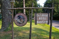
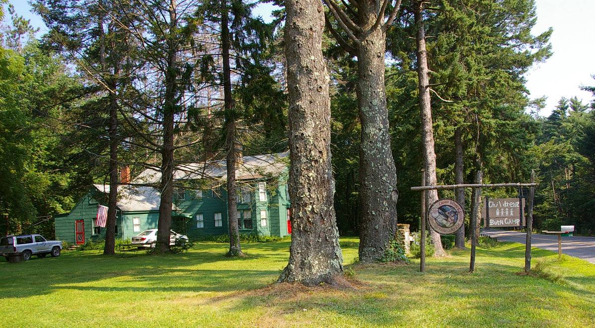
- Children's Burn Camp - Camp Pomperaug
- Building Name (Historic)
- Cleveland House
- Address
- 1174 Buckley Highway (Rte 171), Union
- Typology
- Overview
-
Designations
Historic Significance
Architectural description:
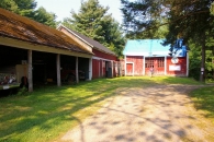
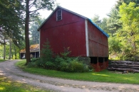
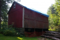
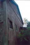
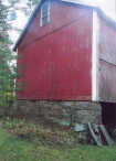
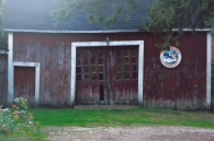
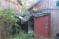
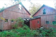
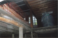
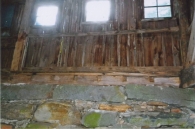
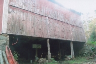
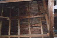
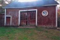
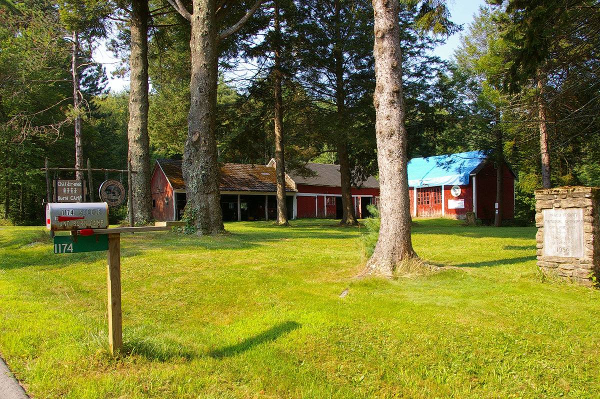
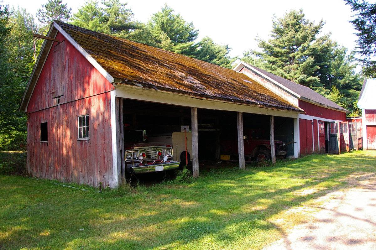
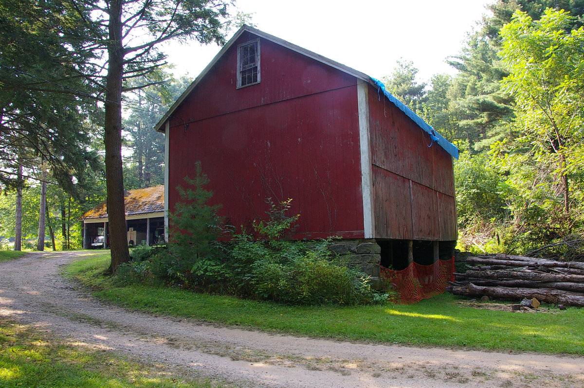
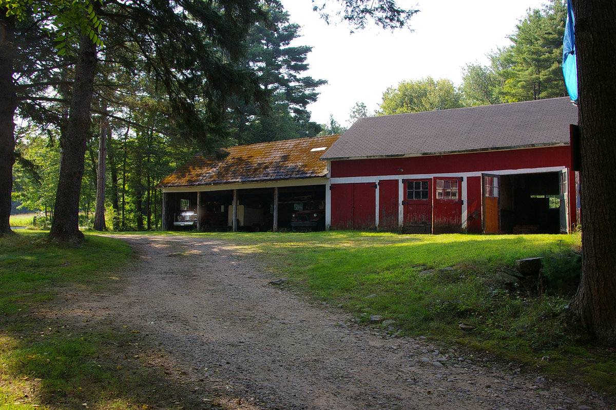
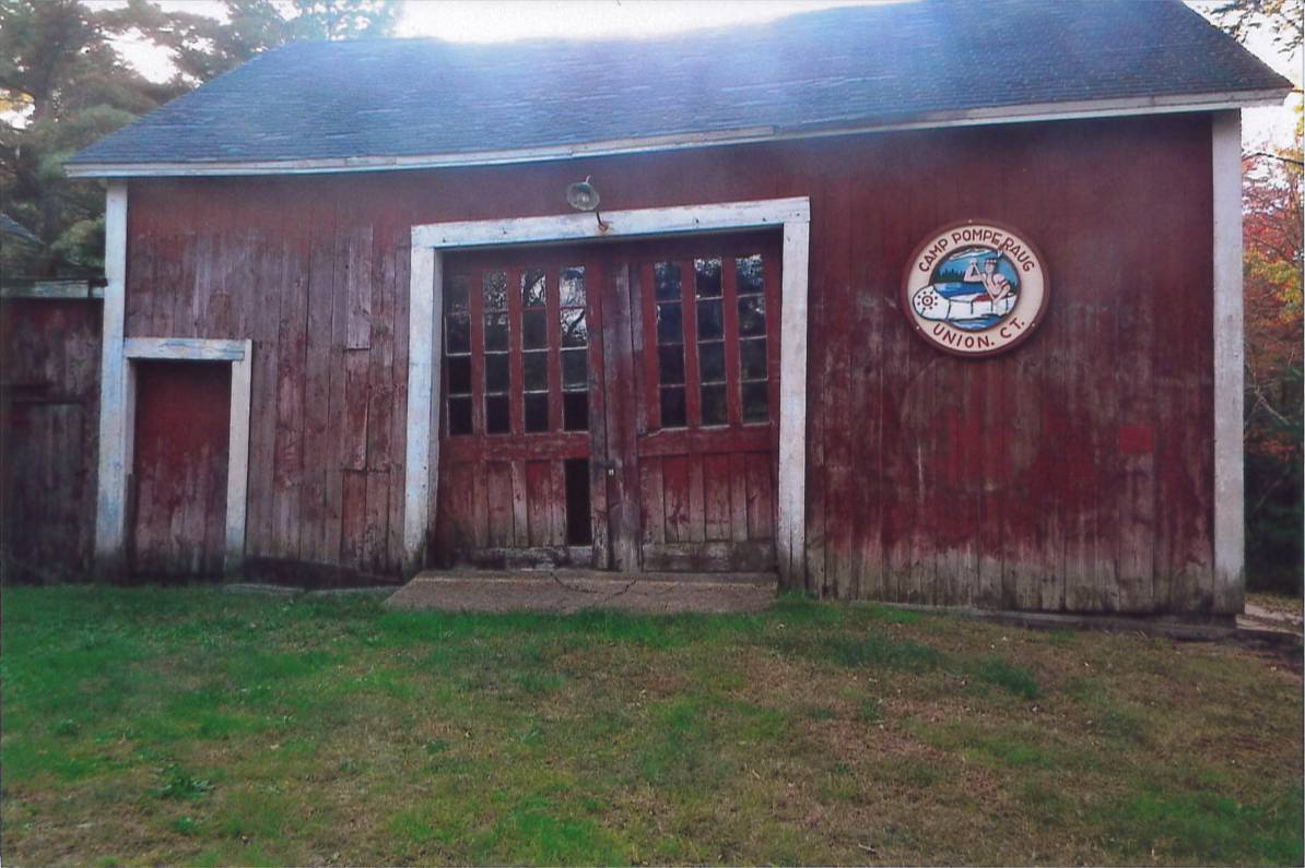
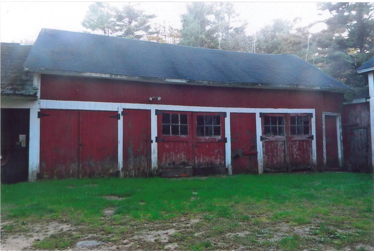
This is a 1-story side or eave-entry bank barn. The main facade faces east and the ridge line is parallel to Buckley Highway, which at this point runs approximately north to south. The main entry is on the east eave-facade of the barn and is located in the middle of three bays and appears to be a pair of interior sliding doors, each with four vertical rows of fixed four-pane windows. The south bay has a pass-through door and the north bay has a sign stating: “Camp Pomperaug, Union, CT”. The north gable-end of the barn has a four-over-six double-hung window just under the apex of the roof. There are no other openings on this side, but the unmortared cut stone foundation is evident. The west eave-side has a three-bay open manure basement below grade. Above grade is a siding line divide about halfway between grade and the eave. The south gable-end of the barn appears to have a small structure that connects the main barn to a free-standing shed attached to a wagon shed. The barn is clad in vertical flush-board siding painted red with white trim. The roof appears to be clad in rolled roofing. The foundation is unmortared cut stone.
Historical significance:
The oldest barns still found in the state are called the “English Barn,” “side-entry barn,” “eave entry,” or a “30 x 40”. They are simple buildings with rectangular plan, pitched gable roof, and a door or doors located on one or both of the eave sides of the building based on the grain warehouses of the English colonists’ homeland. The name 30 by 40 originates from its size (in feet), which was large enough for 1 family and could service about 100 acres. The multi-purpose use of the English barn is reflected by the building’s construction in three distinct bays - one for each use. The middle bay was used for threshing, which is separating the seed from the stalk in wheat and oat by beating the stalks with a flail. The flanking bays would be for animals and hay storage.
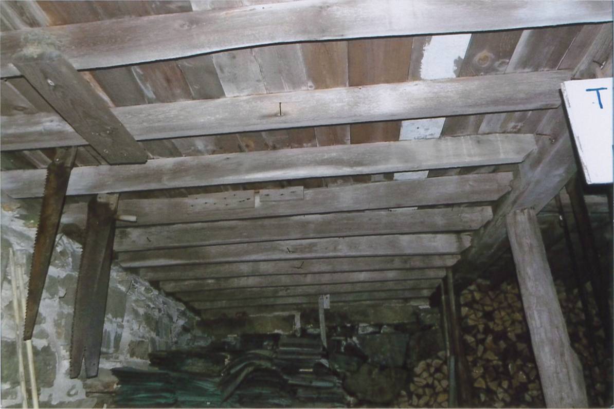
The 19th century saw the introduction of a basement under the barn to allow for the easy collection and storage of a winter’s worth of manure from the animals sheltered within the building. The bank barn is characterized by the location of its main floor above grade, either through building into a hillside or by raising the building on a foundation. This innovation, aided by the introduction of windows for light and ventilation, would eventually be joined by the introduction of space to shelter more animals under the main floor of the barn.
Distinguished by the long shed or gable roof and the row of large openings along the eave side, the typical wagon shed was often built as a separate structure or as a wing connected to the farmhouse or the barn. These open-bay structures protect farm vehicles and equipment from the weather and provide shelter for doing small repairs and maintenance.
Field Notes
Listed on the State Register of Historic Places 3/06/2013 The farmhouse on the property dates back to 1799, therefore it is assumed the barn dates back to roughly the same date.
- Use & Accessibility
Use (Historic)
Use (Present)
Exterior Visible from Public Road?
Yes
Demolished
n/a
Location Integrity
Unknown
- Environment
Related features
Environment features
Relationship to surroundings
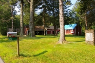
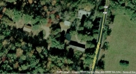
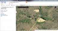
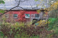
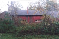
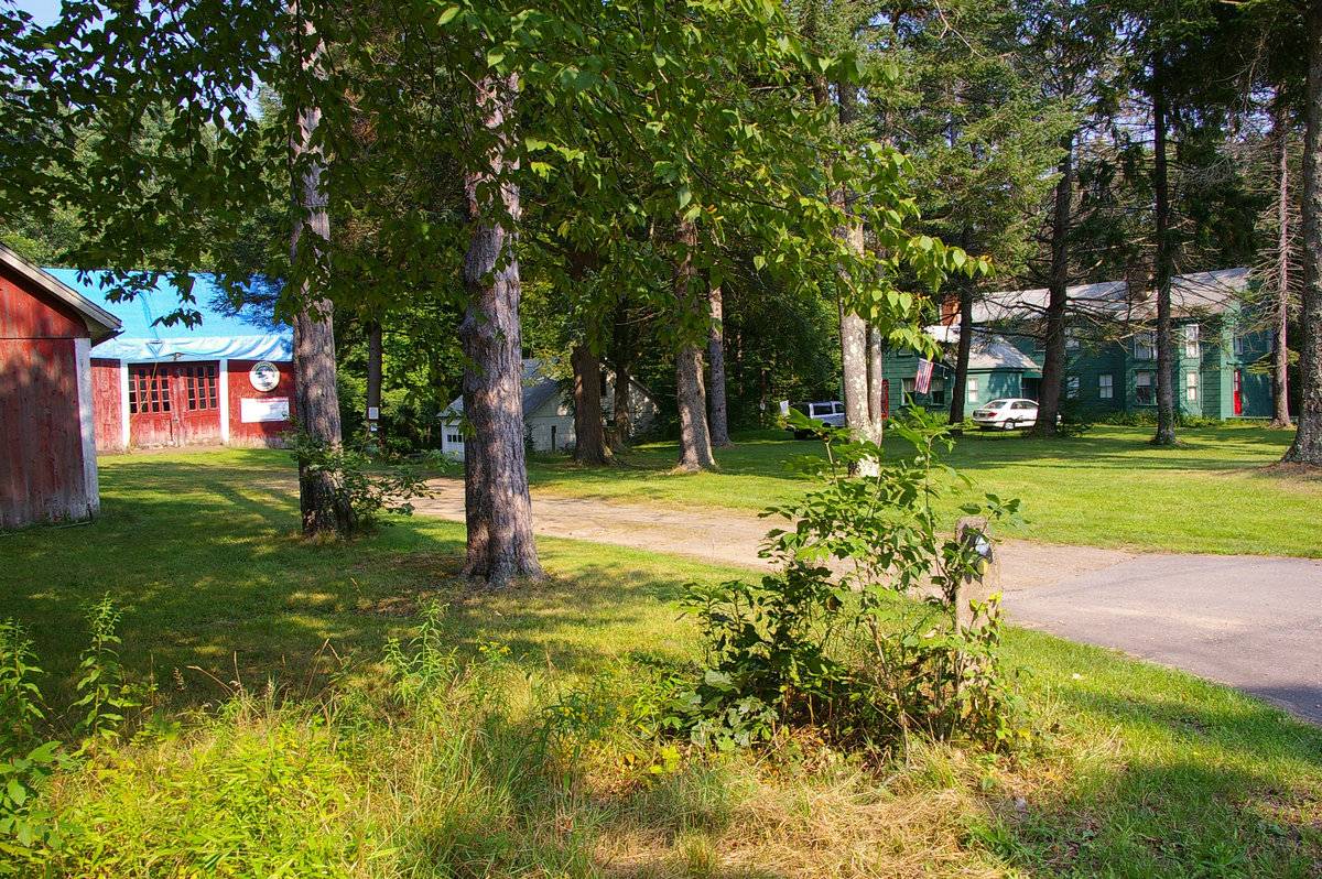
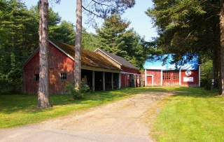
This barn is to the south of the house with which it is associated. Attached to the barn is a four-bay gable-roof shed and a four-bay wagon shed, both with ridge-lines that run perpendicular to Buckley Highway. The barn and additions form an “L” shape. There appears to be a few outbuildings also located on the property; one is to the west of the barn, and the other is to the north of the barn. Directly to the southwest of the property is Wells Pond, and directly to the east is an open tract of land and Mashapaug Pond. To the northeast is Goodhall Pond, and to the north is I-84. To the south is an open tract of land and woodland. Further to the west is Nipmuck State Forest. Surrounding the property are light residential areas, a few open tracts of land, bodies of water, and woodland.
Map/Block/Lot: 12/ 11/ 007
- Typology & Materials
-
Building Typology
Materials
Structural System
Roof materials
Roof type
Approximate Dimensions
884 square feet.
- Source
-
Date Compiled
01/13/2010
Compiled By
Todd Levine, reviewed by the Connecticut Trust
Sources
Photographs by Carol Mancini, William Scranton, Betty Bragdon - 9/16/2009.
Additional field notes and photographs by Charles Johnson - 11/15/2011.
Aerial Mapping: Union Maps
http://www.bing.com/maps - accessed 6/30/2011.Town of Union Assessor’s Records:
http://www.visionappraisal.com/databases/ - accessed 6/30/2011.Sexton, James, PhD; Survey Narrative of the Connecticut Barn, Connecticut Trust for Historic Preservation, Hamden, CT, 2005, http://www.connecticutbarns.org/history.
Visser, Thomas D.,Field Guide to New England Barns and Farm Buildings, University Press of New England,1997.
- PhotosClick on image to view full file
-