Barn Record Willington
RETURN TO ‘FIND BARNS’- Building Name (Common)
- Lester Anderson Farm
- Building Name (Historic)
- Lester Anderson Farm
- Address
- 89 Turnpike Road, Willington
- Typology

- Overview
-
Designations
n/a
Historic Significance
Architectural description:
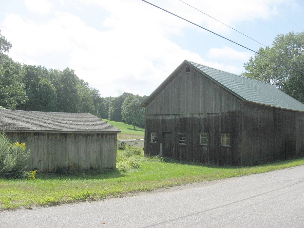
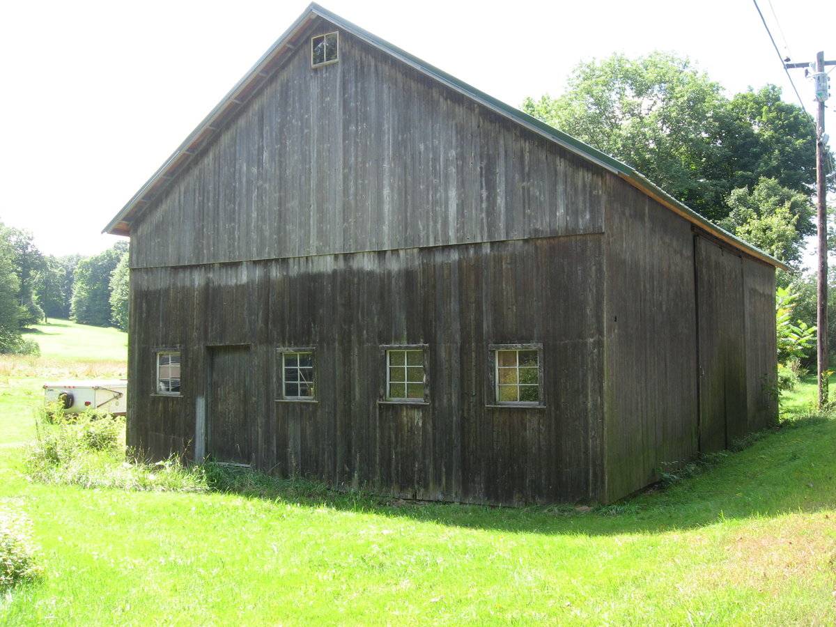
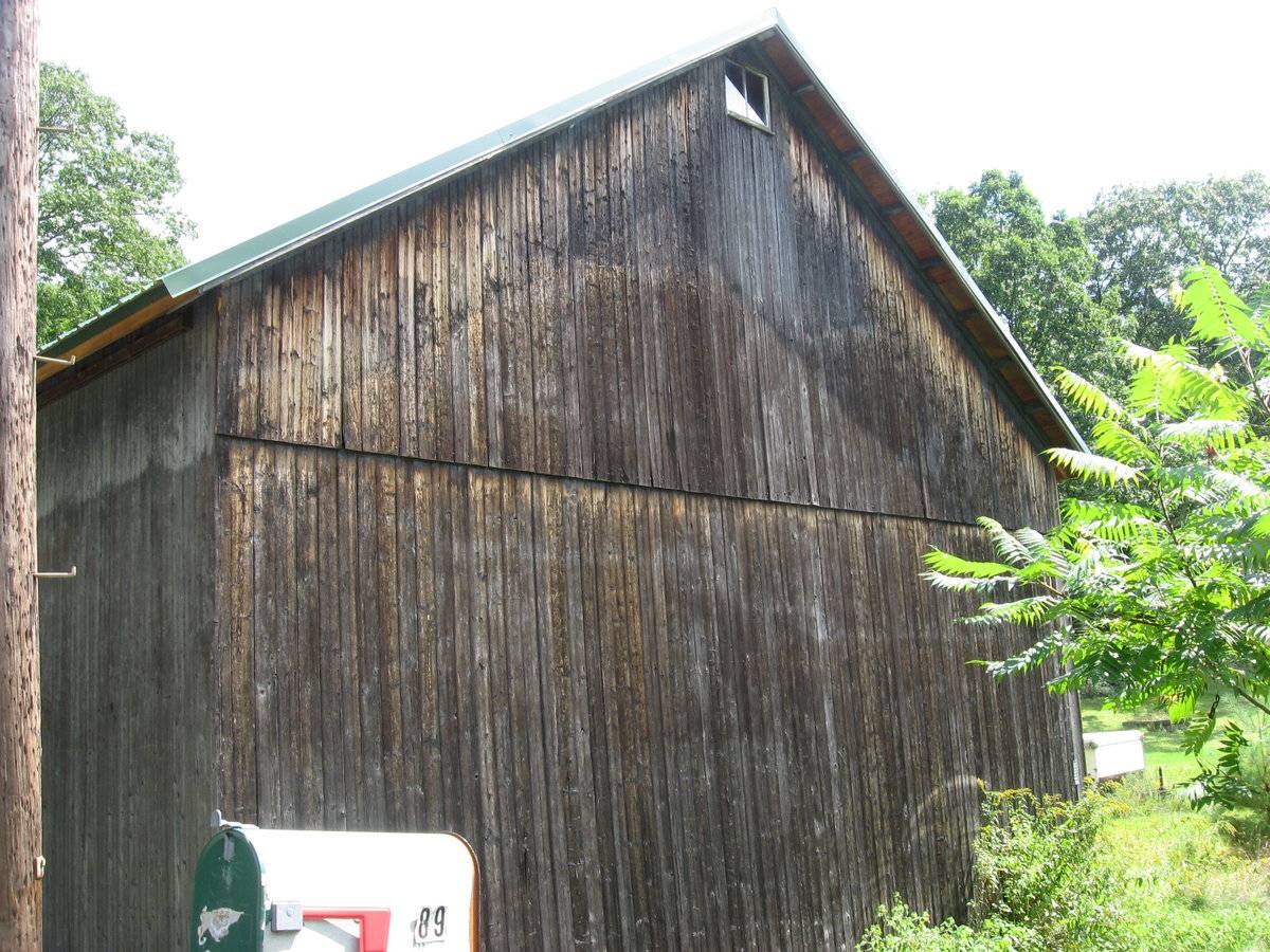
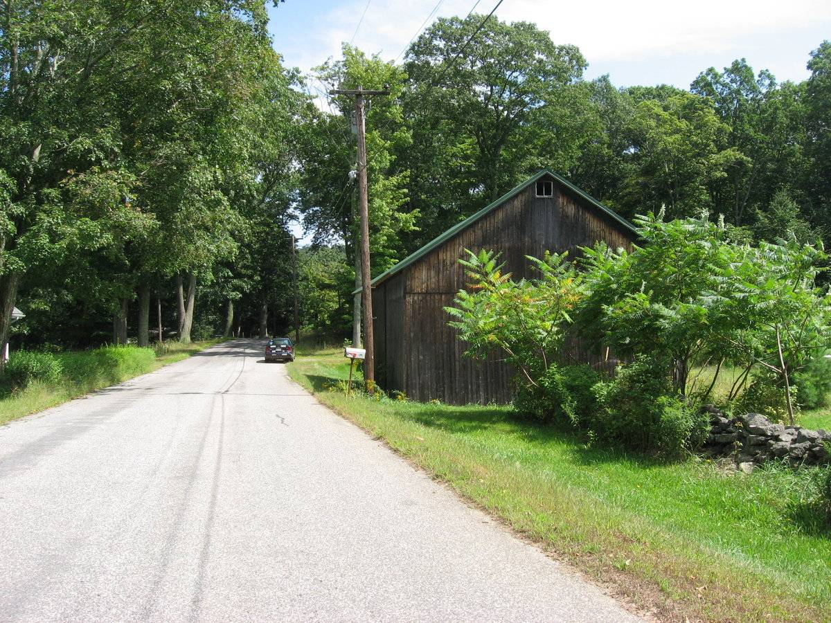
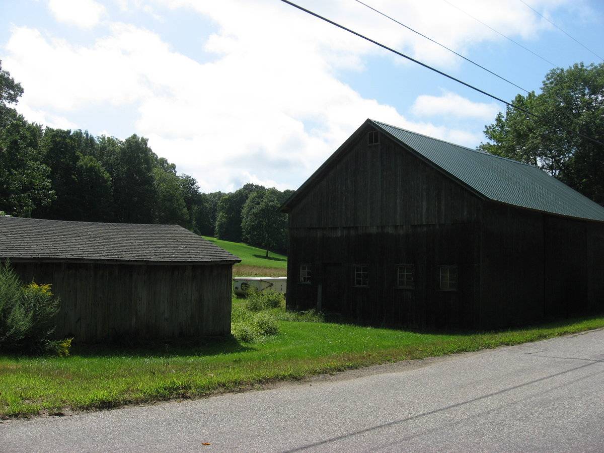
The largest of three outbuildings is a 1 and ½ story gable-roofed barn (A) on the south side of the road, with its ridge oriented east-west parallel to the road. A full-height sliding barn door is on the north façade in the center bay, facing the road. Grass surface adjacent to the door suggests little usage. The east gable-end has four six-light stable windows and a pass-through door off-center. Each gable end has a small two-light sash high in the peak of the gable. All siding is vertical flush-board.
The roof has a moderate overhang, is a pitched gable roofed with newer painted interlocking metal panel roofing.
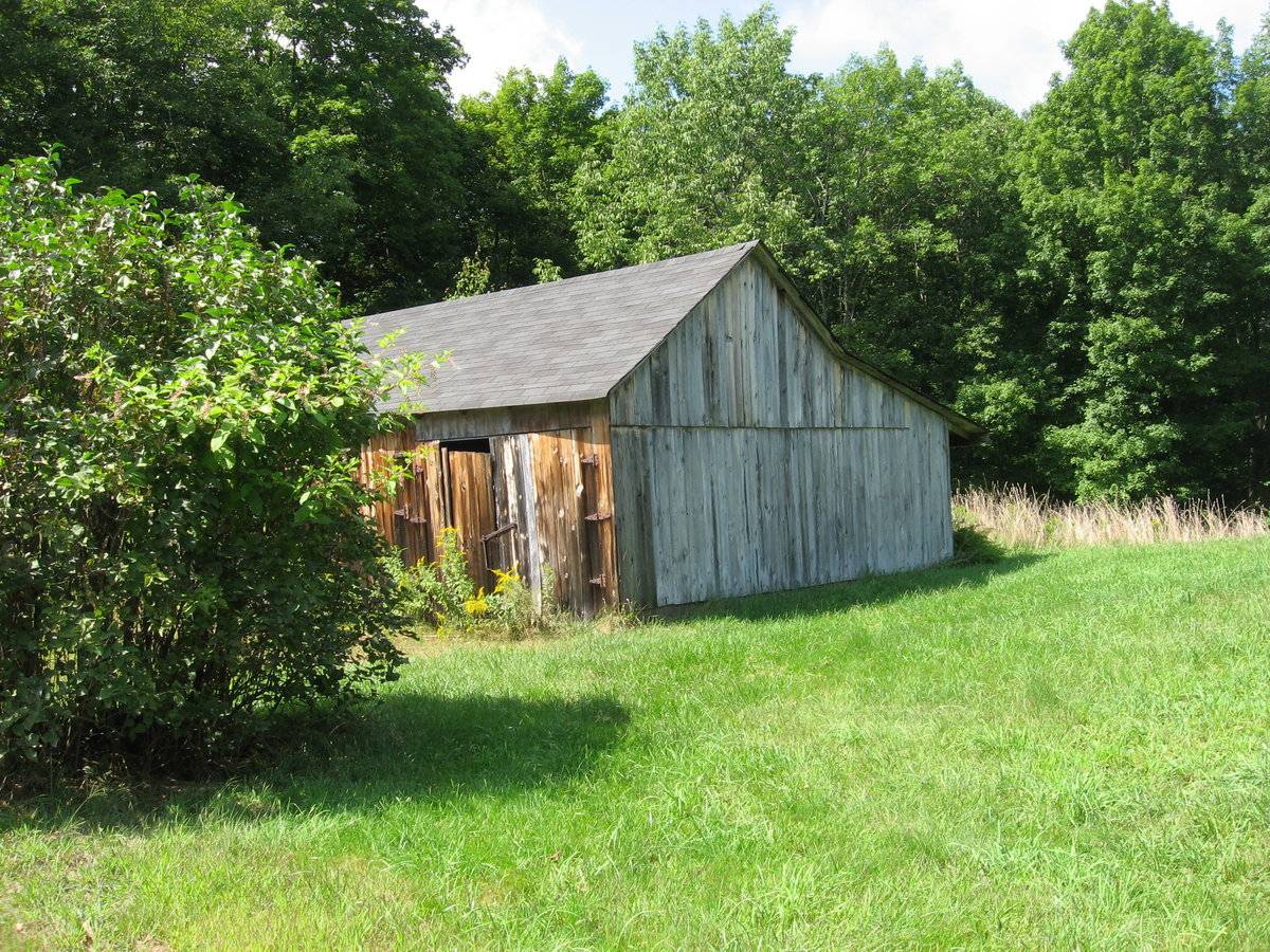
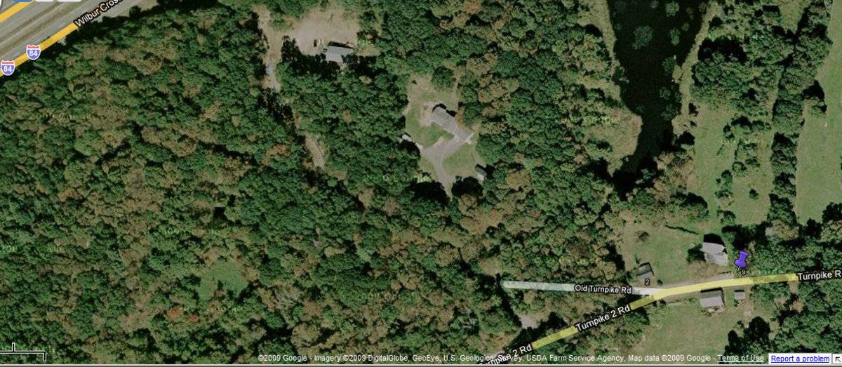
A small 1-story gable-roofed shed is located to the east of Barn A, and another shed is north of the road adjacent to the house. This is a 1-story gable-roofed shed with a shed addition of flatter pitch, attached on the north side.Historical significance:
The oldest barns still found in the state are called the “English Barn,” “side-entry barn,” “eave entry,” or a 30 x 40. They are simple buildings with rectangular plan, pitched gable roof, and a door or doors located on one or both of the eave sides of the building based on the grain warehouses of the English colonists’ homeland. The name “30 by 40” originates from its size (in feet), which was large enough for one family and could service about 100 acres. The multi-purpose use of the English barn is reflected by the building’s construction in three distinct bays - one for each use. The middle bay was used for threshing, which is separating the seed from the stalk in wheat and oat by beating the stalks with a flail. The flanking bays would be for animals and hay storage.
Field Notes
Barn is part of 4-building small agricultural complex, residence appears to be vacant. photos taken from road, buildings are easily accessible. Listed in Town of Willington Plan of Conservation & Development Appendix 6 - Listing of Historic Structures or Sites. Historical School District VI – Roaring Brook District The old Boston Turnpike passed the Roaring Brook schoolhouse, and from there took a nearly direct route northeast toward Boston. Four-horse stages were used on this route, two passing every day. At a tavern near the Methodist meeting house, intoxicating liquors were sold; and during the Revolution counterfeit money was said to have been made here. In the northern part of this district Burnham Lillibridge had a saw and grist mill. He invited the side scraper which was used in repairing roads. John Merrick, in his newspaper columns, refers to it as a “crude affair compared with those in use on the streets of Minneapolis (where Merrick lived at the time he wrote), but the principle of the scraper is the same that was first used on the roads in Willington.”
- Use & Accessibility
Use (Historic)
Use (Present)
Exterior Visible from Public Road?
Yes
Demolished
n/a
Location Integrity
Unknown
- Environment
Related features
Environment features
Relationship to surroundings
This farm is situated along Turnpike Road, historically part of the turnpike route from Hartford to Boston; close to today’s I-84. Now it is an area of scattered 19th-century farms and 20th-century homes.
- Typology & Materials
-
Building Typology
Materials
Structural System
Roof materials
Roof type
Approximate Dimensions
1120 square feet.
- Source
-
Date Compiled
01/07/2010
Compiled By
Charlotte Hitchcock, reviewed by CT Trust
Sources
Photographs by Melodi Lacy 9/18/2009
Town of Willington Assessor’s Record Map/Lot 045/009-00, 045/024-00 (house built 1850, 60+ acres, barn 1120 sf), belonging to owner of 76 Turnpike Road.
Demers, Ronald F., Modernization in a New England Town: A History of Willington, Connecticut, Willington Historical Society, 1983, W. Willington CT, 431 pp.
Sexton, James, PhD, Survey Narrative of the Connecticut Barn, Connecticut Trust for Historic Preservation, Hamden, CT, 2005, http://www.connecticutbarns.org/history.
Visser, Thomas D., Field Guide to New England Barns and Farm Buildings, University Press of New England, 1997.
Willington Common National Register Historic District Nomination, #90001911, 12/18/1990, Cunningham Associates, Ltd., Middletown CT.
Willington Historical Society website - South Willington district: http://www.geocities.com/willingtoncthistory/mapnarrative.htm
Willington Historical Society, Chronology of Willington CT – 1727-1927, 1977.
Willington Plan of Conservation and Development, Appendix 6, Listing of Historic Structures or Sites, 2006.
- PhotosClick on image to view full file
-