Barn Record Willington
RETURN TO ‘FIND BARNS’- Building Name (Common)
- Hipsky Farm
- Building Name (Historic)
- Hanson/Hampton Lillibridge Dairy Farm
- Address
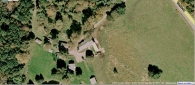
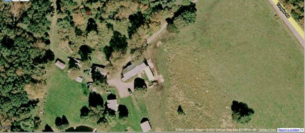
- 136 Turnpike Road, Willington
- Typology

- Overview
-
Designations
n/a
Historic Significance
Architectural description:
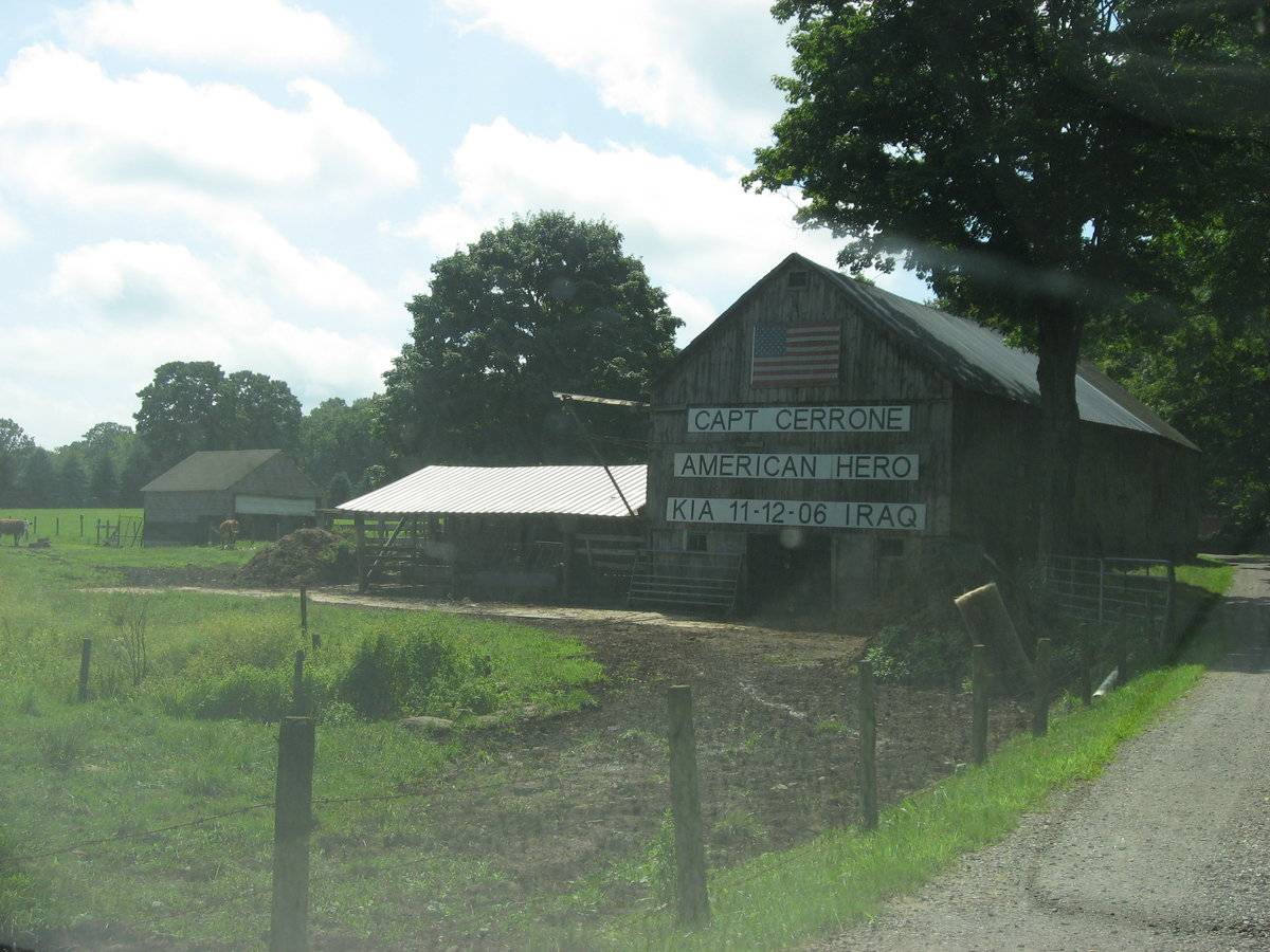
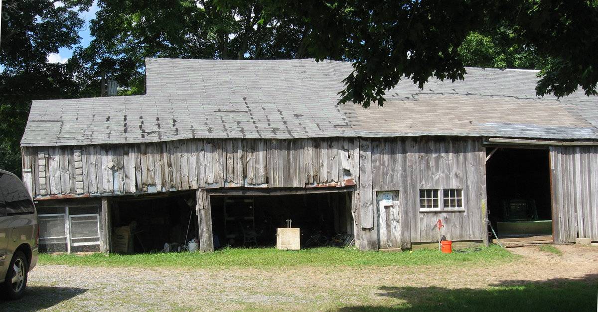
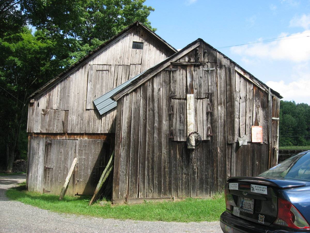
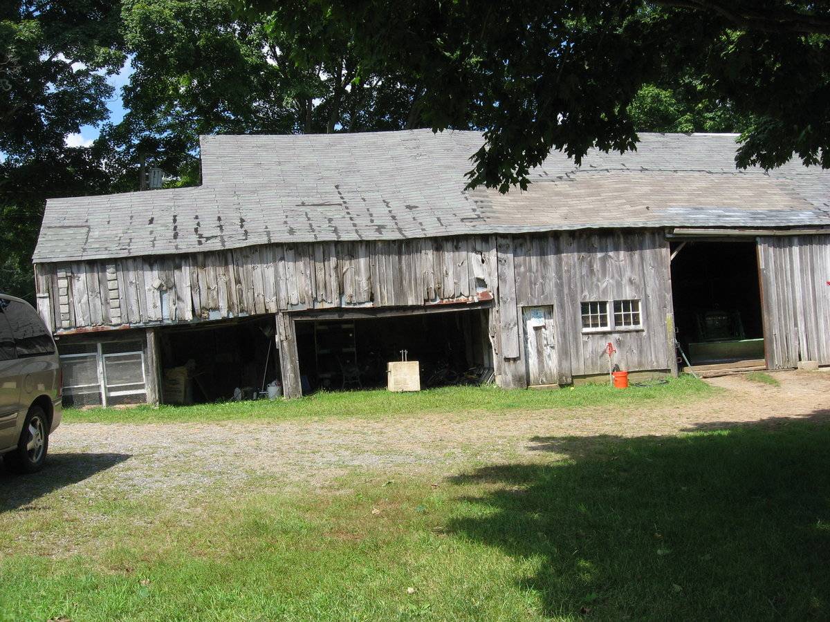
The main barn in a complex which includes several smaller outbuildings, is located in an open field set back from the road. It consists of a long gable-roofed structure with the ridge line oriented approximately east-west. A shed addition on the south side extends to the southwest forming a gable-roofed wing off the west gable-end. The west gable-end also has a pier of hinged doors and a hay door.
The south eave-side elevation has a series of openings including wagon shed open doorways to the west, a pass-through door, a pair of stable windows, and a full-height sliding barn door toward the east end of the façade. Also there is an open-sided pole barn-type ell extending south from this façade.
The east gable-end wall has a lower level with a doorway flanked by stable windows.The north eave-side appears to have no openings.
The pitched gable and shed roof has metal roofing.
Historical significance:
The oldest barns still found in the state are called the “English Barn,” “side-entry barn,” “eave entry,” or a “30 x 40”. They are simple buildings with rectangular plan, pitched gable roof, and a door or doors located on one or both of the eave sides of the building based on the grain warehouses of the English colonists’ homeland. The name 30 by 40 originates from its size (in feet), which was large enough for 1 family and could service about 100 acres. The multi-purpose use of the English barn is reflected by the building’s construction in three distinct bays - one for each use. The middle bay was used for threshing, which is separating the seed from the stalk in wheat and oat by beating the stalks with a flail. The flanking bays would be for animals and hay storage.
The 19th century saw the introduction of a basement under the barn to allow for the easy collection and storage of a winter’s worth of manure from the animals sheltered within the building.
The bank barn is characterized by the location of its main floor above grade, either through building into a hillside or by raising the building on a foundation. This innovation, aided by the introduction of windows for light and ventilation, would eventually be joined by the introduction of space to shelter more animals under the main floor of the barn.
Field Notes
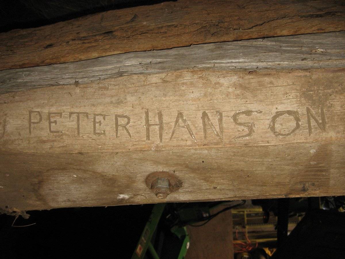
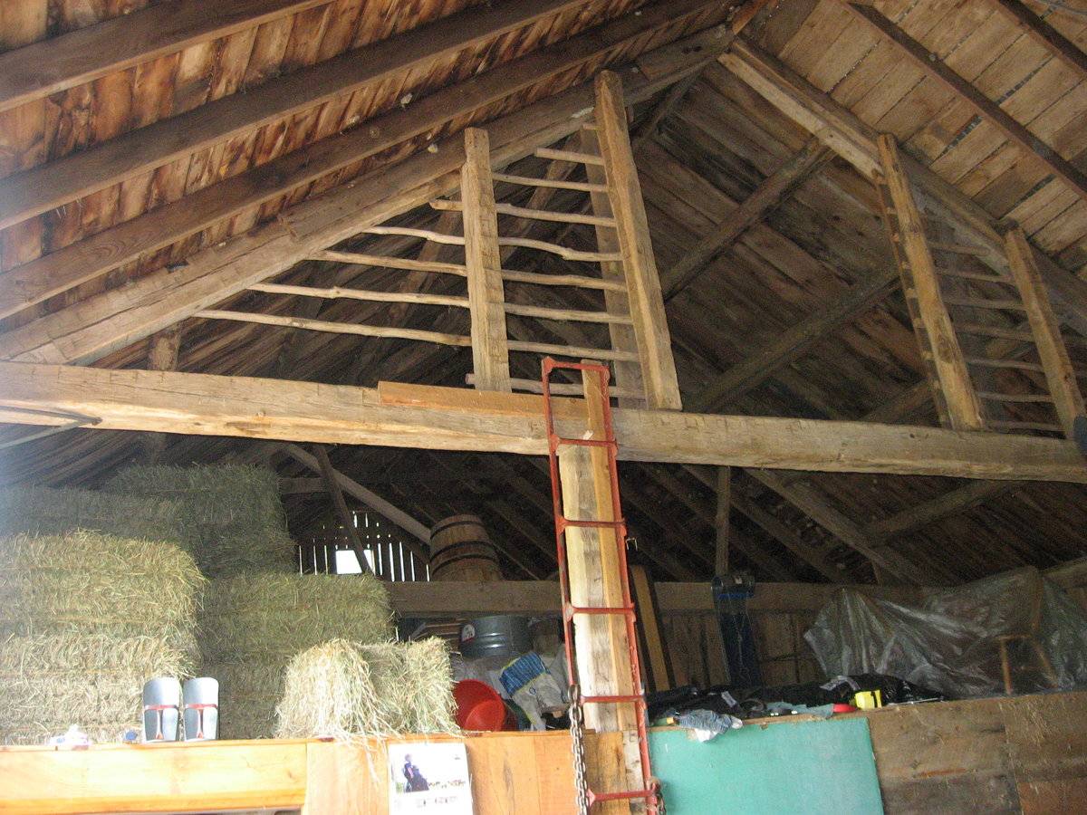
This barn is part of an agricultural complex built between 1810-1820 and was originally part of Hampton Lillibridge Dairy Farm. In the 1880s an immigrant from Denmark named Peter Hanson purchased it and it became Hanson's Dairy Farm (see photo of carved beam, with this name). The current owners, the Hipsky family, have been in possession of the farm since the early 1900's, when the Hansens moved to Windsor, taking timbers from this property to build their new barn in Windsor. This barn's owner, Harold Hipsky, is very knowledgeable about the history of this property and its previous owners and was very friendly. The barn is currently in use as part of a cattle farm for beef and hay storage. In my opinion this barn is worthy of further research and surveys by the historic trust and other interested parties. Listed in Town of Willington Plan of Conservation & Development Appendix 6 - Listing of Historic Structures or Sites. Historical School District VI – Roaring Brook District The old Boston Turnpike passed the Roaring Brook schoolhouse, and from there took a nearly direct route northeast toward Boston. Four-horse stages were used on this route, two passing every day. At a tavern near the Methodist meeting house, intoxicating liquors were sold; and during the Revolution counterfeit money was said to have been made here. In the northern part of this district Burnham Lillibridge had a saw and grist mill. He invited the side scraper which was used in repairing roads. John Merrick, in his newspaper columns, refers to it as a “crude affair compared with those in use on the streets of Minneapolis (where Merrick lived at the time he wrote), but the principle of the scraper is the same that was first used on the roads in Willington.”
- Use & Accessibility
Use (Historic)
Use (Present)
Exterior Visible from Public Road?
Yes
Demolished
n/a
Location Integrity
Unknown
- Environment
Related features
Environment features
Relationship to surroundings
This farm is situated along Turnpike Road, historically part of the turnpike route from Hartford to Boston; close to today’s I-84. Now it is an area of scattered 19th-century farms and 20th-century homes.
- Typology & Materials
-
Building Typology
Materials
Structural System
Roof materials
Roof type
Approximate Dimensions
2110 square feet.
- Source
-
Date Compiled
01/07/2010
Compiled By
Charlotte Hitchcock, reviewed by CT Trust
Sources
Photographs by Melodi Lacy 9/18/2009
Town of Willington Assessor’s Record Map/Lot 045/022-00 (house built 1785, 36.86 acres, barn 2110 sf).
Demers, Ronald F., Modernization in a New England Town: A History of Willington, Connecticut, Willington Historical Society, 1983, W. Willington CT, 431 pp.
Sexton, James, PhD, Survey Narrative of the Connecticut Barn, Connecticut Trust for Historic Preservation, Hamden, CT, 2005, http://www.connecticutbarns.org/history.
Visser, Thomas D., Field Guide to New England Barns and Farm Buildings, University Press of New England, 1997.
Willington Common National Register Historic District Nomination, #90001911, 12/18/1990, Cunningham Associates, Ltd., Middletown CT.
Demers, Ronald F., Modernization in a New England Town: A History of Willington, Connecticut, Willington Historical Society, 1983, W. Willington CT, 431 pp.
Willington Historical Society website - South Willington district: http://www.geocities.com/willingtoncthistory/mapnarrative.htm
Willington Plan of Conservation and Development, Appendix 6, Listing of Historic Structures or Sites, 2006.
Willington Historical Society, Chronology of Willington CT – 1727-1927, 1977.
Willington Historical Society website - South Willington district: http://www.geocities.com/willingtoncthistory/mapnarrative.htmWillington Plan of Conservation and Development, Appendix 6, Listing of Historic Structures or Sites, 2006.
- PhotosClick on image to view full file
-