Barn Record Ledyard
RETURN TO ‘FIND BARNS’- Building Name (Common)
- Amos Avery House
- Building Name (Historic)
- Avery Homestead (built 1712)
- Address
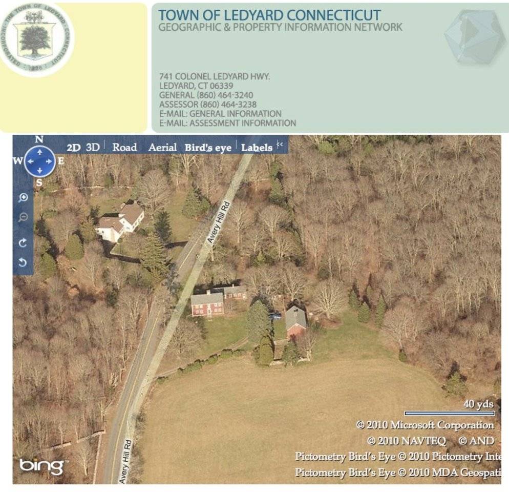
- 20 Avery Hill Road , Ledyard
- Typology
- Overview
-
Designations
Historic Significance
Architectural description:
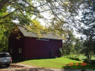
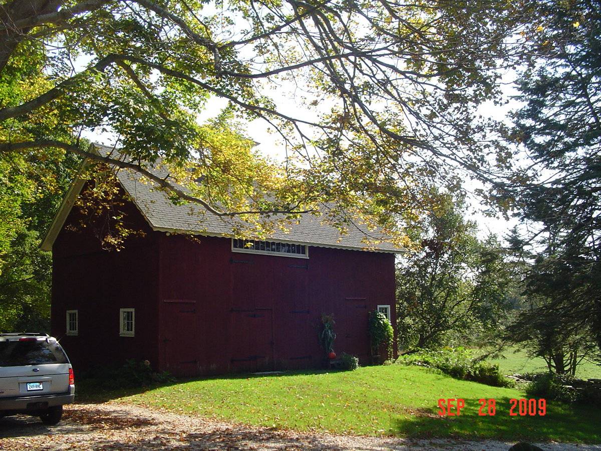
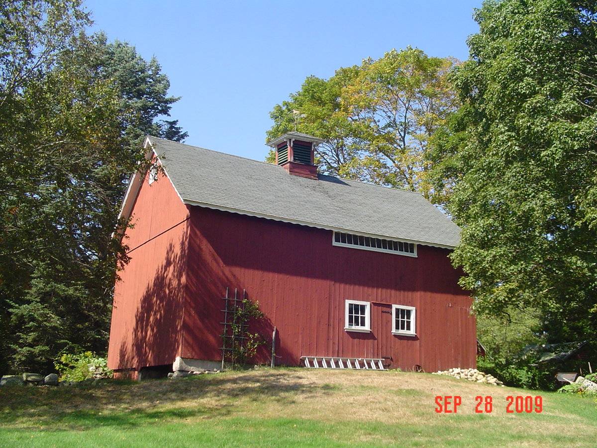
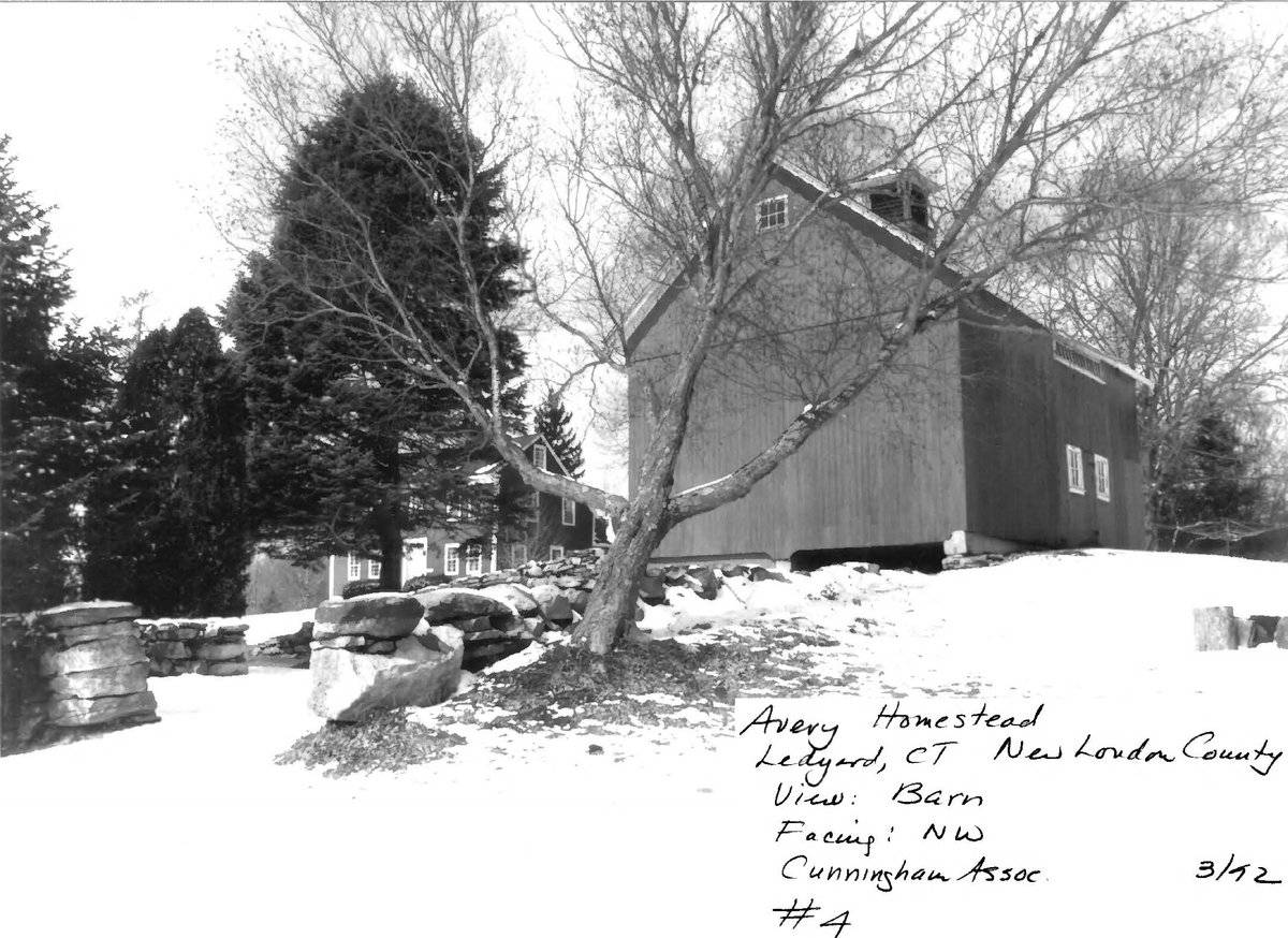
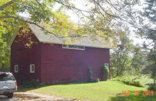
This is a 1 1/2-story 3-bay gable-roofed bank barn structure with its ridge line oriented north-south. The east and west eave-side facades each have an opening for a pair of tall barn doors; these are off-center toward the north end. The east eave-side facade has traces of the original opening, infilled with un-matching siding, a pair of six-pane windows, a pass-through door between them, and a 14-pane transom sash high up under the eave. The north gable-end facade, closest to the farmhouse, has a pair of six-pane stable windows and a small window in the attic near the peak. The west eave-side facade has a large pair of hinged barn doors with iron strap hinges and a weather door in the left (north) leaf. A 14-light transom is above the door. There is a pass-through door with iron strap hinges in the left bay near the north corner, and another pass-through door and a six-pane window in the right (south) bay. The south gable-end has a six-pane window in the attic near the peak, no openings at the main level, and a basement level opening to a lower grade. The basement is partially open, with wood siding enclosing the west of two bays. The barn has a cut stone foundation, an overhang at the rake and eaves with an ornamental scalloped trim board, and a hip-roofed cupola with louvered panels in all sides, carved brackets supporting the roof, and a weathervane. Siding is vertical flush boards and roofing is asphalt shingles.
Historical significance:
The oldest barns still found in the state are called the “English Barn,” “side-entry barn,” “eave entry,” or a 30 x 40. They are simple buildings with rectangular plan, pitched gable roof, and a door or doors located on one or both of the eave sides of the building based on the grain warehouses of the English colonists’ homeland. The name “30 by 40” originates from its size (in feet), which was large enough for 1 family and could service about 100 acres. The multi-purpose use of the English barn is reflected by the building’s construction in three distinct bays - one for each use. The middle bay was used for threshing, which is separating the seed from the stalk in wheat and oat by beating the stalks with a flail. The flanking bays would be for animals and hay storage.
The 19th century saw the introduction of a basement under the barn to allow for the easy collection and storage of a winter’s worth of manure from the animals sheltered within the building. The bank barn is characterized by the location of its main floor above grade, either through building into a hillside or by raising the building on a foundation. This innovation, aided by the introduction of windows for light and ventilation, would eventually be joined by the introduction of space to shelter more animals under the main floor of the barn.In this structure, the eave trim and cupola with brackets, suggest renovations in the late 19th century.
Field Notes
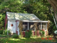
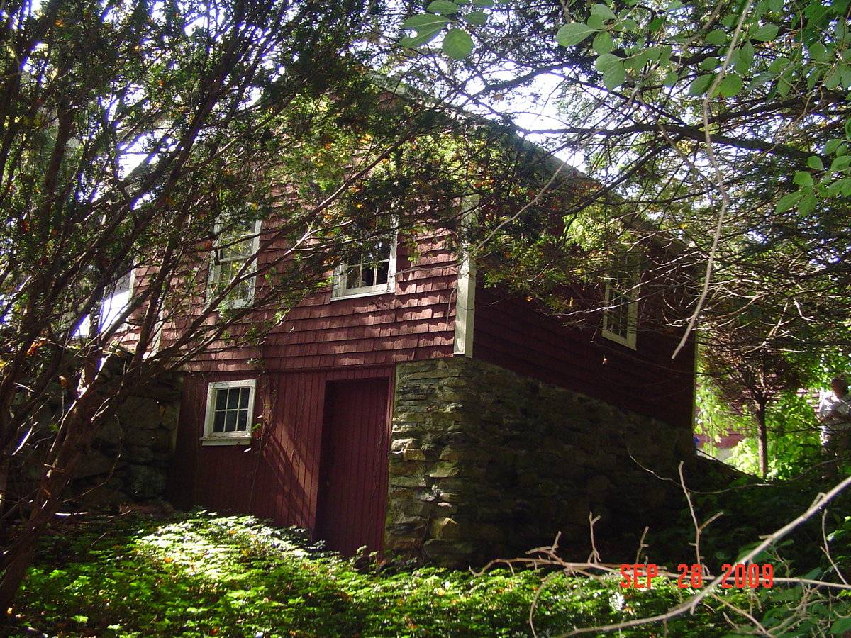
Property listed on National Register of Historic Places. Bank barn is early 1800s. Presumed use as animal barn with hay storage. The small stand alone workshop seen in photos 4 and 5 is the 1780 original ell to the house. Stone foundation.
- Use & Accessibility
Use (Historic)
Use (Present)
Exterior Visible from Public Road?
Yes
Demolished
n/a
Location Integrity
Unknown
- Environment
Related features
Environment features
Relationship to surroundings
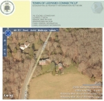
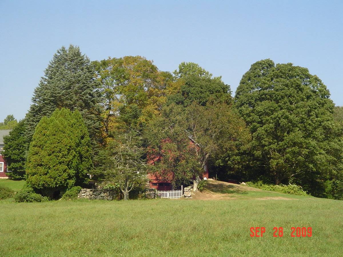
The Avery Homestead is located on the west side of Ledyard in a historic rural setting that has changed very little since the eighteenth century. The house faces south from a commanding position on the east side of Avery Hill Road (Photograph #s 1, 2, 3). It overlooks a sweep of stone-walled pasture land to the south which extends all the way to Stoddards Wharf Road, part of the more than 120 acres originally associated with the farmstead, of which about 100 acres are in a land trust. The road, which swings by the west side of the house, follows the same path that was laid out in 1773. Several outbuildings define the immediate farmyard: a gable-roofed, two-story barn to the southeast of the house and a smaller shed to the immediate east of the house (Photograph
#4). A farm pond, historically an ice pond, is located beyond the barn in a small valley formed by Billings-Avery Brook, which runs behind the house to the Thames River approximately one mile to the west. (Cunningham, NR Nomination Item 7.)- Typology & Materials
-
Building Typology
Materials
Structural System
Roof materials
Roof type
Approximate Dimensions
26 feet x 38 feet
- Source
-
Date Compiled
12/07/2009
Compiled By
Charlotte Hitchcock, reviewed by CT Trust
Sources
Field notes and photographs by Anne T. Roberts-Pierson 12/07/2009
Town of Ledyard Assessor’s Record Map/Lot 50-120-20Cunningham, Jan, A Historic and Architectural Resource Survey of the Town of Ledyard, Ledyard Historic District Commission, 1992.
Cunningham, Jan, Avery Homestead Nation Register Nomination No. 92001641, National Park Service, 1992.
Foster, Kit, Ledyard Town Historian, history of Ledyard
http://www.town.ledyard.ct.us/index.aspx?NID=279
http://www.town.ledyard.ct.us/index.aspx?NID=280
http://www.town.ledyard.ct.us/index.aspx?NID=281Sexton, James, PhD, Survey Narrative of the Connecticut Barn, Connecticut Trust for Historic Preservation, Hamden, CT, 2005, http://www.connecticutbarns.org/history.
Visser, Thomas D., Field Guide to New England Barns and Farm Buildings, University Press of New England, 1997.
- PhotosClick on image to view full file
-