Barn Record Andover
RETURN TO ‘FIND BARNS’
- Overview
-
Designations
n/a
Historic Significance
Architectural description:
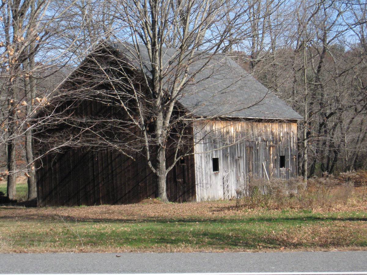
This is a 1 1/2-story side or eave-entry barn. The main facade faces south-east, with the ridge line of the barn oriented north-south, perpendicular to Jonathan Trumbull Highway. The main entry is a pair of hinged swinging doors in the middle of three bays. The southernmost bay has a single window opening and the northern most bay has an identical window opening and a pass-through door with what appears to be original hardware at the east corner. The south gable-facade, which faces the highway, is featureless except for the dropped girt line siding divide. The barn has unpainted vertical siding and an asphalt shingled roof.
Historical significance:
The oldest barns still found in the state are called the “English Barn,” “side-entry barn,” “eave entry,” or a 30 x 40. They are simple buildings with rectangular plan, pitched gable roof, and a door or doors located on one or both of the eave sides of the building based on the grain warehouses of the English colonists’ homeland. The name “30 by 40” originates from its size (in feet), which was large enough for 1 family and could service about 100 acres. The multi-purpose use of the English barn is reflected by the building’s construction in three distinct bays - one for each use. The middle bay was used for threshing, which is separating the seed from the stalk in wheat and oat by beating the stalks with a flail. The flanking bays would be for animals and hay storage.
Field Notes
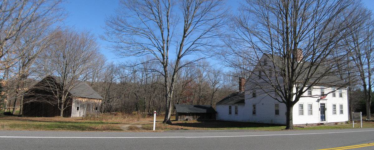
Substantial 2 1/2 story center-chimney Colonial house with one-story ell at rear, woodshed and unpainted English barn. Used by a construction company. Located along the historic main route from Hartford to Willimantic, Norwich, and Providence, this farm was situated on a terrace above the floodplain of the Hop River which provided fertile farmland.
- Use & Accessibility
Use (Historic)
Use (Present)
Exterior Visible from Public Road?
Yes
Demolished
n/a
Location Integrity
Unknown
- Environment
Related features
Environment features
Relationship to surroundings
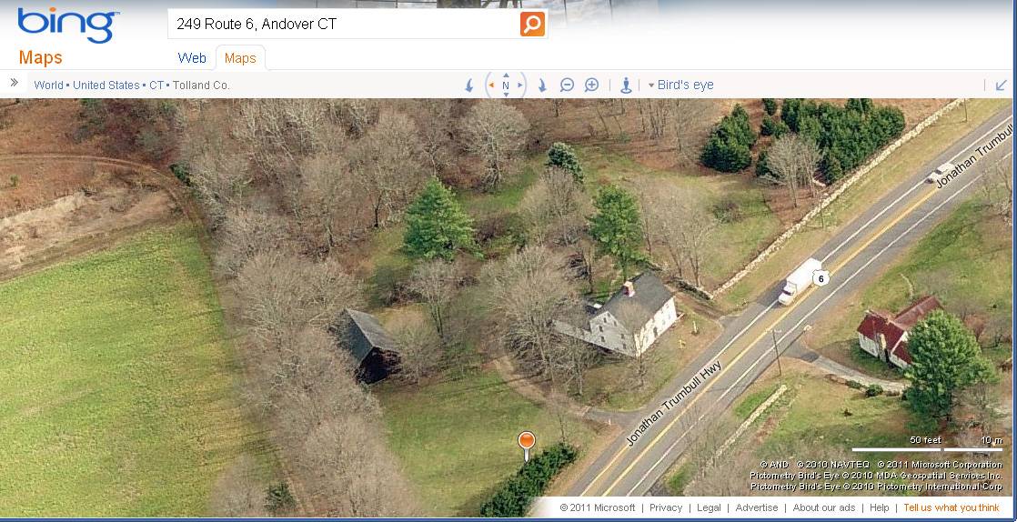
The barn is north-west of the house, a 2 1/2-story center chimney Colonial house dating from c. 1770. The house is sited with its front eave-side facing south toward the road. Located along the historic main route from Hartford to Willimantic, Norwich, and Providence (now US Route 6, also known as Jonathan Trumbull Highway), this farm is situated adjacent to the south bank of the Hop River, which provided fertile farmland to the north of the farm buildings. The current property is 3.27 acres.
- Typology & Materials
-
Building Typology
Materials
Structural System
Roof materials
Roof type
Approximate Dimensions
1240 square feet
- Source
-
Date Compiled
02/16/2010
Compiled By
Todd Levine, reviewed by the Connecticut Trust
Sources
Photographs and field notes by Charlotte Hitchcock - 11/09/2009
Town of Andover Assessor’s Record http://data.visionappraisal.com/AndoverCT
Parcel ID: 28/ 007/ 000030 3.27 acres, house date 1770,
BRN1 Barn - 1 Story 1240 S.F.Aerial views from Bing Maps:
http://www.bing.com/maps accessed 3/02/2011Sexton, James, PhD; Survey Narrative of the Connecticut Barn, Connecticut Trust for Historic Preservation, Hamden, CT, 2005, http://www.connecticutbarns.org/history.
Visser, Thomas D.,Field Guide to New England Barns and Farm Buildings, University Press of New England,1997.
- PhotosClick on image to view full file
-