Barn Record Andover
RETURN TO ‘FIND BARNS’- Building Name (Common)
- n/a
- Building Name (Historic)
- n/a
- Address
- 187 Jonathan Trumbull Highway (US Route 6), Andover
- Typology

- Overview
-
Designations
n/a
Historic Significance
Architectural description:
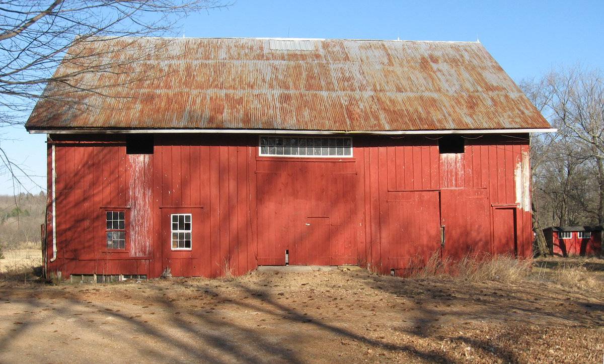
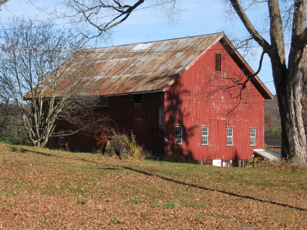
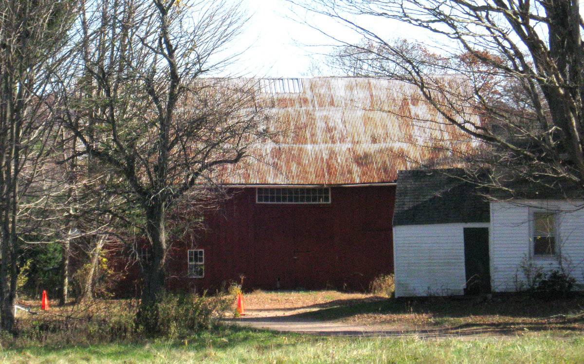
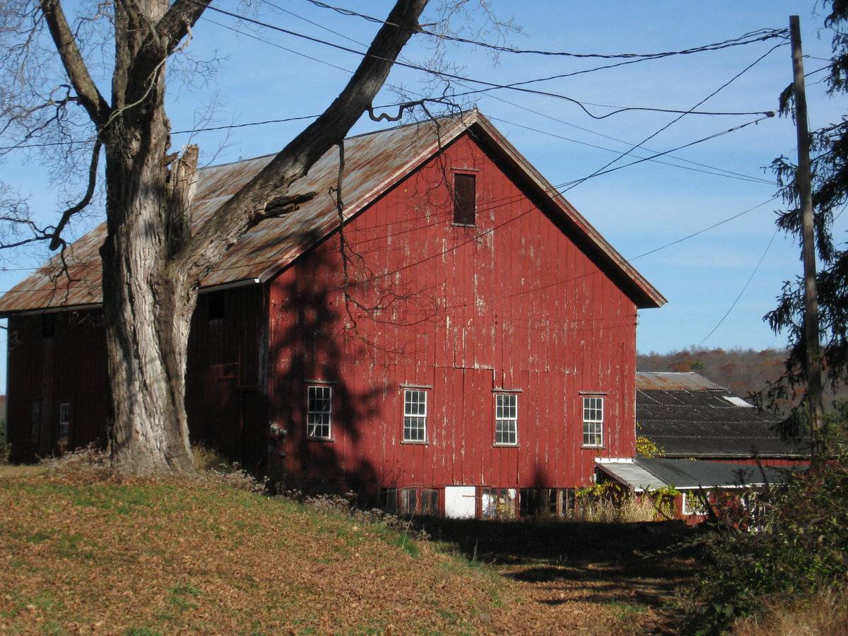
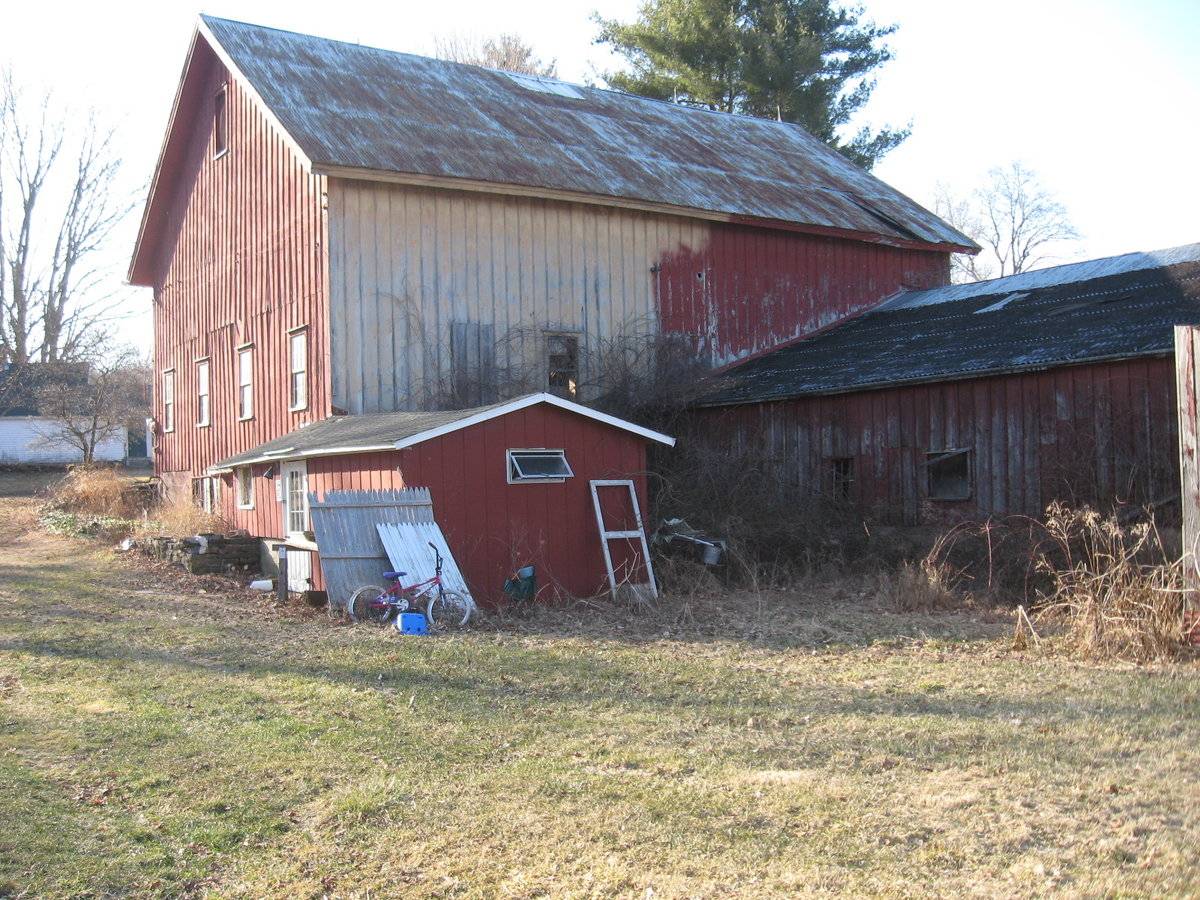
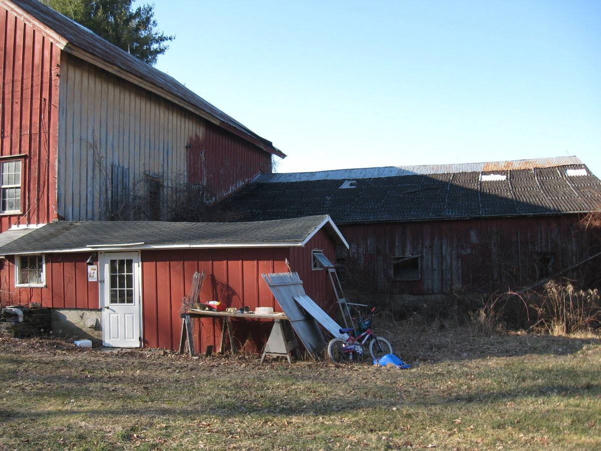
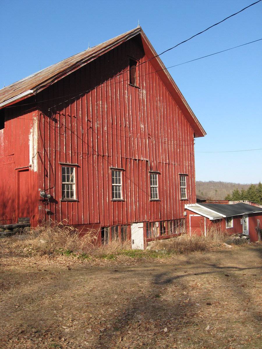
This is a 2 1/2-story side or eave-entry bank barn with a shed-roofed addition and a gable-roofed addition. The main eave-facade faces west, perpendicular to Jonathan Trumbull Highway. The main entry is the middle of three bays and appears to be a pair of interior sliding doors with a twelve-over-twelve transom light above it, just under the eave. The northern-most bay appears to have a six-over-six double hung window and a fixed six-pane window while the southern most bay appears to have a pass-through door with original hardware. The south gable-facade has a series of four six-over-six double hung windows above the main grade. Below grade is a series of basement windows that cover the entire facade. A small 1-story shed-roofed addition extends to the east. The east eave-side has a 1-story low-slope gable-roofed addition at the basement level, extending to the east with a series of shed-roofed shelters attached to its east end. The north gable-end has its grade at the main level, and appears to have a hay door or window opening at the attic loft level.
The barn has board and batten siding painted red with white trim and a metal roof.
Historical significance:
The oldest barns still found in the state are called the “English Barn,” “side-entry barn,” “eave entry,” or a 30 x 40. They are simple buildings with rectangular plan, pitched gable roof, and a door or doors located on one or both of the eave sides of the building based on the grain warehouses of the English colonists’ homeland. The name “30 by 40” originates from its size (in feet), which was large enough for 1 family and could service about 100 acres. The multi-purpose use of the English barn is reflected by the building’s construction in three distinct bays - one for each use. The middle bay was used for threshing, which is separating the seed from the stalk in wheat and oat by beating the stalks with a flail. The flanking bays would be for animals and hay storage.
The 19th century saw the introduction of a basement under the barn to allow for the easy collection and storage of a winter’s worth of manure from the animals sheltered within the building. The bank barn is characterized by the location of its main floor above grade, either through building into a hillside or by raising the building on a foundation. This innovation, aided by the introduction of windows for light and ventilation, would eventually be joined by the introduction of space to shelter more animals under the main floor of the barn.Board-and-batten siding became a popular alternative to wooden shingles on barns during the mid-nineteenth century, especially after the development of the circular saw made the production of long wooden battens easier. Typically measuring about one-and-a-half to two-and-a-half inches wide and about one-and-a-quarter inches think, these battens were nailed over the gaps between the sheathing boards.
Field Notes
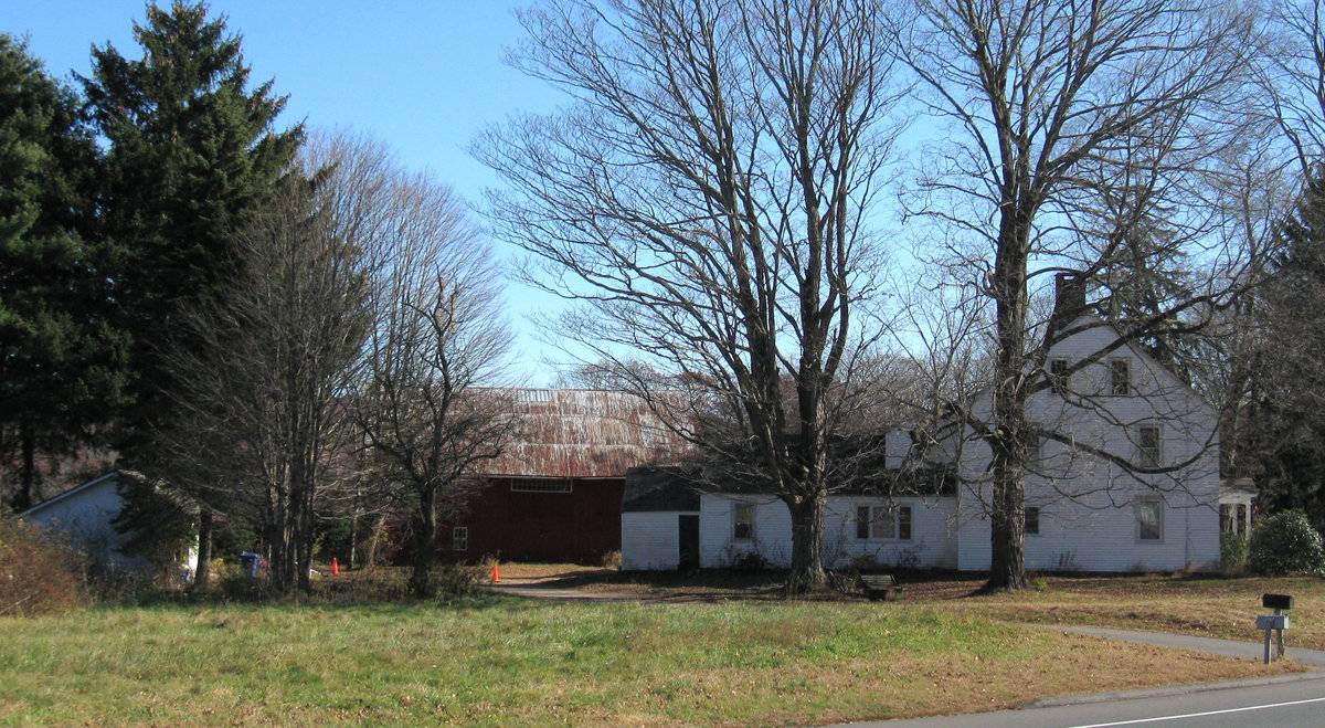
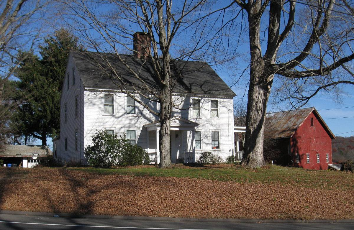
A 2 1/2 story center chimney Colonial house with an English bank barn set at the edge of the slope down to the flood plain of the Hop River. Located along the historic main route from Hartford to Willimantic, Norwich, and Providence, this farm was situated on a terrace above the floodplain of the Hop River which provided fertile farmland. barn is dated 1800's owned by Mrs Post (PB)
- Use & Accessibility
Use (Historic)
Use (Present)
Exterior Visible from Public Road?
Yes
Demolished
n/a
Location Integrity
Unknown
- Environment
Related features
Environment features
Relationship to surroundings
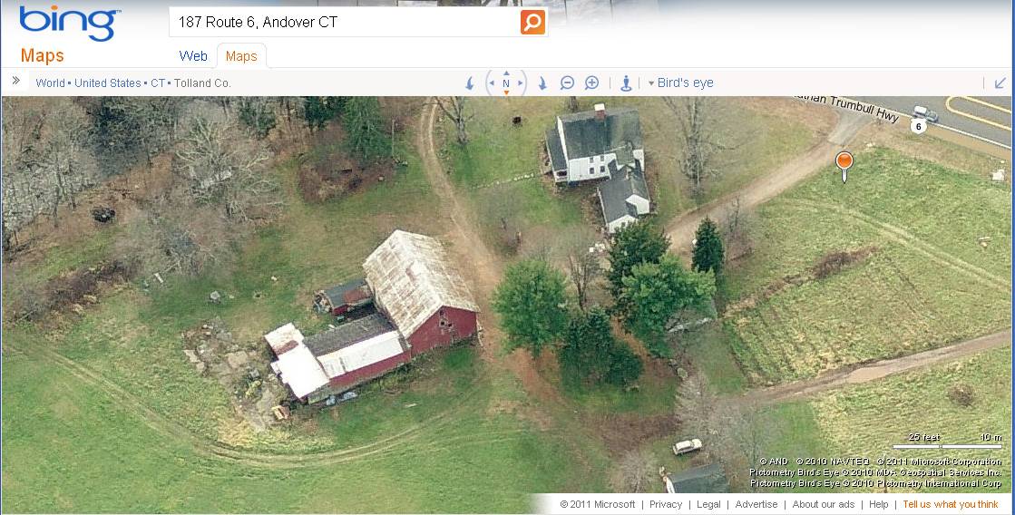
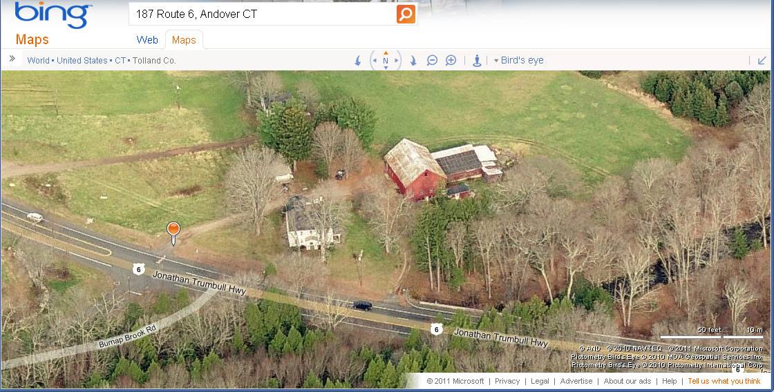
The barn is north-east of the house, a 2 1/2-story center chimney Colonial house dating from the early 19th c. The house is sited with its front eave-side facing south toward the road. Located along the historic main route from Hartford to Willimantic, Norwich, and Providence (now US Route 6, also known as Jonathan Trumbull Highway), this farm is situated on a level terrace above the floodplain of the Hop River, which provided fertile farmland to the north of the farm buildings. The main bank barn is set at the edge of the slope down to the flood plain of the Hop River; the main west entry doors are at the upper terrace level of the house while the east basement level opens to the lower fields in the flood plain. The current property is 2 acres.
- Typology & Materials
-
Building Typology
Materials
Structural System
Roof materials
Roof type
Approximate Dimensions
Main barn 1200 square feet, shed addition 1320 square feet
- Source
-
Date Compiled
02/16/2010
Compiled By
Todd Levine, reviewed by the Connecticut Trust
Sources
Photographs and field notes by Charlotte Hitchcock - 11/09/2009 - and Pamela Brown - 03/08/2010
Town of Andover Assessor’s Records http://data.visionappraisal.com
Parcel ID: 28/ 007/ 000037 - 2 acres - house 1805 -
FGR1 Garage Av 528 S.F.
SHD1 Shed Frame 216 S.F.
IMP Implement Shed 154 S.F.
BRN4 Barn 1St Lft/Bsm 1200 S.F.
SHD1 Shed Frame 1320 S.F.Aerial views from Bing Maps:
http://www.bing.com/maps accessed 3/02/2011Sexton, James, PhD; Survey Narrative of the Connecticut Barn, Connecticut Trust for Historic Preservation, Hamden, CT, 2005, http://www.connecticutbarns.org/history.
Visser, Thomas D.,Field Guide to New England Barns and Farm Buildings, University Press of New England,1997.
- PhotosClick on image to view full file
-