Barn Record Andover
RETURN TO ‘FIND BARNS’- Building Name (Common)
- n/a
- Building Name (Historic)
- n/a
- Address
- 450 Route 6 (corner of Bunker Hill Road), Andover
- Typology

- Overview
-
Designations
n/a
Historic Significance
Architectural description:
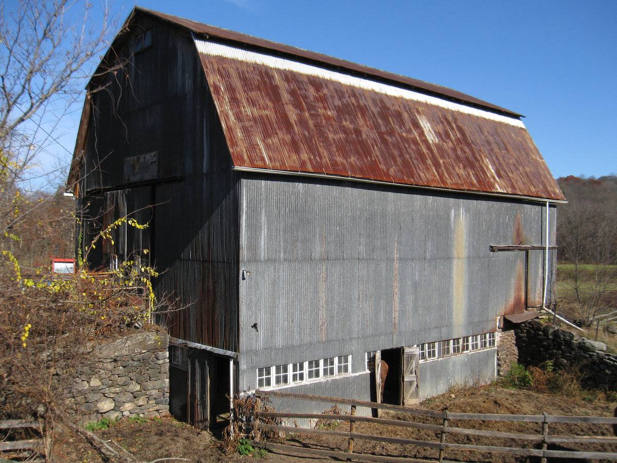
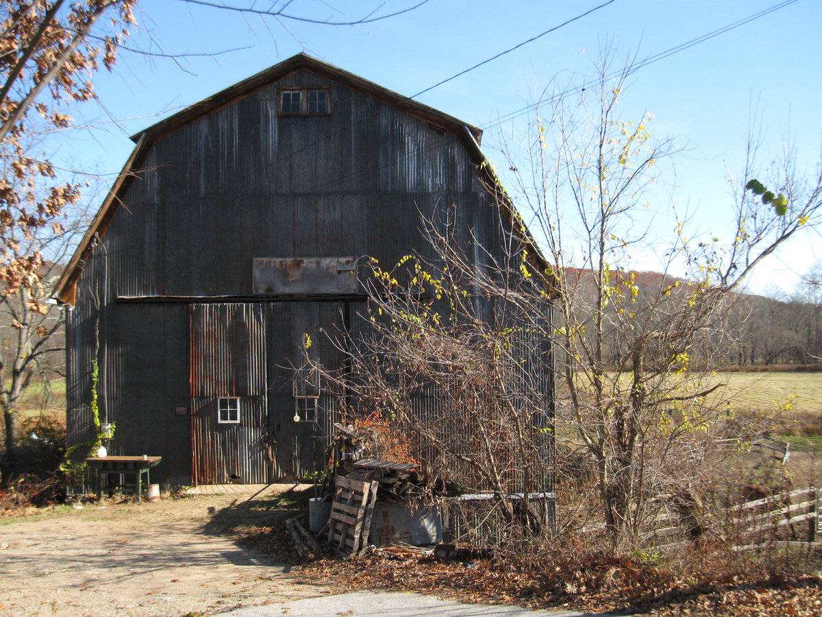
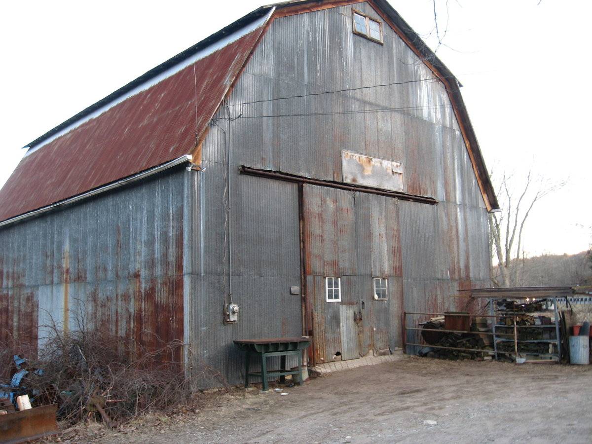
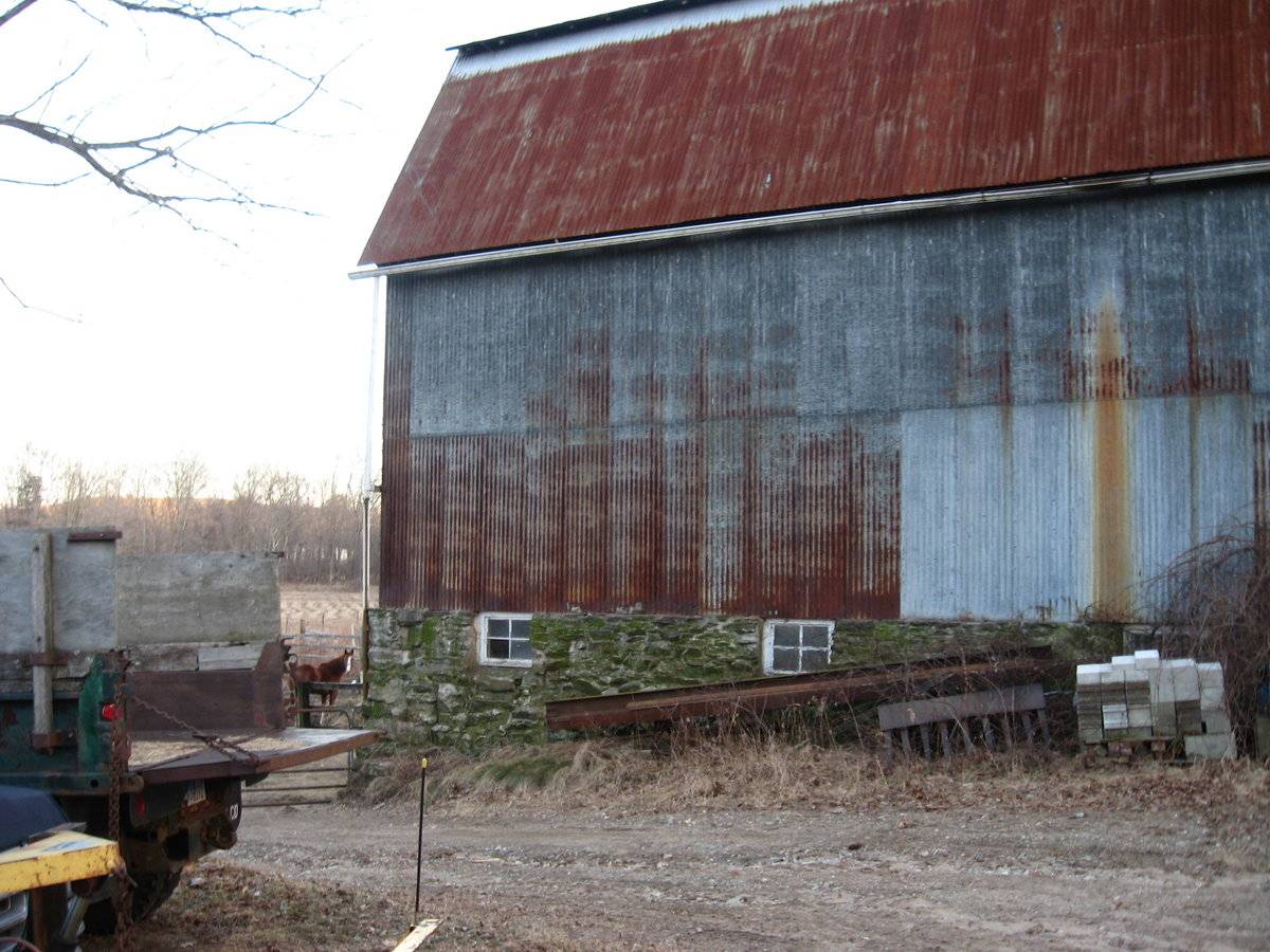
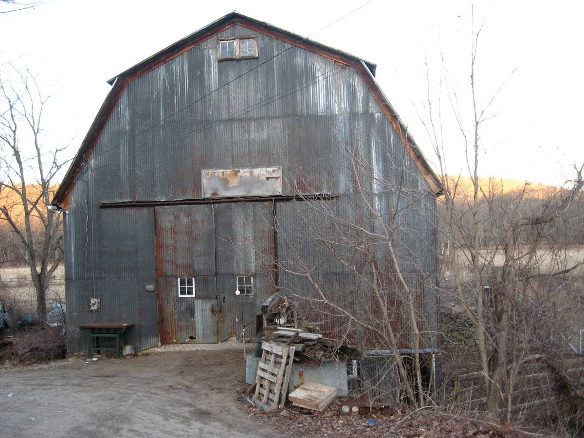
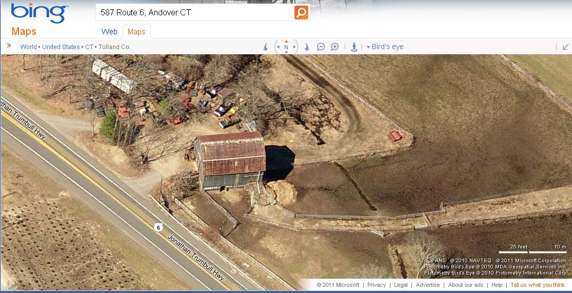
This is a 2 ½-story gable-entry gambrel bank barn. The main façade faces west and the ridge-line is diagonal to this portion of Jonathan Trumbull Highway (Route 6), which runs northwest-southeast. The main entry is a pair of exterior-sliding doors just north of center, each with an inset four-pane window. A faded sign is attached to the siding above the main entry. There is a pair of four-pane hinged sash windows with shared trim in the gable attic just beneath the apex of the roof. Towards the south corner, the grade declines sharply, revealing a basement level in the south corner which has a pass-through door and a pair of four-pane windows with shared trim. A fieldstone retaining wall extends towards the west.
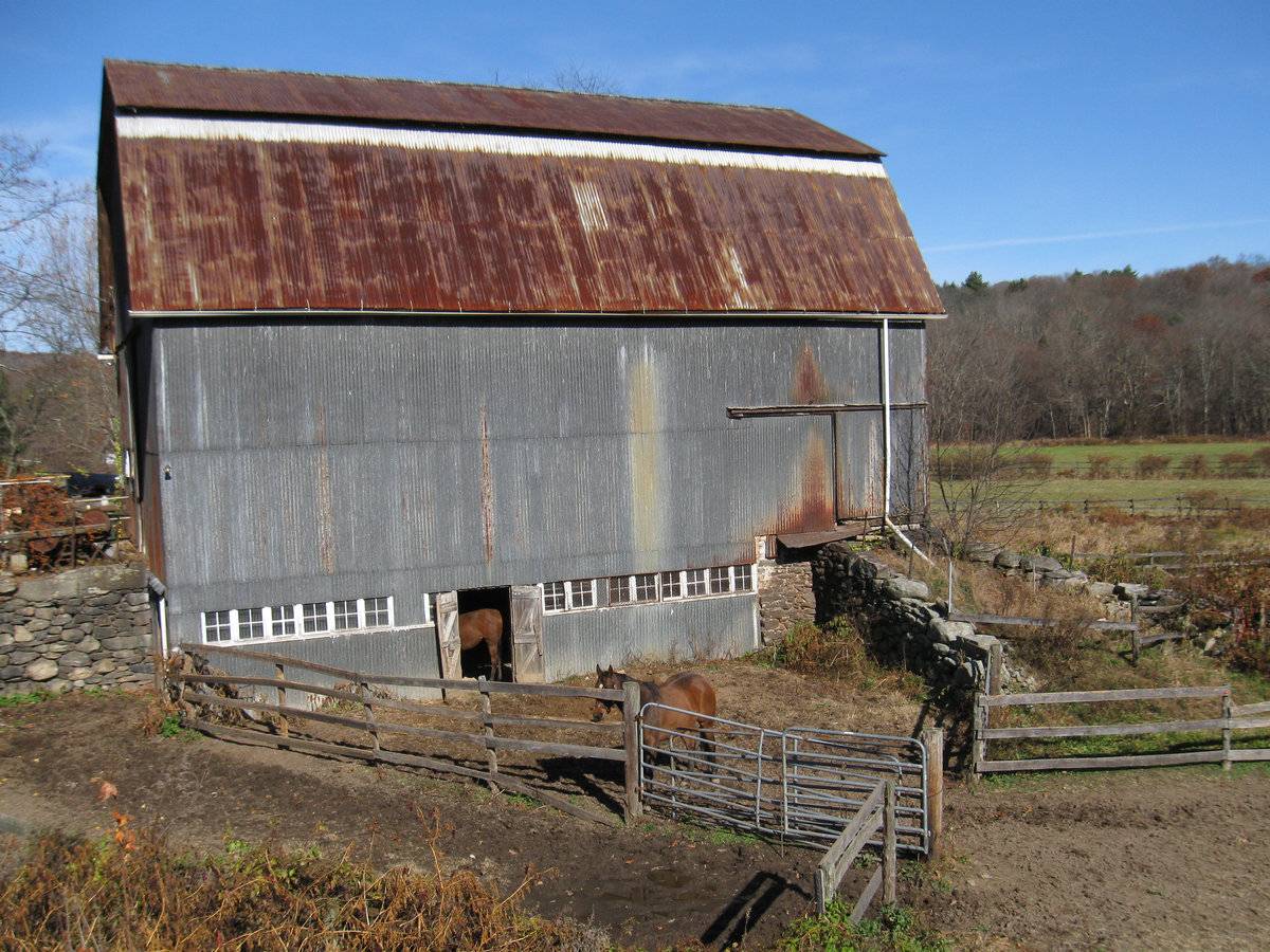
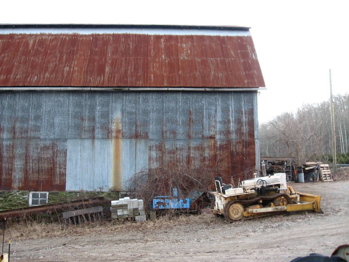
In the south eave-side of the barn is a pair of exterior-swinging doors just west of center in the basement level, flanked by a row six of four-pane stable windows. To the east of the doors is a similar row of eight stable windows. In the east corner, the basement level has mortared fieldstone and a steep earth ramp with unmortared fieldstone retaining walls leading up to an exterior-sliding door in the east corner of the main level. The remainder of the south eave-side is blank.
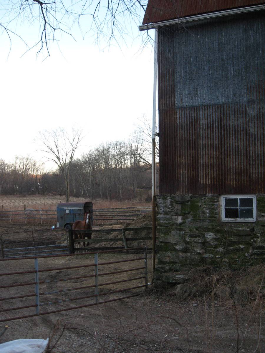
The east gable-end of the barn appears to have an entry in the basement level just south of center, flanked by windows in the same style as those on the south eave-side. There are also four single windows evenly spaced on the main level in the south half. The ground slopes gently down towards the east, revealing a basement level in the east half of the north eave-side of the barn, which has three single four-pane windows set into the fieldstone masonry. The remainder of this side is blank.
The barn has panels of corrugated iron siding and faded white window trim. The roof is covered with rusting corrugated iron.
Historical significance:
The New England barn or gable front barn is the successor to the English barn and relies on a gable entry rather than an entry under the eaves. The gable front offers many practical advantages. Roofs drain off the side, rather than flooding the dooryard. With the main drive floor running parallel to the ridge, the size of the barn could be increased to accommodate larger herds by adding additional bays to the rear gable end. Although it was seen by many as an improvement over the earlier side entry English Barn, the New England barn did not replace its predecessor but rather coexisted with it as both types continued to be constructed. The gambrel roof enclosed a much greater volume than a gable roof did, and its shape could be formed with trusses that did not require cross beams, which would interfere with the movement and storage of hay. Also known as the curb roof, the double slopes of the gambrel offer more volume in the hayloft without increasing the height of the side walls.
The 19th century would see the introduction of a basement under the barn to allow for the easy collection and storage of a winter’s worth of manure from the animals sheltered within the building. The bank barn is characterized by the location of its main floor above grade, either through building on a hillside or by raising the building on a foundation. This innovation, aided
by the introduction of windows for light and ventilation, would eventually be joined by the introduction of space to shelter more animals under the main floor of the barn.Field Notes
Now sided with metal panels, this gambrel bank barn appears old enough to probably have wood siding beneath the metal. Located along the historic main route from Hartford to Willimantic, Norwich, and Providence, this farm was situated on the edge a terrace above the floodplain of the Hop River which provided fertile farmland. Location: 41.735774,-72.361016
- Use & Accessibility
Use (Historic)
Use (Present)
Exterior Visible from Public Road?
Yes
Demolished
n/a
Location Integrity
Unknown
- Environment
Related features
Environment features
Relationship to surroundings
The barn faces west toward the road, US Route 6. The barn does not appear to be associated with any existing house. A driveway from the road runs east to a parking area in front of the west façade of the building and continues past the north eave-side of the barn to a large field behind the barn. There is a fenced yard with horses adjacent to the east and south sides of the barn. To the north of the barn, beyond the driveway, another track lined with vehicles leads northwest, alongside a swamp area. Beyond the field towards the north and east there is woodland. The area surrounding the property is woodland, active agriculture and commercial. The property is approximately a ½ mile east of Andover center.
- Typology & Materials
-
Building Typology
Materials
Structural System
n/a
Roof materials
Roof type
Approximate Dimensions
40 x 75 feet
- Source
-
Date Compiled
03/09/2011
Compiled By
L. Mackintosh & T. Levine, reviewed by CT Trust
Sources
Photographs and field notes by Charlotte Hitchcock and Pamela Brown - 11/09/2009
Andover GIS Viewer: http://www.crcog.org/gissearch/
Parcel ID: unknown - parcel at northeast corner of Bunker Hill and US Route 6.
Aerial Mapping:
http://maps.google.com accessed 3/9/2011
http://www.bing.com/maps accessed 3/9/2011.Sexton, James, PhD, Survey Narrative of the Connecticut Barn, Connecticut Trust for Historic Preservation, Hamden, CT, 2005, http://www.connecticutbarns.org/history.
Visser, Thomas D., Field Guide to New England Barns and Farm Buildings, University Press of New England, 1997.
- PhotosClick on image to view full file
-