Barn Record Andover
RETURN TO ‘FIND BARNS’- Building Name (Common)
- n/a
- Building Name (Historic)
- n/a
- Address
- 84 Long Hill Road, Andover
- Typology

- Overview
-
Designations
n/a
Historic Significance
Architectural description:
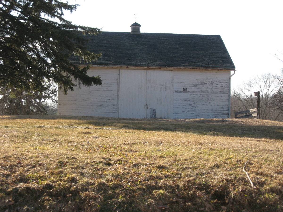
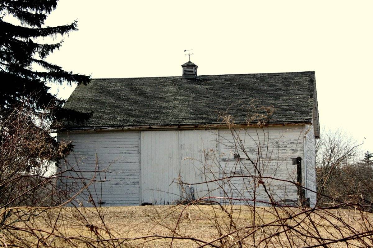
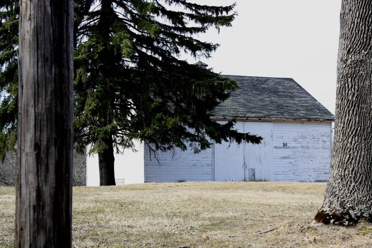
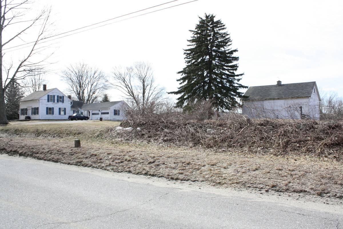
This is a 1 ½-story three-bay gable-roofed eave-entry bank barn. The main entry is in the eave-side facing east and the ridge-line of the barn is parallel with this portion of Long Hill Road, which runs approximately north-south. The main entry is a pair of large exterior-sliding doors of vertical planking, located in the center bay. The remainder of the façade is blank.
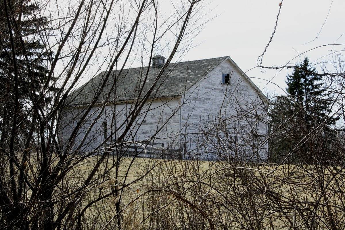
The north gable-end of the barn is blank except for a single fixed window with broken panes high in the gable attic. The ground slopes gently towards the west, revealing what the foundation level at the right (west) corner. The west eave-side of the barn appears to have two windows or an opening above a half-wall in the basement level, and a pair of windows in the center on the main level. The south gable-end of the barn appears to have two windows in each corner of the basement level and a single window high in the gable attic. Unmortared fieldstone walls extend south from the corners to form a paddock south of the barn. The eastern of these appears to act as a retaining wall separating grade of the main level at the east eave-side from the basement level at the south gable-end.
There is a square wooden louvered ventilator with a hip roof, centered in the ridge-line. The barn has horizontal tongue and groove siding, painted white that has faded over time. The roof appears to be covered in asphalt shingles.
Historical significance:The oldest barns still found in the state are called the “English Barn,” “side-entry barn,” “eave entry,” or a 30 x 40. They are simple buildings with rectangular plan, pitched gable roof, and a door or doors located on one or both of the eave sides of the building based on the grain warehouses of the English colonists’ homeland. The name “30 by 40” originates from its size (in feet), which was large enough for 1 family and could service about 100 acres. The multi-purpose use of the English barn is reflected by the building’s construction in three distinct bays - one for each use. The middle bay was used for threshing, which is separating the seed from the stalk in wheat and oat by beating the stalks with a flail. The flanking bays would be for animals and hay storage.
The 19th century saw the introduction of a basement under the barn to allow for the easy collection and storage of a winter’s worth of manure from the animals sheltered within the building. The bank barn is characterized by the location of its main floor above grade, either through building into a
hillside or by raising the building on a foundation. This innovation, aided by the introduction of windows for light and ventilation, would eventually be joined by the introduction of space to shelter more animals under the main floor of the barn.Field Notes
This barn, located on the west side of the road, is noticeable for the placement of its wooden siding, which is horizontal rather than vertical. It is an English-style structure with a very large double-door entrance on its long wall, and a weather-vane cupola on its roof.
- Use & Accessibility
Use (Historic)
Use (Present)
Exterior Visible from Public Road?
Yes
Demolished
n/a
Location Integrity
Unknown
- Environment
Related features
Environment features
Relationship to surroundings
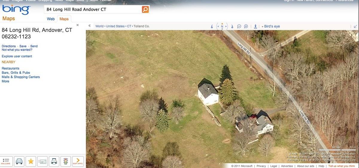
The barn is to the northwest of the house with which it is associated, on the west side of Long Hill Road. The ridge-lines of the barn and house are parallel to Long Hill Road, which is oriented north-south. The 1 ½-story cape style gable-roofed house, built in c. 1774, has a gable roof addition on its rear, west eave-side and an attached gable-roofed garage on the northwest side. A driveway runs west from Long Hill Road along the north side of the house, to a parking area in front of the garage. There is a wooden gate and a large evergreen tree in front of the northeast façade of the barn and a farm track leads northwest past the façade. There is a yard enclosed by stone walls alongside the southeast gable-end of the barn. There is a large area of open land alongside the northwest and southwest sides of the barn. The remainder of the 73.72-acre property is covered in woodlands. The area surrounding the site is woodlands and rural. The property is approximately 1 mile from Andover center.
- Typology & Materials
-
Building Typology
Materials
Structural System
Roof materials
Roof type
Approximate Dimensions
1080 square feet
- Source
-
Date Compiled
03/11/2011
Compiled By
L. Mackintosh & T. Levine, reviewed by CT Trust
Sources
Field notes and photographs by Ellen O’Shaughnessy - Pamela Brown date 3/22/2010.
Town of Andover Assessor’s Record or GIS Viewer: http://data.visionappraisal.com/AndoverCT
Parcel ID: 28/ 007/ 000014/ / /Aerial Mapping:
http://maps.google.com accessed 3/11/2011
http://www.bing.com/maps accessed 3/11/2011.Sexton, James, PhD, Survey Narrative of the Connecticut Barn, Connecticut Trust for Historic Preservation, Hamden, CT, 2005, http://www.connecticutbarns.org/history.
Visser, Thomas D., Field Guide to New England Barns and Farm Buildings, University Press of New England, 1997.
- PhotosClick on image to view full file
-