Barn Record Andover
RETURN TO ‘FIND BARNS’
- Overview
-
Designations
n/a
Historic Significance
Architectural description:
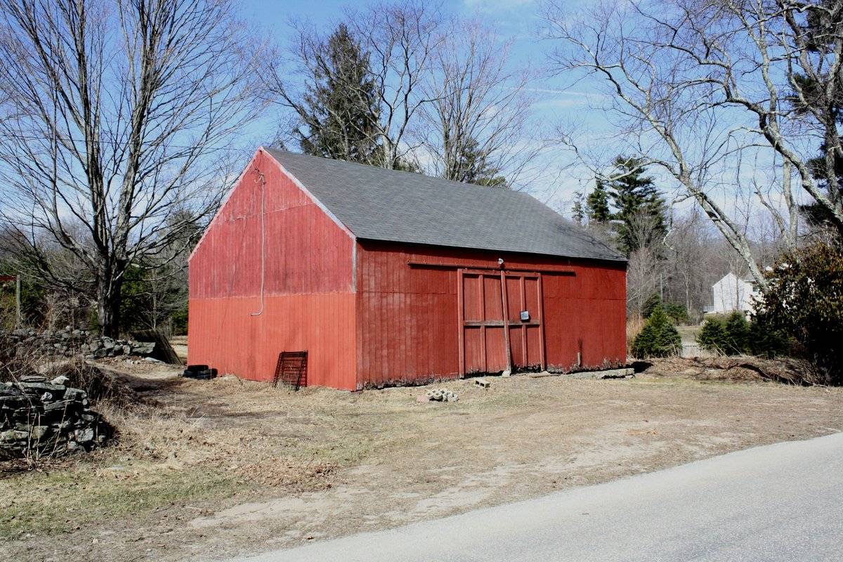
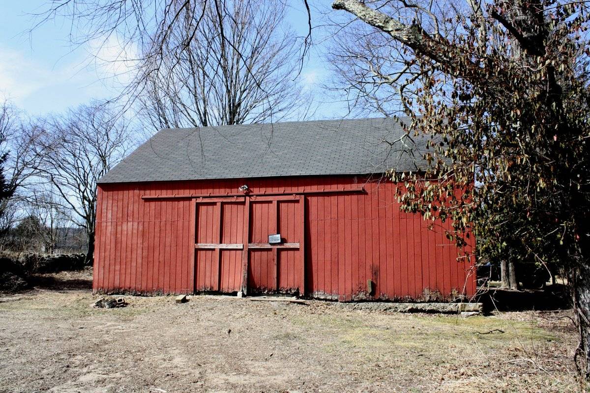
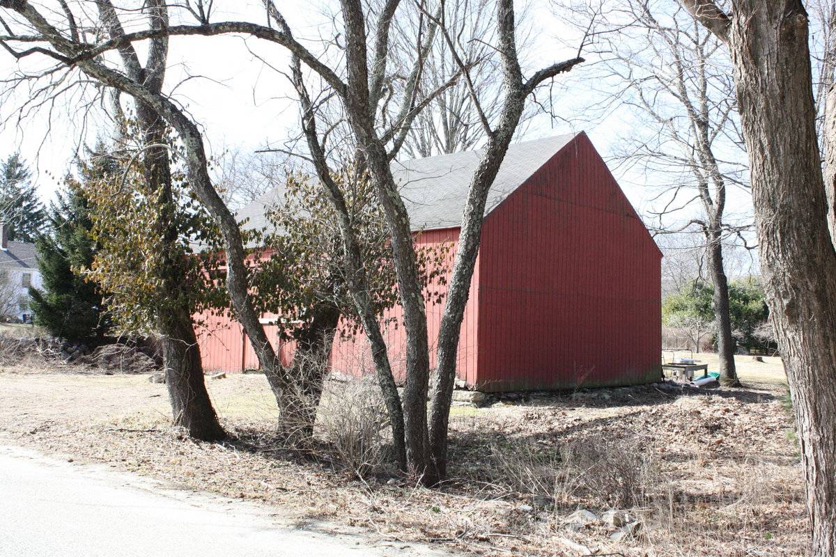
This is a 1 1/2-story, tripartite eave-entry barn. The main façade faces southeast and the ridge-line of the barn is parallel with this portion of Times Farm Road, which runs southwest-northeast. The main entry is a pair of exterior-sliding doors with external bracing in the middle of three bays in the southeast eave-facade. The remainder of the façade is blank. The ground slopes very gently to the east revealing a concrete and fieldstone foundation in the east corner of the façade and the northeast gable-end, which is blank. Both the northwest eave-side and southwest gable-end of the barn are also blank. The northwest eave-side of the barn appears to have an entry. The barn has vertical flush-board siding painted red. The siding on the lower half of the southwest gable-end appears to have been replaced. The roof is covered with asphalt shingles.
Historical significance:Barn, English: The oldest barns still found in the state are called the “English Barn,” “side-entry barn,” “eave entry,” or a 30 x 40. They are simple buildings with rectangular plan, pitched gable roof, and a door or doors located on one or both of the eave sides of the building based on the grain warehouses of the English colonists’ homeland. The name “30 by 40” originates from its size (in feet), which was large enough for 1 family and could service about 100 acres. The multi-purpose use of the English barn is reflected by the building’s construction in three distinct bays - one for each use. The middle
bay was used for threshing, which is separating the seed from the stalk in wheat and oat by beating the stalks with a flail. The flanking bays would be for animals and hay storage.Field Notes
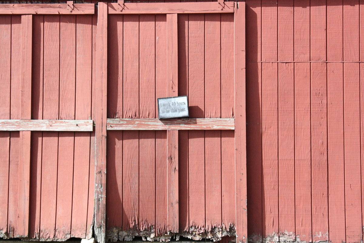
An English-style barn with a shingled roof and wooden sidewalls. Some of the siding on the southwest-facing side appears to have been replaced with newer boards. There is a whimsical sign on the entry that reads "I work 40 hours to be this poor". The foundation is visible on the northeast side, and looks to be constructed of large flat rocks.
- Use & Accessibility
Use (Historic)
Use (Present)
Exterior Visible from Public Road?
Yes
Demolished
n/a
Location Integrity
Unknown
- Environment
Related features
Environment features
Relationship to surroundings
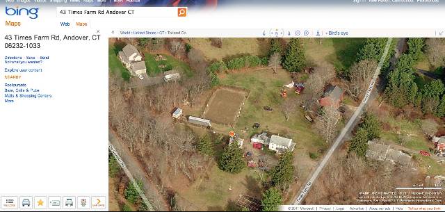
The barn fronts Times Farm Road and is to the northeast of the house with which it is associated with. The ridge-line of the barn is perpendicular to the ridge-line of the house. The 2 story gable-roof house, built c. 1916, has a covered porch on its southeast gable-façade and southwest eave-side and two additions on the rear northwest gable-end. The 3.37-acre property is on the corner of Times Farm Road and Old Coventry Road. A driveway from Times Farm Road runs northwest past the southwest eave-side of the house to a garage. Behind the garage, there are several sheds amongst scattered trees in the northwest corner of the property. There is a garden and open land in the west corner of the property. An additional short driveway leads to a parking area in front of the main façade of the barn and continues past the southwest gable-end to a parking area at the rear, northwest eave-side of the barn. A stone wall follows the line of the driveway. There are scattered trees alongside the northeast gable-end and northwest eave-side of the barn. Beyond the parking area at the rear of the barn, there is open land and an agricultural plot. The property is located 3 miles northwest of the center of Andover.
- Typology & Materials
-
Building Typology
Materials
Structural System
Roof materials
Roof type
Approximate Dimensions
864 sq. ft.
- Source
-
Date Compiled
03/22/2011
Compiled By
L. Mackintosh & T. Levine, reviewed by CT Trust
Sources
Field notes and photographs by Ellen O’Shaughnessy date 3/23/2010.
Town of Andover Assessor’s Record or GIS Viewer: http://data.visionappraisal.com/AndoverCT/
Parcel ID: 29/ 002/ 000007/ / /Aerial Mapping:
http://www.bing.com/maps accessed 3/22/2010.Sexton, James, PhD, Survey Narrative of the Connecticut Barn, Connecticut Trust for Historic Preservation, Hamden, CT, 2005, http://www.connecticutbarns.org/history.
Visser, Thomas D., Field Guide to New England Barns and Farm Buildings, University Press of New England, 1997.
- PhotosClick on image to view full file
-