Barn Record Hebron
RETURN TO ‘FIND BARNS’
- Overview
-
Designations
Historic Significance
Architectural description:
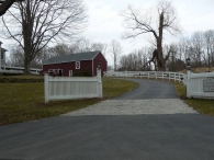
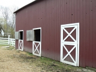
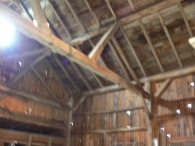
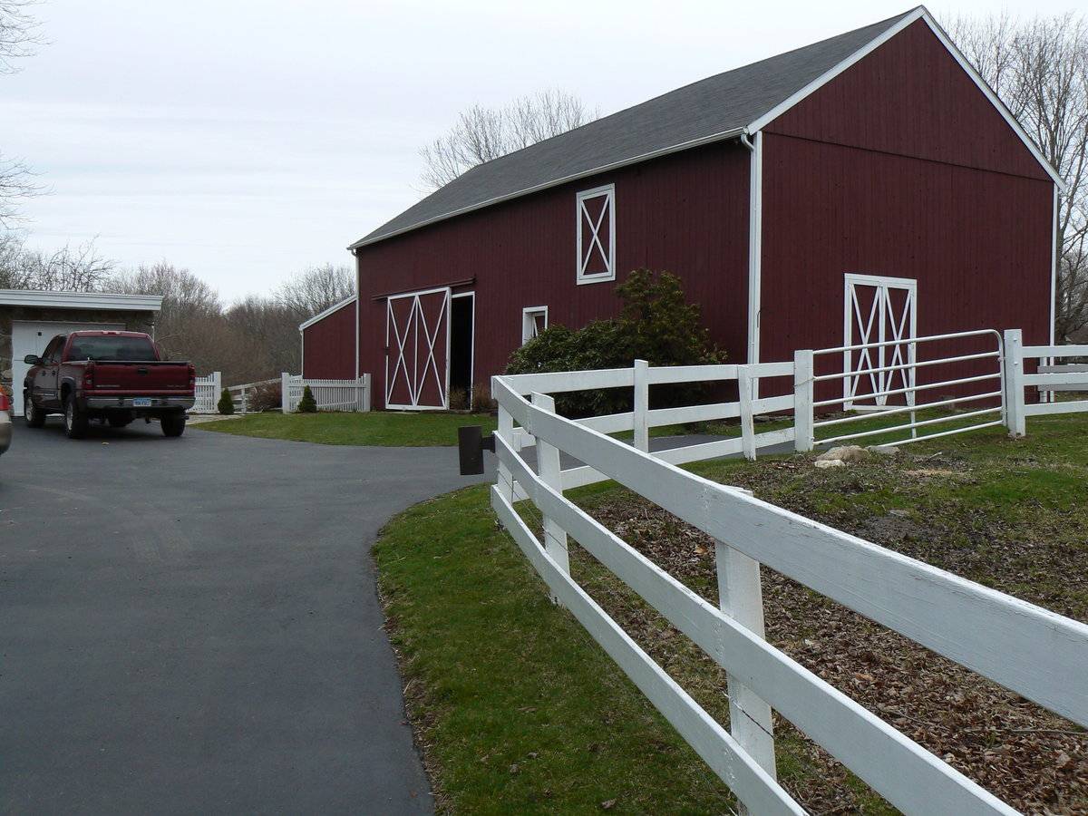
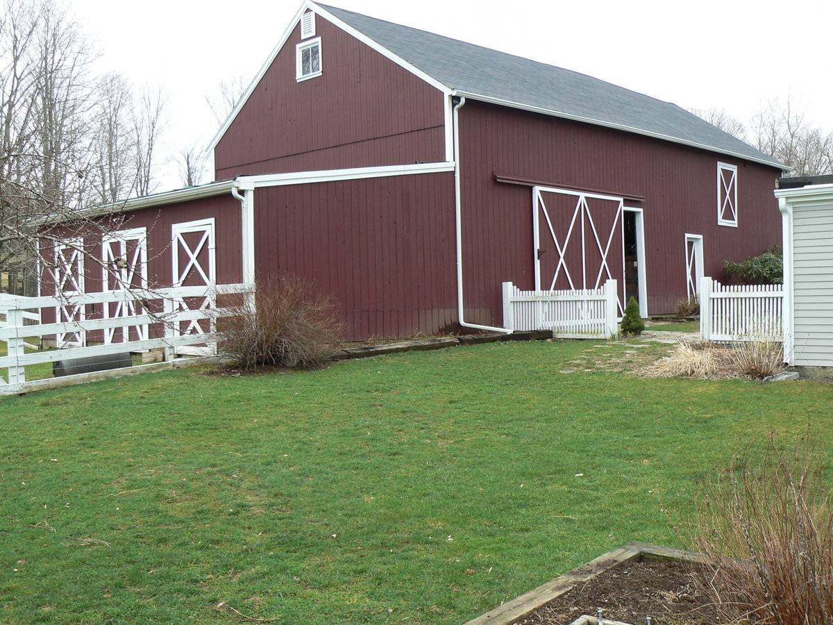
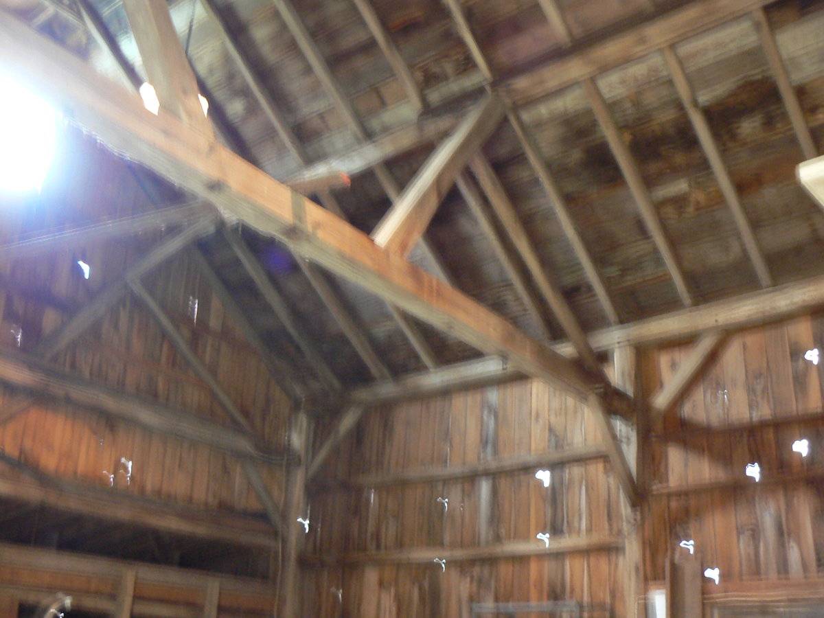
This is a 2 ½-story gable-roofed structure with its ridge-line oriented northwest-southeast (referred to as north-south). The main entry is a sliding barn door in the west eave-side, located off-center toward the left (north). The barn appears to be a four-bay frame with the main door in the second bay from the left. To the right of the barn door there is a pass-through door and to the right of that, a hay door in the second level. The south gable-end is blank except for a pair of hinged doors off-center toward the left (west). The east eave-side has four openings which are Dutch doors for horse stalls. The north gable-end has an attached shed-roofed addition its full width. The north side of the addition has three openings. The center is a pair of hinged doors, while the two flanking are Dutch stable doors. There is a two-pane attic window near the peak of the main gable-end, with a louvered vent above.
Siding is vertical boards, a mix of grooved plywood, tongue-and-groove, and vertical planks. Siding is painted red with white trim, and roofing is gray asphalt shingles. Notable is the difference in the gable-ends: the north end has a dropped girt line siding divide, while the south end has a siding divide at the eave height.
Historical significance:
The oldest barns still found in the state are called the “English Barn,” “side-entry barn,” “eave entry,” or a 30 x 40. They are simple buildings with rectangular plan, pitched gable roof, and a door or doors located on one or both of the eave sides of the building based on the grain warehouses of the English colonists’ homeland. The name “30 by 40” originates from its size (in feet), which was large enough for 1 family and could service about 100 acres. The multi-purpose use of the English barn is reflected by the building’s construction in three distinct bays - one for each use. The middle bay was used for threshing, which is separating the seed from the stalk in wheat and oat by beating the stalks with a flail. The flanking bays would be for animals and hay storage.
This barn appears to have a fourth bay added at the south end; the north end bent has a dropped girt, visible in the interior photograph, while the south end bent does not, as evidenced by the siding divide at the eave height.
Historical background:
Hebron, incorporated as a town in 1708, grew slowly as families from other areas bought tracts of land and settled. Farms were spread out throughout the town, with only the area around the town common and meetinghouse as a focal point. There were few houses there in the 18th century, but the crossroads at the center also provided the core for a small commercial nucleus in the form of a tavern and store.
After the Revolutionary War Hebron began to grow and many more buildings were constructed, forming a small village at the town center. The main road through the village, present-day Route 66, was improved as the Hebron and Middle Haddam Turnpike, further contributing to the village’s prosperity. Church Street also began to expand and develop. The 19th century saw an increase in religious diversity, and as other denominations formed, they built their meeting places at the town center. In the 20th century, the process was repeated: United Brethren synagogue reflects the settlement of East European Jews in Hebron in the early 20th century. Taking up egg and dairy farming, they gave new life to the town’s farmlands.
Hebron’s growth tapered off in the middle of the 19th century. Several buildings were destroyed by the great fires of 1882 and 1888, but it is a testimony to the continuing importance of the center that most were rebuilt. As part of the reconstruction, the Victorian Gothic Congregational Church at 1 Main Street was dedicated in 1883, and a new parsonage was built nearby a few years later. The district school, 18 Main Street, was also replaced in a more Victorian style. New public buildings continued to be built at the center as need arose: a small Queen Anne-style building was erected for a public library at 22 Main Street, on the south side of the green, in 1898, and in 1909, the town built a small brick structure to house town records and to commemorate Hebron’s 200th anniversary (Clouette, Section 8).
Originally this was the Fuller homestead, built around 1840.
Field Notes
Originally the Fuller homestead built around 1840. Current owner restored barn from 1988-1998. Barn originally housed oxen, subsequently housed horses, pigs, turkeys, chickens. Now home to sheep and a goat. Original post and beam square rule construction maintained, originally cedar sided, now pine board and batten with a stone foundation. Now known as Cosker Family Farm established 1988.
- Use & Accessibility
Use (Historic)
Use (Present)
Exterior Visible from Public Road?
Yes
Demolished
n/a
Location Integrity
Unknown
- Environment
Related features
Environment features
Relationship to surroundings
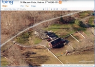
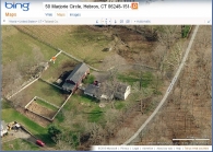
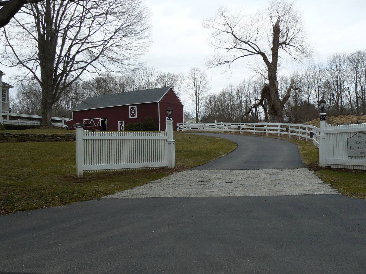
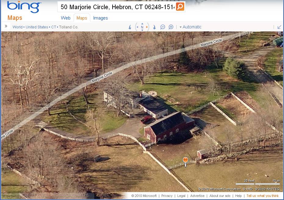
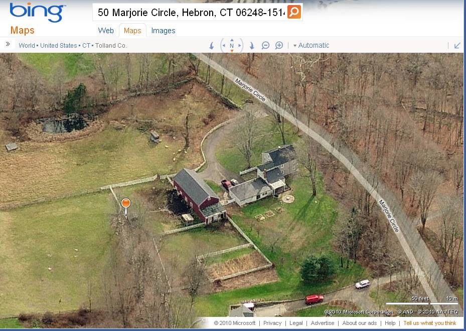
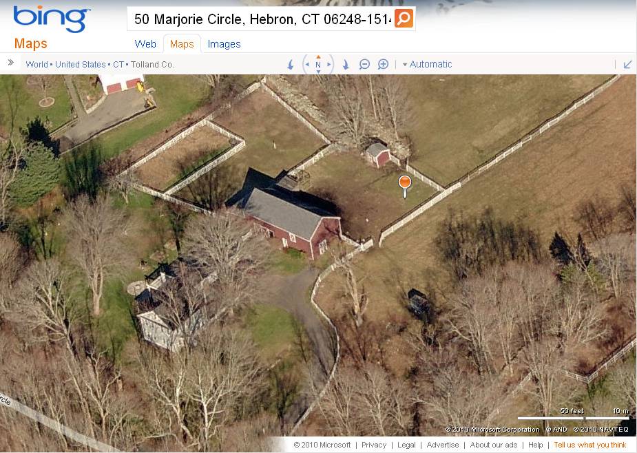
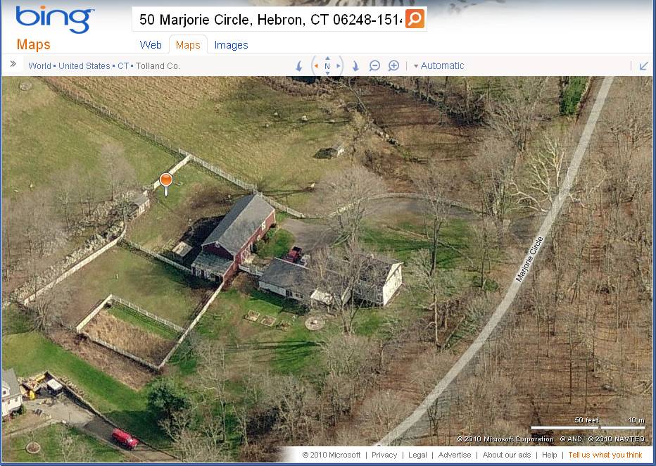
This house on Marjorie Circle, northwest from the center of town, is one of the older extant buildings in the Historic District, having been spared by the fires of the late 19th century. The farmhouse is a 2 ½-story gable-roofed structure with its west gable-end facing the road and a pedimented attic, in a Greek Revival stylistic vocabulary. However the main entrance is in the south eave-side façade, facing the driveway. The barn is located northeast of the house, at the rear. Fenced paddocks extend northward from the barn and a large fenced pasture to the north has sheep. The property is 3.73 acres.
From the 18th century to the present time, Hebron Center, with its churches, early tavern, and current post office, schools, and businesses, has been the center of a small rural community. The town green has been largely eliminated by enlargement of the roadways, but some vestiges remain around the intersection of the main roads. Except for heavy traffic, the streetscape remains residential in scale, with houses and religious buildings lining the roadsides in all directions.- Typology & Materials
-
Building Typology
Materials
Structural System
Roof materials
Roof type
Approximate Dimensions
1456 square feet
- Source
-
Date Compiled
03/26/2010
Compiled By
Charlotte Hitchcock, reviewed by CT Trust
Sources
Field notes by Marilyn Neubert.
Town of Hebron Assessor’s Record http://www.prophecyone.us/index_prophecy.php?town=Hebron
Parcel ID: 23/45 3.73 acres, barn 1452 sf, barn 352 sf, 2 sheds each 100 sf.Aerial views from:
http://maps.google.com/
http://www.bing.com/maps/ accessed 12/15/2010.Clouette, Bruce, Cronin, Maura, Hebron Center National Register Historic District Nomination 93000649, National Park Service, 1993.
Sexton, James, PhD; Survey Narrative of the Connecticut Barn, Connecticut Trust for Historic Preservation, Hamden, CT, 2005, http://www.connecticutbarns.org/history.
Visser, Thomas D.,Field Guide to New England Barns and Farm Buildings, University Press of New England, 1997, 213 pages.
- PhotosClick on image to view full file
-