Barn Record Bolton
RETURN TO ‘FIND BARNS’- Building Name (Common)
- n/a
- Building Name (Historic)
- n/a
- Address
- 65 Birch Mountain Road, Bolton
- Typology

- Overview
-
Designations
n/a
Historic Significance
Architectural description:
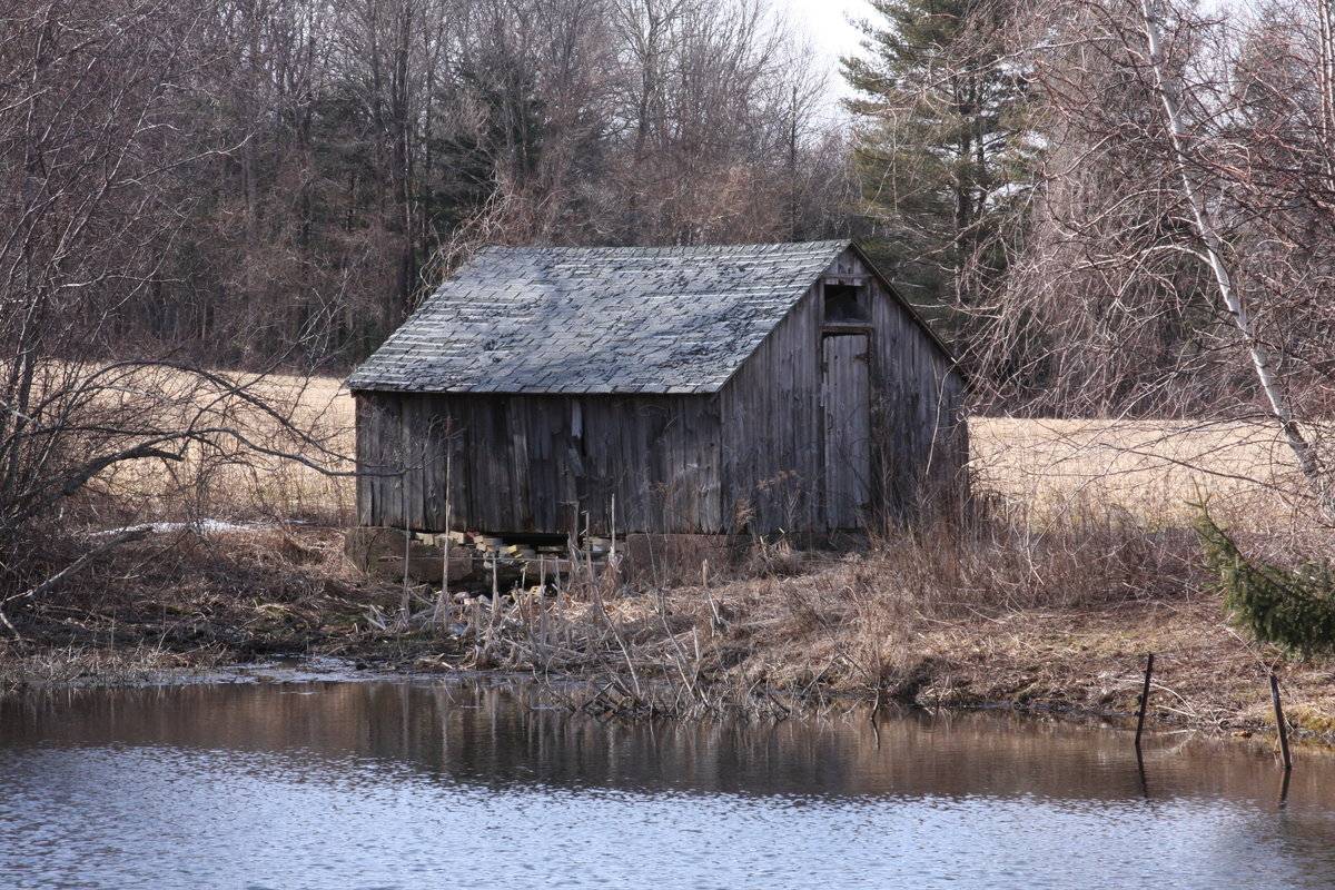
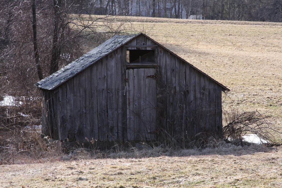
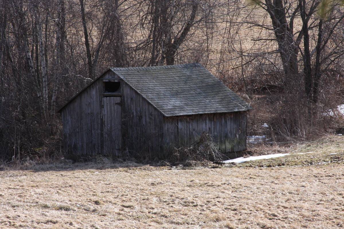
This is a 1-story shed. The main facade faces east and the ridge-line of the shed is perpendicular to this portion of Birch Mountain Road, which runs approximately north-south. The main entry is a pass-through door with trim centered in the east gable-facade. Above the door is an opening with trim. The north and south eave-sides of the shed are blank. The shed has unpainted vertical flush-board siding. The foundation appears to be concrete. The roof is covered in asphalt shingles.
Historical significance:A shed is typically a simple, single-story structure in a back garden or on an allotment that is used for storage, hobbies, or as a workshop. Sheds vary considerably in the complexity of their construction and their size, from small open-sided tin-roofed structures to large wood-framed sheds with shingled roofs, windows, and electrical outlets. Sheds used on farms or in industry can be large structures. This shed is interesting because of its placement in the landscape adjacent to a small body of water.
Field Notes
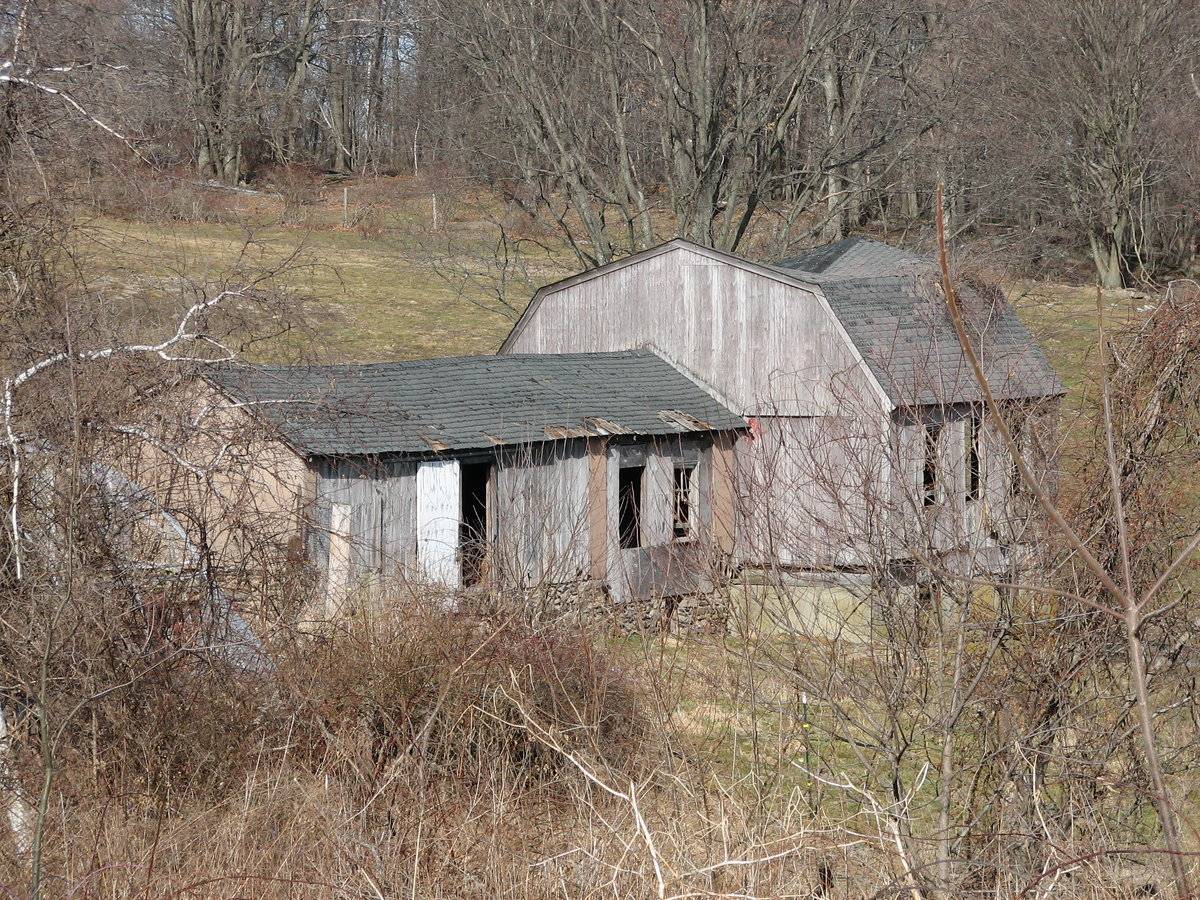
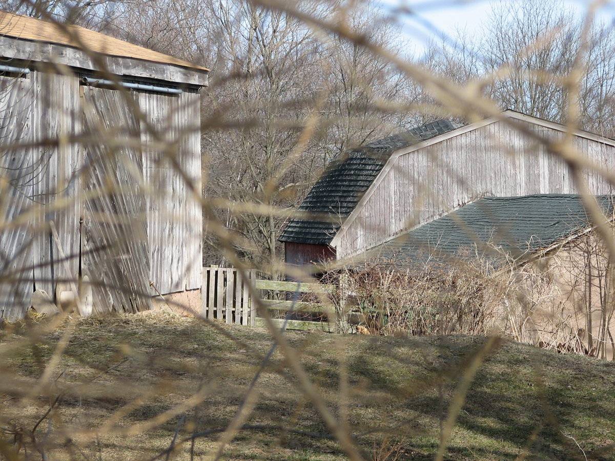
Barn 1- Shed images 1-3 Barn 2- gambrel barn with attached gable-roofed addition (collapsing in on itself) Barn 3- is a gable-roofed barn located near the gambrel-roofed barn.
- Use & Accessibility
Use (Historic)
Use (Present)
Exterior Visible from Public Road?
Yes
Demolished
n/a
Location Integrity
Unknown
- Environment
Related features
Environment features
Relationship to surroundings
The shed sits alone on 25 acres at 65 Birch Mountain Road. Across the road is the 65.69 acre 66 Birch Mountain Road, which has a number of outbuildings, including a gambrel roof barn with attached gable-roofed addition, a gambrel roof garage, a low pitch gable roof shed and a gable roof shed with differing slopes sharing a common ridge. To the southeast of the shed at 65 Birch Mountain Road is a small body of water. The shed is adjacent to the body of water and it appears as if a portion of the water goes under the shed, but to what end is unclear. Just east of the body of water is Birch Mountain Road. To the south, west and north of the shed are large tracks of open space. Further west is a tract of woodland. The area surrounding the shed is light residential, open space, active agriculture and woodland.
Map/Block/Lot 00005 00031 00013- Typology & Materials
-
Building Typology
Materials
Structural System
n/a
Roof materials
Roof type
Approximate Dimensions
n/a
- Source
-
Date Compiled
10/12/2010
Compiled By
Todd Levine, reviewed by the Connecticut Trust
Sources
Photographs and field notes by Kim and Dave Malley.
http://en.wikipedia.org/wiki/Shed
The Capitol Region Council of Governments website. http://www.crcog.org/gissearch/
Map of Bolton, CT, retrieved on October 12, 2010 from website www.zillow.com.
eQuality Valuation Services, LLC Database. http://www.equalitycama.com/tvweb/MainSearch.aspx?city=Bolton
- PhotosClick on image to view full file
-