Barn Record Columbia
RETURN TO ‘FIND BARNS’- Building Name (Common)
- Brand Rex Homestead Part 2 of 2
- Building Name (Historic)
- n/a
- Address
- 80 Old Willimantic Road, Columbia
- Typology

- Overview
-
Designations
n/a
Historic Significance
Architectural description:
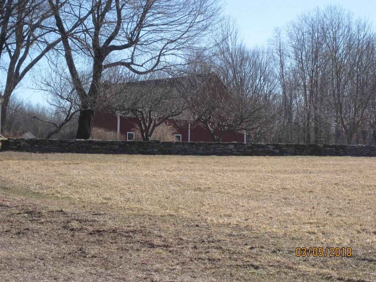
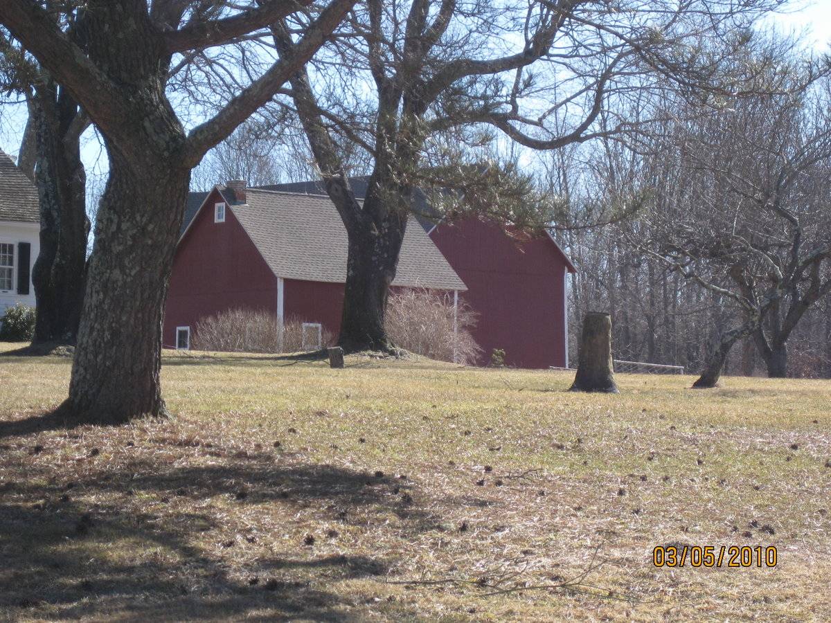
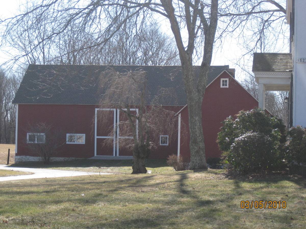
This is a 1 1/2 story side or eave-entry bank barn. The main facade faces roughly north and its ridge-line is parallel to Old Willimantic Road, which runs approximately east-west. The main entry is a pair of double-height sliding doors in the middle bay. The west bay has a six-pane window with trim. The east bay has two sets of two six-pane windows with trim. The ground gently slopes down towards the east facade, revealing a mortared field-stone foundation. The east gable-facade is blank except for a single six-pane window with trim towards the north corner. The south eave-facade of the barn has two adjacent windows with trim towards east corner. The rest of the facade appears blank, although there may be a entry in the middle bay. The west gable-facade ground grades away even further, revealing a two bay open basement. The rest of the facade is blank. The barn has vertical flush-board siding painted red with white trim and corner boards painted white. The roof has a projecting overhang and asphalt shingles.
Historical significance:
The oldest barns still found in the state are called the “English Barn,” “side-entry barn,” “eave entry,” or a 30 x 40. They are simple buildings with rectangular plan, pitched gable roof, and a door or doors located on one or both of the eave sides of the building based on the grain warehouses of the English colonists’ homeland. The name “30 by 40” originates from its size (in feet), which was large enough for 1 family and could service about 100 acres. The multi-purpose use of the English barn is reflected by the building’s construction in three distinct bays - one for each use. The middle bay was used for threshing, which is separating the seed from the stalk in wheat and oat by beating the stalks with a flail. The flanking bays would be for animals and hay storage.
The 19th century saw the introduction of a basement under the barn to allow for the easy collection and storage of a winter’s worth of manure from the animals sheltered within the building. The bank barn is characterized by the location of its main floor above grade, either through building into a hillside or by raising the building on a foundation. This innovation, aided by the introduction of windows for light and ventilation, would eventually be joined by the introduction of space to shelter more animals under the main floor of the barn.
Field Notes
Horse barn
- Use & Accessibility
Use (Historic)
Use (Present)
Exterior Visible from Public Road?
Yes
Demolished
n/a
Location Integrity
Unknown
- Environment
Related features
Environment features
Relationship to surroundings
The barn is behind and to the southeast of the house it is associated with. The ridge-line of the house is parallel to Old Willimantic Road, which it fronts. In front of the barn to the north are four sheds and a carriage house. Along with the house, this cluster of buildings create an U-shaped complex. To the east of the barn is a large tract of open space. To the south and further southeast are tracts of open space. To the east is the yard with a stone wall. To the north, across Old Willimantic Road, are tracts of open space. Directly to the north of the barn is a well. The total size of the site is 89.77 acres. The area is scattered residential, active agriculture, open space and woodland.
M/P = 019//054
- Typology & Materials
-
Building Typology
Materials
Structural System
n/a
Roof materials
Roof type
Approximate Dimensions
520 S.F.
- Source
-
Date Compiled
08/04/2010
Compiled By
Todd Levine, reviewed by the Connecticut Trust
Sources
Photography and field notes by David Bull.
Sexton, James, PhD; Survey Narrative of the Connecticut Barn, Connecticut Trust for Historic Preservation, Hamden, CT, 2005, http://www.connecticutbarns.org/history.
Visser, Thomas D.,Field Guide to New England Barns and Farm Buildings, University Press of New England, 1997.
Map of Columbia, CT, retrieved on August 4, 2010 from website www.zillow.com.
Town of Columbia assessors office, 323 Route 87, Columbia, CT 06237.
- PhotosClick on image to view full file
-