Barn Record Columbia
RETURN TO ‘FIND BARNS’
- Overview
-
Designations
Historic Significance
Architectural description:
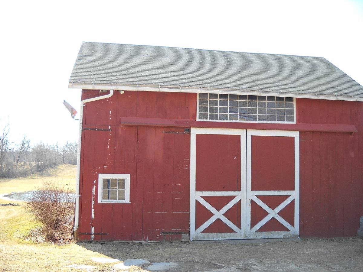
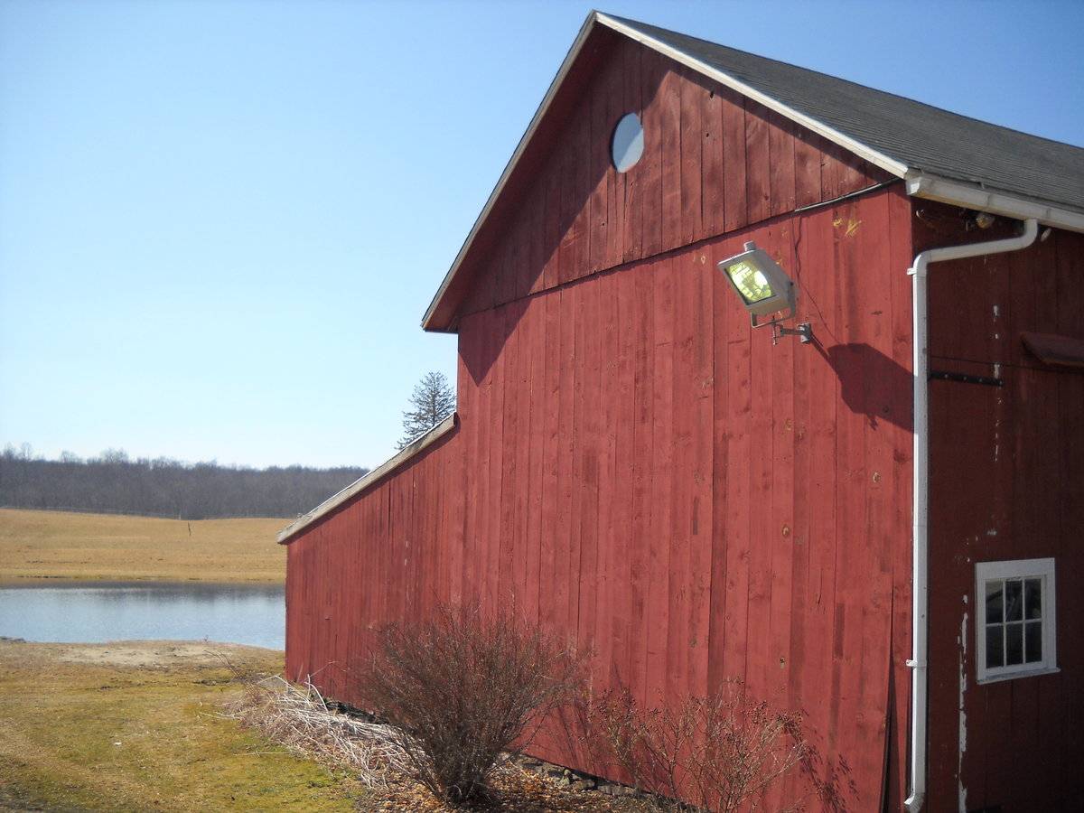
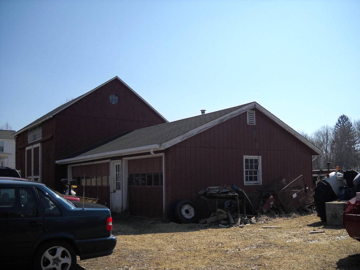
This is a 1 1/2 story side or eave-entry tripartite barn with a shed-roofed addition and a gable-roofed garage addition. The main facade faces northeast and the ridge-line is parallel to this portion of Route 87, which runs approximately southeast-northwest. The main entry is a pair of exterior sliding doors in the middle bay. The sliding door track has a hood. There are remnants of black-smithed hardware remaining on the facade from the original hinged doors. Above the entry is an unusual forty-pane transom. The east bay has a pass-through door towards the east corner with an inset six-pane window. The rest of the facade is blank. The southeast gable-facade is blank except for a round window in the gable attic. Extending southwest from the southwest eave-face is an open bayed, shed-roofed addition that encompasses the entire length of the barn. The southeast side of the addition is flush with the southeast gable-facade of the main structure. The northwest gable-facade has the gable-roofed addition extend to the northwest, encompassing the entire width of the facade. There is a round window in the gable attic of the main structure; otherwise the facade is blank. The round window is interesting in that it appears that it was once a six-pane window; the muntins are still in place. The gable-roofed addition is a two-bay garage with a pass-through door between the two overhead garage doors. The barn has vertical flush-board siding painted red with white trim and an un-mortared field-stone foundation. The roof has asphalt shingles.
Historical significance:
The oldest barns still found in the state are called the “English Barn,” “side-entry barn,” “eave entry,” or a 30 x 40. They are simple buildings with rectangular plan, pitched gable roof, and a door or doors located on one or both of the eave sides of the building based on the grain warehouses of the English colonists’ homeland. The name “30 by 40” originates from its size (in feet), which was large enough for 1 family and could service about 100 acres. The multi-purpose use of the English barn is reflected by the building’s construction in three distinct bays - one for each use. The middle bay was used for threshing, which is separating the seed from the stalk in wheat and oat by beating the stalks with a flail. The flanking bays would be for animals and hay storage.
Field Notes
Columbia Green NR Historic District Inventory description: House, c.1800, 2 1/2 stories, 5-bay facade, center entry with sidelights, transom. Shingled; 6-over-6 sash. Old barn to north.
- Use & Accessibility
Use (Historic)
Use (Present)
Exterior Visible from Public Road?
Yes
Demolished
n/a
Location Integrity
Unknown
- Environment
Related features
Environment features
Relationship to surroundings
The barn is next to and to the northwest of the house it is associated with. The ridge-line of the barn is parallel to the ridge-line of the house. To the northeast between the barn and Route 87 is a large driveway. To the southwest of the barn is a pond. To the southwest of the house is an above-ground pool with a deck. Further to the southwest is a tract of open space. To the south of the site, past section of woodland, is a cemetery. The total size of the site is 12 acres. The area is residential, active agriculture, open space and woodland.
M/P = 017//055
- Typology & Materials
-
Building Typology
Materials
Structural System
Roof materials
Roof type
Approximate Dimensions
660 S.F.
- Source
-
Date Compiled
08/01/2010
Compiled By
Todd Levine, reviewed by the Connecticut Trust
Sources
Photographs by Janice Thibodeau.
Clouette, Bruce, Roth, Matthew, Columbia Green National Register Historic District No. 90001759, National Park Service, 1990.
Sexton, James, PhD; Survey Narrative of the Connecticut Barn, Connecticut Trust for Historic Preservation, Hamden, CT, 2005, http://www.connecticutbarns.org/history.
Visser, Thomas D.,Field Guide to New England Barns and Farm Buildings, University Press of New England, 1997.
Map of Columbia, CT, retrieved on August 1, 2010 from website www.zillow.com.
Town of Columbia assessors office, 323 Route 87, Columbia, CT 06237.
- PhotosClick on image to view full file
-