Barn Record New London
RETURN TO ‘FIND BARNS’- Building Name (Common)
- n/a
- Building Name (Historic)
- n/a
- Address
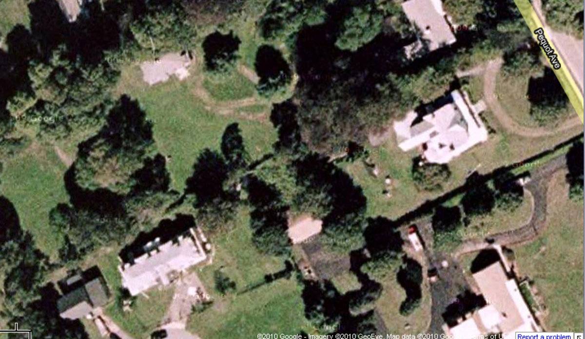
- 23 Harbor Lane, New London
- Typology

- Overview
-
Designations
Historic Significance
Architectural description:
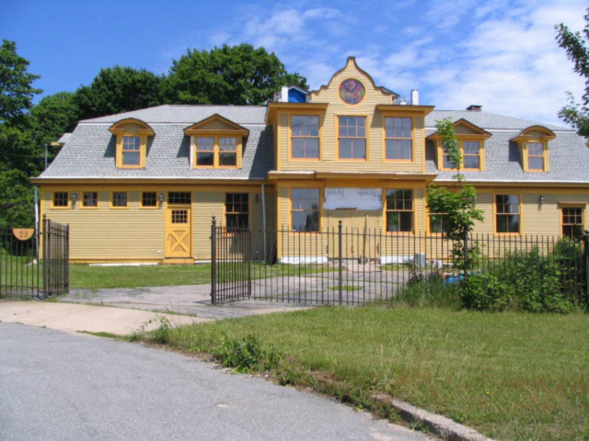
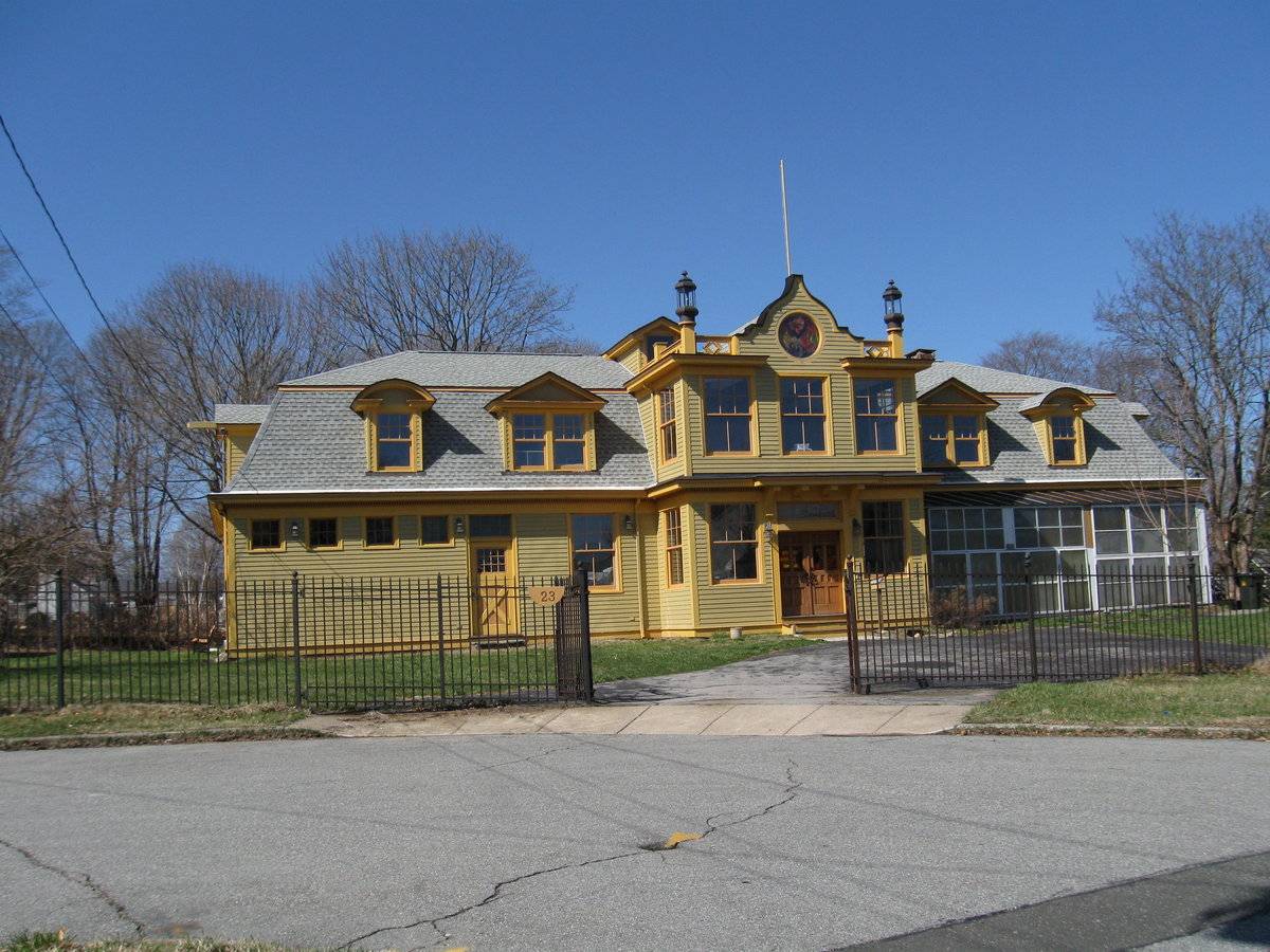
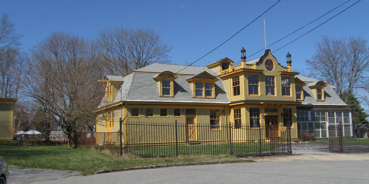
This Second Empire style mansard-roofed carriage barn structure is oriented with its longer side facing south, originally fronting on a drive that entered the site from Pequot Avenue to the east. The main block is one story with a full-height attic floor within the Mansard roof. At the center of the facade is a two-story projecting ornamental Dutch-style gabled pavilion containing entry doors at grade and six-over-six double hung windows on the first and second levels. A photograph from 1988 showing the gable and barn doors, indicates that this has been altered and enlarged in the conversion to a residence. West and east of the entry are six-over-six dormer windows: on each side a pair under a gabled pediment flanked by a single window under a segmental arched roof. In the ground floor the west (left) portion of the facade has four high stable windows at the end, a pass-through door to the right, and a six-over-six double hung window. The east (right) portion has been covered by an attached greenhouse addition.The north and south facades each have a large gabled dormer with a pair of six-over-six double hung windows and a projecting hoist beam. The exterior finish is now painted horizontal clapboard siding with corner board trim; the earlier photograph shows wood shingle siding stained dark with white painted trim.
Historical significance:
Until the 1830s, the horses used for riding and driving carriages were often kept in the main barn along with the other farm animals. By the 1850s, some New England farmers and built separate horse stables and carriage houses. Early carriage houses were built just to shelter a carriage and perhaps a sleigh, but no horses. The precursor to the twentieth-century garage, these outbuildings are distinguished by their large hinged doors, few windows, and proximity to the dooryard. The combined horse stable and carriage house continued to be a common farm building through the second half of the nineteenth century and the first decade of the twentieth century, until automobiles became common.
Field Notes
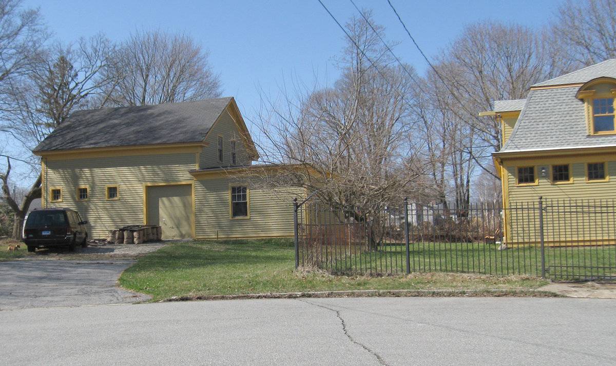
Originally part of the estate at 563 Pequot Avenue as shown on the historic district map from 1988. Mansard-roofed carriage barn at #23 now converted to a residence, and gable-roofed barn at #22 now used as a garage. The Pequot Colony Historic District, active between 1852 and 1930, is historically significant as one of the most prominent summer resort communities on the Connecticut shore. The southern end of New London was used primarily as farmland in the first two centuries following the founding of the city. In 1852, the shoreline railroad connecting New London to New York was completed; two local businessmen purchased 35 acres of the Harbor’s Mouth Farm and began the development of the resort area along Pequot Avenue facing the Thames River and Long Island Sound. A trolley line was built along Montauk Avenue in 1893, and employees of the large estates began to build their own homes along Montauk. In the early 20th century more homes were built as the large estates were subdivided, and more homes were winterized for year-round use. New London is a historically-rich community located at the convergence of the Thames River and Long Island Sound. The area was called Nameaug by the Pequot Indians. John Winthrop, Jr. founded the first English settlement here in 1646. Inhabitants informally named it Pequot after the tribe. On March 10, 1658 the town was officially named after London, England. The harbor was considered to be the best deep water harbor on Long Island Sound, and consequently New London became a base of American naval operations during the Revolutionary War. For several decades beginning in the early 19th century, New London was the second busiest whaling port in the world. The wealth that whaling brought into the city, and later connections by rail and water, furnished the capital to fund much of the city's present architecture, including examples from the early 19th-century whaling period, the late 19th-century industrial age, and an early 20th-century period of popularity as a summer colony for the wealthy.
- Use & Accessibility
Use (Historic)
Use (Present)
Exterior Visible from Public Road?
Yes
Demolished
n/a
Location Integrity
Original Site
- Environment
Related features
Environment features
Relationship to surroundings
Harbor Lane is a cul de sac giving access to what was formerly the rear grounds of a grand summer estate facing Pequot Avenue. The area is now a mix of large and more modest homes and carriage houses from the late 19th and early 20th centuries, most converted to year-round use.
- Typology & Materials
-
Building Typology
Materials
Structural System
Roof materials
Roof type
Approximate Dimensions
No.23: 34' x 90' - 3249 square feet. No. 22 2252 square feet.
- Source
-
Date Compiled
04/14/2010
Compiled By
Charlotte Hitchcock
Sources
Field notes and photographs by Charlotte Hitchcock 3/10/2010
New London Assessor’s Record Map/Lot H23/ 37/ 18/ and G23/ 37/ 19/
(#23 built 1864-1870, 34’ x 90’ carriage house, area 3249 sf)
(#22 built c. 1870, Barn 2252 sf).Churchill, Sharon, Pequot Colony National Register Historic District Nomination No 88002692, National Park Service, 1988, see 563 Pequot Avenue, Harbor Lane.
City of New London Office of Development and Planning, Preserving Our Heritage: A Guide to the National Register Historic Districts and Individually Listed Properties in New London, New London, CT 06320 undated.
Sexton, James, PhD, Survey Narrative of the Connecticut Barn, Connecticut Trust for Historic Preservation, Hamden, CT, 2005, http://www.connecticutbarns.org/history.
Visser, Thomas D., Field Guide to New England Barns and Farm Buildings, University Press of New England, 1997.
Wikipedia: http://en.wikipedia.org/wiki/New_London,_Connecticut - PhotosClick on image to view full file
-