Barn Record East Granby
RETURN TO ‘FIND BARNS’- Building Name (Common)
- n/a
- Building Name (Historic)
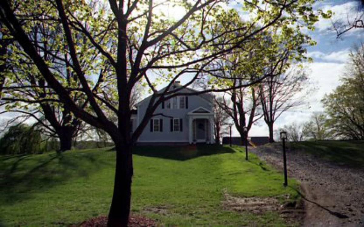
- Gearge B. Holcomb House
- Address
- 129 South Main Street, East Granby
- Typology

- Overview
-
Designations
Historic Significance
Architectural Description:
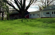
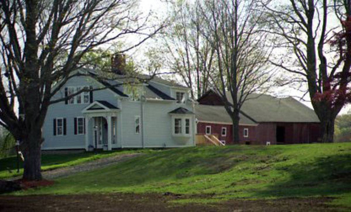
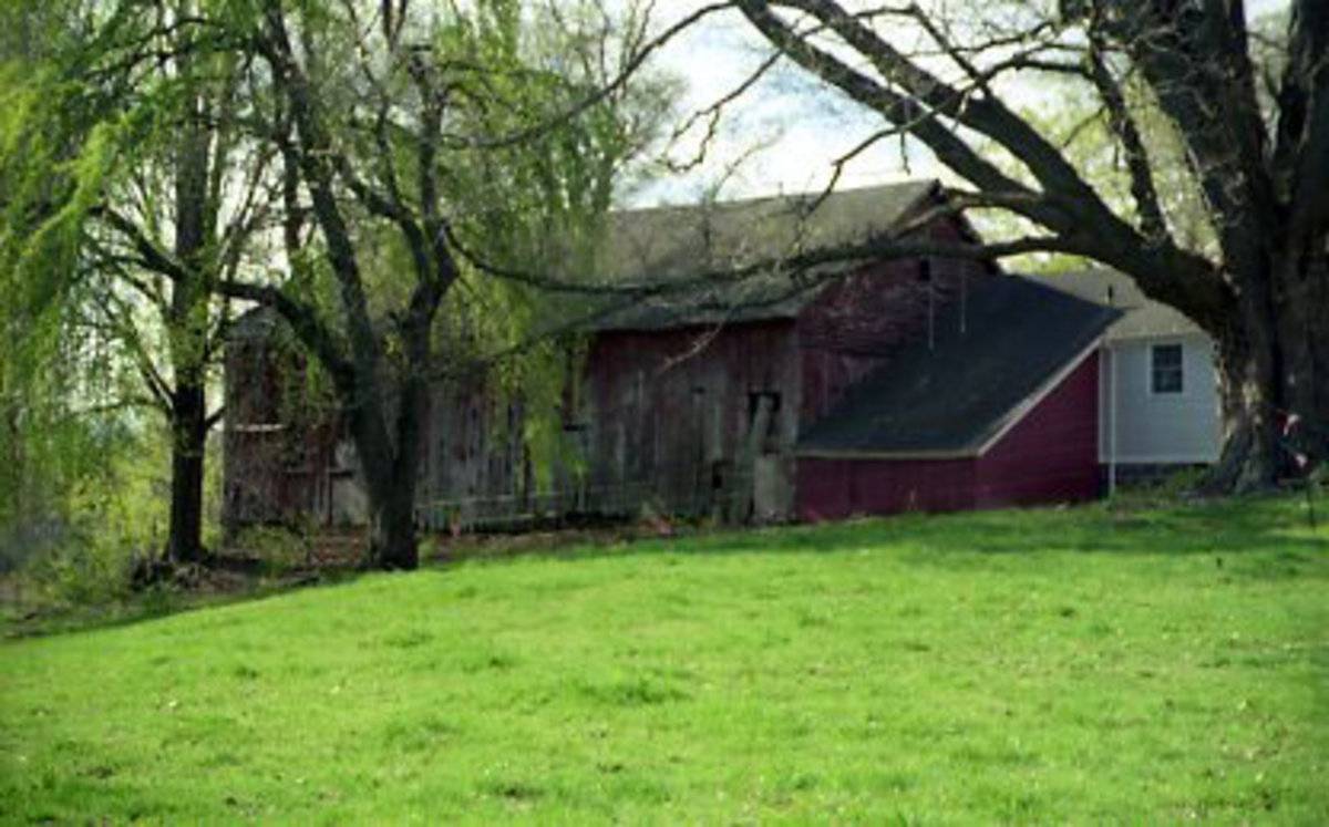
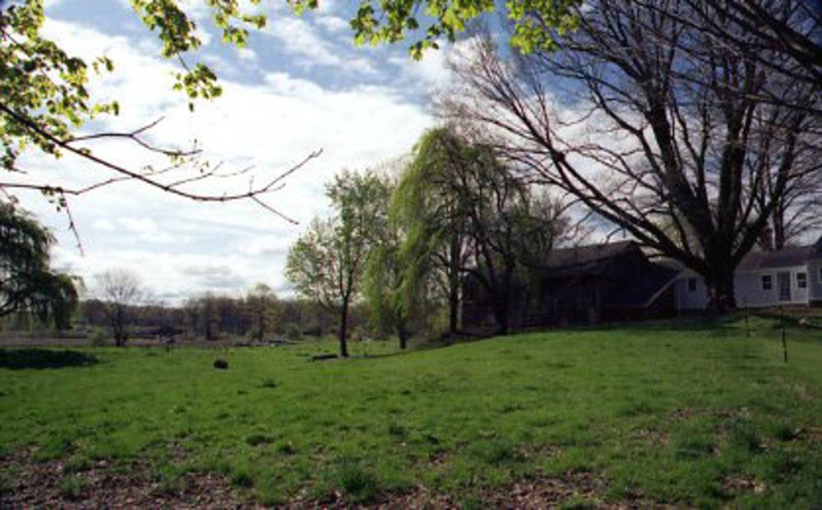
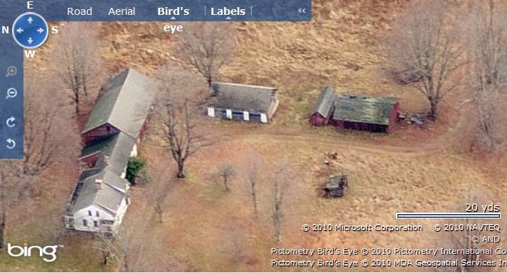
This is a 1 ½- story eave-entry bank barn connected to the main residence by a 1 ½ -story eave-entry gable-roof addition on its west gable-side. The ridge line of the barn and the main residence runs east-west perpendicular to the South Main Street. The main façade of the barn is the south eave-façade with the main entrance at the center through a double-height sliding wagon door. The south eave-side of the gable-roof addition on the west gable-side of the main barn is flush towards the west of the main south eave-façade. The east gable-side of the barn has a lower grade level to form the bank.
The wooden frame of the barn is supported on stone masonry foundation. The barn has red painted vertical siding walls and asphalt shingle roofing.
Historical Significance:The property including the circa 1840 Greek Revival main residence and the barn is contributing to East Granby historic district. [NR]
Connected barns tied all of the functions of a farmstead - home, hearth, workplace and barn - into a series of linked buildings. This is the “big house, little house, back house, barn” of nursery rhymes.
The oldest barns still found in the state are called the “English Barn,” “side-entry barn,” “eave entry,” or a 30 x 40. They are simple buildings with rectangular plan, pitched gable roof, and a door or doors located on one or both of the eave sides of the building based on the grain warehouses of the English colonists’ homeland. The name “30 by 40” originates from its size (in feet), which was large enough for 1 family and could service about 100 acres. The multi-purpose use of the English barn is reflected by the building’s construction in three distinct bays - one for each use. The middle bay was used for threshing, which is separating the seed from the stalk in wheat and oat by beating the stalks with a flail. The flanking bays would be for animals and hay storage.
The 19th century saw the introduction of a basement under the barn to allow for the easy collection and storage of a winter’s worth of manure from the animals sheltered within the building. The bank barn is characterized by the location of its main floor above grade, either through building into a hillside or by raising the building on a foundation.
This innovation, aided by the introduction of windows for light and ventilation, would eventually be joined by the introduction of space to shelter more animals under the main floor of the barn.Field Notes
The barn is attached to house that has been recently remodeled. But the barn appears to be in a state of decay. It is situated south of E. Granby HS near Heritage Farm Rd intersection generally facing W
- Use & Accessibility
Use (Historic)
Use (Present)
Exterior Visible from Public Road?
Yes
Demolished
n/a
Location Integrity
Unknown
- Environment
Related features
Environment features
Relationship to surroundings
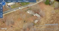
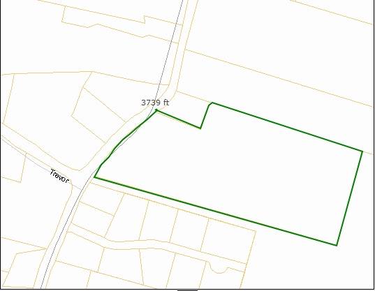
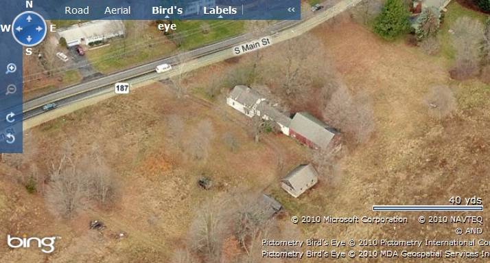
The 13.06 acres property is located in East Granby Historic District towards the east of South Main Street. It is situated in a pre-dominantly residential area of rural character. Parcels of open land designated for agriculture can be seen towards the east and the south of the property. Residential plots and dense vegetation can be seen towards the west of the property across the road.
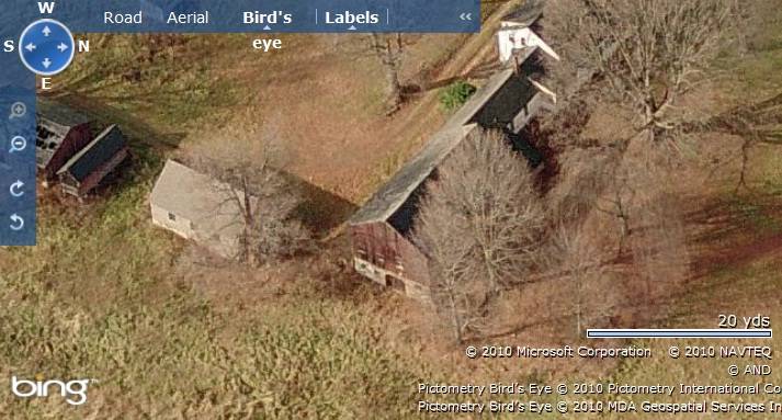
The barn is towards the north-east of the property connected to the circa 1840 Greek revival main residence, Gearge B. Holcomb House. The main residence is towards the west nearer to South Main Street. A 1 ½- story gable-roof shed can be seen towards the south-east of the barn with its ridge line running north-south, parallel to the road. Two other sheds can be seen towards further south-east of the barn. A contributing tobacco shed is located towards the southern edge of the property with parcels of farm land towards the east.
Note: The National Register nomination records six contributing structures in the property- the circa 1840 main residence, two sheds and three tobacco sheds associated with 184 South Main Street.
The East Granby Historic District encompasses a large rural residential/agricultural area (approximately two square miles) which extends from the Suffield town line on the north to about one mile below the East Granby town center. It is located on a broad open plain of rolling farmland on the east side of the Talcott Range, a ridgeline that divides the town almost in half. The district contains a large number of historic farmsteads, along with individual houses, strung out along three principal north-south streets: North Main, South Main, and East streets. At the town center, it includes Route 20, known as Rainbow Road, and School Street run from east to west. [NR]- Typology & Materials
-
Building Typology
Materials
Structural System
Roof materials
Roof type
Approximate Dimensions
n/a
- Source
-
Date Compiled
09/14/2010
Compiled By
T. Levine and M. Patnaik, reviewed by CT Trust
Sources
Photographs and field-notes provided by –
Doug Miller, photoguru@charter.netEast Granby Historic District, National Register Nomination Number- 88001318 NRIS, National Park Service, 1988.
http://pdfhost.focus.nps.gov/docs/NRHP/Text/88001318.pdf
http://pdfhost.focus.nps.gov/docs/NRHP/Photos/88001318.pdfInformation retrieved on September 14th, 2010 from website http://www.zillow.com
GIS Map information retrieved on September 14th, 2010 from website http://www.crcog.org
Hubka, Thomas C., Big House, Little House, Back House, Barn: The Connected Farm Buildings of New England, University Press of New England, Hanover NH 1984, 226 pages.
Sexton, James, PhD; Survey Narrative of the Connecticut Barn, Connecticut Trust for Historic Preservation, Hamden, CT, 2005, http://www.connecticutbarns.org/history.
Visser, Thomas D.,Field Guide to New England Barns and Farm Buildings, University Press of New England, 1997.
- PhotosClick on image to view full file
-