Barn Record Branford
RETURN TO ‘FIND BARNS’
- Overview
-
Designations
n/a
Historic Significance
Architectural description:
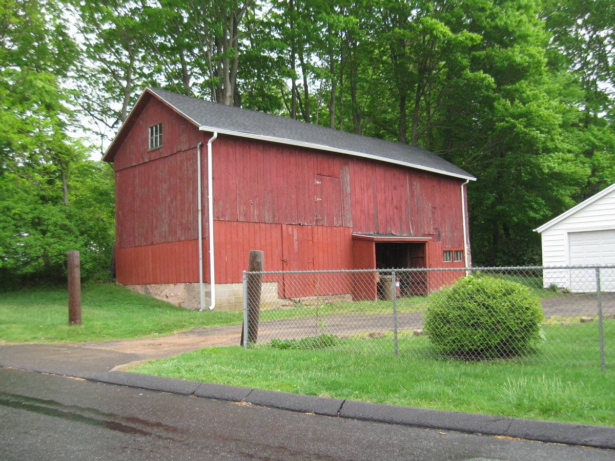
The barn is a 1 1/2-story, gable-roof rectangular structure. It is sited against a low embankment so that the foundation wall is not exposed along the rear or north side of the building. Differences in the character of the siding for the upper and lower portions of the barn’s walling are present. Older, rougher boards are located above, while smoother, more recently painted boards are located below. The presence of recently added concrete-block masonry in the foundation wall at the southwest corner suggest that the barn has either required extensive repair or has received alterations in recent years. The roof ridge is aligned east-west, with the axis of the ridge placed approximately perpendicular to the course of the public road.
The principal façade is the south eave wall. The main entry is located off-center in the eastern half of the wall. Apparently the result of alteration in its present form, this double-width, single-height entry is left open rather than fitted with doors. Instead, the doorway is sheltered by a shallow, un-floored, one-story porch structure with a shed roof and side walls that project forward about three feet from the main wall. The south wall holds four more entries, each fitted with a single-leaf door hung on exterior side hinges. Two of these doorways are on the ground story, one for each half of the wall, each door placed roughly central to its respective half. The other two are loft doors, again with one for each half of the wall. This wall also has two three-pane, fixed-sash windows, located immediately next to each other on the ground story at the east corner.
The west gable-end wall is pierced by a single opening, a six-pane, fixed-sash window located in the gable attic.
The foundation wall is built of concrete and concrete-block. On the east gable end, as visible from the south, the concrete forms the full ground story wall. On the south and west walls, the concrete extends upward for no more than about three feet above grade. The grade rises toward the north. The barn is clad in vertical flush-board siding painted red, although the texture and color shade varies between upper and lower portions of the walling, as noted above. The roof is covered with asphalt shingle. The roof extends beyond the eaves by about one to two feet.
Historical significance:The oldest barns still found in the state are called the “English Barn,” “side-entry barn,” “eave entry,” or a 30 x 40. They are simple buildings with rectangular plan, pitched gable roof, and a door or doors located on one or both of the eaves sides of the building, based on the grain warehouses of the English colonists’ homeland. The name “30 x 40” originates from its size (in feet), which was large enough for 1 family and could service about 100 acres. The multi-purpose use of the English barn is reflected by the building’s construction in three distinct bays – one for each use. The middle bay was used for threshing, which is separating the seed from the stalk by beating the stalks with a flail. The flanking bays would be for animals and hay storage.
Field Notes
Some of the dilapidated original boards on the barn's facade have been replaced with new ones.
- Use & Accessibility
Use (Historic)
Use (Present)
Exterior Visible from Public Road?
Yes
Demolished
n/a
Location Integrity
Unknown
- Environment
Related features
Environment features
Relationship to surroundings
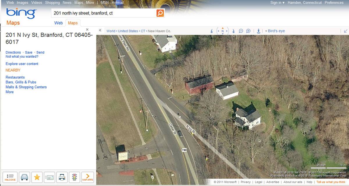
The property is located on the east side of North Ivy Street, immediately to the south of the Y junction where Ivy Street joins with Cedar Street and the roadway continues northward as Brushy Plain Road. This location is approximately a half-mile north of the Branford Center and a quarter-mile north of Interstate 95. The general character of the near vicinity is a mixed one, with modern commercial properties occupying the area to the south toward the interstate, and older exurban residential properties including some other historic farmsteads extending along Brushy Plain Road toward the north. Also to the north, located at intervals along the road, are the entries to residential subdivisions built in recent years, while much of the nearby land remains in dense woodland.
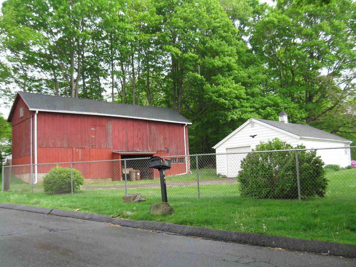
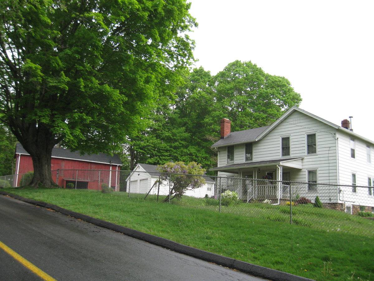
This property, which is 4.25 acres in extent, evidently represents the core area of a larger historic property, whether a large farmstead or a relatively early suburban property. (The house appears to date to about the latter half of the 19th century.) There are four buildings on the property, including the barn, the dwelling, a garage, and a shed (or perhaps poultry house). The barn stands by the north edge of the property, about 40 feet from the public roadside. The dwelling, about 120 feet south of the barn, is set back from the road by about 60 feet. The garage stands next to the southeast corner of the barn, just 10 feet apart from the latter and about 100 feet from the road. The shed is about 50 feet behind or to the east of the barn. The area between house, barn, garage, and public road forms a courtyard area occupied mainly by lawn, which also extends in front of the house and behind the house and garage. An asphalt driveway runs by the front of the barn to reach the garage. An orchard of about a dozen fruit trees and about an acre in area is situated to the south and southeast of the house. Rows of hardwood trees extend along the west and north edges of the property. The rear or east half of the property consists of relatively dense woodland.
- Typology & Materials
-
Building Typology
Materials
Structural System
Roof materials
Roof type
Approximate Dimensions
704 square feet.
- Source
-
Date Compiled
04/09/2011
Compiled By
P. Pendleton & T. Levine, reviewed by CT Trust
Sources
Field notes by Manjusha; photographs by Charlotte Hitchcock, date 5/10/2010.
Town of Branford Assessor’s Record:
http://data.visionappraisal.com/BranfordCT/DEFAULT.asp
Parcel ID: D05-000003-00026Aerial Mapping:
http://www.bing.com/maps accessed 4/9/2011.Sexton, James, PhD, Survey Narrative of the Connecticut Barn, Connecticut Trust for Historic Preservation, Hamden, CT, 2005, http://www.connecticutbarns.org/history.
Visser, Thomas D., Field Guide to New England Barns and Farm Buildings, University Press of New England, 1997.
- PhotosClick on image to view full file
-