Barn Record Branford
RETURN TO ‘FIND BARNS’
- Overview
-
Designations
n/a
Historic Significance
Architectural description:
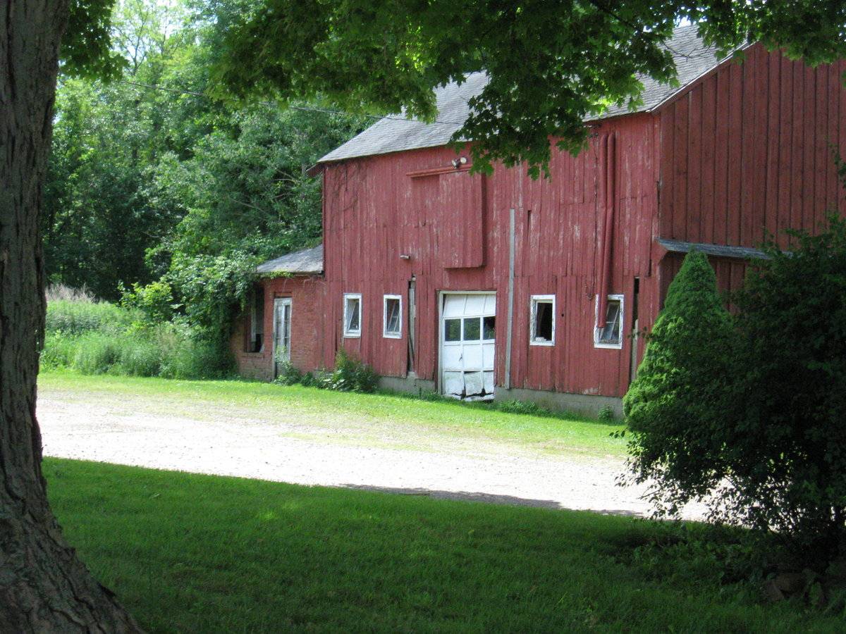
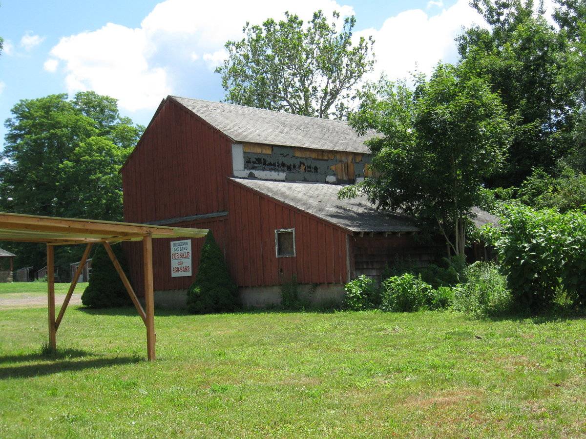
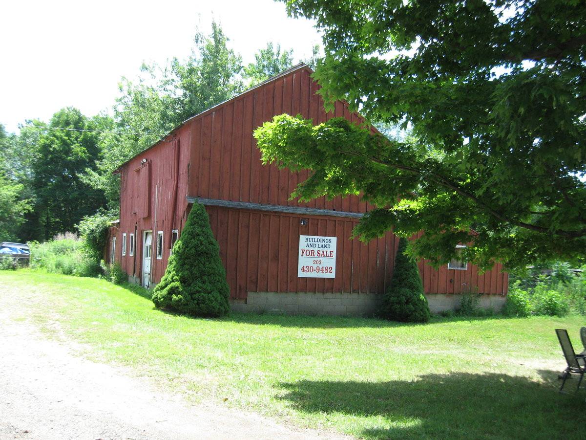
The barn is a 2 1/2-story, gable-roof, rectangular structure. The ridge-line is aligned north-south and extends at an angle approximately perpendicular to the course of the public road. The barn, apparently a relatively late example of the English barn type (late date based on its concrete block foundation), has two evident additions. These are a 1-story, shed-roof addition positioned against the west side and extending the full length of the main block, and an apparently single-cell, 1-story, gable-roof extension at the south end. The latter small section is built of brick masonry and may represent a milk house addition. It is possible that the main block of the barn represents an older structure rebuilt, that is, raised on a new concrete foundation and floor for 20th-century dairying requirements.
The principal façade is the east eave-side of the barn. The main entry is located in the center of this wall. It is a single-height vehicle bay entry, somewhat narrow for a traditional barn wagon entry, fitted with a metal overhead garage door of twelve-panel design with window panes composing the second of four vertical rows of panels. The entry is flanked by pairs of four-pane wooden hopper windows. On the second-story there is a loft entry holding an exterior sliding door mounted on an open track.
The north gable-end of the barn is blank as regards openings, but the wall is divided in half vertically by a narrow pent structure. The west eaves wall is mostly obscured by the presence of the shed-roof addition on that side; the revealed second-story level is also blank.
The north end of the shed-roof addition is pierced by a single centrally positioned window. The west eave-side is apparently blank.
The east eave-side of the milk house addition has two openings. The entry, located off-center toward the north, is a pass-through doorway fitted with a wooden door designed with a long vertical 6-pane sash over a wooden panel. The relatively tall window opening, located toward the south corner, is presently without sash.
The main block and shed-roofed addition are built on a foundation of concrete block masonry. The foundation wall of the milk house is not visible above grade. The east and west eave-sides of the main block are clad in vertical flush-board siding, painted red on the east and yellow with white trim on the west (second story visible). The north end of the overall building (comprising walls of two frame sections) is clad in board-and-batten siding painted red. The west wall of the shed-roof addition is clad in clapboard painted red. The walls of the milk house are built of common bond brick masonry.
The roofs of all three sections are covered with asphalt shingle. The roofs of the main block and of the milk house project just a few inches beyond the eaves on the eaves walls. The main block and shed addition roofs are flush with the building’s end wall on the north end. The shed addition’s roof overhangs by about one foot on the west eaves wall, and that roof’s rafter ends are exposed.
Historical significance:The oldest barns still found in the state are called the “English Barn,” “side-entry barn,” “eave entry,” or a 30 x 40. They are simple buildings with rectangular plan, pitched gable roof, and a door or doors located on one or both of the eaves sides of the building, based on the grain warehouses of the English colonists’ homeland. The name “30 x 40” originates from its size (in feet), which was large enough for 1 family and could service about 100 acres. The multi-purpose use of the English barn is reflected by the building’s construction in three distinct bays – one for each use. The middle bay was used for threshing, which is separating the seed from the stalk by beating the stalks with a flail. The flanking bays would be for animals and hay storage.
Field Notes
WPA survey, American Buildings Survey, Branford Phase I survey, for sale/at risk
- Use & Accessibility
Use (Historic)
Use (Present)
Exterior Visible from Public Road?
Yes
Demolished
n/a
Location Integrity
Unknown
- Environment
Related features
Environment features
Relationship to surroundings
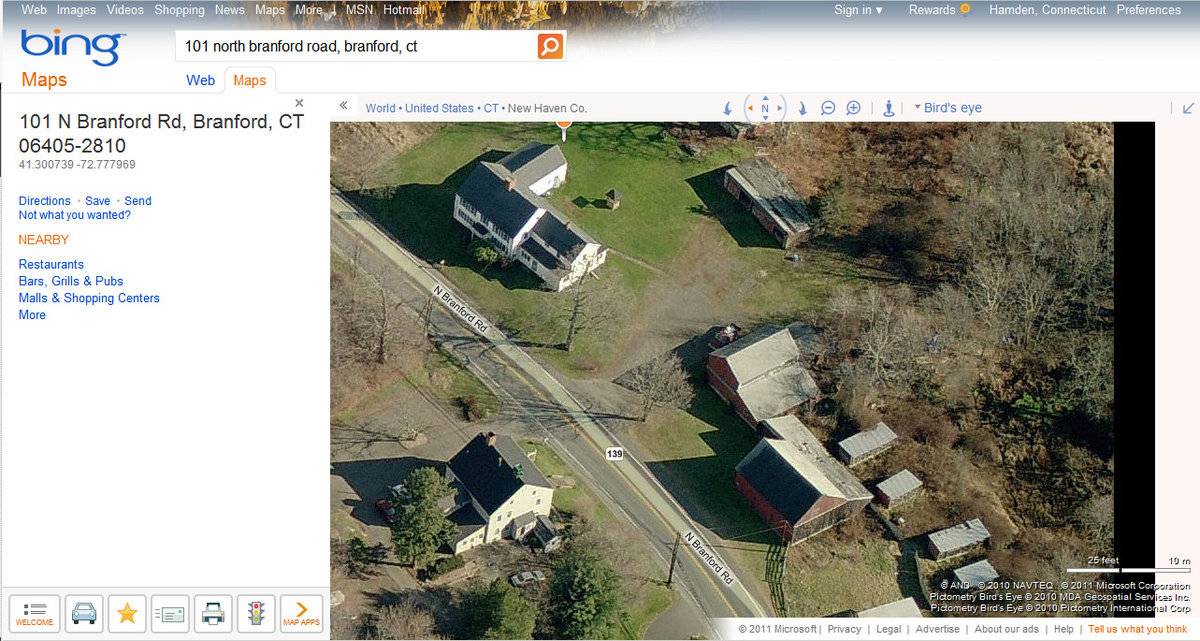
The property is located on the south side of North Branford Road (Route 139), approximately one mile NE of Branford Center and one-third mile north of the junction of Route 139 with US Route 1. The general character of the near vicinity is that of a substantial concentration of light industrial facilities, although much of the land surface is woodland.
As of late 2010, this property, 16.6 acres in extent and largely wooded, was a former farm property in process of reverting to woodland. The agricultural buildings are deteriorating. At some point in very recent years, a barn, the largest among them and sited immediately next to the highway, was taken down (as known from comparison of the Bing Map image with the Google Maps image).
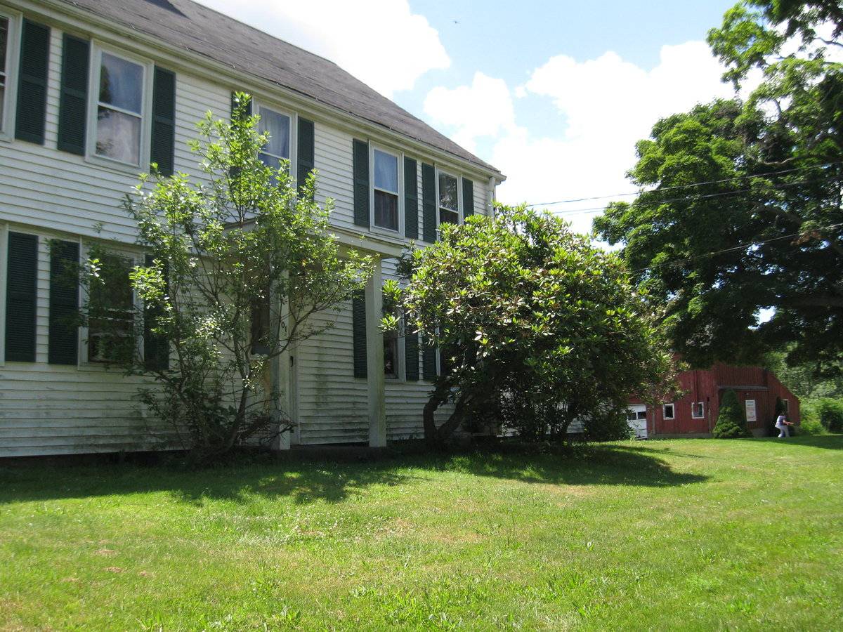
The farmstead building complex is situated at the center of the property boundary on the public road, with the complex ranged along the road, house at northeast end of the range. The large house is set back from the roadside by about 50 feet. The surviving barn stands about 80 feet back from the road and 100 feet SW of the dwelling. A gravel drive and parking area intervenes between house and barn. A line of several poultry houses and sheds of varying size extends along the rear of the complex, from a position about 100 feet directly behind (SE) of the house to a site about 150 feet SW of the barn. These smaller buildings are ranged along the edge of the woodland, although wild shrubs and saplings have encroached thickly among the farm buildings. Large hardwood shade trees flank the drive entrance. Lawn surrounds the house and extends in front of the barn and along the roadside. A large rectangular open area, a former arable field about 3 acres in extent, extends to the NE from the house and along the public road. The remainder of the property is woodland.
- Typology & Materials
-
Building Typology
Materials
Structural System
Roof materials
Roof type
Approximate Dimensions
1225 square feet.
- Source
-
Date Compiled
05/06/2011
Compiled By
P. Pendleton & T. Levine, reviewed by CT Trust
Sources
Field notes and photographs by Leah Beckett and Charlotte Hitchcock - date 6/29/2010.
Town of Branford Assessor’s Record:
Parcel ID: G04/G05-003-00002Aerial Mapping:
http://maps.google.com
accessed 5/6/2011.Sexton, James, PhD, Survey Narrative of the Connecticut Barn, Connecticut Trust for Historic Preservation, Hamden, CT, 2005, http://www.connecticutbarns.org/history.
Visser, Thomas D., Field Guide to New England Barns and Farm Buildings, University Press of New England, 1997.
- PhotosClick on image to view full file
-