Barn Record Sharon
RETURN TO ‘FIND BARNS’- Building Name (Common)
- n/a
- Building Name (Historic)
- n/a
- Address
- 119 Amenia Union Road (Rte 41), Sharon
- Typology

- Overview
-
Designations
Historic Significance
Architectural description:
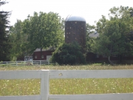
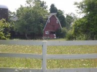
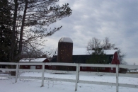
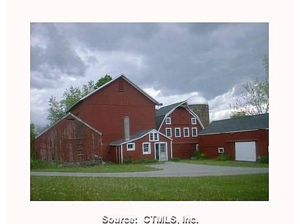
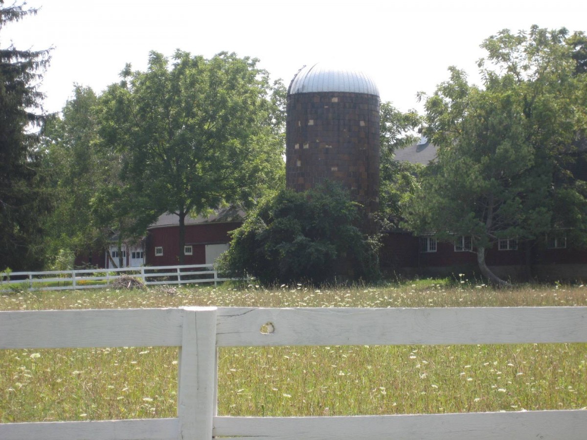
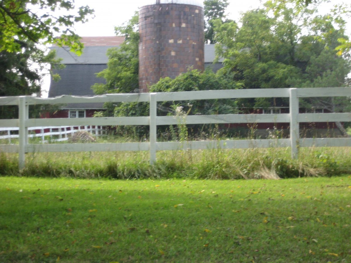
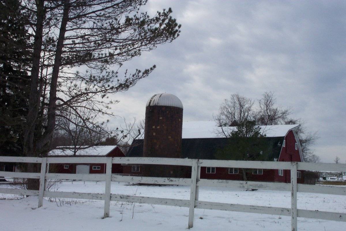
This is a 2 1/2-story, Dutch gambrel-roofed, gable-entry barn with an attached silo. The main facades faces north and the ridge-line of the barn is parallel to this portion of Amenia Union Road, which runs approximately north-south. The main entry is a pair of X-braced, exterior sliding doors (now fallen) in the center of the south gable-facade. Flanking the entry are a set of two nine-pane hopper windows with trim. Above the main entry in the second level is a centered X-braced Dutch door. Beneath the apex of the projected hood in the roof is a pair of large sliding hay doors, with the tracks parallel to the line of the roof. Flanking the hay doors are nine-pane hopper windows with trim. The east eave-side of the barn has a series sets of two, nine-pane hopper windows with trim below the eave. Off center to the south on the east eave-side of the barn is a connector to the porcelain-enamel tile silo.
Centered in the south gable-side of the barn are a pair of exterior sliding doors. Flanking the entry appear to be nine-pane hopper windows with trim. In the second level of the south gable-side are a series of four twelve-pane windows equally spaced. Beneath the apex of the projected hood in the roof is a pair of sliding hay doors, with the tracks parallel to the line of the roof. Flanking the hay doors are nine-pane hopper windows. The west eave-side of the barn is mostly out of sight due to the gable-roofed barn adjacent to the west of it. The barn has horizontal siding painted red with white trim. The roof has a projecting overhang with hay hood on both gable faces. The roof is covered with asphalt shingles and has two metal ventilators atop the ridge. The foundation is concrete.
Historical significance:
By the early 20th century agricultural engineers developed a new approach to dairy barn design: the ground-level stable barn, to reduce the spread of tuberculosis bacteria by improving ventilation, lighting, and reducing the airborne dust of manure. A concrete slab typically serves as the floor for the cow stables. Many farmers converted manure basements in older barns into ground-level stables with concrete floors. Some older barns were jacked up and set on new first stories to allow sufficient headroom. With the stables occupying the entire first story, the space above serves a a hayloft. By the 1920s most ground-level stable barns were being constructed with lightweight balloon frames using two-by-fours or two-by-sixes for most of the timbers. Novelty or tongue-and-groove beveled siding is common on the walls, although asbestos cement shingles also were a popular sheathing. Some barns have concrete for the first-story walls, either poured in place or built up out of blocks. The gambrel roof design was universally accepted as it enclosed a much greater volume than a gable roof did, and its shape could be formed with trusses.
Field Notes
Located in the Sharon Local Historic District.
- Use & Accessibility
- Environment
Related features
Environment features
Relationship to surroundings
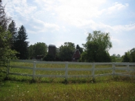
The gambrel barn is at the heart of a farming complex. The gambrel barn is behind and to the northwest of the house it is associated with. The ridge-line of the house is parallel to the ridge-line of the gambrel barn. The house fronts Amenia Union Road and has a white picket fence demarcating the east end of the 7.40 acre site, as well as the north border. To the south of the gambrel barn is an English barn and possibly the oldest of the outbuildings. To the west of the gambrel barn is a 2 1/2-story gable-roofed barn. To the south of the 2 1/2-story barn is a workshop. Further west of the gambrel barn is a three bay wagon shed. To the northeast of the gambrel barn is a small body of water. A driveway separates the house from the barn and runs east-west back behind the house to a gable-roofed barn with a cupola. Other sheds line the driveway. To the west are tracts of open space. The area surrounding the site is residential, active agriculture, open space and woodland.
FGR1 Garage 972 S.F.
SHD1 Shed 121 S.F.
SHD1 Shed 294 S.F.
BRN1 Barn 1 St. 1000 S.F.
BRN1 Barn 1 St. 480 S.F.
SHD1 Shed 108 S.F.
BRN1 Barn 1 St. 846 S.F.
SLO2 Silo Porcelan 800 DIAxHT
BRN5 Barn 2 St. 2788 S.F.
SHP1 Work Shop 1426 S.F.
SHD1 Shed 480 S.F.
SHP1 Work Shop 240 S.F.- Typology & Materials
-
Building Typology
Materials
Structural System
n/a
Roof materials
Roof type
Approximate Dimensions
n/a
- Source
-
Date Compiled
08/24/2010
Compiled By
Todd Levine, reviewed by the Connecticut Trust
Sources
Photographs by Libby Hall - 8/23/2010.
Additional photograph by Adele Strelchun - 2/6/2008.
Sexton, James, PhD; Survey Narrative of the Connecticut Barn, Connecticut Trust for Historic Preservation, Hamden, CT, 2005, http://www.connecticutbarns.org/history.
Visser, Thomas D.,Field Guide to New England Barns and Farm Buildings, University Press of New England, 1997.
Vision Appraisal Online Database. www.visionappraisal.com/sharonct.
Map of Sharon, CT, retrieved on August 24, 2010 from website www.zillow.com.
Local Historic District - Sharon Historic District, 1975,1985,1991:
http://www.historicdistrictsct.org - accessed 5/24/2012. - PhotosClick on image to view full file
-