Barn Record Cheshire
RETURN TO ‘FIND BARNS’- Building Name (Common)
- Michael's Greenhouses, Inc./Arisco Farms
- Building Name (Historic)
- Michael's Greenhouses
- Address
- 300 South Meriden Road, Cheshire
- Typology

- Overview
-
Designations
n/a
Historic Significance
Architectural description:
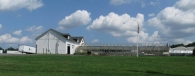
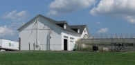
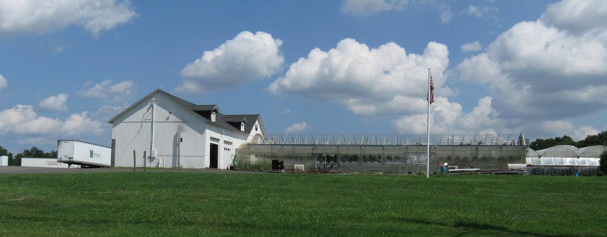
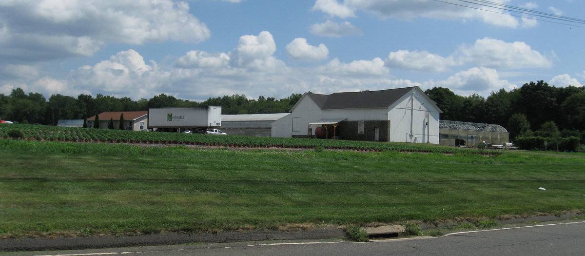
This is a 1 ½-story gable-roofed barn structure with a gable-roofed addition and a shed-roofed addition. The central block of the barn is oriented with its ridge-line north-south, parallel to South Meriden Road. A large 1 ½-story gable-roofed wing extends west with its ridge-line oriented east-west. A 1-story shed-roofed addition is attached at the east eave-side of the main block, covering the full width.
The south eave-side of the west addition has two overhead garage doors at grade and two small attic dormers at the west and east corners of the roof. Extending south off the south gable-façade of the main block of the barn is a large triple-arched greenhouse structure extending south.
The east side of the shed addition appears to have a door in the center.
The north side of the shed-roofed addition and the main block appear to be blank. Located along the west portion of the north eave-side of the west wing is a shed-roofed porch roof and a pass-through door. The west gable-end of the barn is blank.
The structures have vertical siding painted white except for the lower half of the north eave-side of the barn which appears to be a cobblestone wall and some areas of the west and south sides which have concrete half-height foundation walls, painted white. The roofs have projecting overhangs and are asphalt shingles.
Historical significance:The oldest barns still found in the state are called the “English Barn,” “side-entry barn,” “eave entry,” or a 30 x 40. They are simple buildings with rectangular plan, pitched gable roof, and a door or doors located on one or both of the eave sides of the building based on the grain warehouses of the English colonists’ homeland. The name “30 by 40” originates from its size (in feet), which was large enough for 1 family and could service about 100 acres. The multi-purpose use of the English barn is reflected by the building’s construction in three distinct bays - one for each use. The middle bay was used for threshing, which is separating the seed from the stalk in wheat and oat by beating the stalks with a flail. The flanking bays would be for animals and hay storage.
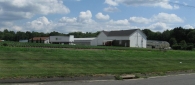
These structures have been altered almost beyond recognition for use in the wholesale plant business, in conjunction with extensive plastic hoop greenhouses.
Field Notes
Wholesale greenhouse business. Rubble stone wall on north side for cold storage.
- Use & Accessibility
Use (Historic)
Use (Present)
Exterior Visible from Public Road?
Yes
Demolished
n/a
Location Integrity
Unknown
- Environment
Related features
Environment features
Relationship to surroundings
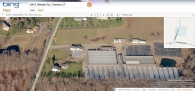
The barn is to the east of South Meriden Road, which runs approximately north-south. Located to the east and south of the barn is a large complex of various modern hoop-style greenhouses. To the north of the barn and extending to the east and north is a large open field. The total size of the site is 37.05 acres. The area surrounding the site is residential, agricultural, and woodland. It is located in the eastern part of Cheshire, east of Route 10, north of Route 70, major through roads, and west of Broad Brook Reservoir.
- Typology & Materials
-
Building Typology
Materials
Structural System
Roof materials
Roof type
Approximate Dimensions
35 x 96 feet
- Source
-
Date Compiled
03/26/2011
Compiled By
A. Ehrgott & T. Levine, reviewed by CT Trust
Sources
Field notes and photographs by Kristen Young date 08/16/2010.
Additional field notes by Elizabeth P. Fox - 11/6/2010.
Town of Cheshire Assessor’s Record http://www.prophecyone.us/fieldcard.php?property_id=2171235
Parcel ID: 59-62
GIS Viewer: http://www.cogcnvgis.com/cheshire/ags_map/Aerial Mapping:
http://www.bing.com/maps accessed 03/26/2011.Sexton, James, PhD, Survey Narrative of the Connecticut Barn, Connecticut Trust for Historic Preservation, Hamden, CT, 2005, http://www.connecticutbarns.org/history.
Visser, Thomas D., Field Guide to New England Barns and Farm Buildings, University Press of New England, 1997.
- PhotosClick on image to view full file
-