Barn Record Tolland
RETURN TO ‘FIND BARNS’- Building Name (Common)
- n/a
- Building Name (Historic)
- n/a
- Address
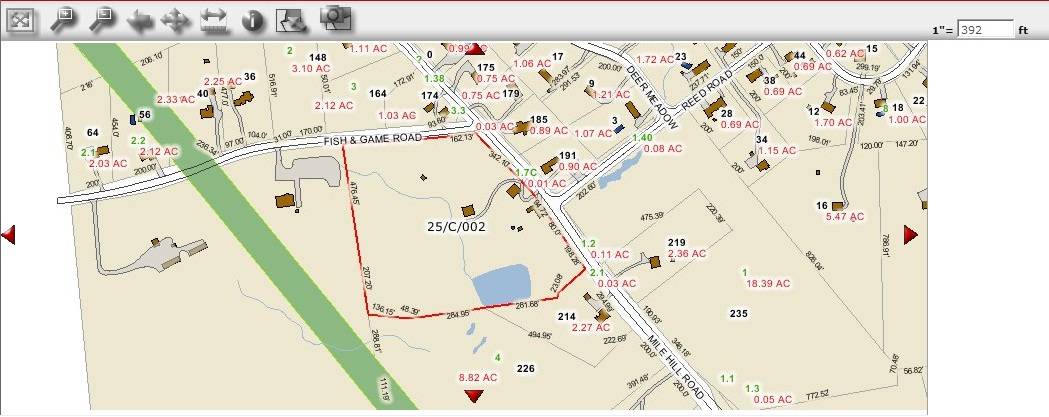
- 192 Mile Hill Road (Route 31), Tolland
- Typology

- Overview
-
Designations
n/a
Historic Significance
Architectural description:
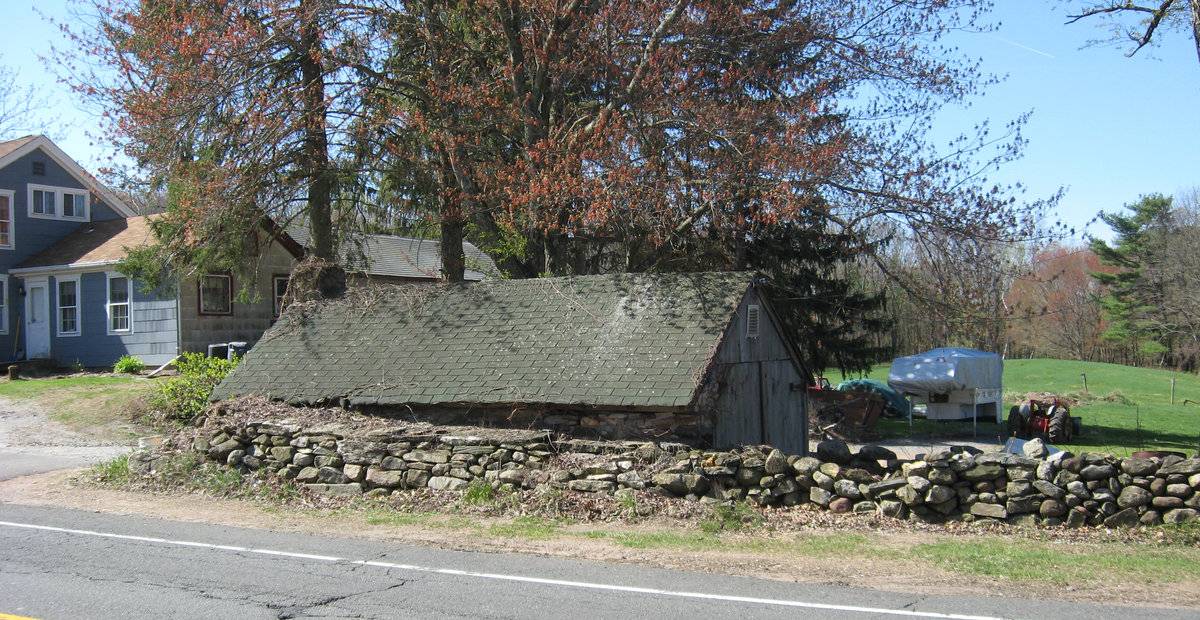
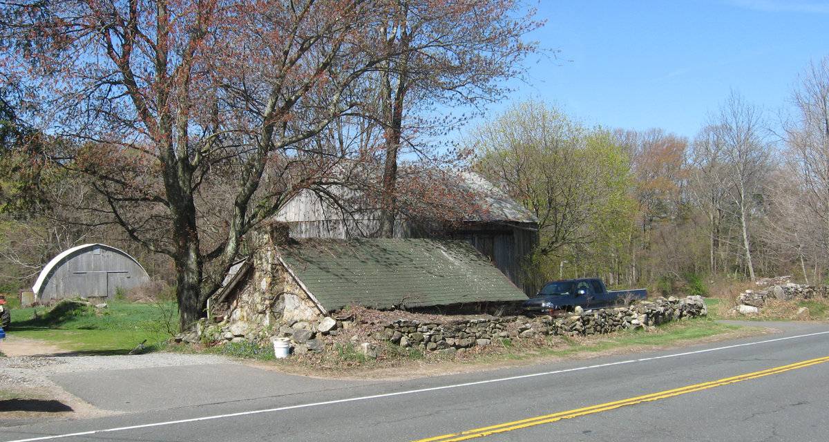
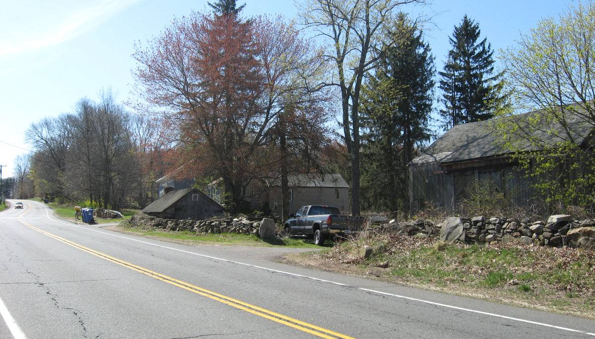
This is a multi-unit barn complex towards the west of Mile Hill Road comprising of an eave-entry gable-roof barn towards the east, Barn-I, a gable-roof subterranean barn towards the southeast of Barn-I, Barn-II and a semi-circular roof Quonset barn towards the west, Barn-III. The ridge lines of both Barn-I and Barn-II runs north-south, almost parallel to each other and to Mile Hill Road while that of Barn-III runs east-west.
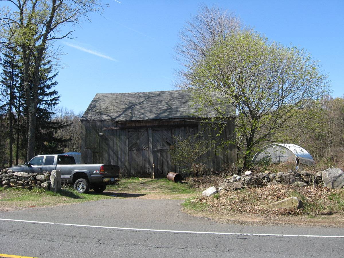
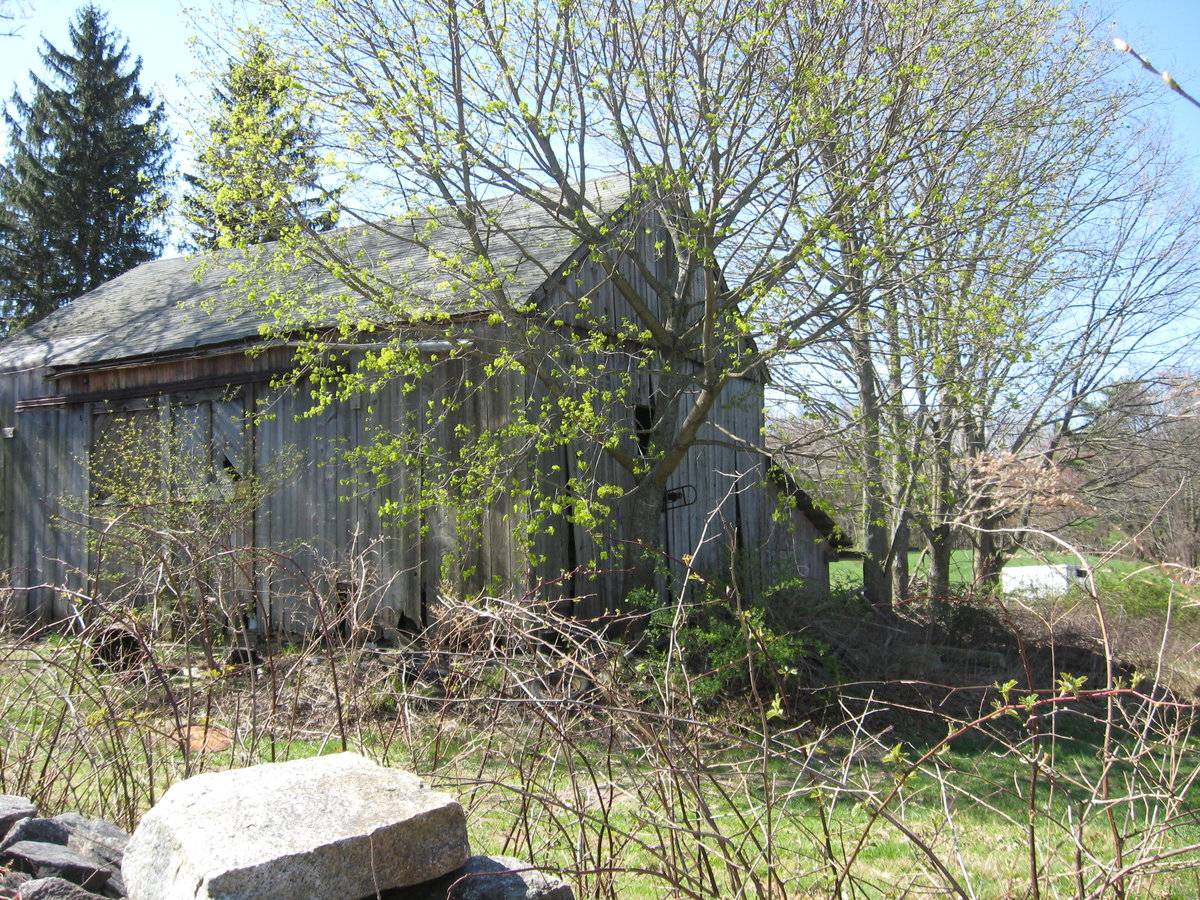
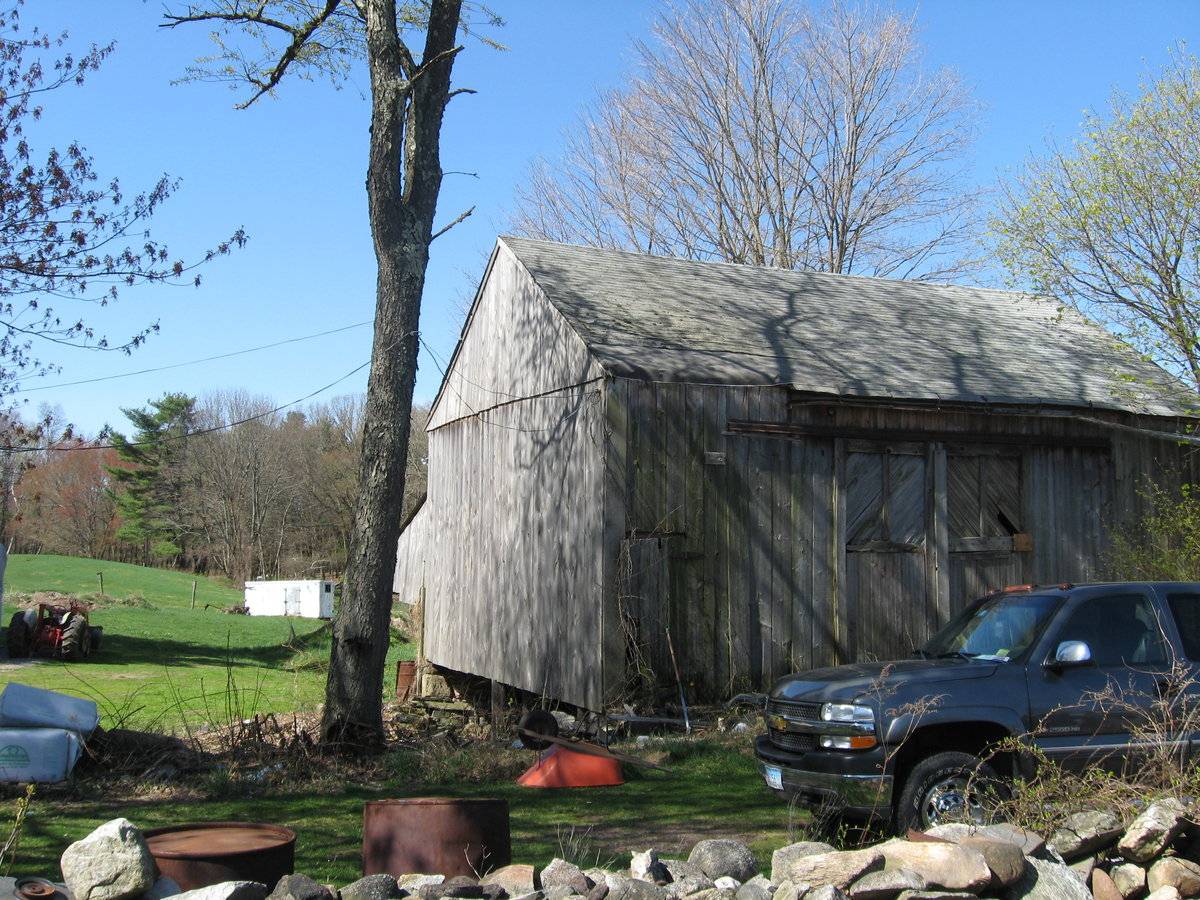
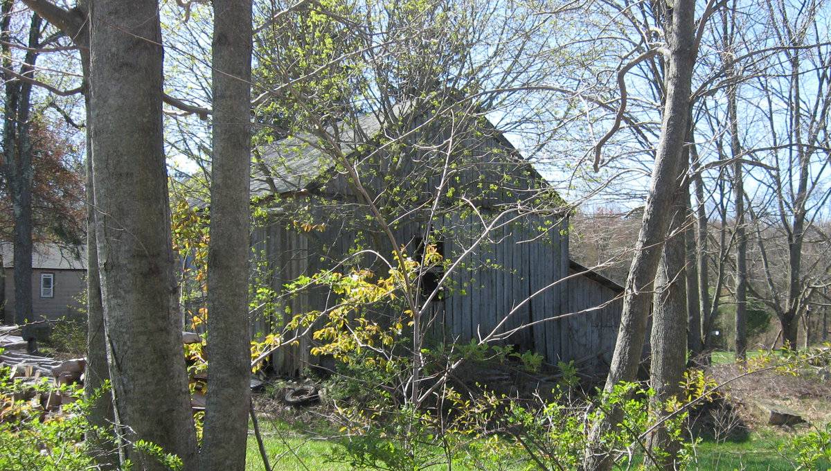
Barn-I: This is a 1 ½ - story three-bay eave-entry barn with a shed-roof encompassing the entire length of its west eave-side. The ridge line of the barn runs north-south almost parallel to Mile Hill Road. The three-bay east eave-side of the barn facing the road is the main façade with the main entrance centered in the middle bay through a pair of exterior-hung double-height sliding wagon doors with diagonal boards in the upper portion of the door leafs. The façade has a second entrance towards the extreme south through a hinged pass-through door. The south gable-end of the barn is blank with a distinct girt siding divide line separating the gable attic. The grade level along the south gable-end gradually declines towards the west revealing the wood and field stone foundation of the barn. The north gable-end of the barn has a window opening at the center with the gable attic separated by a distinct girt siding divide line. The north side-wall of the shed-roof addition on the west eave-side of the barn is flush with the north gable-end of the main barn.
The wooden frame of the barn is supported on wood and field stone foundation. The barn has asphalt shingles roofing and grey painted vertical siding walls.
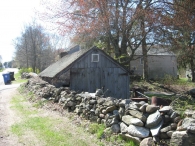
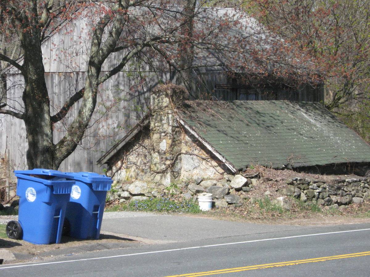
Barn-II: This is a 1 - story gable-entry subterranean barn. The east eave-side of the barn faces Mile Hill Road while the ridge line runs north-south, almost parallel to this portion of the road. The north gable-end of the barn is the main façade with the main entrance towards the extreme west through a hinged pass-through door with blacksmith hardware. The gable attic is separated by a distinct siding divide line and has a louvered vent just below the apex of the roof. The south gable-end of the barn has high grade level with a mortared stone masonry chimney rising at the center. The low eave level of the east eave-side of the barn almost touches the road and is covered by the coursed un-mortared field stone boundary wall of the property.
The main structure of the barn appears to be of mortared stone masonry walls apart from the main north gable-façade and the west eave-side which have grey painted vertical siding on wooden frame. The gable-roof of the barn has asphalt shingles roofing.
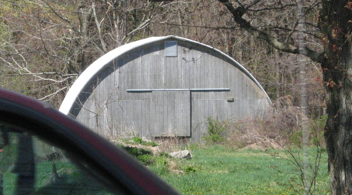
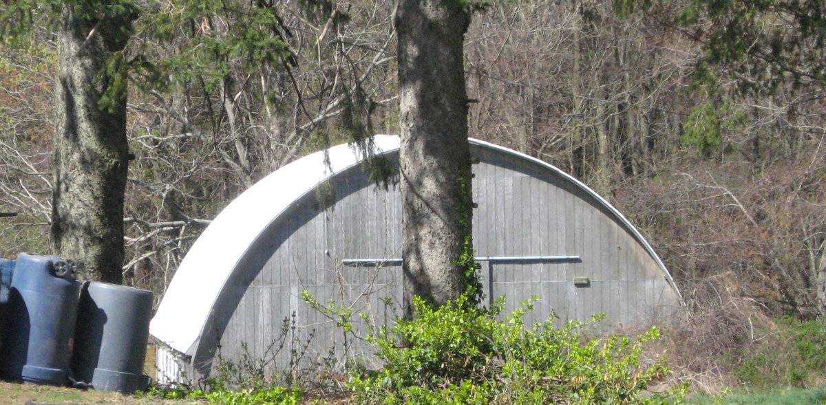
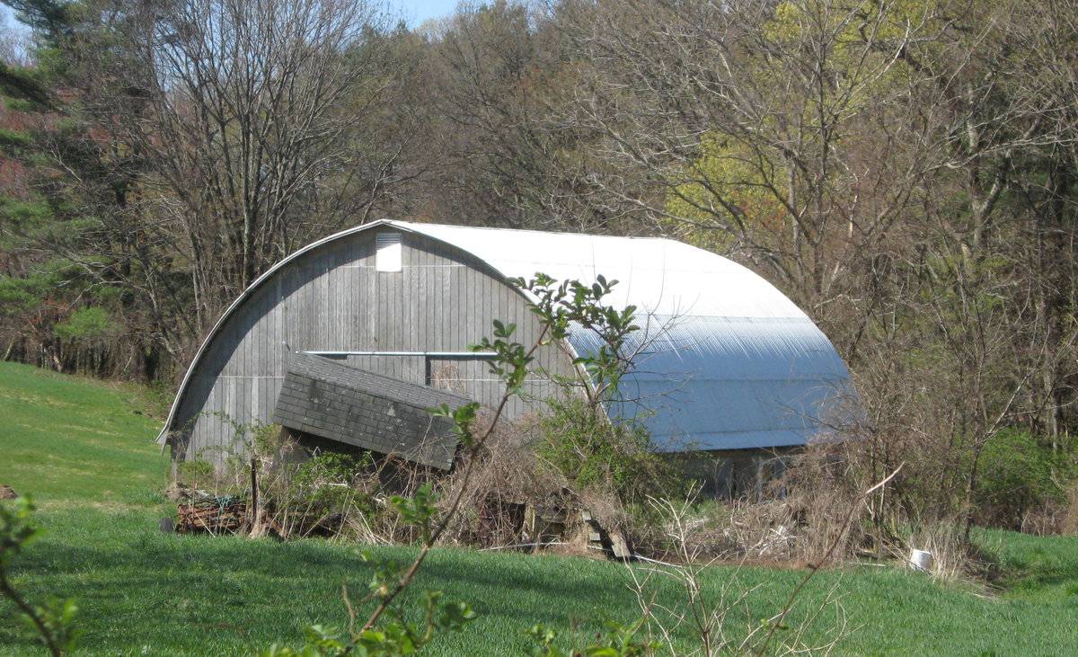
Barn-III: This is a 1 ½ - story eave-entry semi-circular roof barn. The east gable-end of the barn faces Mile Hill Road while the ridge line runs east-west, almost perpendicular to this portion of the road. The barn has fenestration on both the eave-sides. The east and the west gable-ends of the barn have an exterior-hung sliding hay door at the center and a louvered vent just below the apex of the roof.
The wooden frame of the barn has metal sheet roofing and light grey painted vertical siding walls.
Historical significance:The oldest barns still found in the state are called the “English Barn,” “side-entry barn,” “eave entry,” or a 30 x 40. They are simple buildings with rectangular plan, pitched gable roof, and a door or doors located on one or both of the eave sides of the building based on the grain warehouses of the English colonists’ homeland. The name “30 by 40” originates from its size (in feet), which was large enough for 1 family and could service about 100 acres. The multi-purpose use of the English barn is reflected by the building’s construction in three distinct bays - one for each use. The middle bay was used for threshing, which is separating the seed from the stalk in wheat and oat by beating the stalks with a flail. The flanking bays would be for animals and hay storage.
Field Notes
On the west side of the road. Three structures: regular free standing gray barn (Barn I), a low level gray structure (Barn II) and a very large Quonset hut (Barn III).
- Use & Accessibility
Use (Historic)
Use (Present)
Exterior Visible from Public Road?
Yes
Demolished
n/a
Location Integrity
Unknown
- Environment
Related features
Environment features
Relationship to surroundings
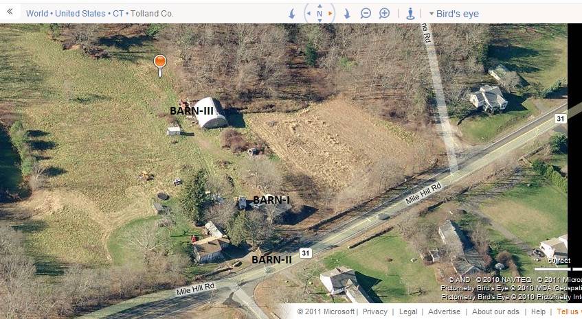
The 11.56 acres property, Account Number- 2367 and MBLU number- 25/ C/ 2/00 / /, is a corner plot located towards the west of Mile Hill Road and the south of Fish and Game Road. The property is located in a predominantly residential area of sub-urban character with individual plots separated by open land and woodland. Residential plots can be seen towards the north and the east of the property across the roads in respective directions while dense woodland covers the area towards the west and the south.
The multi-unit barn complex includes the eave-entry gable-roof barn towards the east, Barn-I with the gable-roof subterranean barn, Barn-II, towards its southeast abutting to Mile Hill Road. The semi-circular roof Quonset barn, Barn-III is located towards the west of Barn-I. The ridge lines of both Barn-I and Barn-II runs north-south, almost parallel to each other and to Mile Hill Road while that of Barn-III runs east-west. The eastern edge of the property is defined by field stone masonry boundary wall while the circa 1860 main residence is located towards the further southeast of Barn-I. Few other sheds and outbuildings can be seen scattered towards the west and the southwest of Barn-I. The property has open land towards the north and the south of the barn complex while dense woodland covers the area towards the fringes. A small pond is located along the southern edge of the property, offset from the road.
- Typology & Materials
-
Building Typology
Materials
Structural System
Roof materials
Roof type
Approximate Dimensions
Barn : 936 SqFt; Barn : 1520 SqFt; Poultry house: 160 SqFt; Garage: 220 SqFt; Shed: 576 SqFt;
- Source
-
Date Compiled
05/26/2011
Compiled By
T. Levine and M. Patnaik, reviewed by CT Trust
Sources
Field notes provided by: Carol and Alan Lyons, 08/27/2010.
Assessors’ information retrieved on May 26th, 2011 from website http://data.visionappraisal.com/TollandCT/
GIS Map retrieved on May 26th, 2011 from website http://hosting.tighebond.com/tollandct/main.htm
Photograph/Information retrieved on May 26th, 2011 from website http://www.google.com
Photograph/Information retrieved on May 26th, 2011 from website http://www.bing.com.
Photograph/Information retrieved on May 26th, 2011 from website http://www.zillow.com.
Sexton, James, PhD; Survey Narrative of the Connecticut Barn, Connecticut Trust for Historic Preservation, Hamden, CT, 2005, http://www.connecticutbarns.org/history.
Visser, Thomas D.,Field Guide to New England Barns and Farm Buildings, University Press of New England, 1997.
- PhotosClick on image to view full file
-