Barn Record Durham
RETURN TO ‘FIND BARNS’- Building Name (Common)
- Herzig Farm [ Part - 1/2]
- Building Name (Historic)
- Herzig Farm
- Address
- 0 Maiden Lane, Durham
- Typology

- Overview
-
Designations
n/a
Historic Significance
Architectural description:
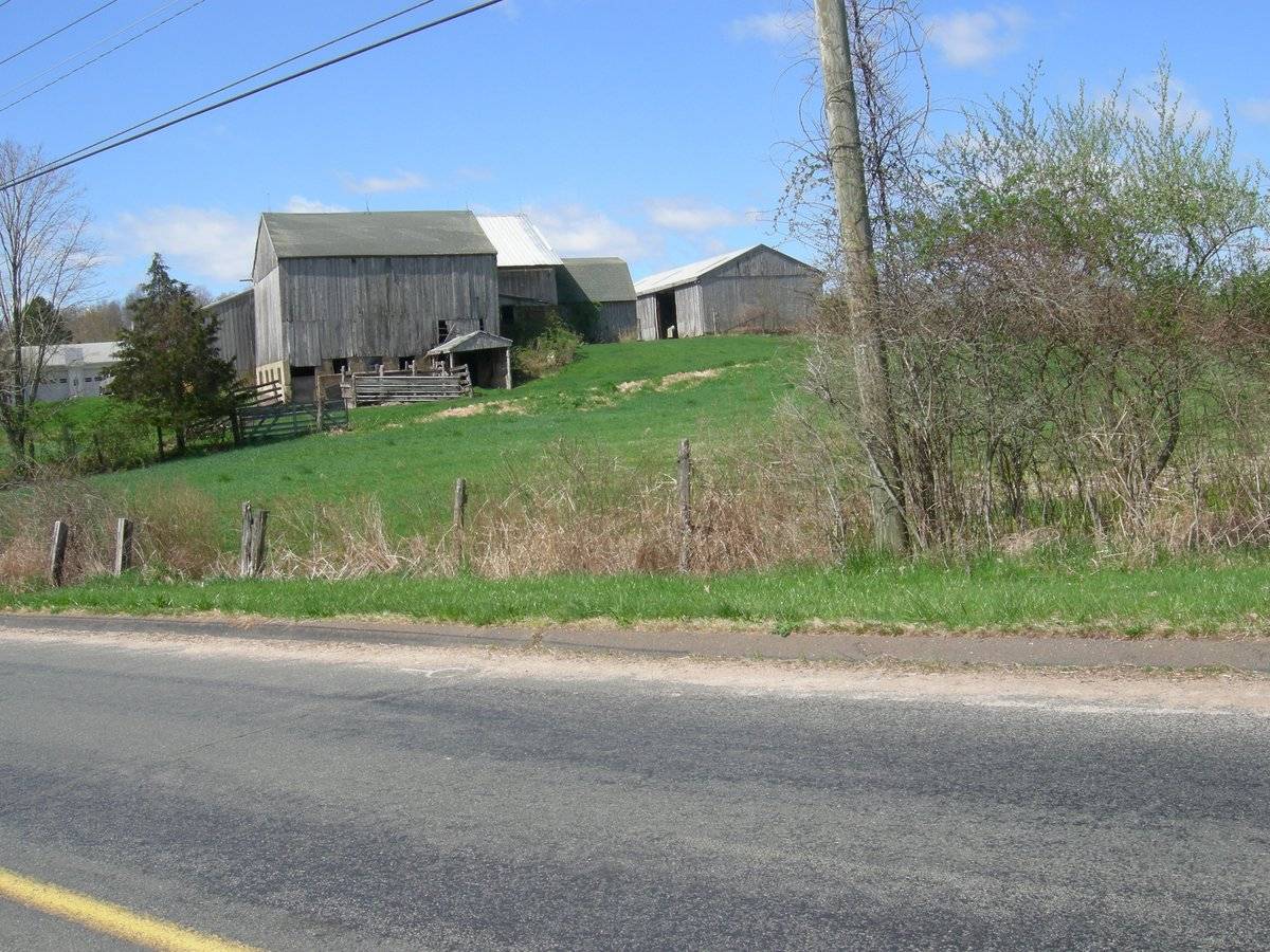
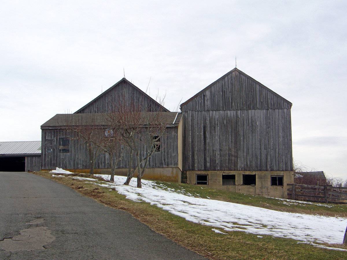
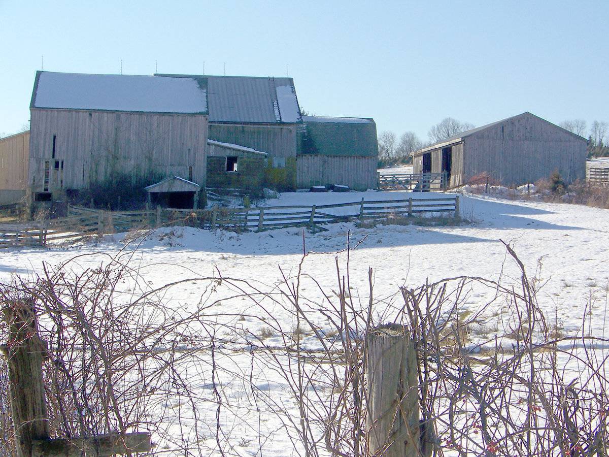
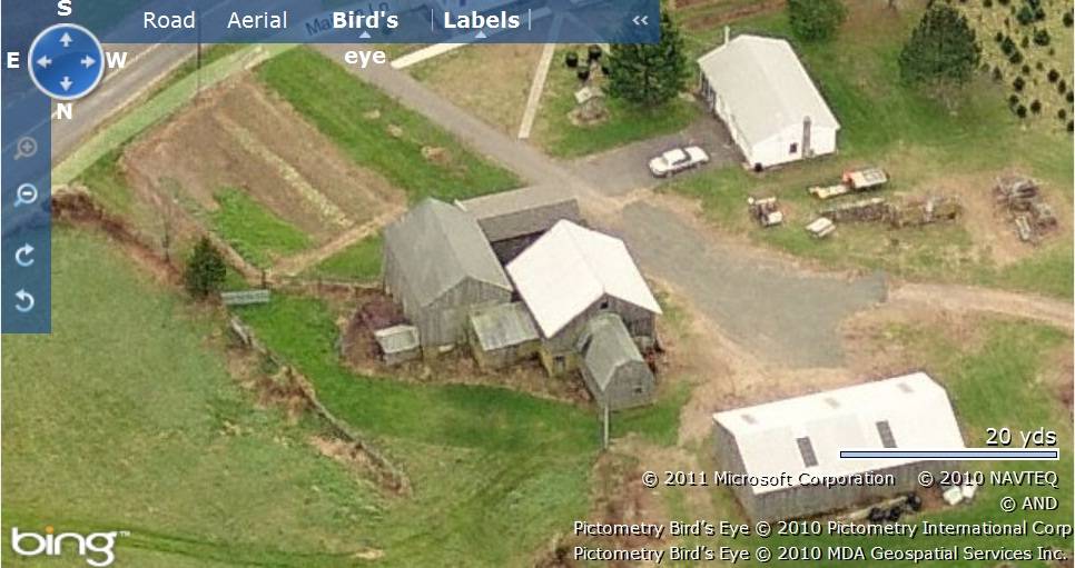
This is a multi barn complex towards the north of Maiden Lane consisting of a barn complex, Barn-I, towards the south and another stand alone barn, Barn-II, towards its north-west. The ridge line of the main bank barn of the complex Barn-I runs north-south perpendicular to the road while that of Barn-II runs east-west. The following is the description of Barn-I while Barn-II is discussed in http://www.connecticutbarns.org/index.cgi/37384.
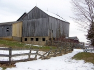
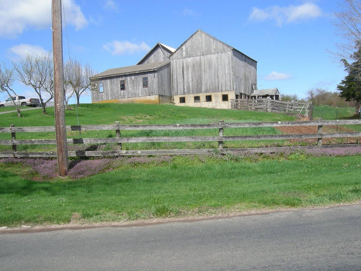
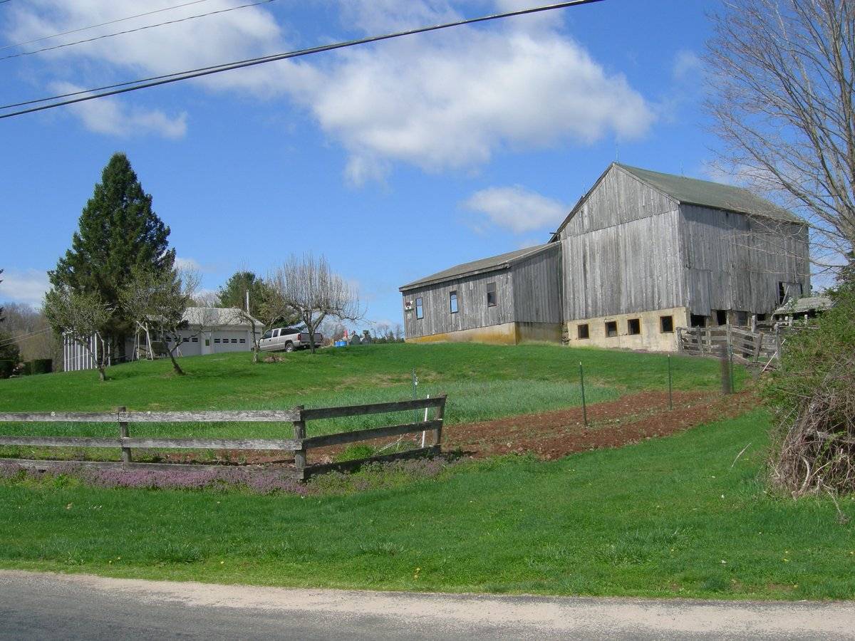
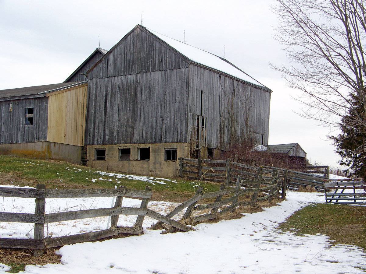
Barn-I: This is a three barn complex comprising of a 1 1/2- story eave-entry main bank barn with a salt-box roof addition on its west eave-side towards the south and a 1 1/2- story gable-roof addition towards the north. The main barn has the bank along its east eave-side. The ridge line of the main barn and the gable-roof addition run north-south perpendicular to the road while that of the salt-box roof addition runs east-west. The main entrance to the main barn appears to be centered in the west eave-facade through a double-height wagon door entrance. The grade level along south gable-end of the main barn gradually declines towards the east revealing the plastered masonry wall of the bank level. The south gable end has four equally spaced square windows at the bank level with a distinct dropped girt siding divide line separating the gable attic. The east eave-side of the main barn has a gable dormer entrance towards the north to access the bank level. The bank level also appears to have a second entrance towards the south through a pass-through door with the door leaf no longer in place. The east eave-side of the barn has missing siding above the pass-through door.
The west gable-end of the salt-box roof addition on the west eave-side of the main barn has a wagon door entrance at the center. The south eave-side of the salt-box roof addition as three equally spaced windows. The grade level along the south eave-side gradually declines towards the east revealing the cement plastered masonry foundation below.
The wooden frame of the barn complex is supported on cement plastered masonry foundation. The barn complex has grey painted vertical siding and asphalt shingle roofing.
Historical significance:The oldest barns still found in the state are called the “English Barn,” “side-entry barn,” “eave entry,” or a 30 x 40. They are simple buildings with rectangular plan, pitched gable roof, and a door or doors located on one or both of the eave sides of the building based on the grain warehouses of the English colonists’ homeland. The name “30 by 40” originates from its size (in feet), which was large enough for 1 family and could service about 100 acres. The multi-purpose use of the English barn is reflected by the building’s construction in three distinct bays - one for each use. The middle bay was used for threshing, which is separating the seed from the stalk in wheat and oat by beating the stalks with a flail. The flanking bays would be for animals and hay storage.
The 19th century saw the introduction of a basement under the barn to allow for the easy collection and storage of a winter’s worth of manure from the animals sheltered within the building. The bank barn is characterized by the location of its main floor above grade, either through building into a hillside or by raising the building on a foundation.
This innovation, aided by the introduction of windows for light and ventilation, would eventually be joined by the introduction of space to shelter more animals under the main floor of the barn.
Historical background:Geographical constraints, as well as advantages, and a particularly heterogeneous settlement population drawn from all over the Connecticut Colony, were some of the factors that shaped the course of Durham’s history, transforming the town from a self-sufficient farming village into a relatively cosmopolitan center of commercial agriculture and small-scale, agrarian-based industry.
Prior to settlement the Town of Durham was known as the Coginchaug, or Great Swamp. Most of the land in the town had been granted to individuals for distinguished service to the colony in military or civic affairs in the seventeenth century. All of these men were absentee owners; none were anxious to occupy what was then one of the least desirable areas for settlement in the colony. Swamp and marshland occupied most of the central part of the area, surrounded by rolling hills overlaying rocky ledges. Less than one third of the mere 15,000 acres was suitable for cultivation.
Field Notes
Also see Barn - II in Part - 2/2 : http://www.connecticutbarns.org/index.cgi/37384 Additional text by Rachel Parris.
- Use & Accessibility
Use (Historic)
Use (Present)
Exterior Visible from Public Road?
Yes
Demolished
n/a
Location Integrity
Unknown
- Environment
Related features
Environment features
Relationship to surroundings
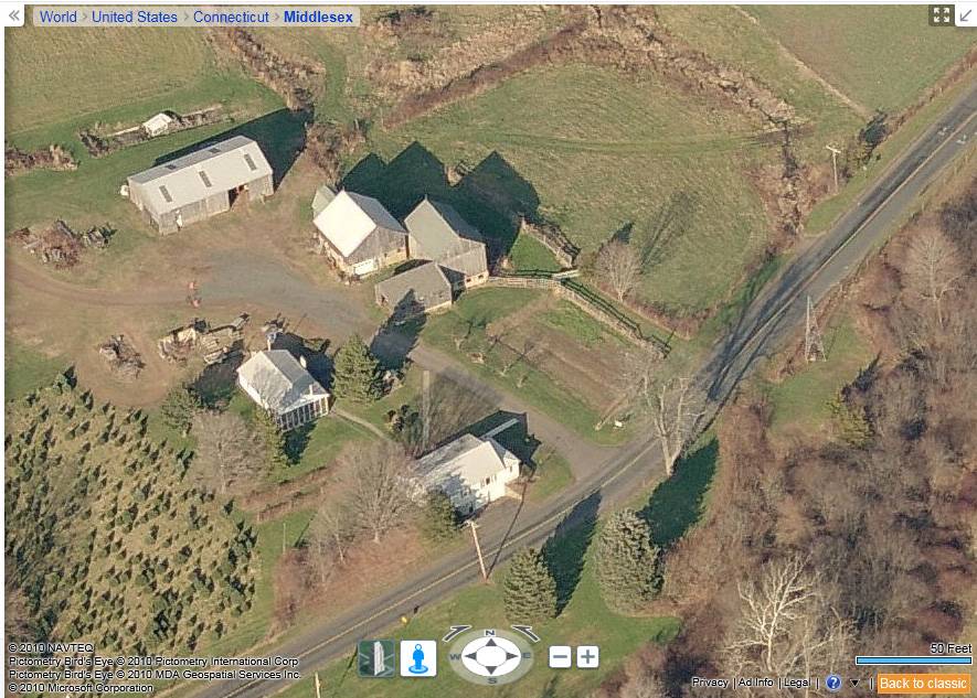
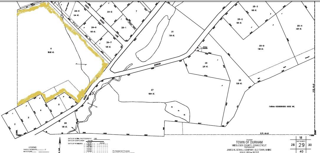
The 35.83 acres property, map number – 29, is located towards the north of Maiden Lane in a pre-dominantly residential area of rural character. It is located towards the east of the residential plot at 310 Maiden Lane, parcel number - H0119800 and map number – 29. Other residential plots can be seen towards the east, north, west and south of the property across Maiden Lane. Dense woodland demarcates the eastern and the western edge of the property.
The barn complex is located towards the southern edge of the property, nearer to Maiden Lane, with Barn-I, towards the south and Barn-II towards its north-west. The ridge line of the main bank barn of the complex Barn-I runs north-south perpendicular to the road while that of Barn-II runs east-west. The main residence of plot number 310 is located towards its south-west, abutting to the road. A 1 ½ - story gable-roof eave-entry garage with its ridge line running north-south can be seen towards its west. The property includes a water body towards further north of the barn complex while parcels of farm land can be seen towards the east, north and the north-west.
- Typology & Materials
-
Building Typology
Materials
Structural System
Roof materials
Roof type
Approximate Dimensions
n/a
- Source
-
Date Compiled
08/31/2010
Compiled By
T. Levine and M. Patnaik, reviewed by CT Trust
Sources
Field notes and photographs provided by Jim McLaughlin and Gloria Earls.
Additional photographs provided by C. Hitchcock.Assessors’ records retrieved on February 15th, 2011 from website http://durham.univers-clt.com
Map and property records retrieved on February 15th, 2011 from website http://www.townofdurhamct.org
Photograph/Information retrieved on February 15th, 2011 from website http://www.google.com
Photograph/Information retrieved on February 15th, 2011 from website http://www.zillow.com
Cunningham, Jan, Main Street Historic District Nomination No. 86002837, National Park Service, 1986.
Sexton, James, PhD; Survey Narrative of the Connecticut Barn, Connecticut Trust for Historic Preservation, Hamden, CT, 2005, http://www.connecticutbarns.org/history
Visser, Thomas D.,Field Guide to New England Barns and Farm Buildings, University Press of New England, 1997.
- PhotosClick on image to view full file
-