Barn Record Durham
RETURN TO ‘FIND BARNS’- Building Name (Common)
- n/a
- Building Name (Historic)
- n/a
- Address
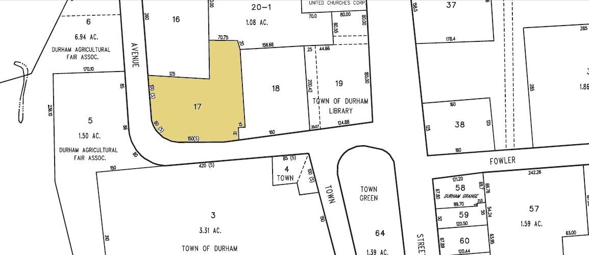
- 29 Maple Avenue, Durham
- Typology

- Overview
-
Designations
n/a
Historic Significance
Architectural description:
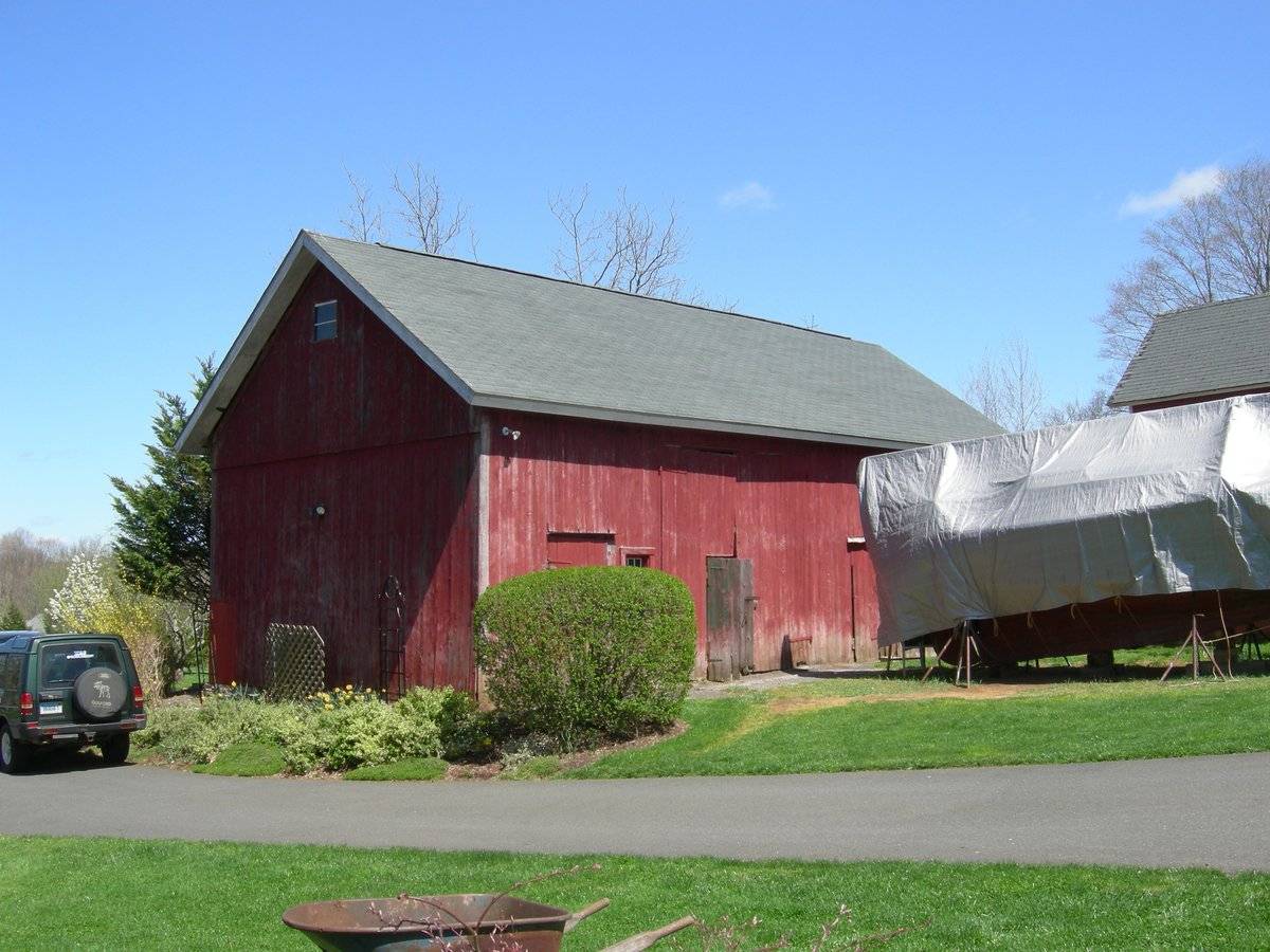
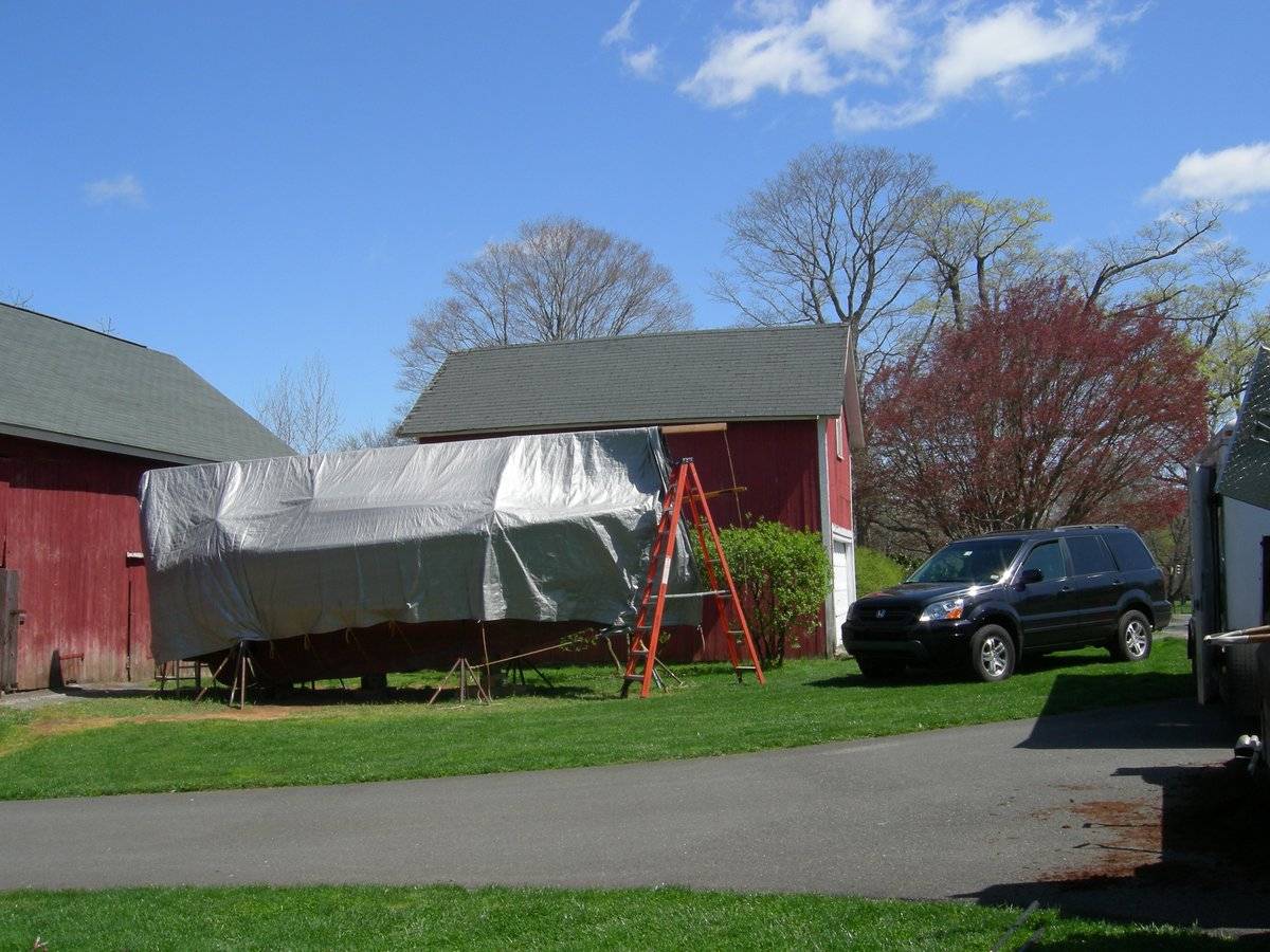
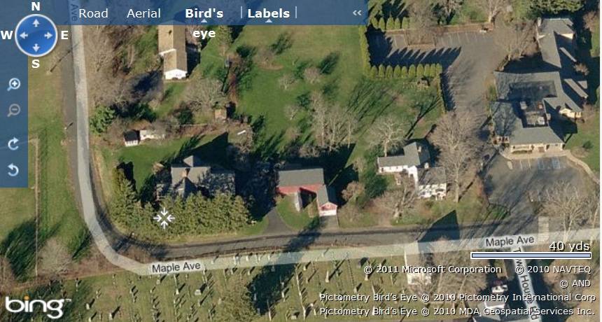
This is an L-shaped barn complex towards the north of Maple Avenue consisting of two barns, Barn-I towards the north and Barn-II towards south-east of Barn-I. The ridge line of Barn-I runs east-west parallel to the road while that of Barn-II runs along north-south perpendicular to it.
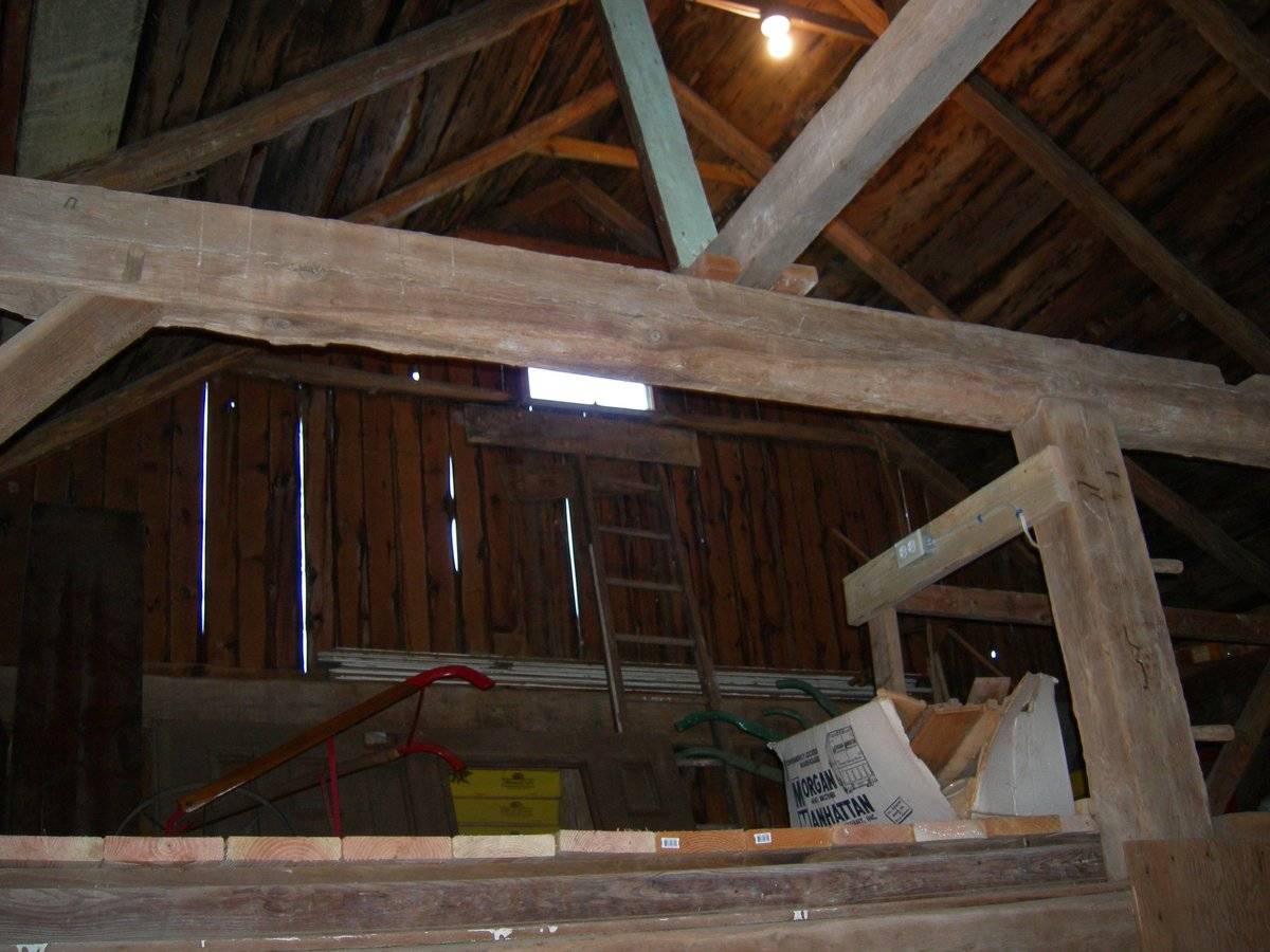
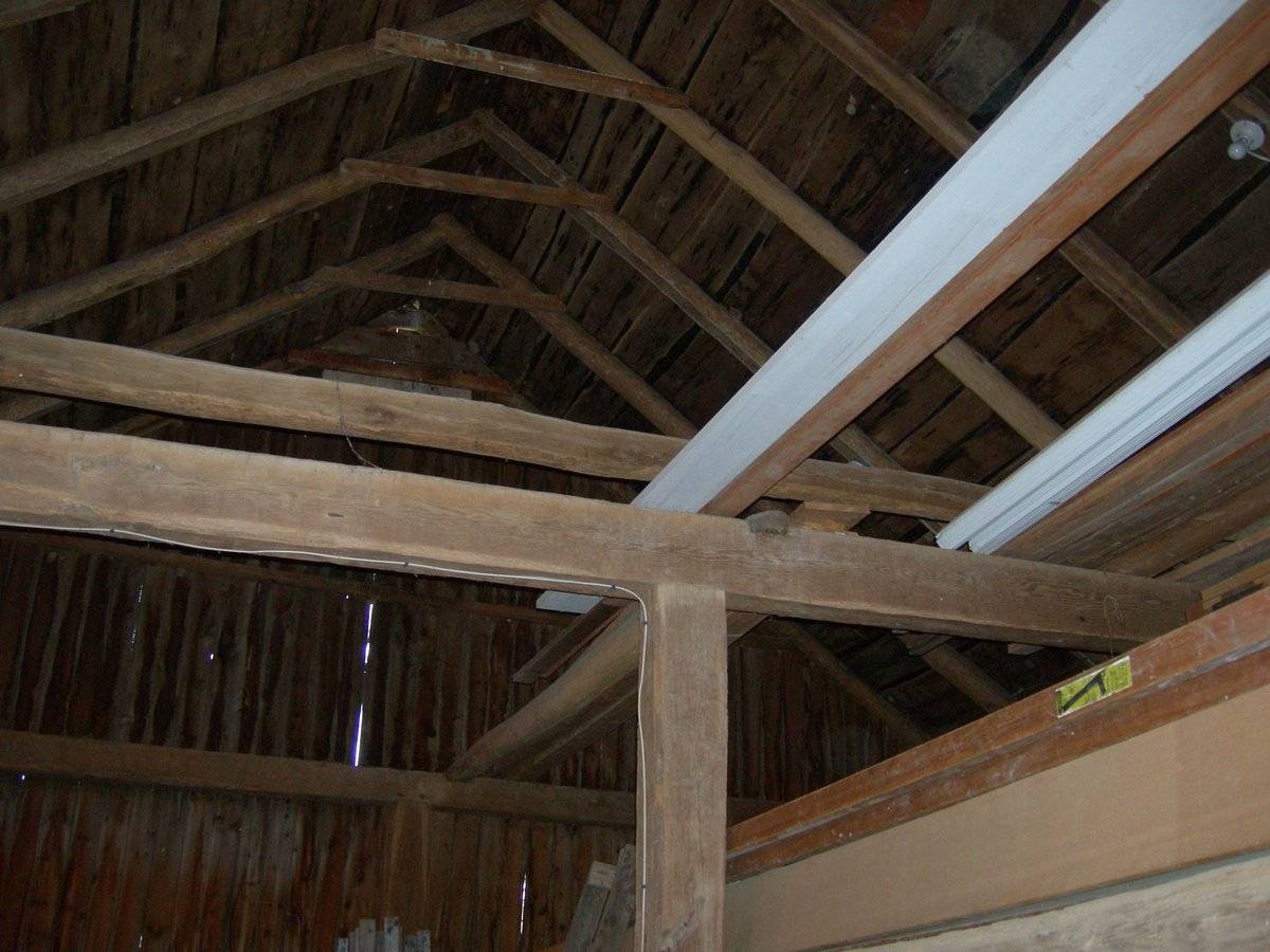
Barn-I: This is a 1 ½ - story three-bay eave-entry barn with its south eave-side facing Maple Avenue. The main facade of the barn is the three-bay south eave-facade with the main entrance centered in the middle bay through a pair of double-height hinged wagon doors with a hinged weather door insert and blacksmith hardware. The barn has two more entrances, one each in each flanking bay of the main facade. The entrance in the first bay from the west is through a hinged wagon door with blacksmith hardware, separated from the main entrance by a framed window. The entrance in the first bay from the east appears to be through a pair of hinged wagon doors with a hood at the lintel level. The west gable-side of the barn has a distinct dropped girt siding divide line separating the gable attic above which has a one-over-one double-hung sash window just below the apex of the roof.
The wooden frame of barn has asphalt shingle roofing and red painted vertical siding with white corner boards.
Barn-II: This is a 1 ½ - story gable-entry barn with its main south gable-façade facing Maple Avenue. The main entrance to the barn is centered on the main south gable-façade encompassing the entire length of the façade. The gable attic above has a white framed window just below the apex of the roof.The wooden frame of barn has asphalt shingle roofing and red painted vertical siding with white corner boards.
Historical significance:The oldest barns still found in the state are called the “English Barn,” “side-entry barn,” “eave entry,” or a 30 x 40. They are simple buildings with rectangular plan, pitched gable roof, and a door or doors located on one or both of the eave sides of the building based on the grain warehouses of the English colonists’ homeland. The name “30 by 40” originates from its size (in feet), which was large enough for 1 family and could service about 100 acres. The multi-purpose use of the English barn is reflected by the building’s construction in three distinct bays - one for each use. The middle bay was used for threshing, which is separating the seed from the stalk in wheat and oat by beating the stalks with a flail. The flanking bays would be for animals and hay storage.
The New England barn or gable front barn was the successor to the English barn and relies on a gable entry rather than an entry under the eaves. The gable front offers many practical advantages. Roofs drain off the side, rather than flooding the dooryard. With the main drive floor running parallel to the ridge, the size of the barn could be increased to accommodate larger herds by adding additional bays to the rear gable end. Although it was seen by many as an improvement over the earlier side-entry English Barn, the New England barn did not replace its predecessor but rather coexisted with it, as both types continued to be built.
Field Notes
For Barn II, see record for 13 Maple Avenue.
- Use & Accessibility
Use (Historic)
Use (Present)
Exterior Visible from Public Road?
Yes
Demolished
n/a
Location Integrity
Unknown
- Environment
Related features
Environment features
Relationship to surroundings
The .92 acres property, parcel number - M0166500 and map number 48, is a corner plot bounded by Maple Avenue on its west and the south. The property is situated in a mixed-use area flanked by residential plots towards its east and the north. Durham cemetery is located towards the south of the property across Maple Avenue while Durham Public Library is located towards further east along the road. Parcels of open land can be seen towards the west of the property across Maple Avenue.
The L-shaped barn complex is located in the south-eastern corner of the property with Barn-I towards the north and Barn-II towards its south-east. The circa 1950 cape style main residence is located in the south-western corner of the property, separated from the barn complex by a driveway. A row of trees can be seen lined along the south-western edge of the property to restrict the view from Maple Avenue while a small patch of open land occupies the area towards the north of the property.
- Typology & Materials
-
Building Typology
Materials
Structural System
Roof materials
Roof type
Approximate Dimensions
Barn: 46X23 SqFt, Circa 1880 Barn: 16X24 SqFt, Circa 1920 Shed, frame: 180 SqFt, Circa 1920 Shed, metal: 200 SqFt, Circa 1920
- Source
-
Date Compiled
08/31/2010
Compiled By
T. Levine and M. Patnaik, reviewed by CT Trust
Sources
Photographs and field-notes provided by – Jim McLaughlin
Assessors’ records retrieved on January 27th, 2011 from website http://durham.univers-clt.com
Map and property records retrieved on January 27th, 2011 from website http://www.townofdurhamct.org
Photograph/Information retrieved on January 27th, 2011 from website http://www.google.com
Photographs/Information retrieved on January 27th, 2011 from website http://www.zillow.com
Sexton, James, PhD; Survey Narrative of the Connecticut Barn, Connecticut Trust for Historic Preservation, Hamden, CT, 2005, http://www.connecticutbarns.org/history
Visser, Thomas D.,Field Guide to New England Barns and Farm Buildings, University Press of New England, 1997.
- PhotosClick on image to view full file
-