Barn Record Durham
RETURN TO ‘FIND BARNS’
- Overview
-
Designations
n/a
Historic Significance
Architectural description:
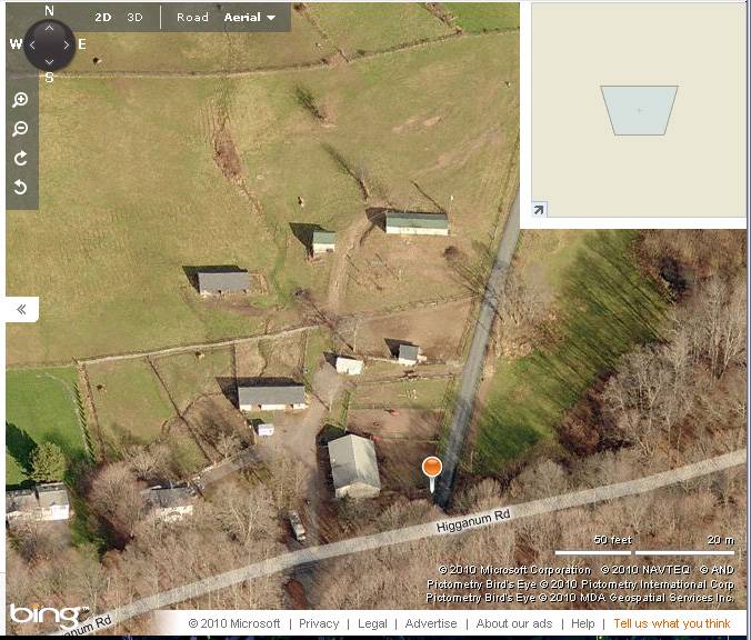
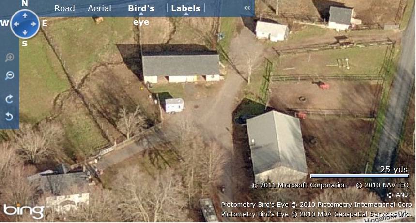
This is a barn complex towards the north of Higganum Road consisting of two barns and two sheds . Barn-I is located in the south-east corner of the property with Barn-II towards its north-west. The two sheds are located towards the north-east of Barn-II. The ridge line of Barn-I runs north-south perpendicular to the road while that of Barn-II runs east-west. The ridge lines of the two sheds run at an angle from the north-west to the south-east.
Barn-I: This is a 1 ½ -story six-bay eave-entry barn with its south gable-side facing Higganum Road. The main façade of the barn is its west eave-façade with four main entrances. The north gable-side of the barn has four equally spaced square stable windows. The east eave-side of the barn facing Strawberry Hill Road has exposed posts of the six bays with a square stable window centered in each bay. The wooden frame of the barn has concrete block masonry and asphalt shingle roofing.
Barn-II: This is a 1 ½ -story eave-entry barn with its main south eave-facade facing Higganum Road. The barn has two main entrances on its main south eave-façade through two wagon door openings. The west gable-side of the barn is symmetrical with three six-pane awning windows equally spaced at the first floor level and a hay-door opening just below the apex of the roof. The wooden frame of the barn is supported on concrete footings and has asphalt shingle roofing.
Historical significance:The oldest barns still found in the state are called the “English Barn,” “side-entry barn,” “eave entry,” or a 30 x 40. They are simple buildings with rectangular plan, pitched gable roof, and a door or doors located on one or both of the eave sides of the building based on the grain warehouses of the English colonists’ homeland. The name “30 by 40” originates from its size (in feet), which was large enough for 1 family and could service about 100 acres. The multi-purpose use of the English barn is reflected by the building’s construction in three distinct bays - one for each use. The middle bay was used for threshing, which is separating the seed from the stalk in wheat and oat by beating the stalks with a flail. The flanking bays would be for animals and hay storage.
By the early 20th century agricultural engineers developed a new approach to dairy barn design: the ground-level stable barn, to reduce the spread of tuberculosis bacteria by improving ventilation, lighting, and reducing the airborne dust of manure. A concrete slab typically serves as the floor for the cow stables. Many farmers converted manure basements in older barns into ground-level stables with concrete floors. Some older barns were jacked up and set on new first stories to allow sufficient headroom. With the stables occupying the entire first story, the space above serves a a hayloft. By the 1920s most ground-level stable barns were being constructed with lightweight balloon frames using two-by-fours or two-by-sixes for most of the timbers. Novelty or tongue-and-groove beveled siding is common on the walls, although asbestos cement shingles also were a popular sheathing. Some barns have concrete for the first-story walls, either poured in place or built up out of blocks.
Field Notes
Street number approximate - corner of Strawberry Hill.
- Use & Accessibility
Use (Historic)
Use (Present)
Exterior Visible from Public Road?
Yes
Demolished
n/a
Location Integrity
Unknown
- Environment
Related features
Environment features
Relationship to surroundings
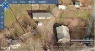
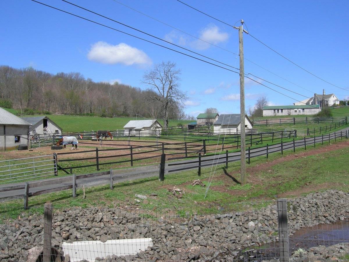
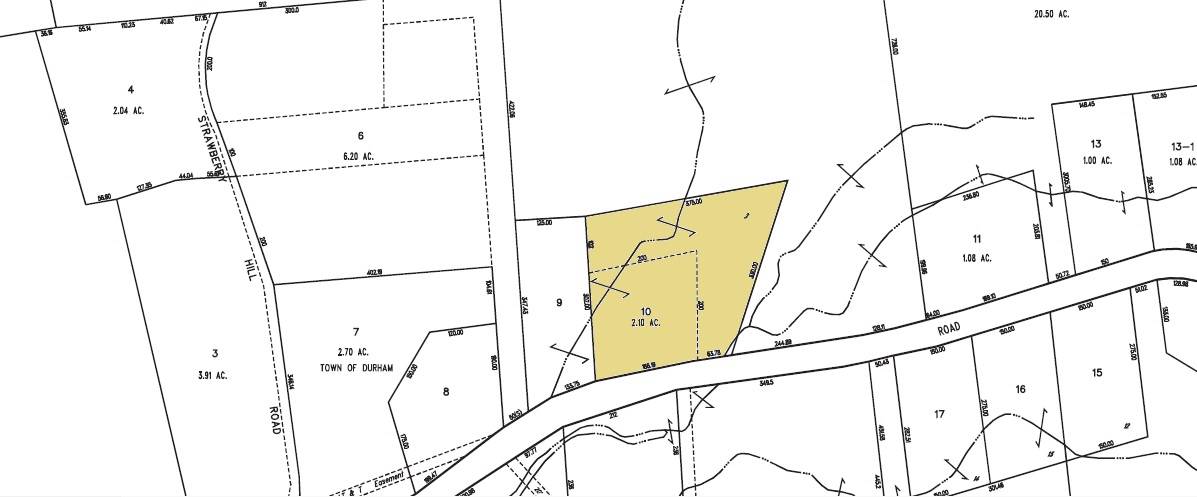
The 2.1 acres property, parcel number - R0207500 and map number 59, is a corner plot located towards the north of Higganum Road and the west of Strawberry Hill Road. The property is situated in a pre-dominantly residential area of rural character with residential plots flanking the plot towards the west, east and the south, across Higganum Road. Horseshoe Hill Equestrian Center with its associated open land, paddocks and barns can be seen towards the north of the property along Strawberry Hill Road.
This is a complex of two barns and two sheds scattered towards the north and the east of the property while the circa 1939 colonial style main residence is located in the south-west corner. Barn-I is located in the south-east corner of the plot with Barn-II towards its north-west. Two gable-roof sheds are located towards the north-east of the Barn-II. Two fenced paddocks towards the north of Barn-I while another fenced paddock can be seen towards the north of Barn-II. The property includes a parcel of open land towards the north-west with cluster of trees in the south-west corner surrounding the main residence.
- Typology & Materials
-
Building Typology
Materials
Structural System
Roof materials
Roof type
Approximate Dimensions
Barn: 1800 SqFt, Circa 1930 Garage: 40X69 SqFt, Circa 1900 Shed: 12X22 SqFt, Circa 1996 Shed : 16X22 SqFt, Circa 1996
- Source
-
Date Compiled
09/01/2010
Compiled By
T. Levine and M. Patnaik, reviewed by CT Trust
Sources
Photographs and fieldnotes provided by Jim McLaughlin
Assessors’ records retrieved on February 3rd , 2011 from website http://durham.univers-clt.com
Map and property records retrieved on February 3rd , 2011 from website http://www.townofdurhamct.org
Photograph/Information retrieved on February 3rd , 2011 from website http://www.google.com
Photograph/Information retrieved on February 3rd , 2011 from website http://www.zillow.com
Additional photographs retrieved on September 1st , 2010 by Charlotte Hitchcock from website http://www.zillow.com
Sexton, James, PhD; Survey Narrative of the Connecticut Barn, Connecticut Trust for Historic Preservation, Hamden, CT, 2005, http://www.connecticutbarns.org/history
Visser, Thomas D.,Field Guide to New England Barns and Farm Buildings, University Press of New England, 1997.
- PhotosClick on image to view full file
-