Barn Record Durham
RETURN TO ‘FIND BARNS’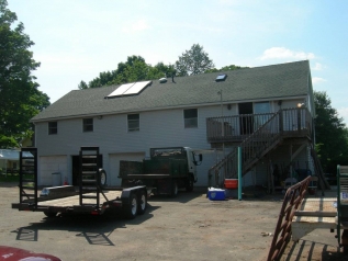
- Overview
-
Designations
n/a
Historic Significance
Architectural description:
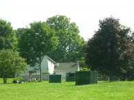
This is a 2 ½-story gable-roofed barn. The ridge-line of the barn is parallel to New Haven Road, which runs approximately east-west. It appears as though the original entrance was located on the south eave-side of the barn. Currently, the south eave-facade of the barn has four overhead garage doors doors. The second level of the south eave-facade has four double-hung windows right below the eave. Towards the southeast corner, it appears as though what would have been the fifth double-hung window has been converted into a sliding glass door. There is a second story wood porch added to this corner of the barn with a set of stairs leading west. The west gable-end of the barn appears to have two windows in the gable attic and one window centered below the apex of the roof. The north eave-side of the barn has four windows right below the eave. There is a 1 ½-story cross gable addition that has been added to the northwest corner. On the west eave-side of the addition there appears to be one window below the eave towards the center. The east eave-side of the addition has a window right below the eave towards the northeast corner. The east gable-end of the barn has one window in the gable attic. There appears to be a pass-through entrance towards the southeast corner. The barn is clad in aluminum siding painted white. The roof has slight projecting eaves and is clad in asphalt shingles. There has been a skylight and two solar panels added to the south side of the roof.
Historical significance:
The oldest barns still found in the state are called the “English Barn,” “side-entry barn,” “eave entry,” or a 30 x 40. They are simple buildings with rectangular plan, pitched gable roof, and a door or doors located on one or both of the “eave” sides of the building based on the grain warehouses of the English colonists’ homeland. The New England barn or gable front barn was the successor to the English barn and relies on a gable entry rather than an entry under the eaves. The gable front offers many practical advantages. Roofs drain off the side, rather than flooding the dooryard. Although it was seen by many as an improvement over the earlier side entry English Barn, the New England barn did not replace its predecessor but rather coexisted with it. It this case, both an eave entry and a gable entry are used.
Historical background:
Geographical constraints, as well as advantages, and a particularly heterogeneous settlement population drawn from all over the Connecticut Colony, were some of the factors that shaped the course of Durham’s history, transforming the town from a self-sufficient farming village into a relatively cosmopolitan center of commercial agriculture and small-scale, agrarian-based industry.
Prior to settlement the Town of Durham was known as the Coginchaug, or Great Swamp. Most of the land in the town had been granted to individuals for distinguished service to the colony in military or civic affairs in the seventeenth century. All of these men were absentee owners; none were anxious to occupy what was then one of the least desirable areas for settlement in the colony. Swamp and marshland occupied most of the central part of the area, surrounded by rolling hills overlaying rocky ledges. Less than one third of the mere 15,000 acres was suitable for cultivation.
(Cunningham)
Field Notes
n/a
- Use & Accessibility
Use (Historic)
Use (Present)
Exterior Visible from Public Road?
Yes
Demolished
n/a
Location Integrity
Unknown
- Environment
Related features
Environment features
Relationship to surroundings
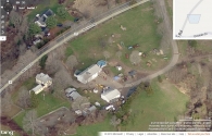
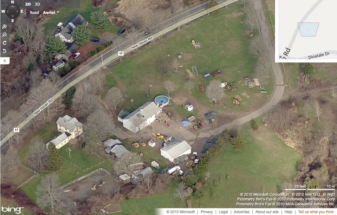
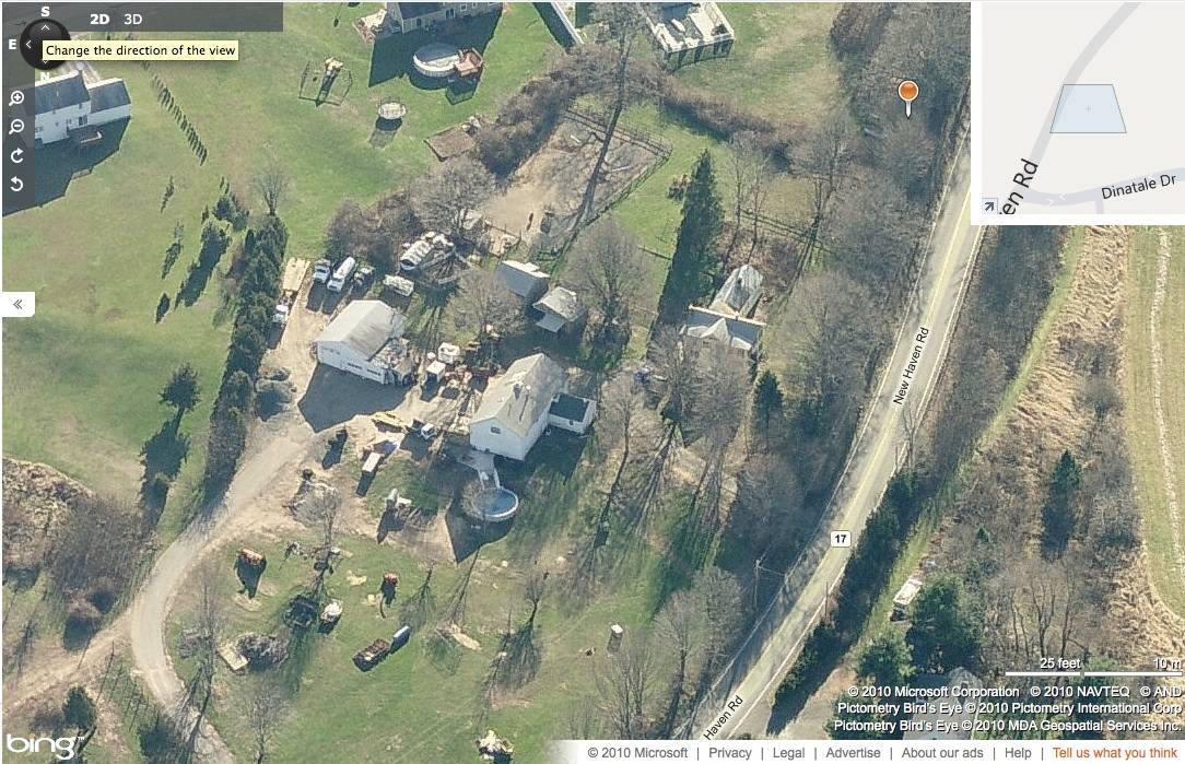
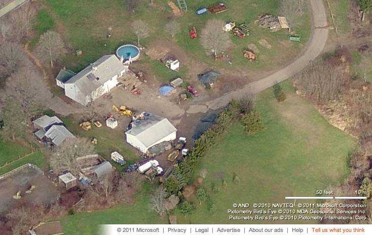
The barn has been adapted for residential use. The ridge-line of the barn is perpendicular to the ridge-line of the house. To the north are scattered trees. To the east of the is open land while there are scattered trees and buildings towards the south and west. The total size of the property is 1.69 acres. Surrounding the site is active agriculture, woodland and residential. The property is located 1.5 miles northeast of Durham, the nearest major town center.
- Typology & Materials
-
Building Typology
Materials
Structural System
Roof materials
Roof type
Approximate Dimensions
n/a
- Source
-
Date Compiled
02/12/2011
Compiled By
R. Parris & T. Levine; reviewed by CT Trust
Sources
Field notes and photographs by Jim McLaughlin date 9/01/2010.
Town of Durham Assessor’s Record or GIS Viewer http://durham.univers-clt.com/view_property_R.php?account_no=P0184300&series_card=1
Parcel ID: P0184300Aerial Mapping:
http://www.bing.com/maps accessed 02/12/2010.
http://www.bing.com/maps accessed 9/01/2010.Cunningham, Jan, Main Street Historic District Nomination No. 86002837, National Park Service, 1986.
Fitch, p.44; National Park Service, Secretary of the Interior’s Standards.
Sexton, James, PhD, Survey Narrative of the Connecticut Barn, Connecticut Trust for Historic Preservation, Hamden, CT, 2005, http://www.connecticutbarns.org/history.
Visser, Thomas D., Field Guide to New England Barns and Farm Buildings, University Press of New England, 1997.
- PhotosClick on image to view full file
-