Barn Record Durham
RETURN TO ‘FIND BARNS’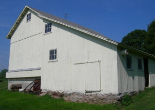
- Overview
-
Designations
n/a
Historic Significance
Architectural description:
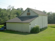
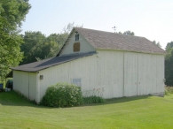
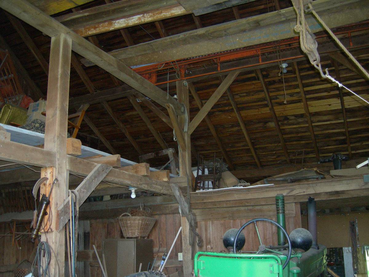
This is a 1 ½ - story eave-entry barn with a shed-roof addition encompassing the entire length of its east gable-side and a salt-box roof addition encompassing the entire length of its south eave-side. The east gable-side of the barn faces Cherry Lane while its ridge line runs east-west, almost perpendicular to the road. The main façade of the barn is the north eave-façade with the main entrance at the center through a pair of double-height exterior-hung sliding wagon doors. The north side-wall of the shed-roof addition is flush with the main north eave-façade of the barn and has a six-pane awning window at the center. The east gable-side of the barn has deep soffit lined with exposed projecting purling. A six-pane window with trim can be seen centered in the gable attic with an eagle motif just below the apex of the roof. A signboard stating “BURR’S BELLY ACRES; CONRAD’S HEAD ACRES” is placed below the window trim. The east eave-side of the shed-roof addition appears to have an entrance off-centered towards the north through an exterior-hung sliding pass-through door. The south eave-side of the salt-box roof addition appears to have an entrance at the center through an exterior-hung sliding door and two windows towards the west. The west gable-side of the barn has a lower grade level revealing the concrete-block masonry foundation of the main barn and the un-coursed mortared rubble masonry foundation of the salt-box roof addition towards the south. The gable attic above is separated by a distinct dropped girt siding divide line and has a six-pane window with trim just below the apex of the roof. The west side-wall of the salt-box roof addition has an exterior-hung sliding pass-through door towards the south and two six-pane stable windows with trim towards the north. The two windows are placed one above the other, staggering towards the north. A weather vane can be seen centered on the gable-roof of the main barn.
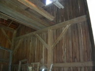
The wooden frame of the main barn is supported on cement foundation and concrete block masonry foundation while that of the salt-box roof addition is supported on un-coursed mortared rubble masonry. The barn has light yellow painted vertical siding walls and asphalt shingle roofing. The shed-roof addition on the east gable-façade of the main barn has asphalt paper roofing.
Historical significance:The oldest barns still found in the state are called the “English Barn,” “side-entry barn,” “eave entry,” or a 30 x 40. They are simple buildings with rectangular plan, pitched gable roof, and a door or doors located on one or both of the eave sides of the building based on the grain warehouses of the English colonists’ homeland. The name “30 by 40” originates from its size (in feet), which was large enough for 1 family and could service about 100 acres. The multi-purpose use of the English barn is reflected by the building’s construction in three distinct bays - one for each use. The middle bay was used for threshing, which is separating the seed from the stalk in wheat and oat by beating the stalks with a flail. The flanking bays would be for animals and hay storage.
Field Notes
n/a
- Use & Accessibility
Use (Historic)
Use (Present)
Exterior Visible from Public Road?
Yes
Demolished
n/a
Location Integrity
Unknown
- Environment
Related features
Environment features
Relationship to surroundings
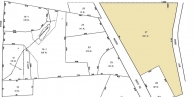
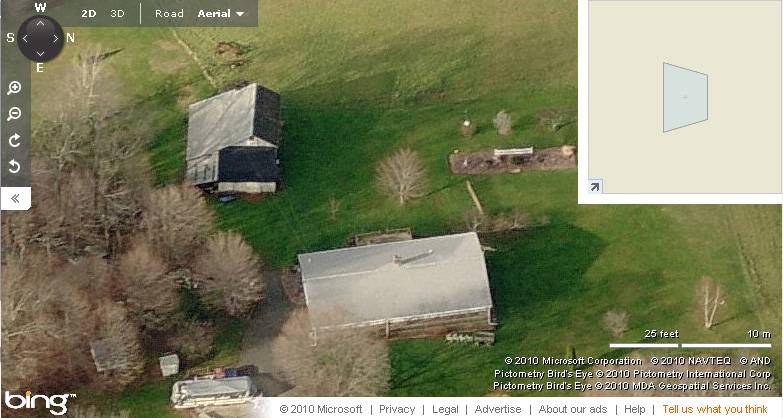
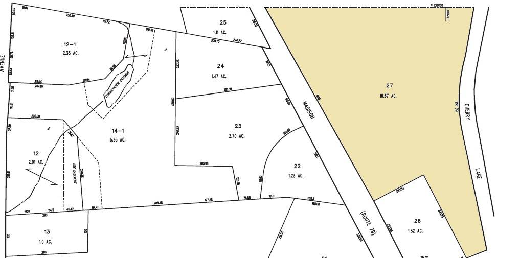
The 10.67 acres property, parcel number - C0054800 and map number 78, is towards the west of Cherry Lane and the east of Madison Road. It is located in a predominantly residential area of rural character with its edges defined by woodland. Residential plots can be seen towards the north, south and the west of the property, across Madison Road while parcels of farm land can be seen towards the east, across Cherry Lane.
The barn is located in the south-west corner of the property offset from Cherry Lane. The circa 1989 ranch main residence is located towards the north-east of the barn, nearer to the road. The ridge line of the barn runs east-west almost perpendicular to the road while that of the main residence runs north-south. A few small gable-roof sheds can be seen scattered towards the east of the barn. The property has open land towards the north of the building complex while dense woodland covers the area towards the south.
- Typology & Materials
-
Building Typology
Materials
Structural System
Roof materials
Roof type
Approximate Dimensions
Barn: 600 SqFt
- Source
-
Date Compiled
09/01/2010
Compiled By
T. Levine and M. Patnaik, reviewed by CT Trust
Sources
Photographs and field-notes provided by – Jim McLaughlin
Assessors’ records retrieved on December 13th, 2010 from website http://durham.univers-clt.com
Map and property records retrieved on December 13th, 2010 from website http://www.townofdurhamct.org
Photograph/Information retrieved on December 13th, 2010 from website http://www.google.com
Information retrieved on December 13th, 2010 from website http://www.zillow.com
Sexton, James, PhD; Survey Narrative of the Connecticut Barn, Connecticut Trust for Historic Preservation, Hamden, CT, 2005, http://www.connecticutbarns.org/history
Visser, Thomas D.,Field Guide to New England Barns and Farm Buildings, University Press of New England, 1997.
- PhotosClick on image to view full file
-