Barn Record Durham
RETURN TO ‘FIND BARNS’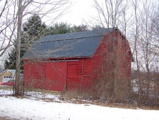
- Overview
-
Designations
n/a
Historic Significance
Architectural description:
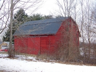
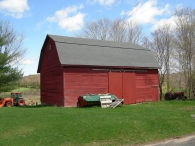
This is a 1 ½ - story eave-entry three-bay gambrel-roof barn with its south eave-side facing Cherry Lane. The ridge line of the runs east-west parallel to the road. The main façade of the barn is the three-bay south eave-façade with the main entrance in the middle bay through a pair of exterior-hung sliding wagon doors. The façade has a second entrance towards the eastern edge through a hinged pass-through door with lintel trim. The west gable-side of the barn has a six-pane window centered in the gable attic. The grade level along the west gable-side gradually drops towards the north revealing the cement plastered masonry foundation of the barn.
The wooden frame of the barn is supported on cement plastered masonry foundation. The barn has red painted horizontal clapboard siding on walls and asphalt shingle roofing.
Historical significance:This is an English barn with a gambrel roof.
The oldest barns still found in the state are called the “English Barn,” “side-entry barn,” “eave entry,” or a 30 x 40. They are simple buildings with rectangular plan, pitched gable roof, and a door or doors located on one or both of the eave sides of the building based on the grain warehouses of the English colonists’ homeland. The name “30 by 40” originates from its size (in feet), which was large enough for 1 family and could service about 100 acres. The multi-purpose use of the English barn is reflected by the building’s construction in three distinct bays - one for each use. The middle bay was used for threshing, which is separating the seed from the stalk in wheat and oat by beating the stalks with a flail. The flanking bays would be for animals and hay storage.
Field Notes
n/a
- Use & Accessibility
Use (Historic)
Use (Present)
Exterior Visible from Public Road?
Yes
Demolished
n/a
Location Integrity
Unknown
- Environment
Related features
Environment features
Relationship to surroundings
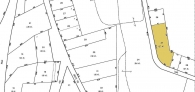
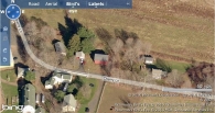
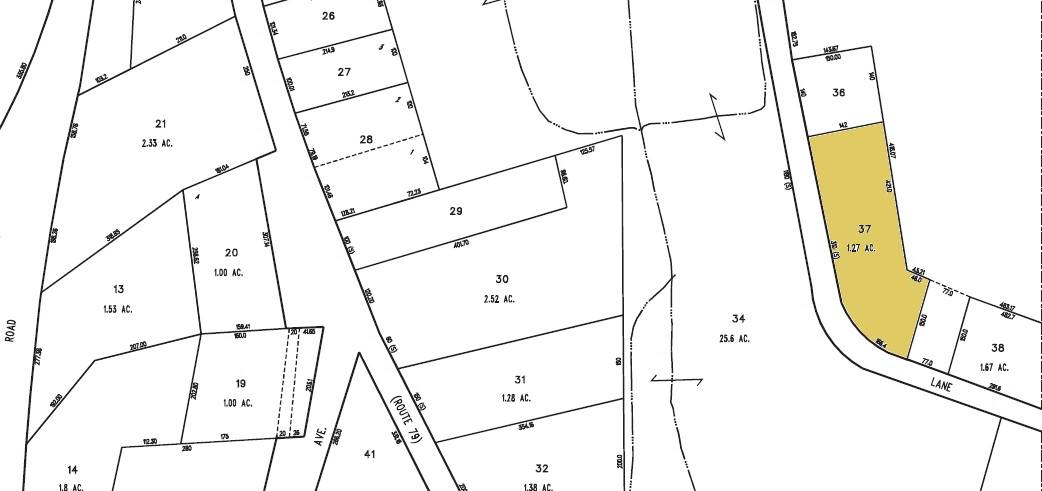
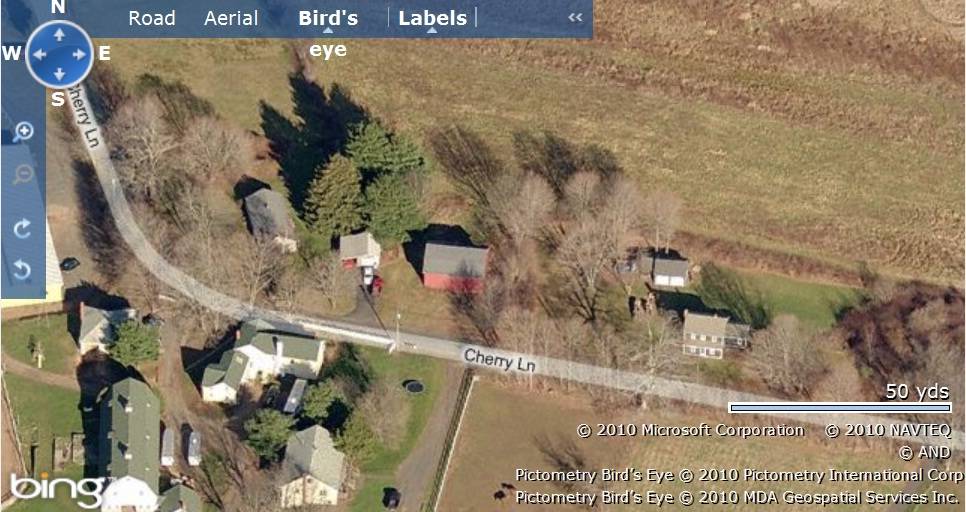
The 1.27 acres property, parcel number - M0164500 and map number 68, is towards the north of Cherry Lane located in a predominantly residential area of rural character. Open land with barns can be seen towards the south of the property across the road while parcels of farm land with active agriculture can be seen towards the north.
The barn is located almost at the center of the property with the circa 1952 ranch main residence towards its south-east abutting to Cherry Lane. A garage with a shed-roof addition can be seen towards the west of the barn while another gable-roof outbuilding can be seen towards further west. Clusters of trees surround the barn towards the north and the east.
- Typology & Materials
-
Building Typology
Materials
Structural System
Roof materials
Roof type
Approximate Dimensions
n/a
- Source
-
Date Compiled
09/01/2010
Compiled By
T. Levine and M. Patnaik, reviewed by CT Trust
Sources
Photographs and field-notes provided by – Jim McLaughlin, Gloria Earls
Assessors’ records retrieved on December 13th, 2010 from website http://durham.univers-clt.com
Map and property records retrieved on December 13th, 2010 from website http://www.townofdurhamct.org
Photograph/Information retrieved on December 13th, 2010 from website http://www.google.com
Information retrieved on December 13th, 2010 from website http://www.zillow.com
Sexton, James, PhD; Survey Narrative of the Connecticut Barn, Connecticut Trust for Historic Preservation, Hamden, CT, 2005, http://www.connecticutbarns.org/history
Visser, Thomas D.,Field Guide to New England Barns and Farm Buildings, University Press of New England, 1997.
- PhotosClick on image to view full file
-