Barn Record Southington
RETURN TO ‘FIND BARNS’- Building Name (Common)
- Selah Barnes Place/Barns
- Building Name (Historic)
- Selah Barnes Place/Barns
- Address
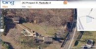
- 282 Prospect Street, Southington
- Typology

- Overview
-
Designations
Historic Significance
Architectural description:
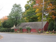
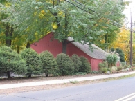
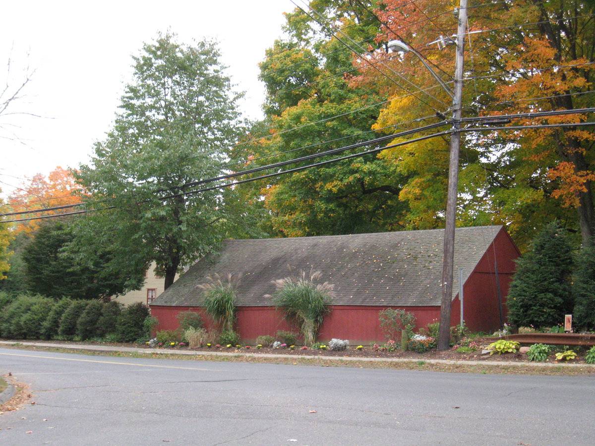
Barn I is a 1-story wagon shed-type building with a saltbox roof, its ridge-line oriented roughly east-west. The high eave-side is open to the south, facing the rear yard of the property. The low rear (north) eave-side faces Prospect Street. The east and west gable-ends have vertical wide flush-board siding with no openings except three drilled holes in the attic peak for birds. Siding is vertical wood painted red, and roofing is asphalt shingles, with no overhang on the gable-ends or rear eave-side.
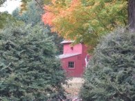
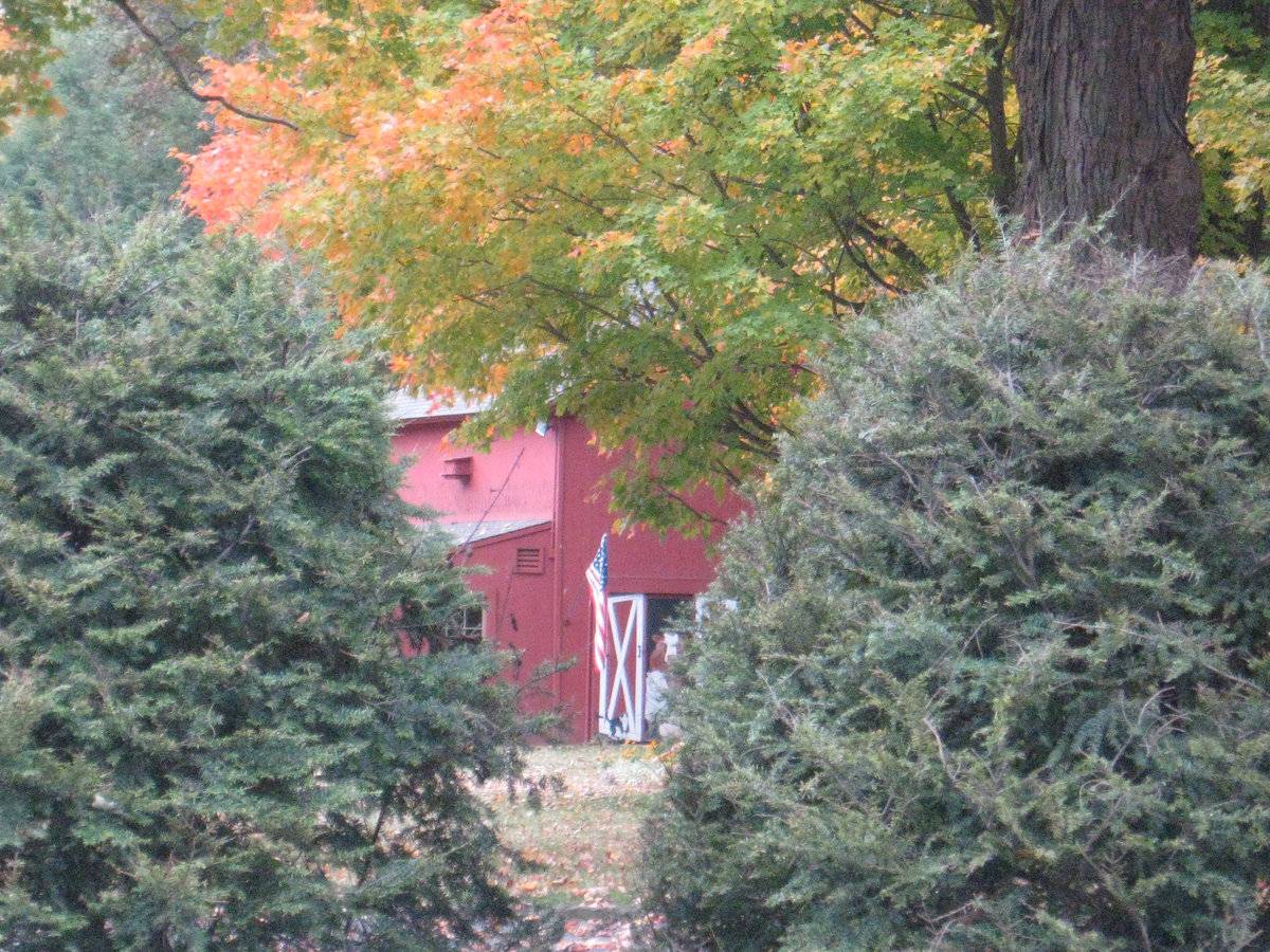
Barn II is a 2 ½-story gable-roofed structure with its ridge-line oriented north-south. The north gable-end has a pair of hinged doors in the ground floor and a window above. The east eave-side has a full-width one-story shed-roofed addition, likely used for pool equipment. Siding is vertical boards painted red. Roofing is asphalt shingles with an overhang at the eaves and rake.
Historical significance:Distinguished by the long shed or gable roof and the row of large openings along the eave side, the typical wagon shed was often built as a separate structure or as a wing connected to the farmhouse or the barn. These open-bay structures protect farm vehicles and equipment from the weather and provide shelter for doing small repairs and maintenance.
The New England barn or gable front barn was the successor to the English barn and relies on a gable entry rather than an entry under the eaves. The gable front offers many practical advantages. Roofs drain off the side, rather than flooding the dooryard. With the main drive floor running parallel to the ridge, the size of the barn could be increased to accommodate larger herds by adding additional bays to the rear gable end. Although it was seen by many as an improvement over the earlier side-entry English Barn, the New England barn did not replace its predecessor but rather coexisted with it.
Historical background:The Plantsville Historic District, located in Southington, Connecticut, encompasses approximately 116 acres. Formerly known as “Pearl’s Corners,” Plantsville developed at the junction of roads leading from Farmington to Waterbury and from Bristol to New Haven (present day Main, South Main, and West Main Streets). The district contains a mixture of industrial, commercial, and residential architecture. At the center of the district are several industrial complexes that were home to Southington’s prosperous hardware industry, which flourished in the mid-to-late nineteenth century. Plantsville’s identity as an industrial center began to take shape in 1842 when the Plant Brothers, A.H. Plant and E.M. Plant harnessed the water power of the Quinnipiac River to operate a factory for the manufacture of carriage bolts. Manufacturing buildings are located along the Quinnipiac River and Penn Central Railroad (formerly the New Haven and Northampton Railroad, now the Farmington Canal Trail) that bisects the district and along the Eight Mile River that runs through the western edge of the district. A strip of commercial architecture runs east-west along Main and West Main Streets, connecting the district’s two main residential concentrations. These areas are centered on Church Street and on Grove Street. A substantial strip of residential architecture also extends northward along Summer Street (formerly Water Street) near the course of the Quinnipiac River (Lewis, 1988).
Field Notes
Contributing resource in the Plantsville Historic District.
- Use & Accessibility
Use (Historic)
Use (Present)
Exterior Visible from Public Road?
Yes
Demolished
n/a
Location Integrity
Unknown
- Environment
Related features
Environment features
Relationship to surroundings
Prospect Street runs west from Plantsville, north of and paralleling West Main Street. This property is on the outskirts of Plantsville in a rolling landscape between the Quinnipiac River headwaters and the Eightmile River. Now the route of I-84 runs just west of the Eightmile River. This 3-acre property abuts the east bank of the river.
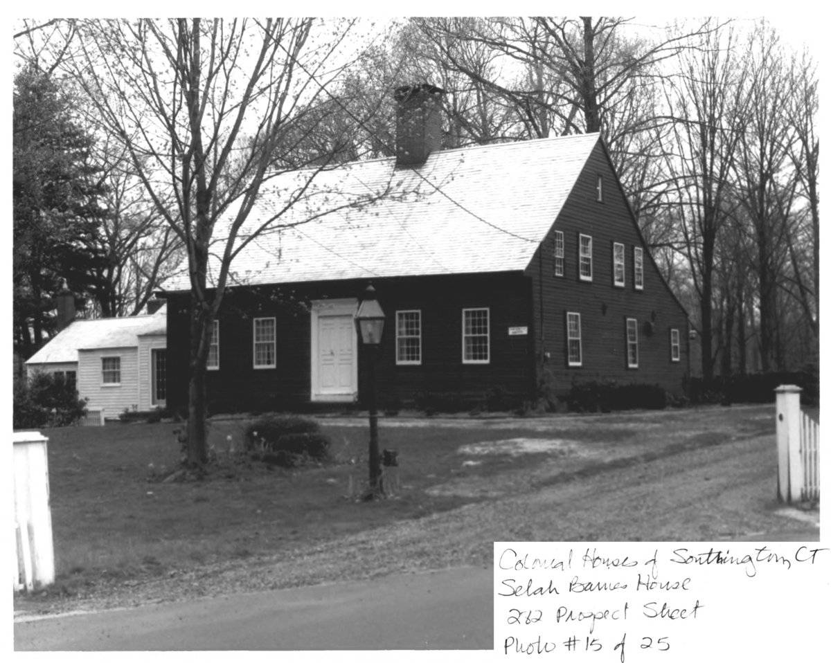
The house, dating from 1778, 1 ½-story cape-style building which faces east and has several additions extending south and west from the main block. The barns and a swimming pool appear to be mid- to late-20th-century features, per the Assessors Record, although visual evidence may indicate otherwise. Barn I is located northwest of the house, near the street; Barn II is located southwest of the house, near the river bank.- Typology & Materials
-
Building Typology
Materials
Structural System
Roof materials
Roof type
Approximate Dimensions
24 feet x 40 feet wagon shed, 24 feet x 32 feet barn .
- Source
-
Date Compiled
12/06/2010
Compiled By
Charlotte Hitchcock, reviewed by CT Trust
Sources
Field notes and photographs by Charlotte Hitchcock date 10/21/2010.
Town of Southington Assessor’s Record and GIS Viewer http://www.southingtongis.com/ags_map/
Parcel ID 086201 3 acres 24 x 32 ft barn 24 x 40 wagon shed.
396 sq ft barn built 1940, 292 sf open shed built 1976.Aerial Mapping:
http://maps.google.com
http://www.bing.com/maps accessed 11/19/2010Andrews, Gregory, Sherrow, Doris, Colonial Houses of Southington Thematic Resource National Register Nomination, Selah Barnes House No. 88003114, National Park Service, 1987.
Ransom, David, Historic Resource Inventory Form, Selah Barnes House, 1984 (incorporated in above thematic resource listing).
Lewis, Barbara, Andrews, Gregory, Plantsville National Register District Nomination No. 88002673, National Park Service, 1988.
Sexton, James, PhD, Survey Narrative of the Connecticut Barn, Connecticut Trust for Historic Preservation, Hamden, CT, 2005, http://www.connecticutbarns.org/history.
Visser, Thomas D., Field Guide to New England Barns and Farm Buildings, University Press of New England, 1997.
- PhotosClick on image to view full file
-