Barn Record Bethel
RETURN TO ‘FIND BARNS’
- Overview
-
Designations
n/a
Historic Significance
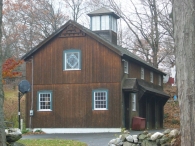
Architectural description:
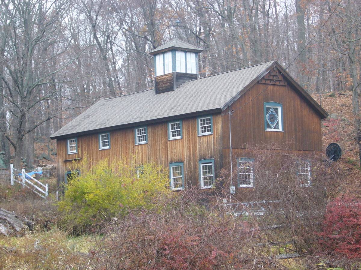
This is a 2 ½ - story eave-entry barn which appears to be four-bay. The south gable-end of the barn faces Codfish Hill Road while the ridge line runs north-south perpendicular to this portion of the road. The four-bay east eave-side of the barn is the main façade with three main entrances through three double-height entrances; one each in the first three bays from the north. All the three main entrances are tied together by a continuous hood at the lintel level supported on brackets. The façade also has an entrance in the first bay from the south through a pass-through door with a gable-dormer above. The second floor level of the main east eave-façade of the barn has four eight-over-eight double-hung sash windows, one each centered above each entrance. The south gable-end of the barn facing the road has two eight-over-eight double-hung sash windows with trim at the first floor level, one each towards each side. A margin of cement plastered masonry foundation can be seen along the grade level while the second floor level is separated by a distinct siding divide line. The second floor level of the south gable-end of the barn has a stained glass window at the center while tiered sparrow holes can be seen just below the apex of the roof. The west eave-side of the barn has an entrance towards the extreme north through a pass-through door while four eight-over-eight double-hung sash windows can be seen equally spaced towards the south. The second floor level of the west eave-side of the barn also has four eight-over-eight double-hung sash windows towards the south and a similar eight-over-eight double-hung sash window centered above the pass-through door. The gable-roof of the barn has a cupola centered along the ridge line with two windows on each side-wall.
The wooden frame of the barn and is supported on cement plastered masonry foundation. The barn has asphalt shingles roofing and vertical siding walls.
Historical significance:
The oldest barns still found in the state are called the “English Barn,” “side-entry barn,” “eave entry,” or a 30 x 40. They are simple buildings with rectangular plan, pitched gable roof, and a door or doors located on one or both of the eave sides of the building based on the grain warehouses of the English colonists’ homeland. The name “30 by 40” originates from its size (in feet), which was large enough for 1 family and could service about 100 acres. The multi-purpose use of the English barn is reflected by the building’s construction in three distinct bays - one for each use. The middle bay was used for threshing, which is separating the seed from the stalk in wheat and oat by beating the stalks with a flail. The flanking bays would be for animals and hay storage.
Field Notes
Visible from road, residential area; historic verification uncertain; conversion to other use. 2-story English type, gable roof with asphalt shingles. vertical siding unpainted. Large Cupola.
- Use & Accessibility
Use (Historic)
Use (Present)
Exterior Visible from Public Road?
Yes
Demolished
n/a
Location Integrity
Unknown
- Environment
Related features
Environment features
Relationship to surroundings
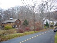
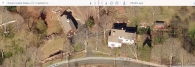
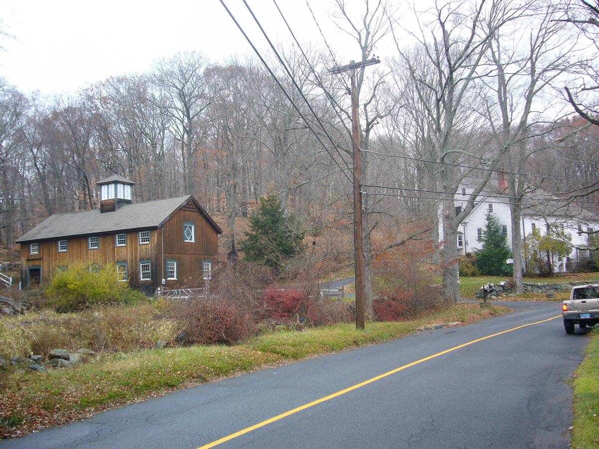
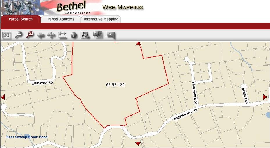
The 49.85 acres property, Account Number- R05874 and Map-block-lot number- 65 57 122, is located towards the north of Codfish Hill Road. The property is located in a pre-dominantly residential area of rural character with individual plots separated by woodland and open land. Residential plots can be seen towards the east, west and the south of the property across the road while the area towards the north is covered by dense woodland.
The barn is located in the southwest corner of the property offset from codfish Hill Road. The ridge line of the barn runs north-south perpendicular to this portion of the road. The circa 1768 old style main residence of the property is located towards its southeast, nearer to the road. A small gable-roof shed can be seen towards the northeast of the main residence with its ridge line running east-west. Open land with cluster of trees can be seen towards the north of the shed while the area towards further north is covered by dense woodland.
- Typology & Materials
-
Building Typology
Materials
Structural System
Roof materials
Roof type
Approximate Dimensions
Barn: 10X24 Sqft, Circa 1968; Shed: 9X24 Sqft, Circa 1990; Garage: 24X52 Sqft, Circa 1997;
- Source
-
Date Compiled
11/29/2010
Compiled By
T. Levine and M. Patnaik, reviewed by CT Trust
Sources
Field notes and photographs provided by: Gary Nurnberger, 11/29/2010.
Assessors’ records retrieved on June 13th, 2011 from website http://bethel.univers-clt.com/
GIS Map/ information retrieved on June 13th, 2011 from website http://hosting.tighebond.com/bethelct/main.htm
Photograph/Information retrieved on June 13th, 2011 from website http://www.google.com
Photograph/Information retrieved on June 13th, 2011 from website http://www.bing.com.
Photograph/Information retrieved on June 13th, 2011 from website http://www.zillow.com.
Sexton, James, PhD; Survey Narrative of the Connecticut Barn, Connecticut Trust for Historic Preservation, Hamden, CT, 2005, http://www.connecticutbarns.org/history
Visser, Thomas D.,Field Guide to New England Barns and Farm Buildings, University Press of New England, 1997.
- PhotosClick on image to view full file
-