Barn Record Sherman
RETURN TO ‘FIND BARNS’- Building Name (Common)
- The Stuart House Tobacco Barn
- Building Name (Historic)
- The Stuart House Tobacco Barn
- Address
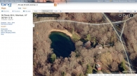
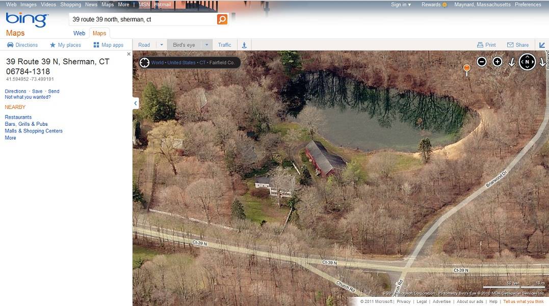
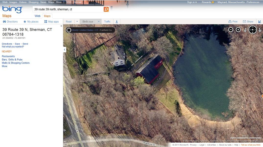
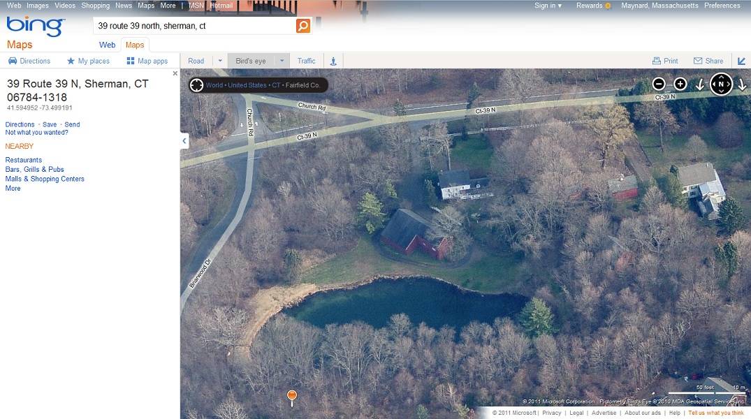
- 39 Route 39 North, Sherman
- Typology
- Overview
-
Designations
n/a
Historic Significance
Architectural description:
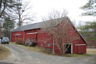
This barn is two barns attached together. Both these barns are 1 ½-stories, eave-entry, bank barns. The main façades face east and the ridge-lines are approximately perpendicular to Route 39 North which at this point runs approximately north to south.
Barn I:
The main entry of Barn I is centered on the east eave-façade of Barn I and consists of a pair of exterior hung sliding doors with a hooded track. The main entry is reached by what appears to be a concrete ramp. Towards the north, near the north corner is a window. There are no other openings on this side. The south gable-end of Barn I appears to have no openings. The grade drops towards the west revealing a full basement level on the west eave-side of Barn I. Located on this level is what appears to be a sliding door. Above this, spaced evenly across the west eave-side of the barn appears to be two window openings. Attached to, and encompassing the entire north gable-end of Barn I is Barn II.
Barn II:
Barn II is attached to the north gable-end of Barn I, and encompassing the entire south gable-end of Barn II. The main entry is to the south of the center and consists of an exterior hung sliding door with a hooded track, reached by a set of wooden steps and porch. The grade drops towards the north, revealing a fieldstone foundation on this side. Just above the foundation are two six-pane windows.
The grade drops towards the west along the north gable-end of Barn II, revealing a full basement. Near the east corner is a window, and just to the west of that is what appears to be an interior sliding door with trim. On the west corner of the north gable-end of Barn II is a pair of exterior hung sliding doors with a hooded track. Located in the gable-attic is a window with trim. Barn II extends further towards the west than Barn I, creating a saltbox-roof. There appear to be no openings on the west eave-side or the south gable-end of Barn II.
Both barns are clad in vertical flush-board siding painted red. The gable-roofs have overhanging eaves and are clad in asphalt shingles. Barn II has a fieldstone foundation.
Historical significance:By the mid-1800s many farmers saw their traditional English barn as being too small, inefficient, and old fashioned. As competition from the American West changed the economics of farming in New England, favoring larger herds and new ventures, some New England farmers ... expanded the older barns by building lean-to additions of the sides or rear of the barn. Some added basements, while others lengthened the barns by adding extra bays at the end. These extended barns often have several front doors, with one opening to the original threshing floor. The 19th century saw the introduction of a basement under the barn to allow for the easy collection and storage of a winter’s worth of manure from the animals sheltered within the building. The bank or side-hill barn is characterized by the location of its main floor above grade, either through building into a hillside or by raising the building on a foundation. This innovation, aided by the introduction of windows for light and ventilation, would eventually be joined by the introduction of space to shelter more animals under the main floor of the barn.
The tobacco barn, or shed as it is called in the Connecticut River Valley, is one of the most distinctive of the single-crop barns. They tend to be long, low windowless buildings with pitched roofs. They are characterized by vented sides and roofs to regulate air flow and allow harvested tobacco to cure at the appropriate rate. Derived initially from the design of the English barn, the shed is composed of a fixed skeleton consisting of two- or three-aisle bents repeated at intervals of 15 feet to the desired length. The wood-framed bents sit on piers of stone or concrete and the bents are connected by girts and diagonal braces. Typically there are one or two door openings at each end, making the shed a “drive-through,” although some sheds are accessed through doors on the sides. The interior structural framework serves a second purpose in addition to supporting the walls and roof of the building; it provides a framework for the rails used to hang the tobacco as it cures.
Field Notes
Barn Type: Tobacco Earliest date of ownership 1796 by Silvanus Stuart, son of Alexander Stewart, Jr. See "SH" 53. Note: The barn entry has an initialed stone of local marble. 6.55 acres of land. Pond to northwest
- Use & Accessibility
- Environment
Related features
Environment features
Relationship to surroundings
This barn is to the west of the house with which it is associated. The main façade of the house faces east and the ridge-line is parallel with Route 39 North, which at this point runs approximately north to south. This property is just to the south of the intersection of Route 39 North, Church Road and Briarwood Drive. Directly to the west of the barn is a small pond. A driveway extends to the west off Route 39 North and leads to the barn and house. To the north of the property are the State Police station, Sherman Nursery School, open tracts of land, few residential areas, and woodland. To the south are Munch Meadows, Veterans Memorial Park, Sherman Center Cemetery, open tracts of land, woodland and few residential areas. To the east are woodland, open tracts of land and few residential areas. To the west are open tracts of land, woodland, Spring Lake and the border of New York State. Surrounding the property are open tracts of land, woodland, and few residential areas.
- Typology & Materials
-
Building Typology
Materials
Structural System
Roof materials
Roof type
Approximate Dimensions
Barn: 17 x 40, Barn: 24 x 74
- Source
-
Date Compiled
08/31/2011
Compiled By
K. Young & T. Levine, reviewed by CT Trust
Sources
Ware, Wilson, The Sentinel Houses: Sherman, Connecticut, Sherman Historical Society: The Sentinel, 1978.
Field notes and photographs by John Jenner & Hildi Grob - 12/28/2010.
Aerial Mapping: Sherman Maps
http://www.bing.com/maps - accessed 8/31/2011.Sexton, James, PhD, Survey Narrative of the Connecticut Barn, Connecticut Trust for Historic Preservation, Hamden, CT, 2005, http://www.connecticutbarns.org/history.
Visser, Thomas D.,Field Guide to New England Barns and Farm Buildings, University Press of New England, 1997.
- PhotosClick on image to view full file
-